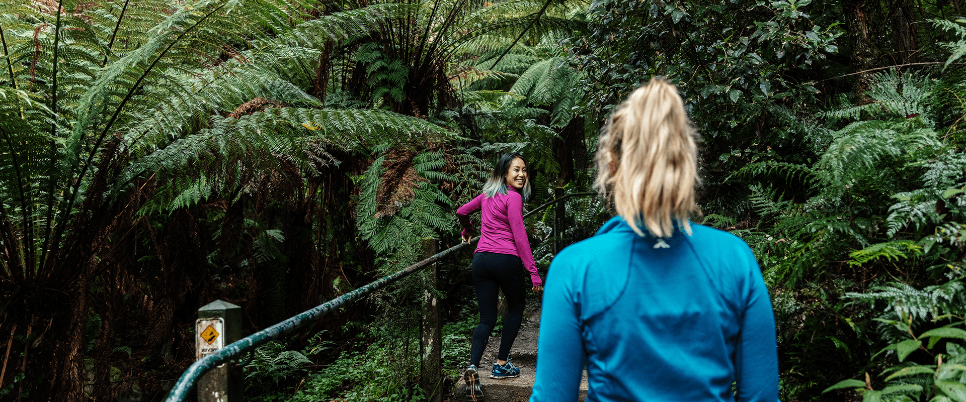
The Kokoda Track Memorial Walk (incorporating the 1000 Steps) departs from Ferntree Gully Picnic Ground, winding up a steep hill along a creek through lush rainforest, before emerging into a clearing where you can enjoy great views of Melbourne through the trees. Complete the loop by taking the Lyrebird Track back to the carpark.
The path is steep and beautiful, which makes it attractive to fitness walkers and tourists however please leave your dog at home, as this walk is not for your pets. Dogs are not allowed at the 1,000 Steps.
The 1000 Steps Cafe
The 1000 Steps Café is nestled under the tranquil gumtrees of the Dandenong Ranges. Start your day with a coffee while absorbing the picturesque surroundings of the national park, or take a seat and enjoy the great range of food and drinks off the menu. Inside you can take your time surrounded by locally-produced artwork and watch the world go by from our window seats. In front of the café is a large outdoor area with picnic tables allowing you to soak up the sun while taking in the wonderful environment with friends and family.
How to enjoy the 1000 Steps
The 1000 Steps is very popular. To get the most out of this place, it’s advisable to visit at a quieter time. That means midweek, early in the morning or both. That way you can appreciate the atmosphere of this magical rainforest and why Australian soldiers felt it was so similar to the Kokoda Track in Papua New Guinea where they fought in the Second World War. You’ve also got a better chance of spotting the noisy but very shy Superb Lyrebird.
1000 Steps alternatives
If you simply want to enjoy the majesty of the old trees around Ferntree Gully, and are not set on walking the 1000 Steps, try the Ramblers Track Loop. This is a gentle and quiet walk through old-growth forest. If you’re looking for a less popular but similarly demanding walk or run, the Granite Track in nearby Lysterfield Park is worth a go. You can even cool off with a swim in the lake afterwards!
Kokoda Track Memorial Walk or 1000 Steps?
At the foot of the 1000 Steps are a series of signs explaining this walk’s association with the Australian soldiers. Created in the early 1900s, the 1000 Steps Walk was originally made from tree fern trunks laid along the wetter areas of the track to make the climb a little easier. These were replaced by wooden palings, and more permanent concrete steps were installed in 1950.
The veterans of the Kokoda campaign adopted this park as their memorial site in 1998. The similarity of the walk to the first 100 metres of the Kokoda Track in Papua New Guinea resulted in the establishment of fourteen plaques along the walk, dedicated to the Australian Military Forces who fought and died on Kokoda. The 1000 Steps represent the ‘Golden Staircase’, a name given by Australian soldiers to the 2000 steps cut by the Australian Army Engineers and others into the track between Uberi and Imita Ridge.
Things to do
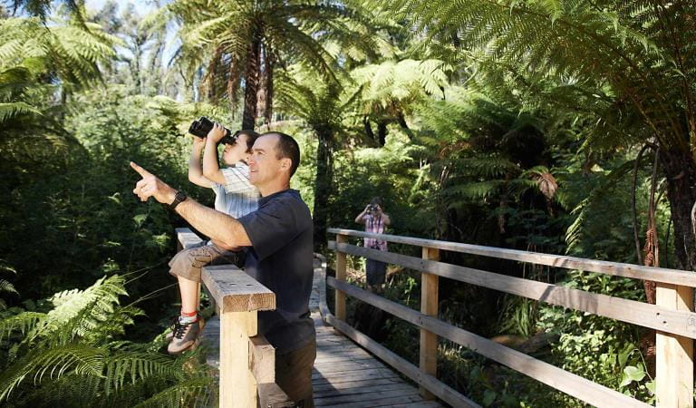
Bird watching
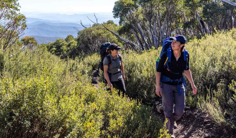
Walking
Wildlife
How to get there
1000 Steps Walk (Trail)
Facilities
When you're there
The 1000 Steps is a very popular walk and the car park at Ferntree Gully picnic area will be full by 10am on most weekend mornings. You might have better luck parking your car at One Tree Hill Picnic Ground at the top of the 1000 Steps. Alternatively, leave your car at home. It's a a leisurely 1200m stroll from Upper Fern Tree Gully train station to the bottom of the steps. Download the visitor guide before you go.
1000 Steps Walk
Need to know
1000 Steps Walk (Trail)
Accessibility
Visiting a park can be more of a challenge for people with disabilities, however in Victoria there are a wide range of facilities to help people of all abilities enjoy our wonderful parks around the state. Grants, O’Donohue, Sherbrooke, One Tree Hill and Ferntree Gully picnic grounds were assessed for accessibility in June 2020, providing information about the accessibility of these areas and photos.
Assistance dogs are welcome in Parks Victoria parks and reserves. Entry requirements apply for parks and reserves that are usually dog prohibited, such as national parks.
Change of Conditions
Nature being nature, sometimes conditions can change at short notice. It’s a good idea to check this page ahead of your visit for any updates.
-
Olinda Falls Picnic Area (Dandenong Ranges National Park)
Olinda Falls Toilet Closed
The Olinda Falls toilet is closed indefinitely, nearby toilets at Kalorama Park or in the Olinda Township are open.Olinda Falls Lower Viewing Platform - update
The Olinda Falls lower viewing platform is currently closed due to severe damage caused by a fallen tree. All access to the lower falls area is closed to the public. The viewing platform is expected to be replaced sometime in 2024.
Mechanics Track closed between Mt Dandenong Tourist Road and Falls Road
- Mechanics walking track from the Mt Dandenong Tourist Rd through to Falls Rd is closed due to significant damage from the June 2021 Storm. Parks Victoria is currently working with insurance assessors and contractors on a plan to re-open this severely impacted walking track.
- Works completed so far has been the replacement of a timber bridge that was destroyed along with most of the large fallen trees having been cut through, the remaining walking track requires re-benching and tree branch removal where limbs have been partly buried due to the force of the impact with the ground. Works are expected to be completed by June 2024.
-
Sherbrooke Track (Dandenong Ranges National Park)
Wattle Track Bridge Closure Update
Wattle Track Bridge in Sherbrooke Forest is closed due to significant structural damage to the Foot Bridge by a fallen tree. Parks Victoria has engaged a contractor to commence construction works in March 2024, it is anticipated that the bridge will be opened by May 2024. The existing damaged timber bridge will be replaced with an all steel constructed bridge which includes a non slip FRP decking, during the construction period there may be some delays along Sherbrooke Track as building materials are carried to the site, Sherbrooke track will remain open. -
Valley Picnic Ground (Dandenong Ranges National Park, RJ Hamer Arboretum)
Valley Picnic Ground Closed
- Valley Picnic Ground is closed, the site will eventually be improved after it was damaged in the June 2021 Storm event ; visitors can use Boundary Road to access the park however no vehicle access to the picnic ground carpark is permitted. Please use Eagle Nest or Kalorama Park Picnic Ground as an alternative.
-
Dandenong Ranges National Park
Temporary closed areas due to deer control activities
Parks Victoria are continuing deer control in the Dandenong Ranges National Park. This program will be taking place between the hours of 4pm and 7am on a number of nights between February 13th 2024 and November 29th 2024. These control works are being undertaken by accredited and authorised contractors.For reasons of public safety, various areas of the park will be inaccessible during the evening throughout this period.Signage will be in place at access points when control activities are occurring. For your own safety please observe the signage during this time and do not enter any closed areas.For further information please call 131963Attachments: Neighbour_Notification_Map_DRNP_2324 (2,529KB)
Deer control in the Dandenong Ranges National Park
Parks Victoria are continuing deer control in the Dandenong Ranges National Park. This program will be taking place between the hours of 4pm and 7am on a number of nights between the 1st of November 2023 and the 30th of November 2024. These control works are being undertaken by accredited and authorised contractors.For reasons of public safety, various areas of the park will be inaccessible from dusk until dawn throughout this period.For your safety please observe all closure signage during this time and do not enter any closed areas.For further information please call 131963Attachments: Neighbour_Notification_Map_DRNP_2324 (2,529KB)
Track 13 - Silvan Storm Recovery Works Notification
FFMVic Storm recovery works will take place in the Dandenong Ranges National Park near Silvan.
Date: April to May 2024
Duration: Works will take place from April and are expected to be completed by 30 May 2024, weather and forest conditions permitting
Location: Track 13, near Silvan Reservoir Park, Silvan (see map)
Impact:
Mountain bike and walking tracks in the area will be closed while the works are underway. For your safety, please follow track closures or detours.Tracks closed include:- Bakers Dozen Loop Track
- Downhill Track
- Link Track
- Magpie Loop Track
- Pipeline Track
- Track 11
- Track 12
- Track 24
Why:
FFMVic is continuing to remove fallen debris along key fire access roads and fuel breaks to make the Dandenong Ranges National Park safer for everyone. It’s important to undertake maintenance of the strategic fuel break network to reduce the rate of spread of bushfires and provide vital protection for communities.
This block sits within a Bushfire Moderation Zone, which aims to reduce the intensity, rate of spread, and ember loads from significant bushfires.
The protection of environmental, biodiversity and cultural values during all recovery and bushfire risk reduction works are a high priority.For more information about bushfire risk reduction activities visit the FFMVic website or call 136 186.Attachments: FFMVic Track Closure Map (554KB)
- Bakers Dozen Loop Track
-
Grants Picnic Ground (Dandenong Ranges National Park)
Bleakley Track closure for upgrade works
As part of the ngurrak barring | RidgeWalk project, Bleakley track that connects Grants Picnic ground to Belgrave will be closed for public safety. These maintenance works will take up to four weeks to complete
Attachments: Bleakley track works update (92KB)