Mountain Lion (Designated
rock-climbing and bouldering area) – Temporary exclusion
Significant Aboriginal
cultural values have recently been rediscovered at the Mountain Lion designated
rock-climbing and bouldering area.
While Parks Victoria and
Gariwerd Traditional Owners determine a longer-term management response, and
out of respect for this significant cultural landscape, visitors are
requested to not access this area.
The Aboriginal Heritage
Act 2006 protects Aboriginal cultural heritage and significant financial
penalties apply for harm caused by individuals or corporate bodies.
For more information please
visit the FAQ Update at the Rock Climbing in Gariwerd link below.
The Grampians (Gariwerd)
National Park has several roads temporarily closed for repair works, upgrades,
and recent fire impacts. Please be aware the movement of visitors in these
parts of the National Park is restricted.
Road Closures
Mitchell Road is closed between Redman Road and Mt William Picnic Ground Road.
Old Mill Road (from Smiths
Mill Campground to Mt Difficult Road) and Rose Creek Road (from Mt Victory Road
to Old Mill Road) will be closed for Planned Burn Prep from March 28 to April
15.
Seasonal Closures
Launders and Sanders Tracks are closed.
Moora Moora Track is
partially closed in the southern section, from Homestead Track
intersection to Glenelg River Road.
Grampians
Peaks Trail – Trailhead Access
Road access (Griffin Track) to the Griffin Trailhead for the Grampians Peaks
Trail is open to 4WD vehicles only. Walkers can access the GPT on foot via the
Griffin Track from the Grampians Tourist Road.
Redman Road Trailhead
carpark is closed. The nearest site for parking is at Borough Huts Campground.
Please see the
latest road report attachment for full road and track details at the bottom of
this page.
Attachments:
Grampians (Gariwerd) National Park - Road Report - 12.04.2024 (275KB)
FFMVIC have scheduled
ignition for the following Planned Burn within Grampians (Gariwerd) National
Park
Victoria Range
Road (GR-WIM-CAV-0009)
Start Date: Monday
15 April 2024
End Date: Monday
22 April 2024
Forest Fire Management
Victoria advise that the planned burn will be carried out tomorrow, weather and
fuel moisture conditions permitting.
Burn Name: Victoria
Range Road
Temporary closures:
Chimney Pots Car Park and
Walking Track
Strachans Campground
Sawmill Track
Victoria Range Road (from
intersection of Victoria Range Tk)
Victoria Range Track (MVO)
(from intersection of Victoria Range Rd to Glenelg River Rd)
Visitor access to remain open:
Glenelg River Road (please adhere to signage)
Visit & Sign Up: Sign up
to Planned Burns Victoria www.vic.gov.au/plannedburns Set up automated notifications about
upcoming planned burns on public land near you. There is no charge to sign up
to receive text messages.
Download: The Vic
Emergency App. Set up a watch zone and choose to be notified about planned
burns in the ‘alerts’ settings
Call: The Vic
Emergency Hotline on 1800 226 226 and request an interpreter or assistance
for hearing difficulties via the National Relay Service. IN AN EMERGENCY CALL
000
For Information about park closures and
campground bookings within Grampians National Park:
Visit Brambuk the National Park and Cultural
Centre – 277 Grampians Road Halls Gap, Ph 8427 2058 or for bookings and
cancellations advice contact the Parks Victoria Information Centre Ph 13 1963
or email info@parks.vic.gov.au
You may see or smell smoke in the vicinity of
the burn. For advice on how
this may impact your health, visit www.epa.vic.gov.au/smoke
You may see or smell smoke
in the vicinity of the burn. For advice on how this may impact
your health, visit www.epa.vic.gov.au/smoke
Attachments:
Flyer_GRAMPIANS NP_VICTORIA RANGE RD (427KB)
Ignition of the Victoria
Point (GR-WIM-CAV-0064) burn is scheduled for Sunday April 14, 2024 and is
subject to favourable weather and fuel moisture conditions.
Start Date:
Sunday 14 April 2024
End Date: Sunday 21 April 2024
Burn Name: Victoria Point
Burn No: GRWIM-CAV-0064
Temporary Closures:
Geerak Track
Visitor Access remaining open:
Glenelg River Road (please adhere to signage)
For more details see the attachment below.
Stay informed
about the Autumn planned burns schedule:
Visit &
Sign Up: Sign up to Planned Burns
Victoria www.vic.gov.au/plannedburns Set up automated notifications about
upcoming planned burns on public land near you. There is no charge to sign up
to receive text messages.
Download: The Vic Emergency App. Set up a watch
zone and choose to be notified about planned burns in the ‘alerts’ settings
Call: The Vic Emergency Hotline on 1800 226
226 and request an interpreter or assistance for hearing difficulties via
the National Relay Service. IN AN EMERGENCY CALL 000
For
Information about park closures and campground bookings within Grampians
National Park:
Visit Brambuk the National
Park and Cultural Centre – 277 Grampians Road Halls Gap, Ph 8427 2058 or for
bookings and cancellations advice contact the Parks Victoria Information Centre
Ph 13 1963 or email info@parks.vic.gov.au
Attachments:
Flyer_GRAMPIANS NP_VICTORIA POINT (482KB)
FFMVIC
have scheduled ignition for the following Planned Burn within Grampians
(Gariwerd) National Park
Oslers Track (GR-WIM-HGP-0042)
Start Date: Wednesday 17 April 2024
End
Date: Friday 19 April 2024
Forest
Fire Management Victoria advise that the planned burn will be carried out,
weather and fuel moisture conditions permitting.
Burn
Name: Oslers
Track
Temporary
closures:
Mt Zero Rd (from Redgum
Lease Tk to Heatherlie Tk)
Pines Rd (from Fyans Creek
Rd to Mt Zero Rd)
Plantation Campground
Oslers Track
Oslers Track Bush Camps
Visitor access
to remain open:
Red Gum Lease Bush Camps (3km north of Halls Gap)
Heatherlie Quarry (from
Roses Gap Rd only)
Visit &
Sign Up: Sign up to Planned Burns
Victoria www.vic.gov.au/plannedburns Set up automated notifications about upcoming planned burns on
public land near you. There is no charge to sign up to receive text
messages.
Download: The Vic Emergency App. Set up a watch zone
and choose to be notified about planned burns in the ‘alerts’ settings
Call: The Vic Emergency Hotline on 1800 226 226 and request an
interpreter or assistance for hearing difficulties via the National Relay
Service. IN AN EMERGENCY CALL 000
For Information about park closures and campground bookings within Grampians National
Park:
Visit Brambuk the National
Park and Cultural Centre – 277 Grampians Road Halls Gap, Ph 8427 2058 or for
bookings and cancellations advice contact the Parks Victoria Information Centre
Ph 13 1963 or email info@parks.vic.gov.au
You may see or smell smoke
in the vicinity of the burn. For advice on how this may impact your
health, visit www.epa.vic.gov.au/smoke
Attachments:
Flyer_GRAMPIANS NP_OSLERS TRACK_closures (378KB)
The popular
Watchtower designated climbing area located near Halls Gap in the Grampians
(Gariwerd) National Park is undergoing minor trail improvement works.
The
access trail to the Watchtower will be temporarily closed from Monday April 15
to Friday April 19, 2024.
FFMVIC have scheduled ignition for
the following Planned Burn within Grampians (Gariwerd) National Park
Cassidy Gap – GR_WIM_CAV_00071
Ignition
scheduled from Saturday April 20th - Sunday April 21st and possibly
into Monday April 22nd 2024.
Closures could remain in place
throughout the following week.
This
burn is located 3km north of Dunkeld.
For
visitor safety and to allow FFMVIC staff to prepare and deliver the burn, temporary
closures along the Grampians Peaks Trail and some day walks will be in place. These will re-open when the burn, or specific
areas of the burn are declared safe:
Closures from 5:30pm Friday April 19th,
throughout ignition (Saturday April 20th until at least Monday April
22nd )
·
Grampians Peaks Trail (Section
S3) north and south bound hiking between Cassidy Gap Rd Trailhead, over Signal
Peak to Dunkeld Reservoir Road, (including Mud-dadjug Hike in campground).
·
Mt Abrupt day walk
·
Signal Peak day walk
·
Mann’s Road - closed east of
the intersection with Victoria Valley Rd
·
Serra Range Fireline - closed
at the intersection of Vic Valley Road and Cassidy Gap Road
·
Djardji-Djawara Hike in
Campground will remain open, though depending on conditions, smoke may impact
the area.
How will this burn impact my Grampians Peaks Trail experience?
There
are no walking track detours around the burn unit and closures along section S3
of Grampians Peaks Trail (Cassidy Gap to Piccaninny). This means a change to
your GPT itinerary.
There
are multiple ways to re-plan your visit and Parks Victoria staff will help you
to work through the best option.
Day visitor access remains open to:
·
Piccaninny (Baingugg) day walk
from Vic Valley Trailhead and Piccaninny Car park
·
Mt Sturgeon (Wurgarri) from Mt
Sturgeon Car Park and Dunkeld
Stay informed about this Autumns planned burns schedule:
Visit & Sign Up: Sign up to Planned Burns Victoria www.vic.gov.au/plannedburns Set up automated notifications
about upcoming planned burns on public land near you. There is no charge to
sign up to receive text messages.
Download: The Vic Emergency App. Set up a watch zone and choose to be notified about
planned burns in the ‘alerts’ settings
Call: The Vic Emergency Hotline on 1800 226 226 and request an
interpreter or assistance for hearing difficulties via the National Relay
Service. IN AN EMERGENCY CALL 000
For Information about park closures and
campground bookings within Grampians (Gariwerd) National Park:
Visit
Brambuk the National Park and Cultural Centre – 277 Grampians Road Halls Gap,
Ph 8427 2058 or for bookings and cancellations advice contact the Parks
Victoria Information Centre Ph 13 1963 or email info@parks.vic.gov.au
You
may see or smell smoke in the vicinity of the burn. For advice on how
this may impact your health, visit www.epa.vic.gov.au/smoke
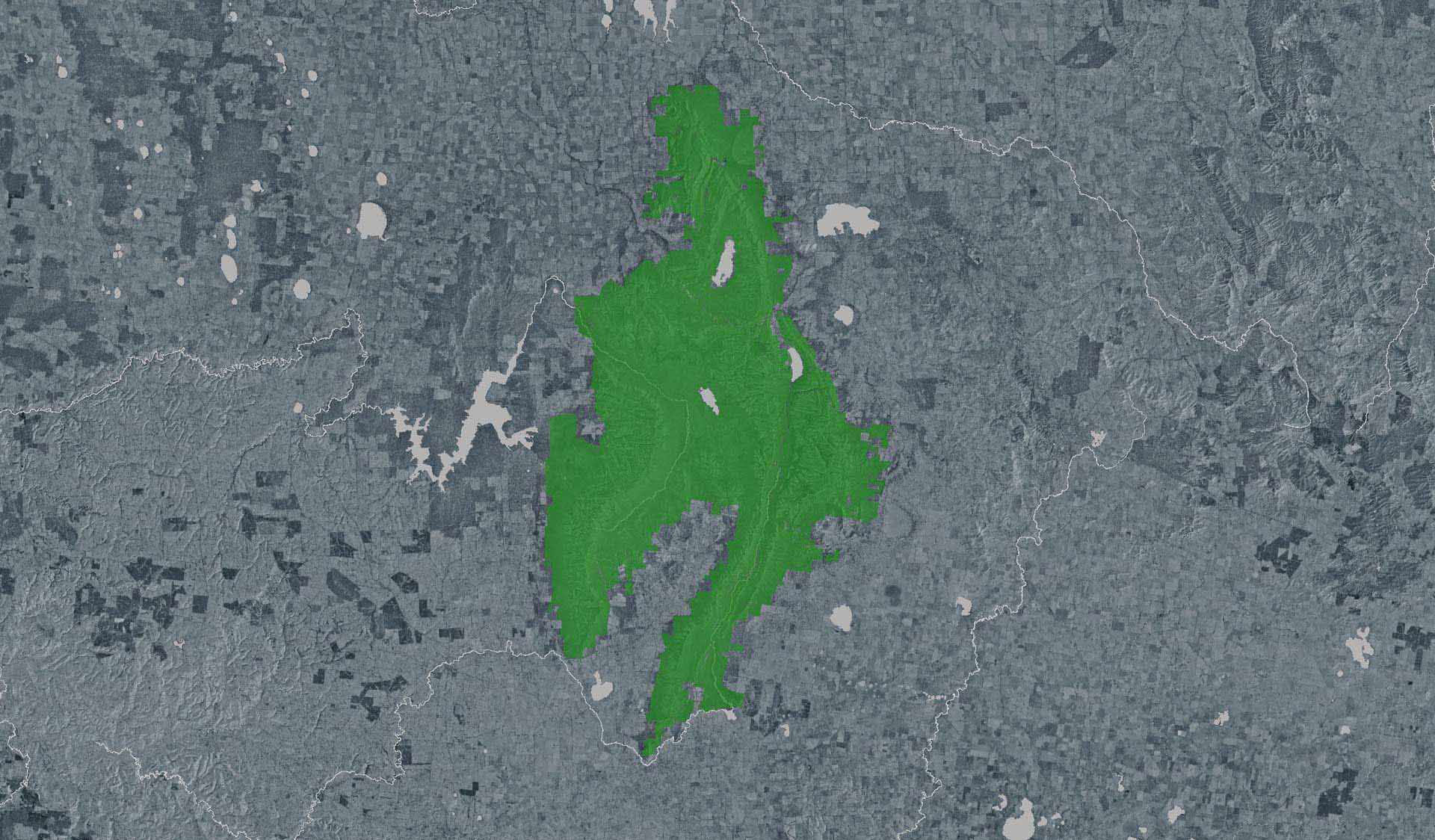
Grampians
(Gariwerd) National Park Update
The Autumn
planned burn program has commenced.
Forest
Fire Management Victoria (FFMVic) have commenced the Autumn Planned Burning
Program in Grampians (Gariwerd) National Park and surrounding reserves.
· The map attached,
outlines the burns programmed for this year. Detailing the exact date and time
of ignition can be difficult and the final decision to proceed may only be made
on the day of the burn - once resources, weather conditions and local fuel
moisture levels are deemed suitable. Once a burn is scheduled for ignition,
FFMVIC will send out regular notifications.
· Some
of the planned burns this Autumn may involve the temporary closure of visitor
sites, roads and campgrounds within Grampians Gariwerd National Park and other
reserves. This may include detours or closures of hike in campgrounds along
the Grampians Peaks Trail, and other vehicle-based campgrounds.
· Closures
will be enforced for the duration of ignition and may remain in place for some
days. Visitor sites will re-open once the burn is declared safe.
· We recommend that
you seek information and stay informed about the status of the planned burns
scheduled near you.
Stay
informed about this Autumns planned burns schedule:
Visit
& Sign Up:
Sign
up to Planned Burns Victoria to set up automated notifications about upcoming
planned burns on public land near you. There is no charge to sign up to receive
text messages.
Sign up via Planned Burns Victoria at www.vic.gov.au/plannedburns
Download: the VicEmergency
App
Set
up a watch zone and choose to be notified about planned burns in the ‘alerts’
settings
Call: the VicEmergency
Hotline on 1800 226 226 and request an interpreter or assistance for
hearing difficulties via the National Relay Service
For
Information about park closures and campground bookings within Grampians
National Park:
Visit Brambuk the National Park and Cultural Centre – 277 Grampians Road
Halls Gap, Ph 8427 2058
or for bookings and cancellations advice contact the Parks Victoria
Information Centre Ph 13 1963 or email info@parks.vic.gov.au
Attachments:
Grampians (Gariwerd) Planned Burns 2024 Map (17,972KB)