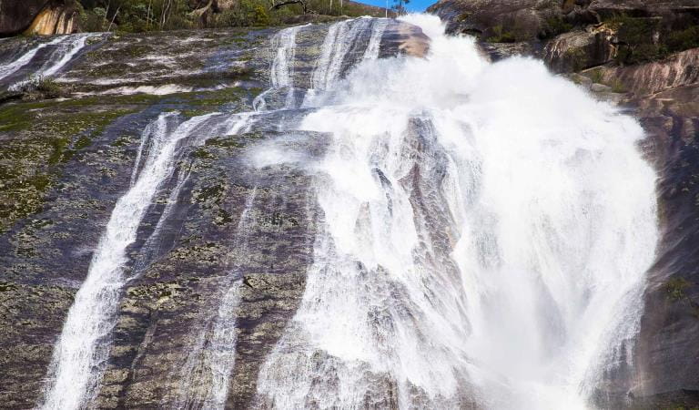
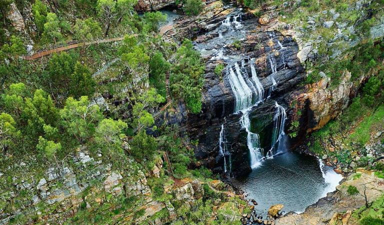
Sheoak Falls is a place of tranquillity and beauty just off the Great Ocean Road. Here, the waters of Sheoak Creek cascade 15m down a sheer rock face into a pool surrounded by trees.
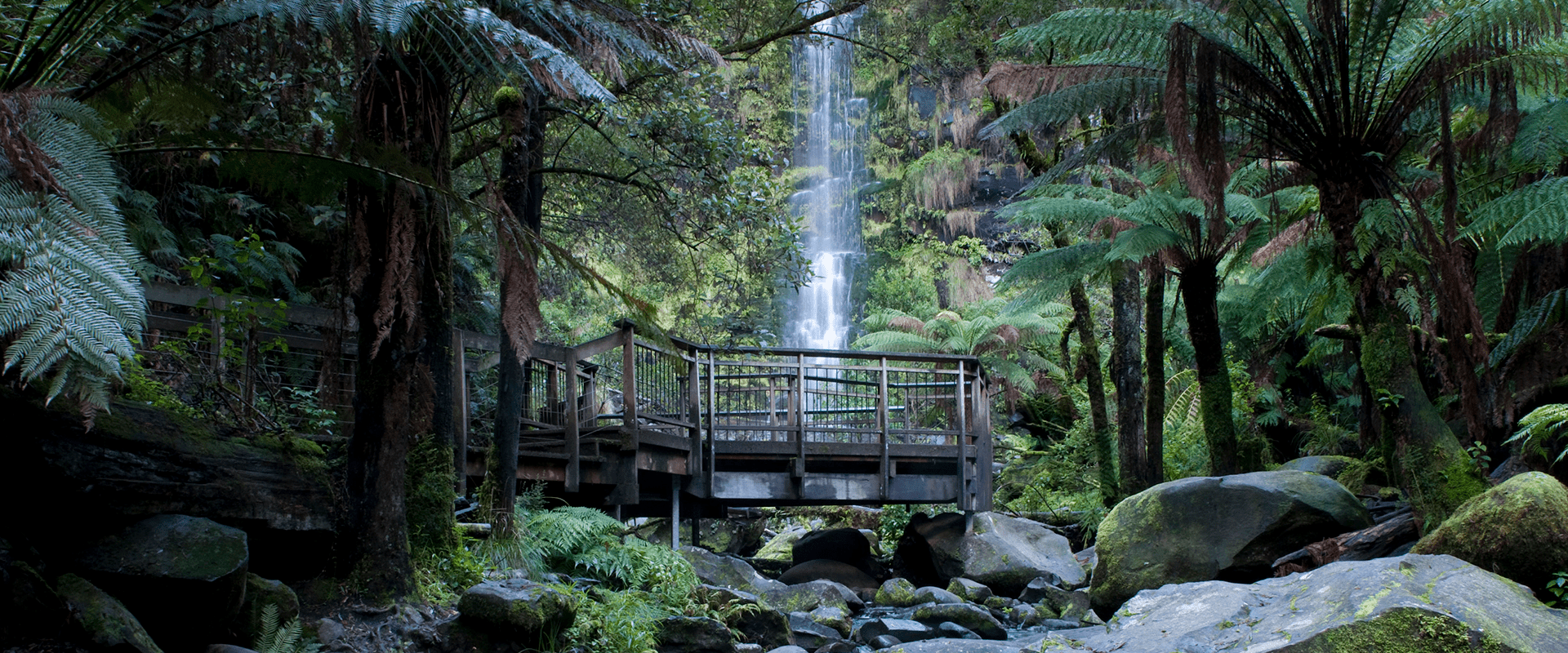
It's a short walk from the carpark to the falls (although there are plenty of steps), so if you fancy a longer stroll, continue up the trail to see Swallow Cave. It's quite a climb, but you'll also see some alternative views of the falls along the way. This trail also requires a river crossing, so it might be impassable in the winter. At Swallow Cave, look out for Tree Martins, which live in the grotto during spring, summer and autumn. These birds use mud from the creek to build their nests.
For a longer and more challenging hike, you could park your car at Sheoak Picnic Area and walk the 3.6km trail (one way) to Sheoak Falls. Sheoak Picnic Area has better facilities than Sheoak Falls Carpark, including toilets and picnic benches.
As waterfalls are within a natural environment, you may encounter hazards. Follow our water safety advice to make sure your day out at Sheoak Falls is a safe and enjoyable one.
Things to do
Sheoak Picnic Area
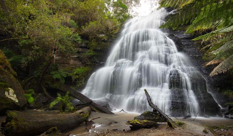
Erskine Falls
How to get there
Sheoak Falls
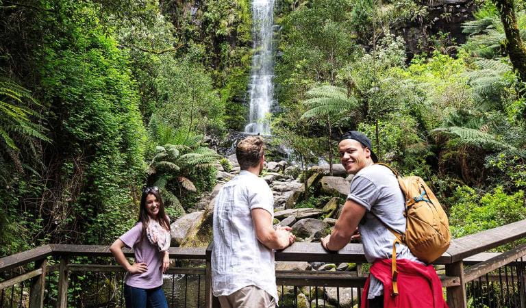
When you're there
Sheoak Falls is not to be confused with Sheoak Picnic Area, which is nearby and a popular trailhead for several waterfall walks. It is possible to walk to Sheoak Falls from Sheoak Picnic Area, but the trail is 3.6km one way and it is a challenging hike.
Need to know
Sheoak Falls
Accessibility
Sheoak Falls carpark has a good smooth surface and good circulation. The tracks nearby are not so accessible as they have steep sections and steps. There are no picnic facilities or toilets onsite. The nearest facilities are in Lorne.
Visiting a park can be more of a challenge for people with disabilities, however in Victoria there are a wide range of facilities to help people of all abilities enjoy our wonderful parks around the state.
Assistance dogs are welcome in Parks Victoria parks and reserves. Entry requirements apply for parks and reserves that are usually dog prohibited, such as national parks.
Change of Conditions
Nature being nature, sometimes conditions can change at short notice. It’s a good idea to check this page ahead of your visit for any updates.
-
Great Otway National Park
Delayneys Track Closed
Delayneys Track is closed until further notice.
Wye Road Closure
Wye Road is temporarily closed for grading and landslip repair.Temporary park closures Great Otway National Park
Sections of the Great Otway National Park will be temporarily closed at night from Monday 15th April 2024 through to June 1st 2024 to allow for the safe delivery of park conservation work. Temporary closed areas will be clearly sign posted. All campgrounds will remain open during this operation. For further information please contact Parks Victoria on 13 19 63 or email westregiondcp@parks.vic.gov.au -
Other issues
Sharps Campground permanently closed
Permanently closed due to environmental and safety risks. -
Lemonade Creek Walk (Great Otway National Park)
Lemonade Creek Walking Track Closure
Due to multiple unsafe bridges the Lemonade Creek Walking Track will be closed indeffinately -
Aire Crossing Campground (Aire River Heritage River, Great Otway National Park)
Youngs Creek Track Closed Great Otway National Park
Following recent rainfall and current conditions, Youngs Creek track within the Great Otway National Park is currently closed.Safety for our visitors and protection of the environment has led to this decision. The nearby Triplet Falls and Aire Crossing visitor sites remain open along with the tracks leading to them. -
Jamieson Creek (Great Otway National Park)
Wye Road Temporary Closure
Wye Road will be closed temporarily for grading and landslip repair. -
Notices Affecting Multiple Sites
Planned Burn Operations Around Anglesea
Planned burning operations are scheduled in this park which will result in the following areas being affected from the time a burn is approved for ignition, until the area is declared safe. Ignition of the burns are scheduled from 12th April 2024 and are subject to favourable weather.Please adhere to all closure and advice signs in the area as planned burn activity commences.Check the status of current planned burns at https://plannedburns.ffm.vic.gov.auAreas Affected:Duckponds Burn:Ironbark SpurGentle Annie TrackDam Wall TrackMcKenzie Link TrackDuckponds TrackLoves TrackWoodlands Burn:Woodlands TrackHarrison NorthMotorbike Offload Area (Cecil)Informal Track west of Flaxbourne’s RoadCecil Burn:Cecil TrackMotorbike offload area (Tanners/Gumflat)Moggs Creek Track/Robyn Road:Oceanview TrackMoggs Creek Picnic AreaMoggs Creek TrackMoggs Creek Link TrackHammonds:Both Parks National Park and Otway Forest Park Campgrounds affected, check planned burn updatesHammonds RoadBreakfast Creek:Hammonds RoadBreakfast Creek RoadBoth Hammonds CampgroundsRed River BurnYan Wirring Miir LoopDenhams TrackRed River TrackBunjil LookoutPlease take your rubbish home
Reminder to campers and visitors to please take your rubbish home. Please do not put rubbish in toilets. Visitors have been placing rubbish in the pit toilets making human waste removal difficult. Parks appreciates your assistance in looking after the Park. -
Melba Gully Day Visitor Area (Great Otway National Park)
Melba Gully - Large bus access
Melba Gully Walk Track and picnic area is accessible for large coaches. Toilet facilities are available on site -
Maits Rest Rainforest Walk (Great Otway National Park)
Maits Rest Carpark- bus access
Maits Rest Carpark is suitable for small coaster buses only. Large buses or coaches are advised to use Melba Gully walk track near Lavers Hill. -
Blanket Bay Day Visitor Area (Great Otway National Park)
Blanket Bay Campground- water supply
Blanket Bay campground in Great Otway National Park water supply is very low. Campers are advised to bring their own water. -
Aire River West Campground (Great Otway National Park, Aire River Heritage River)
Aire River West Campground flooding
Aire River West campground is currently subject to flooding. The river mouth is closed and an attempt to open will be undertaken on Friday the 19th of April.
Similar experiences
MacKenzie Falls
Erskine Falls