Explore
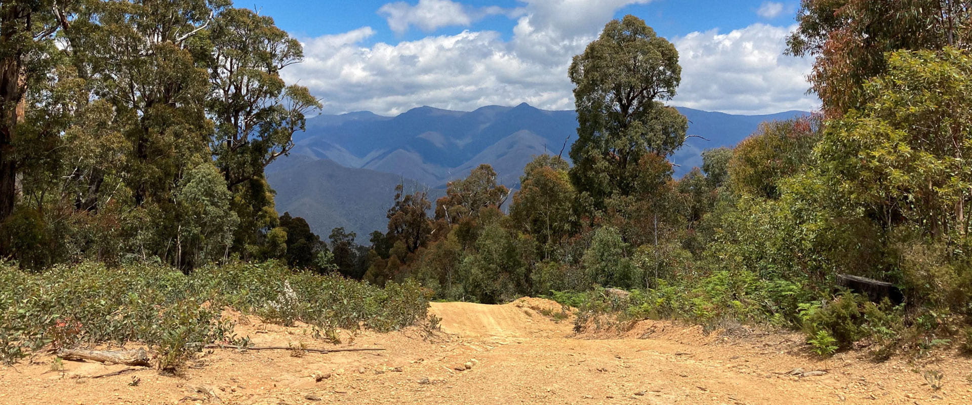
Grant Historic Area
Grant Historic Area is primarily covered by dry forest and woodlands and if you visit in spring, you’ll see a colourful display of wildflowers. More than 100 native plant species occur in here, including some rare and threatened species.
This is a great place to view wildlife. It is common to see wildlife on the roads and tracks so make sure you drive carefully. Keep your eye out for swamp wallabies, bare-nosed wombats, eastern grey kangaroos, brush-tailed possums, and a variety of bat species. Bird watches will spot a variety of cockatoos, parrots, the superb lyrebird, and a variety of owl species. Grant Historic Area is also the perfect place to see many species of skinks, snakes, frogs, and water dragon’s so keep your eye out while exploring.
A variety of vehicle and walking tracks wander through the area and there are pleasant camping sites along the grassy river flats at Talbotville or high on the ridge top at Grant Historic Area.
The thickly forested area hides many features of the mining days including cemeteries, township sites and mining relics.
1864 and 1865 are the great boom years of the district, alluvial gold had been discovered along the rivers as early as 1850. Quartz (reef) gold was discovered in the Crooked River area. By the end of 1865, there were fifteen hotels, a church, courthouse, police station and lockup, medical hall, numerous stores and a newspaper office publishing once a week – the Crooked River Chronicle. The population grew to just on 2000.
The mining industry boomed through the later half of the 1860s. Eight crushing mills driven by steam or water were erected, tramways built and 250 reefs were registered. But only ten years later most of the gold was gone and the town was largely deserted. By 1902 there were only six families, the last residents leaving in 1916.
Keen walkers and history buffs will see their two passions combined in Grant Historic Area. Take a short walk to the Jewellers Shop Mine which didn’t produce water until after Grant township was abandoned, a missed opportunity as water was scarce and sold by the barrel from a horse and cart. Visit the New Good Hope battery site on the Crooked River Track where ore carts lie abandoned and the boiler and stamper still sit in their original positions.
Things To Do
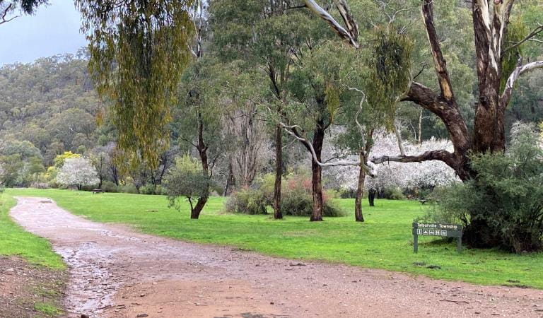
Camping in Grant Historic Area
Wonnangatta Icon Drive
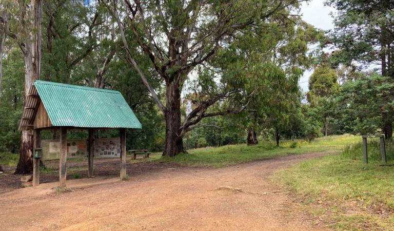
Walking in Grant Historic Area
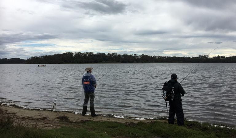
Fishing in Grant Historic Area
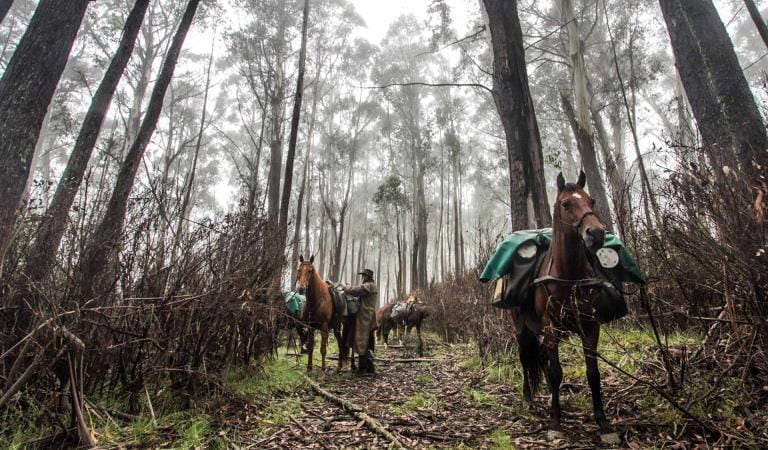
Horse riding in the park
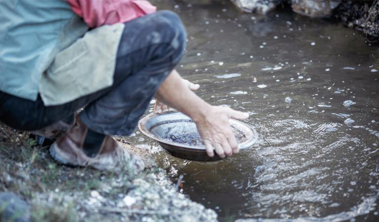
Fossicking in Grant Historic Area
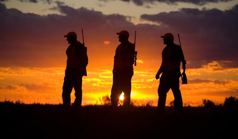
Hunting in the park
Grant Historic Area
This area is well known for its wildlife. Keep an eye out for:
Tours and adventure experiences in parks
One of the best ways you can get into nature is with a Licensed Tour Operator.
There are more than 400 Licensed Tour Operators across Victoria who are ready and waiting to help you experience and connect with Victoria’s spectacular parks and waterways.
Discover more than 60 different types of nature-based experiences including hiking, mountain biking, boating, four-wheel driving, indigenous culture tours, birdwatching, surfing, diving and so much more.
Licensed Tour Operators know all the best places to go and will plan and prepare your visit to ensure you are safe and can enjoy your nature-based adventure to the fullest.
How to get there
Grant Historic Area
Need to know
Grant Historic Area
Accessibility
Visiting a park can be more of a challenge for people with disabilities, however in Victoria there are a wide range of facilities to help people of all abilities enjoy our wonderful parks around the state.
Assistance dogs are welcome in Parks Victoria parks and reserves. Entry requirements apply for parks and reserves where dogs are normally prohibited, such as national parks.
Safety
Grant H.A is in the West & South Gippsland fire district. Bushfire safety is a personal responsibility. Anyone entering parks and forests during the bushfire season needs to stay aware of forecast weather conditions. Check the Fire Danger Rating and for days of Total Fire Ban at www.emergency.vic.gov.au on the VicEmergency smartphone app or call the Hotline on 1800 226 226.
No fires may be lit on Total Fire Ban days however gas cookers (fuel stoves) may be used for preparing food. On Catastrophic Fire Danger Rating days this park will be closed for public safety. Check the latest conditions here or by calling 13 1963. For emergency assistance call Triple Zero (000). If there is a green emergency marker sign near you, read the information on the marker to the operator.
The park has many remote areas, plan wisely before your visit:
- Firewood supplies are limited, so the use of camping stoves is preferred.
- Do not leave fires unattended. Extinguish fire with water.
- Mobile phone service does not exist in many areas.
- Drinking water is not provided – bring plenty of your own.
- Drive carefully on roads, wildlife regularly cross without warning.
Weather conditions can change rapidly in mountain and alpine areas. Snowfalls can happen at any time of the year. Always be prepared with:
- Warm clothing, including wind and waterproof jacket.
- Gloves, hat, sunglasses, and strong footwear.
- First aid kit and sunscreen.
- Food and water.
- Compass and relevant topographical map.
Before you go, let someone know where you are going, and when you expect to return. Also, please keep your group small.
Please keep to walking tracks and existing roads, particularly in old gold mining areas where there may be mine shafts or unsafe cliff edges.
Change of Conditions
Nature being nature, sometimes conditions can change at short notice. It’s a good idea to check this page ahead of your visit for any updates.
-
Notices Affecting Multiple Sites
Wonnangatta Complex Fire - Area and Road Closures - Gippsland Alps
Certain Tracks and Sites in the Alpine National Park and Grant Historic Area remain CLOSED - Due to the Dargo Wonnangatta complex fires in the area
Closed Sites/Tracks:
- McMillans walking track within the closure area
- National Horse Trail from Wonnangatta Valley to Dargo within the closure area
- Pinnacles Day visitor area and viewing platform. Closed at junction of Pinnacles Road and Billy Goat Bluff Track Intersection.
- Certain Areas within the Grant Historic Area.
- Pioneer Racecourse Camping Areas (Alpine National Park)
- CLOSED Tracks include: Hern Spur Track, Scrubby Creek Track, Mccarthy Spur Track, Castleburn Track, Black Range Track, 65 Fire Trail Track, Junction Spur Track
Open areas
Open areas include:
- Wonnangatta Valley including access from Dargo
- Wellington Campsites on Tamboritha Road
- Wellington River Trailhead to Lake Tali Karng
- Thomastown Camping area, Kelly Hut, McMichaels Hut
- King Spur Track into Mayford
- Alpine National Park beyond Hotham Heights to the north and to Omeo
- Avon Wilderness Park
- Howitt Road
- Tamboritha Road
- King Billy Track
- Mt Howitt Carpark
- Vallejo Gantner Hut
- Macalister Springs
- Mount Howitt Walking Track
- Howitt Hut
- Bryces Gorge
- Horseyard Flat
- MacFarlane Saddle access to Tali Karng northern trail network.
- Moroka Hut
- Blue Rag Range
- Dargo High Plains including Mayford.
- Billy Goat Bluff Track
- Talbotville Camping Ground via McMillans Road
- McMillans Road from Dargo High Plains Rd to Talbotville Camping Area.
- Eaglevale Camping Area.
Please see FFM closure map https://www.ffm.vic.gov.au/permits-and-regulations/closures-of-parks-and-forests
How we keep it special
Help us care for the park by following these guidelines:
- Please take all rubbish with you and leave no trace of your visit.
- Do not put glass, aluminium, plastic, rubbish, or food scraps into your campfire. Please take these items home with you.
- All native plants and animals are protected by law, please do not disturb, or feed them in any way.
- Dogs are permitted but must always be on leash or under control.
- Do not disturb or remove any fossil, relic, or historic artefact.
- Collect only dead, fallen timber for firewood. Keep your fire small and never leave it unattended.
- Felling trees for firewood is not permitted.
- Keep to existing tracks and roads.