The Forrest section of Great Otway National Park, along with Otway Forest Park, encompasses a stunning landscape including undulating plains and plateaus of the hinterlands and magnificent Mountain Ash forests. Mountain bike riding and bird watching along peaceful Lake Elizabeth are among a range of pursuits to be enjoyed here.
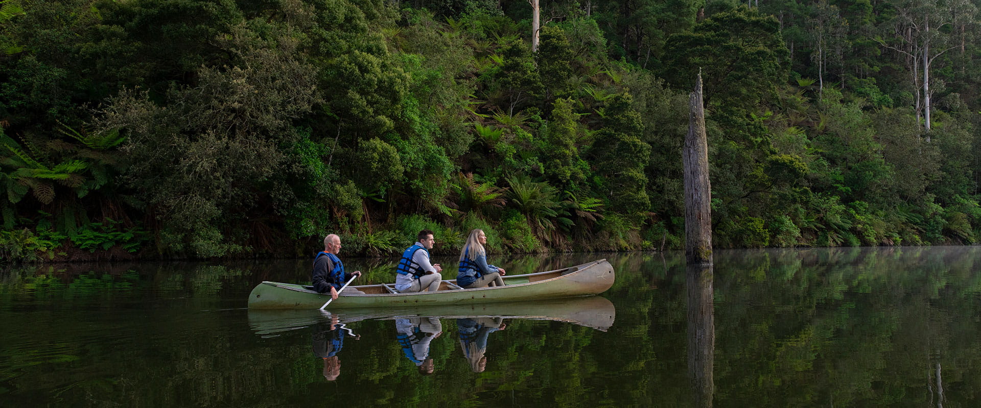
Explore the Lake Elizabeth Loop Walk and and its forested hinterland. A massive landslide in 1952 dammed the East Barwon River, turning the remote forested valley into the lake you see today.
A colony of shy platypus live in the timber-flanked lake. The quiet visitor may see them at at dusk or dawn foraging in the shallow waters. Bird enthusiasts may be treated to birdsong and sightings of Striated Fieldwrens, Rufous Bristlebirds, and Pink Robins. A number of excellent bird apps are useful guides to birdsong and recognition.
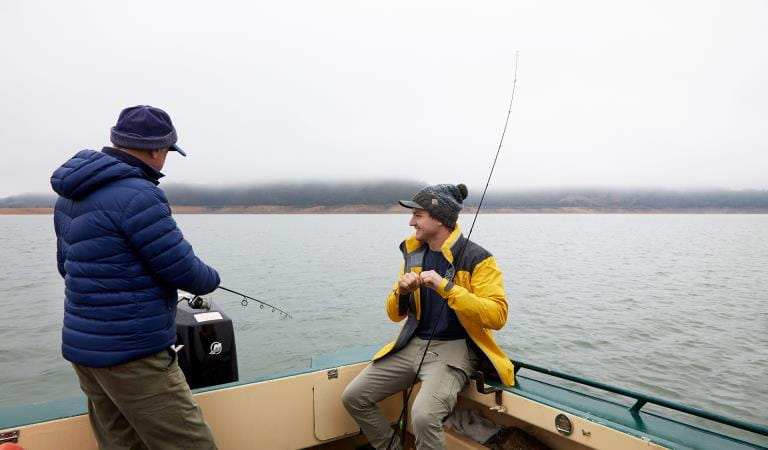
Streams and rivers throughout the park and provide great opportunities for fishing. Cast a line at the West Barwon Dam for your chance to catch trout and redfin or the East Barwon River for Brown Trout.
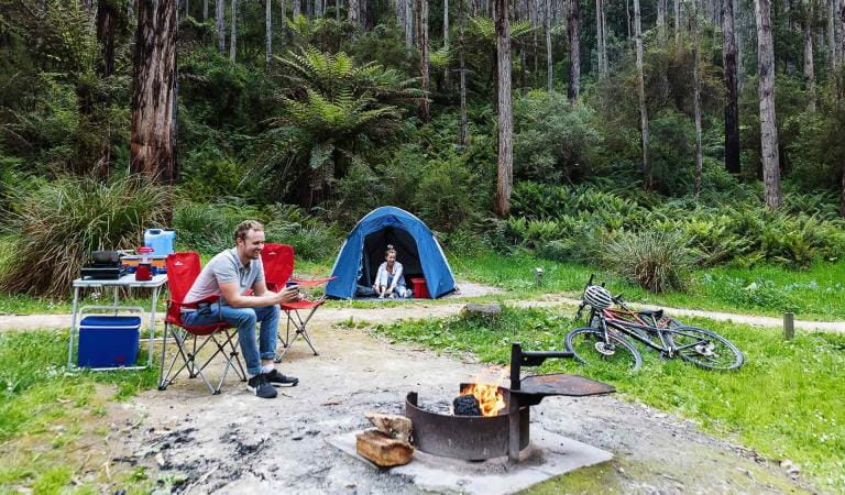
The tranquil Lake Elizabeth Campground is nestled beneath tall eucalypts on the bank of the east branch of the small Barwon River. This is a dogs-on-lead camping opportunity and it is separate to the Day Visitor Area. The lake is a 1km walk from the visitor area .
Beautiful picnic areas of the Great Otway National Park and Otway Forest Park include Lake Elizabeth, Dandos Campground, Birnham Station and Stevensons Falls Campground.
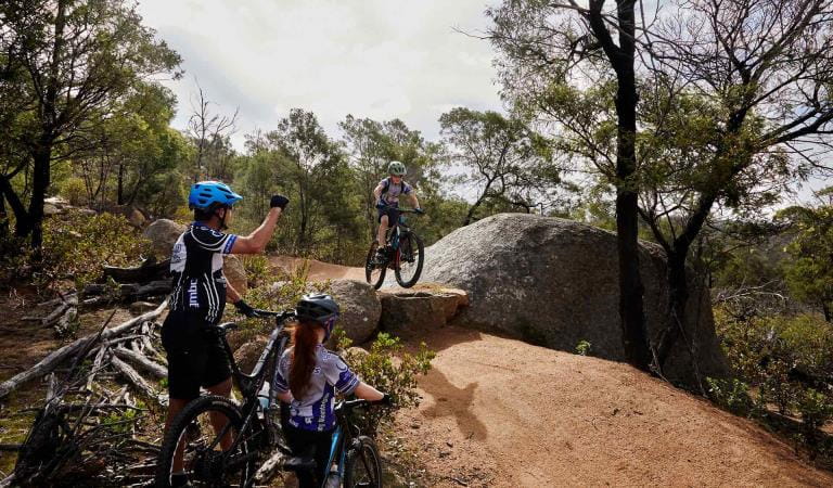
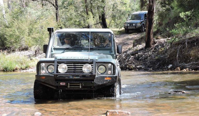
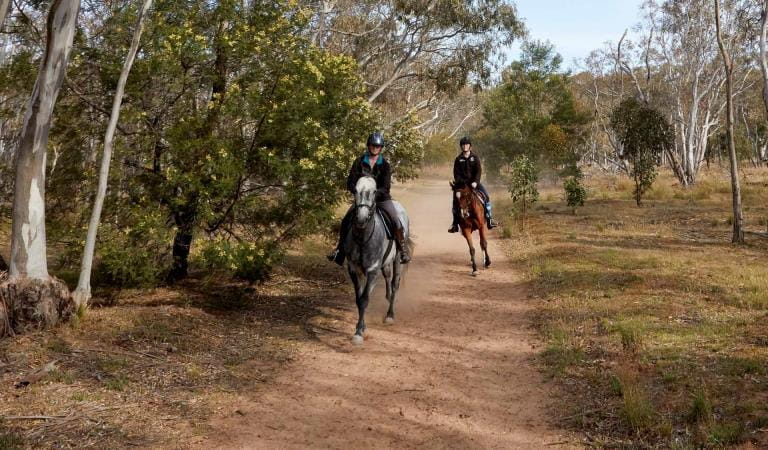
You can also explore and enjoy the natural environment of this part of the Otways on horseback, mountain bike, or in a four wheel drive vehicle.
The roads in the Wonga and Barongarook areas of the Otway Forest Park are ideal for horse riding as there are a number of wider, slashed roadsides.
Mountain bike riders of all levels are catered for by more than 60km of formed tracks and a 12km mountain bike loop linking the Forrest township with West Barwon Reservoir and Lake Elizabeth.
For driving enthusiasts, a range of formed tracks and roads provide four-wheel drive access throughout the parks. Seasonal track closures may apply.
Things to do
Lake Elizabeth Campground
Mountain biking
4WD
Fishing
Horse riding
How to get there
Forrest
When you're there
In this area of Great Otway National Park, dogs are permitted on lead only in the Lake Elizabeth Camping Area and the Lake Elizabeth Day Visitor Area and adjoining walking tracks. Dog owners should keep dogs on leads when visiting this area to reduce incidents of snake bite. Dogs are permitted in all areas of Otway Forest Park.
Download the visitor guide before you go.
Need to know
Forrest
Accessibility
Visiting a park can be more of a challenge for people with disabilities, however in Victoria there are a wide range of facilities to help people of all abilities enjoy our wonderful parks around the state.
Assistance dogs are welcome in Parks Victoria parks and reserves. Entry requirements apply for parks and reserves that are usually dog prohibited, such as national parks.
Change of Conditions
Nature being nature, sometimes conditions can change at short notice. It’s a good idea to check this page ahead of your visit for any updates.
-
Aire River West Campground (Great Otway National Park GORCAPA, Aire River Heritage River)
Aire West Campground – Partial Seasonal Closure
Visitors are advised that sites 17–40 at Aire West Campground in Great Otway National Park are temporarily closed from 29 May to 25 September 2026 due to seasonal conditions.What to expect:Sites 17–40 are closed and unavailable for camping or vehicle access during this periodRemaining sites may still be accessible, subject to conditionsImportant information:The closure period may be extended if conditions remain too wet to safely support camping and vehicle accessVisitors are asked to follow any on-site signage and avoid closed areas to prevent damage to the campground and ensure safety.The Great Ocean Walk hike in camp site is not impacted.Entering into or camping within closed areas is subject to National Park regulationsWe appreciate your cooperation in helping protect the park during these conditions. -
Aire River East Campground (Great Otway National Park GORCAPA, Aire River Heritage River)
Aire East Campground – Seasonal Closure
Aire East Campground in Great Otway National Park will be closed from 29 May to 25 September 2026 as part of the annual seasonal winter closure.This closure is necessary to protect the campground and access tracks during periods of wet weather, when conditions are highly susceptible to damage from vehicle use and camping activity.What to expect:No visitor or vehicle access to the campground during the closure period.Campground and toilet facilities will be unavailable.Important information:The closure period may be extended if conditions remain too wet to safely support vehicle access and camping.Visitors are encouraged to plan ahead and consider alternative campgrounds.We appreciate your cooperation in helping protect the park environment during this time. -
Notices Affecting Multiple Sites
Great Otway Natonal Park - flood damge impact
Severe thunderstorms and flash flooding on 16 January 2026 caused significant damage across parts of the eastern Great Otway National Park.Recovery works are ongoing.We are pleased to advise that some areas have now reopened, while others remain closed to ensure public safety during assessment and repair work.The following areas are now open to visitors:- Moggs Creek Picnic Area
- Distillery Creek Picnic Area
- Ocean Track
- Castle Rock
- Sheoak Falls to Swallow Cave Track
Parks Victoria has reopened sections of the Kalimna Falls Walking Trail, providing:
- Access from Sheoak Picnic Ground
- Walking access to Lower Kalimna Falls
- Return via the same route or continuing through to Garvey Track
✅ Open sections are marked in green on park signage/maps
❌ Closed sections remain in red and must not be enteredVisitors should remain on marked open tracks and follow all onsite signage.
⚠️ Important Visitor Advice- Always follow posted signage and staff directions
- Stay within reopened (green-marked) track sections
- Do not enter closed areas under any circumstances
- Conditions may change without notice
-
Great Otway National Park
Wye Road Closure
Due to recent storm and flood damage, Wye Road will remain closed until the end of winter to allow for road maintenance and repair works.