


The track leads you through coastal scrub to the magnificent Bushrangers Bay, which is surrounded by basalt cliffs with a large sandy beach formed by the outlet of Main Creek. If the tide is in you may get wet feet when wading across the shallow estuary of Main Creek.
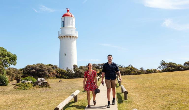
When you have finished exploring the beach, or investigating the wonderful landscape, follow the track back to Cape Schanck Lighthouse.
The track is 5 km for the return trip. The walk has steep stairs and sandy unsealed narrow paths.
Hooded Plovers call the dunes at Bushrangers Bay home, so it is important to follow all signage and keep out of the habitat area of this magnificent but vulnerable beach-nesting bird. Snakes are another creature that call this area home, so please stay on the track to avoid unnecessary encounters. If you see a snake, stand still and don’t panic. Snakes nearly always move away when they feel footstep vibrations.
Although beautiful, Bushrangers Bay is a high-risk area affected by tidal changes and can have high surf, unexpected waves, strong currents, slippery rocks, shallow areas and submerged rocks. This beach is not patrolled. Swimming is not recommended.
If you want a longer hike, continue along the Two Bays Walking Trail from the Bushrangers Bay Track and continue north through shady banksia groves along the west bank of Main Creek back towards Boneo Road and Greens Bush.

Walk

Picnic
History tour
Wildlife
The Superb Fairy-wren, the icon of the Two Bays Walking Trail, is often seen along the Bushrangers Bay Track. It is native to Australia and its habitat is thick undergrowth. They eat insects, but also seeds and fruit.
How to get there
Bushrangers Bay Track
The Bushrangers Bay Track commences at the eastern carpark at Cape Schanck. It is a small section of the longer Two Bays Walking Trail, a 26 km hike from Cape Schanck to Dromana, which showcases the landscapes of Mornington Peninsula National Park and Arthurs Seat State Park. The trail is identified by a circular symbol displaying a blue wren, which can be seen on signage along the route.
The trailhead is 75 km from Melbourne. If you plan to walk the Bushrangers Bay Track or start the Two Bays Walking Trail from the south, follow the directions to Cape Schanck and park in the carpark. Alternatively, you can access the track from Boneo Road, but parking is limited here at the Bushrangers Bay Picnic Area and the track is 2.5 km in one direction from this starting point.
When you're there
Help us look after Mornington Peninsula National Park by remembering the following points:
- Dogs, cats, horses and motorbikes are not permitted
- Fires or heat beads are not permitted
- Please take all your rubbish home with you
- Do not feed the animals
- Bicycles are not permitted
- Firearms are not permitted
- Camping is only permitted at Lightwood Creek Camping Area
- Snakes live in the park and sometimes sunbake on the paths. Do not approach.
Need to know
Bushrangers Bay Track
Accessibility
Visiting a park can be more of a challenge for people with disabilities, however in Victoria there are a wide range of facilities to help people of all abilities enjoy our wonderful parks around the state.
Assistance dogs are welcome in Parks Victoria parks and reserves. Entry requirements apply for parks and reserves that are usually dog prohibited, such as national parks.
Bushrangers Bay Track is not suitable for wheelchairs or strollers due to the unsealed narrow paths and steep stairs.
Safety in nature
Bushrangers Bay is a high-risk area affected by tidal changes and can have high surf, unexpected waves, strong currents, slippery rocks, shallow areas and submerged rocks. Drinking alcohol significantly increases the risk of drowning. Always actively supervise children in or near water: children under ten should always be within sight; children under five should always be within reach.
Swimming is not recommended. This beach is not patrolled.
The track is a significant distance from hospitals and access is limited for emergency services.
Bring your own drinking water, there is no drinking water available.
Before you visit check the Fire Danger Rating and for days of Total Fire Ban at VicEmergency, on the VicEmergency smartphone app or call the VicEmergency Hotline on 1800 226 226.
Change of Conditions
Nature being nature, sometimes conditions can change at short notice. It’s a good idea to check this page ahead of your visit for any updates.
-
Flinders Ocean Beach (Mornington Peninsula National Park, Mushroom Reef Marine Sanctuary)
Mushroom Reef Toilet Closure Finders Ocean Beach
The toilet at Flinders Ocean Beach, Mushroom Reef is permanently closed. The nearest alternative public toilets are Flinders town centre public toilets.Landslip affecting beach west of Mushroom Reef, Flinders Ocean Beach
There is a landslip affecting the beach west of Mushroom Reef, Flinders Ocean Beach (within Mornington Peninsula NP). Please do not approach the slip.
Landslip affecting beach west of Mushroom Reef, Flinders Ocean Beach
There is a landslip affecting the beach west of Mushroom Reef, Flinders Ocean Beach (within Mornington Peninsula NP). Please do not approach the slip.
Similar experiences
