Explore
Dispersed camping in Alpine National Park
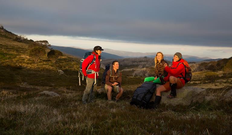
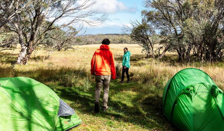
The Alpine National Park offers some of the most authentic and scenic bush camping opportunities in Victoria. Camping in the park is suited to experienced hikers and campers that are self sufficient.
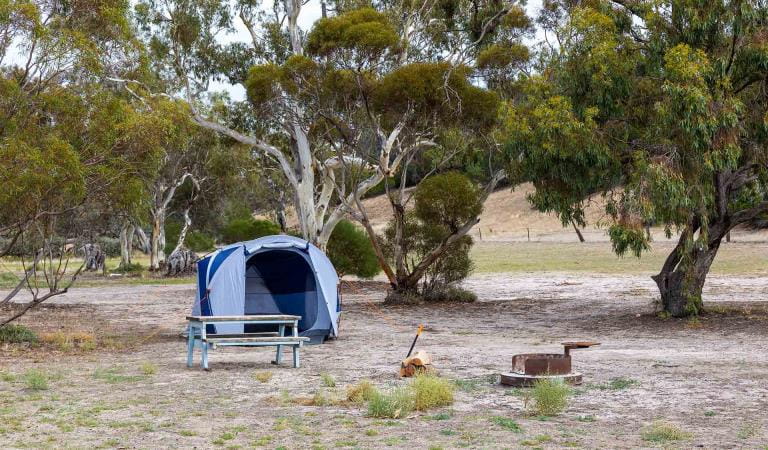
Dispersed camping is permitted throughout much of the park. There are some camping areas that include facilities such as pit toilets, picnic tables and fireplaces.
Within the Alpine National Park bookings and fees apply only to the Falls to Hotham Alpine Crossing.
Further information and the location of camping areas can be found in the related publications below.
When camping you should be fully self sufficient with food, water and camping equipment. Always carry a tent. Huts are for emergency use only. Firewood supplies are limited especially in the alpine and sub alpine areas, so the use of camping stoves is preferred.
Weather can deteriorate suddenly and without warning, and snow can fall at any time of year, including mid-summer. Don't hesitate to turn back if the trip becomes too difficult or the weather deteriorates. Some roads are subject to seasonal closures in winter and early spring, check closures before you go.
Things to do in the area

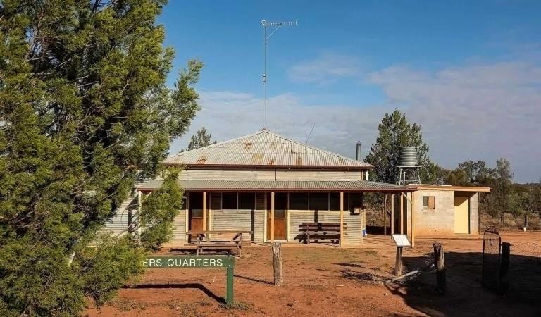
Camping with your horse in Alpine National Park and Howqua Hills
Falls to Hotham Alpine Crossing

Tali Karng
How to get there
Dispersed camping in Alpine National Park
Sites
When you're there
Need to know
Dispersed camping in Alpine National Park
Where to Camp
Around Bright, Mount Beauty, Omeo and Dargo
Dispersed bush camping is permitted throughout the area except within 200 metres of the Bogong High Plains or Pretty Valley Roads.
Toilets, picnic tables and fireplaces are provided at the following camping areas:
- JB Plain between Hotham Village and Dinner Plain on the Great Alpine Road (walk in only)
- Buckety Plain, Rasberry Hill and Langfords West (horse yards) on the Bogong High Plains east of Falls Creek
- Mountain Creek at the foot of Mt Bogong near Tawonga
Around Heyfield, Licola and Dargo in the Wonnangatta - Moroka area
Toilets, picnic tables and fireplaces are provided at the following camping areas:
- Wellington River - 13 unnumbered camping areas beneath shady peppermints and manna gums, toilets located at some sites. Horse yards at site 12. Tamboritha Road approximately 10 km from Licola.
- Horseyard Flat - set amongst Black Sallees on the banks of the Moroka River.
- Eaglevale - on the Wonnangatta River below the towering ramparts of Mt Kent and Snowy Bluff.
- Wonnangatta Valley (4WD access only) - near the historic site of the Wonnangatta Homestead.
- Talbotville (4WD access only) - on the grassy flats of the Crooked River.
- Grant - a grassy clearing in the forest and all that remains of a once thriving gold mining town.
Around Mansfield and Whitfield
Sites with facilities are:
- Sheepyard and Frys Flats, and several other flats upstream along the Howqua River
- Bluff Hut (4WD access)
- Bennies camping area beside the Rose River (2WD access)
- Lake Cobbler (4WD access recommended - very rough 2WD past Bennies)
- Pineapple Flat (4WD access)
- King Hut (4WD access)
Around Mitta Mitta, Omeo, Tallangatta, Corryong and Cobberas
Camper trailers are not recommended for Cobberas Trail, MacFarlane Flat Track and Ingeegoodbee Track due to very steep, loose and rocky terrain.
Camper trailers are not recommended on Davies Plain Track, Limestone Creek Track and McCarthys Track due to steep, loose and rocky terrain.
Sites with basic facilities such as pit toilets and fireplaces are:
- Taylor’s Crossing beside the Mitta Mitta River
- Dogman Hut near Tom Groggin Station
- Limestone Creek (4WD only) - Limestone - Black Mountain Road (Camper trailers can access Limestone Creek Camping Area from the Black Mountain-Limestone Road)
- The Poplars (4WD dry weather only) - Limestone Creek - McCarthy’s Tracks
- Charlies Creek (4WD only) on the southern end of Davies Plain Track
- Davies Plain Hut (4WD only) on the northern end of Davies Plain Track.
- Bunroy Creek on the banks of the Murray River, access via the Bunroy Road
Trailers are not recommended on Davies Plain Track, Limestone Creek Track and McCarthys Track due to steep, loose and rocky terrain. Camper trailers are okay to Limestone Creek camping area from the Black Mountain Limestone Road. No trailers on Cobberas Trail, MacFarlane Flat Track and Ingeegoodbee Track due to very steep, loose and rocky terrain.
Along the Omeo Highway - travelling from Omeo to Mitta Mitta there is:
- CRB Camp near Anglers Rest
- Anglers Rest near the historic ‘Blue Duck’ hotel
- Jokers Flat beside the Big River
- Big River Bridge near Glen Valley
Around Wabonga Plateau, Mt Cobbler and Powers Lookout
Sites with facilities are:
- Bennies Camping Area (2WD access)
- Lake Cobbler (4WD access recommended - very rough 2WD past Bennies)
- Pineapple Flat (4WD access)
- King Hut (4WD access)
Around Howitt, Snowy Range and Tali Karng
Sites for bushwalkers with basic facilities are:
- Macalister Springs - fuel stove only area.
- Tali Karng - fuel stove only area. Large groups are asked to register at the Heyfield Office. Preferred campsites are situated at Riggals Hut site and along Wellington River.
Sites for car based campers with basic facilities are: - Wellington River - 9 km along the river, beginning 10 km north of Licola. Toilets at some sites.
- Horseyard Flat - Beside the Moroka River.
- Wonangatta Valley (4WD only) - near the historic site of the Homestead.
Alpine back country winter safety
Safe backcountry travel in Victorian Alpine areas during winter requires training and experience. You control your risk by choosing how, when and where you travel, and the activities you participate in.
Change of Conditions
Nature being nature, sometimes conditions can change at short notice. It’s a good idea to check this page ahead of your visit for any updates.
-
Pinnacles Lookout Day Visitor Area (Pinnacle Ck - East Branch Natural Catchment Area, Alpine National Park)
Pinnacles toilet CLOSED until further notice
The drop toilet located at the Pinnacles lookout is closed until further notice due to maintenance requirements. The closest alternative toilet is at Horseyard Flat, Alpine National Park.
We apologise for any inconvenience. -
Moroka Hut and Camping Area (Alpine National Park)
Moroka River Pedestrian Bridge CLOSED until further notice
The Moroka River pedestrian bridge is closed until further notice due to being assessed as structurally unsound.Access to Moroka Hut is via the Moroka Range Walking Track (4WD only). -
Alpine National Park
Eastern Alps track closures due to storm and flood damage
The 4x4 tracks in the Eastern Region are an iconic part of Victoria and an important focal point for many people. With a large number of visits per year, they are very popular for outdoor activities such as camping, hiking, mountain biking and four-wheel driving.Unfortunately, sometimes we must close infrastructure in the interests of public safety and environmental protection.
The following tracks have been significantly damaged by storms and floods and are currently closed to motor vehicles to ensure public safety and environmental protection:- Cobberas Track
- Macfarlane Flat Track
- Ingeegoodbee Track
Before visiting, Visitors should always check the Parks Victoria website for the latest information about their destination.Road maintenance - Tamboritha Road
Road maintenance is currently underway on Tamboritha Road in the Foothills & Southern Alps area of the Alpine National Park. There will be an increase in Truck movements and equipment operating along Tamboritha Road between Bennison Gravel Pit and Arbuckle Junction.Please be aware traffic management is in place with possible delays. Always adhere to signs and please drive carefully and to the conditions.Restricted Access at Eastern end of Spring Saddle Track
The eastern end of Spring Saddle Track has restricted access due to machinery continuing to clear soil as part of the Bogong Village landslip remediation works. The track is open to pedestrian traffic but not vehicles and no Park visitors will be able to enter the works site at the Eastern end of Spring Saddle Track. There is signage explaining the restrictions at the Spring Saddle Track Fainter Fire Trail intersections.Bogong High Plains Road
Following the landslide at Bogong Village the Bogong High Plains Road is now open however remediation work will continue into the foreseeable future to rectify the damage created by the landslide. Parks Victoria advises that all visitors check the Regional Roads Victoria and Victoria's big build website for the latest traffic updates on closures or delays before visiting.https://regionalroads.vic.gov.au/map/north-eastern-improvements/bogong-high-plains-road-landsliphttps://bigbuild.vic.gov.au/projects/mrpv/bogong-high-plains-road-landslipGround shooting operations targeting Feral Pigs Eastern Alps from 15 April 2024.
Ground operations (ground shooting) targeting Feral Pigs are undertaken across the Eastern Alps, and include areas to the west and north of Suggan Buggan, west of Wulgulmerang, and east of Cobberas and Brumby. The Park will remain open to visitors during operations.
This work is to be carried out dusk to dawn from:
* 15 to 26 April, and
* 29 May to 15 June 2024.Attachments: Flyer for feral pig control FINAL (165KB)
Mt Pinnibar Track - poor track conditions
Mt Pinnibar Track, between Walkers Road and Tom Groggin Track, has developed sections of significant and deep track erosion following flood and storm events.While the track remains open it is recommended that only experienced drivers in well equipped 4WD vehicles attempt this track in dry conditions.All visitors are advised to consider alternate routes to the summit of Mt Pinnibar until repairs can be carried out.Road Conditions – Tamboritha and Howitt Roads
Tamboritha and Howitt Roads in the Foothills and Southern Alps area of the Alpine National Park are currently recommended for all wheel drive and four wheel drive vehicles with sufficient clearance and appropriate tyres. Road maintenance works have been completed on sections the Tamboritha and Howitt Roads in summer 2024, however some road surfaces conditions remain poor.Vehicles travelling on the these roads require attention to variations of the surface condition.Allow more time for your journey and always drive to the conditions. - Cobberas Track
-
Notices Affecting Multiple Sites
TRACK CLOSURE: Wild Horse Gap Track, Alpine National Park
Wild Horse Gap Track is currently closed as a result of poor track condition until further notice.Access to the park is not affected - alternate routes are available that will enable transit through this section of the Alpine National Park. If you require assistance with journey planning as a result of the closure, please contact the local Parks Victoria office for assistance via 13 19 63. -
Notices Affecting Multiple Parks
Ground shooting operations targeting deer
Control operations (ground shooting) targeting deer are undertaken in this area. The Park will remain open to visitors during operations. -
Federation Hut (Alpine National Park)
Water tank at Federation Hut is currently empty.
The water tank at Federation Hut is currently empty and will not be replenished until significant rainfalls.The nearby springs have also slowed up, so walkers should consider taking their own water with them and not be fully reliant on those springs in case they do stop flowing.
Similar Experiences
Camping in Baw Baw National Park
Wonga Camping Area