Explore
Dispersed camping in Alpine National Park
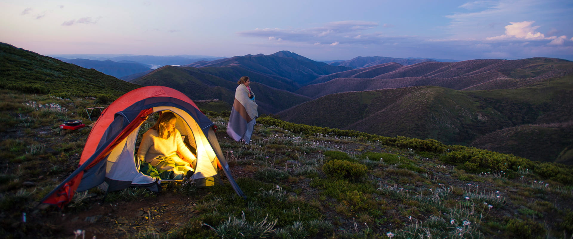
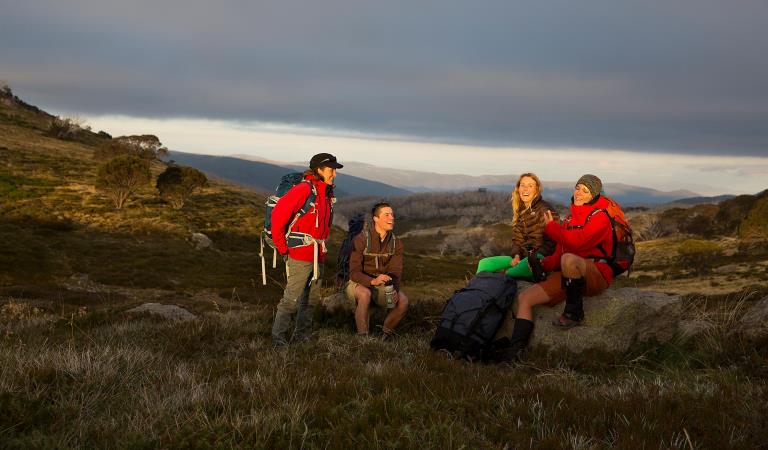
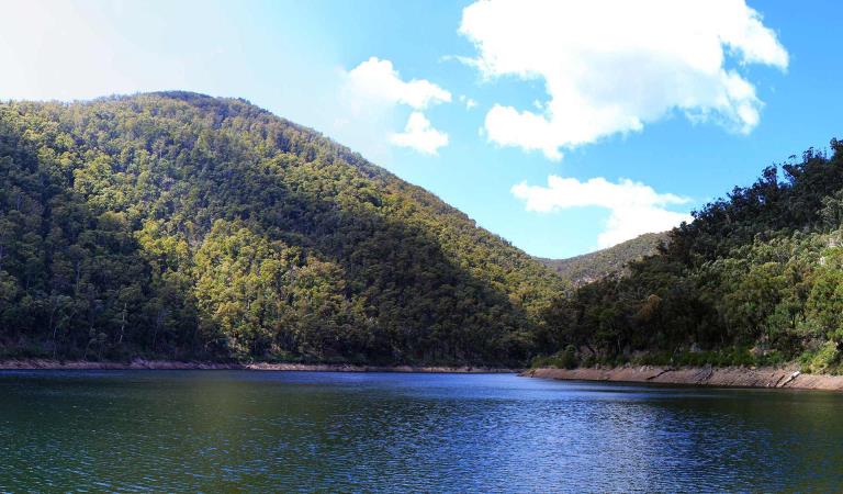
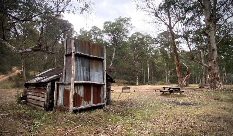
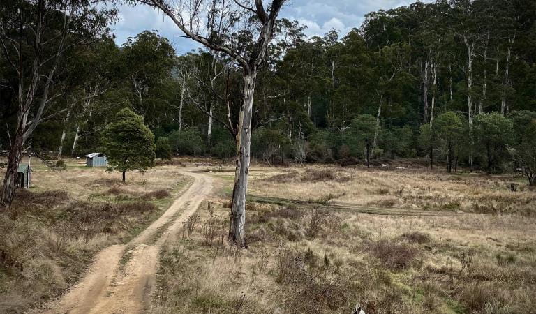
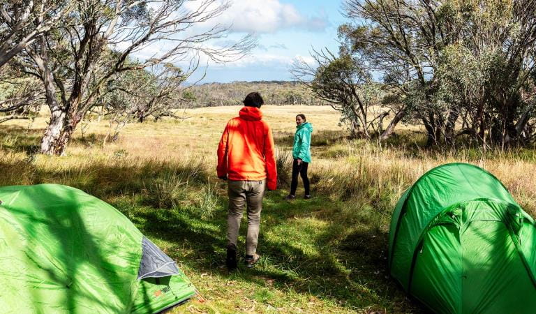
The Alpine National Park offers some of the most authentic and scenic bush camping opportunities in Victoria. Camping in the park is suited to experienced hikers and campers that are self sufficient.
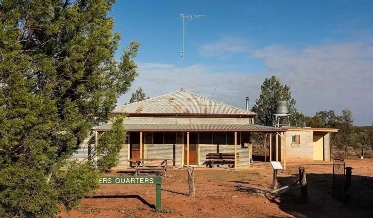
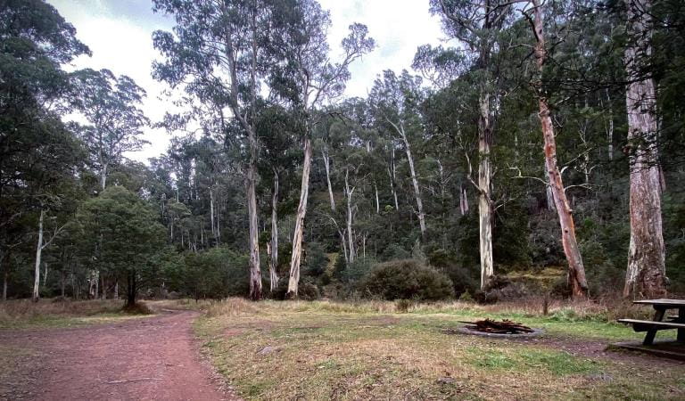
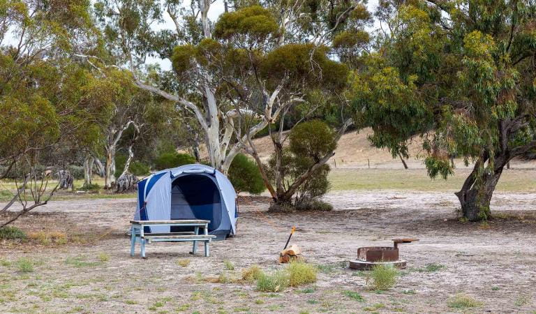
Dispersed camping is permitted throughout much of the park. There are some camping areas that include facilities such as pit toilets, picnic tables and fireplaces.
Within the Alpine National Park bookings and fees apply only to the Falls to Hotham Alpine Crossing.
Further information and the location of camping areas can be found in the related publications below.
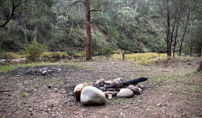
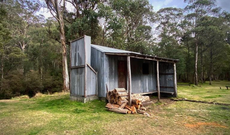
When camping you should be fully self sufficient with food, water and camping equipment. Always carry a tent. Huts are for emergency use only. Firewood supplies are limited especially in the alpine and sub alpine areas, so the use of camping stoves is preferred.
Weather can deteriorate suddenly and without warning, and snow can fall at any time of year, including mid-summer. Don't hesitate to turn back if the trip becomes too difficult or the weather deteriorates. Some roads are subject to seasonal closures in winter and early spring, check closures before you go.
Things to do in the area
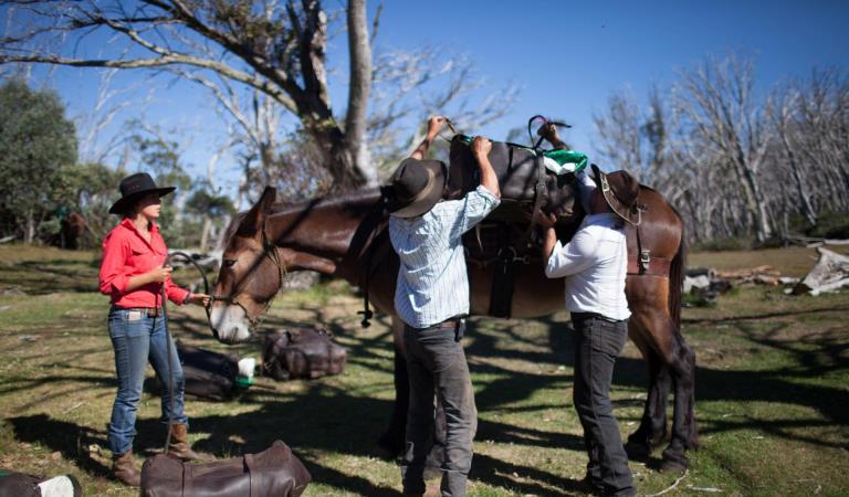
Camping with your horse in Alpine National Park and Howqua Hills
Falls to Hotham Alpine Crossing
Tali Karng
6 Mile Flat Camping Area
7 Mile Flat Camping Area
8 Mile Flat Camping Area
Bindaree Flat Camping Area
King Hut Camping Area
Pikes Flat Camping Area
Upper Howqua Camping Area
How to get there
Dispersed camping in Alpine National Park
Sites
When you're there
Need to know
Dispersed camping in Alpine National Park
Where to Camp
Around Bright, Mount Beauty, Omeo and Dargo
Dispersed bush camping is permitted throughout the area except within 200 metres of the Bogong High Plains or Pretty Valley Roads.
Toilets, picnic tables and fireplaces are provided at the following camping areas:
- JB Plain between Hotham Village and Dinner Plain on the Great Alpine Road (walk in only)
- Buckety Plain, Rasberry Hill and Langfords West (horse yards) on the Bogong High Plains east of Falls Creek
- Mountain Creek at the foot of Mt Bogong near Tawonga
Around Heyfield, Licola and Dargo in the Wonnangatta - Moroka area
Toilets, picnic tables and fireplaces are provided at the following camping areas:
- Wellington River - 13 unnumbered camping areas beneath shady peppermints and manna gums, toilets located at some sites. Horse yards at site 12. Tamboritha Road approximately 10 km from Licola.
- Horseyard Flat - set amongst Black Sallees on the banks of the Moroka River.
- Eaglevale - on the Wonnangatta River below the towering ramparts of Mt Kent and Snowy Bluff.
- Wonnangatta Valley (4WD access only) - near the historic site of the Wonnangatta Homestead.
- Talbotville (4WD access only) - on the grassy flats of the Crooked River.
- Grant - a grassy clearing in the forest and all that remains of a once thriving gold mining town.
Around Mansfield and Whitfield
Sites with facilities are:
- Sheepyard and Frys Flats, and several other flats upstream along the Howqua River
- Bluff Hut (4WD access)
- Bennies camping area beside the Rose River (2WD access)
- Lake Cobbler (4WD access recommended - very rough 2WD past Bennies)
- Pineapple Flat (4WD access)
- King Hut (4WD access)
Around Mitta Mitta, Omeo, Tallangatta, Corryong and Cobberas
Camper trailers are not recommended for Cobberas Trail, MacFarlane Flat Track and Ingeegoodbee Track due to very steep, loose and rocky terrain.
Camper trailers are not recommended on Davies Plain Track, Limestone Creek Track and McCarthys Track due to steep, loose and rocky terrain.
Sites with basic facilities such as pit toilets and fireplaces are:
- Taylor’s Crossing beside the Mitta Mitta River
- Dogman Hut near Tom Groggin Station
- Limestone Creek (4WD only) - Limestone - Black Mountain Road (Camper trailers can access Limestone Creek Camping Area from the Black Mountain-Limestone Road)
- The Poplars (4WD dry weather only) - Limestone Creek - McCarthy’s Tracks
- Charlies Creek (4WD only) on the southern end of Davies Plain Track
- Davies Plain Hut (4WD only) on the northern end of Davies Plain Track.
- Bunroy Creek on the banks of the Murray River, access via the Bunroy Road
Trailers are not recommended on Davies Plain Track, Limestone Creek Track and McCarthys Track due to steep, loose and rocky terrain. Camper trailers are okay to Limestone Creek camping area from the Black Mountain Limestone Road. No trailers on Cobberas Trail, MacFarlane Flat Track and Ingeegoodbee Track due to very steep, loose and rocky terrain.
Along the Omeo Highway - travelling from Omeo to Mitta Mitta there is:
- CRB Camp near Anglers Rest
- Anglers Rest near the historic ‘Blue Duck’ hotel
- Jokers Flat beside the Big River
- Big River Bridge near Glen Valley
Around Wabonga Plateau, Mt Cobbler and Powers Lookout
Sites with facilities are:
- Bennies Camping Area (2WD access)
- Lake Cobbler (4WD access recommended - very rough 2WD past Bennies)
- Pineapple Flat (4WD access)
- King Hut (4WD access)
Around Howitt, Snowy Range and Tali Karng
Sites for bushwalkers with basic facilities are:
- Macalister Springs - fuel stove only area.
- Tali Karng - fuel stove only area. Large groups are asked to register at the Heyfield Office. Preferred campsites are situated at Riggals Hut site and along Wellington River.
Sites for car based campers with basic facilities are: - Wellington River - 9 km along the river, beginning 10 km north of Licola. Toilets at some sites.
- Horseyard Flat - Beside the Moroka River.
- Wonangatta Valley (4WD only) - near the historic site of the Homestead.
Alpine back country winter safety
Safe backcountry travel in Victorian Alpine areas during winter requires training and experience. You control your risk by choosing how, when and where you travel, and the activities you participate in.
Change of Conditions
Nature being nature, sometimes conditions can change at short notice. It’s a good idea to check this page ahead of your visit for any updates.
-
Alpine National Park
Cobberas, Ingeegoodbee and Macfarlane Flat Track closures.
The following tracks have been significantly damaged by storms and floods and are currently closed to motor vehicles to ensure public safety and environmental protection:- Cobberas Track
- Macfarlane Flat Track
- Ingeegoodbee Track
The tracks are likely to remain closed to motor vehicles until detailed site assessments have been completed. It is difficult to predict when planning approvals will be obtained to allow for repairs to commence.
Before visiting, visitors should check the Parks Victoria website for the latest information about their destination.Attachments: FAQs for Cobberas ingeegoodbee and mcfarlane tks (128KB)
Wonnangatta Complex Fire - Area and Road Closures - North East
Closed sites/tracks include:- Rileys, Humffray River, Whites & Water Spur Tracks.Open areas:- Access to the Wonnangatta Valley via East Buffalo Road, East Riley, Zeka Spur and Wonnangatta Tracks.- West Buffalo, Harry Shephards, & Penny Track- West Humffray River Track- Australian Alps Walking Track- King Hut- King Billy Track through to Howitt Road- Cobbler Lake Track, Speculation Rd & Lake Cobbler- The Bogong High Plains- Mt Feathertop and Mt Loch areas- Mt Bogong- Walking tracks between Falls Creek and Mt Hotham- Mt Buffalo- Visitor sites accessed from the Omeo Highway- Howqua Hills- Lake Cobbler- Beveridges Station- Twins Tk, Selwyn Ck Tk, Mt Murray South Track
Please see FFM closure map for https://www.ffm.vic.gov.au/permits-and-regulations/closures-of-parks-and-forestsAlpine National Park: road and track closures
These roads and tracks are closed due to current weather conditions at alpine elevations:
- Dargo High Plains Road
- Blue Rag Range Track
- Basalt North Track
- Twins Track
- Twins Jeep Track
- Mount Murray Track North
- Gunns Track
These tracks will remain closed until seasonal closure openings on 29 October 2026.In the interest of public safety, Victoria Police, Department of Energy Environment and Climate Action (DEECA) and Parks Victoria closed these high elevation alpine roads and tracks in State Forest and the Alpine National Park.Wonnangatta Complex Fire - Debris and Fallen Trees
Due to the recent Wonnangatta Complex Fire – Park Visitors may experience increased amount of debris and fallen trees along the track and road network.Whilst every effort will be made to keep tracks open and safe, post bushfire conditions may mean that tracks and roads may change in condition quickly.Please be aware and suitably prepared if visiting opened areas within the fire effected areas.Ground shooting operations targeting deer
Control operations (ground shooting) targeting deer are undertaken in this area. The Park will remain open to visitors during these operations.For more information about Parks Victoria deer control to protect biodiversity, please visit: https://www.parks.vic.gov.au/get-into-nature/conservation-and-science/conserving-our-parks/feral-animals/deer -
Beveridge Station Camping Area (Alpine National Park, UNKNOWN)
Change of Condition Alpine NP – Road & Track Closures:
Dargo High Plains Road, Blue Rag Range Track, Basalt North Track, Twins Track, Twins Jeep Track, Mount Murray Track North and Gunns Track.Due to current weather conditions at alpine elevations and in the interest of public safety Victoria Police, Department of Energy Environment and Climate Action (DEECA) and Parks Victoria will be closing the above-mentioned high elevation alpine roads and tracks in State Forest and the Alpine NP. These tracks will now remain closed until seasonal closure openings on the 29th of October 2026. -
Notices Affecting Multiple Sites
Wonnangatta Complex Fire - Area and Road Closures - Gippsland Alps
Certain Tracks and Sites in the Alpine National Park and Grant Historic Area remain CLOSED - Due to the Dargo Wonnangatta complex fires in the area
Closed Sites/Tracks:
- McMillans walking track within the closure area
- National Horse Trail from Wonnangatta Valley to Dargo within the closure area
- Pinnacles Day visitor area and viewing platform. Closed at junction of Pinnacles Road and Billy Goat Bluff Track Intersection.
- Certain Areas within the Grant Historic Area.
- Pioneer Racecourse Camping Areas (Alpine National Park)
- CLOSED Tracks include: Hern Spur Track, Scrubby Creek Track, Mccarthy Spur Track, Castleburn Track, Black Range Track, 65 Fire Trail Track, Junction Spur Track
Open areas
Open areas include:
- Wonnangatta Valley including access from Dargo
- Wellington Campsites on Tamboritha Road
- Wellington River Trailhead to Lake Tali Karng
- Thomastown Camping area, Kelly Hut, McMichaels Hut
- King Spur Track into Mayford
- Alpine National Park beyond Hotham Heights to the north and to Omeo
- Avon Wilderness Park
- Howitt Road
- Tamboritha Road
- King Billy Track
- Mt Howitt Carpark
- Vallejo Gantner Hut
- Macalister Springs
- Mount Howitt Walking Track
- Howitt Hut
- Bryces Gorge
- Horseyard Flat
- MacFarlane Saddle access to Tali Karng northern trail network.
- Moroka Hut
- Blue Rag Range
- Dargo High Plains including Mayford.
- Billy Goat Bluff Track
- Talbotville Camping Ground via McMillans Road
- McMillans Road from Dargo High Plains Rd to Talbotville Camping Area.
- Eaglevale Camping Area.
Please see FFM closure map https://www.ffm.vic.gov.au/permits-and-regulations/closures-of-parks-and-forests
Similar Experiences
Camping in Baw Baw National Park
Wonga Camping Area