
Grampians National Park is part of the Gariwerd Aboriginal cultural landscape. Parks Victoria respects the deep and continuing connection that Traditional Owners have to these lands and waters, and we recognise their ongoing role in caring for Country.
![]()
![]()
![]()
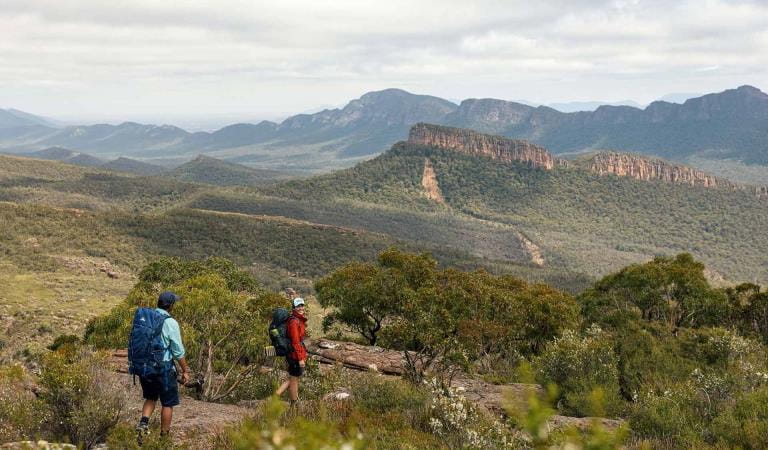
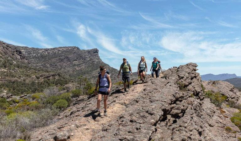
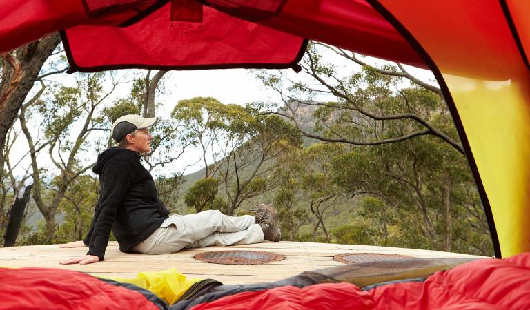
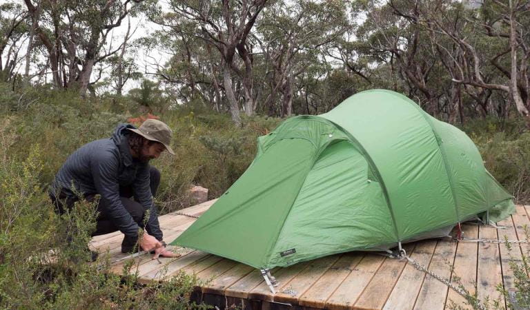
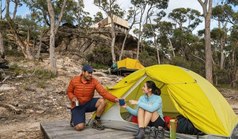
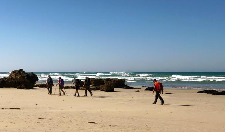
Hike during the day and camp 1-night under the stars to experience a little bit more of what the Grampians Peaks Trail has to offer. Choose from three 2-day hike options and explore the ancient, rugged landscape of Gariwerd. All itineraries require a car shuffle from start to finish. If you only have one vehicle, contact a Grampians Peaks Trail Licensed Tour Operator for transport services or visit Brambuk the National Park and Cultural Centre for other pick-up or hiking options.
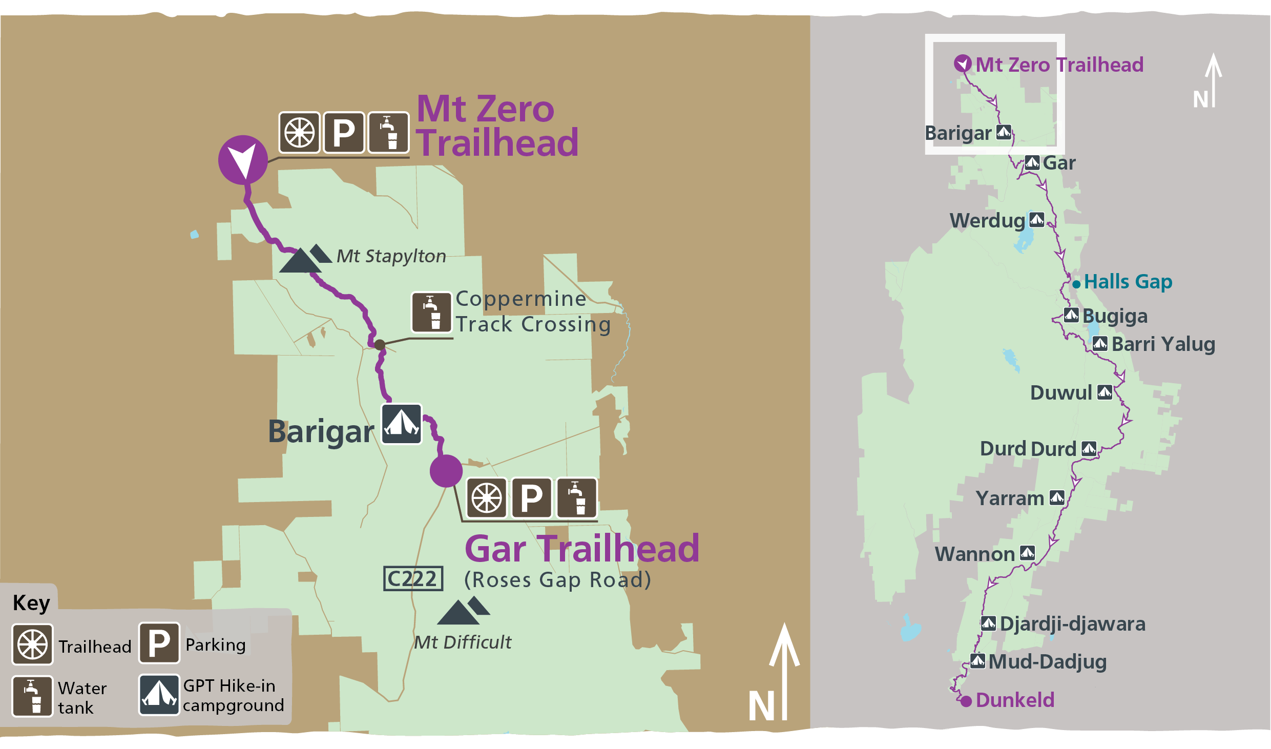
Barigar
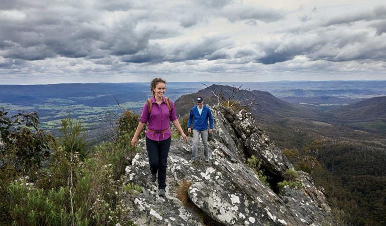
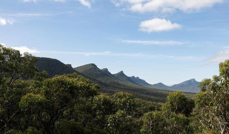
This overnight hike takes in the dramatic Stapylton Amphitheatre with the magnificent orange wave of Taipan Wall, Bird Rock, Mt Stapylton, panoramic ridgeline walking, wildflowers, seasonal creeks and a hidden waterfall located not far from Barigar Hike-in Campground.
Grade: 4
Length: 16.0km Day 1: 12.1km Day 2:3.9km
Start: Mt Zero Picnic Area (N1 on GPT Topographic map)
Finish: Gar Trailhead (Roses Gap Road)
Pick up and drop off: Short vehicle shuffle between Mt Zero Picnic Area and Gar Trailhead or arrange a bus transfer with Licensed Tour Operator. 45min round trip.
How to get there: From Melbourne (290km, 3hrs and 15mins), drive west on the Western Highway (A8) through Ararat, Stawell and Dadswells Bridge to Wonwondah-Dadswells Bridge Road. Turn left and follow for 6.4km to Winfields Road (unsealed), turn left and follow for 1.2km to Mt Zero Road (unsealed), turn left and follow for 2.2km to Mt Zero Picnic Area.
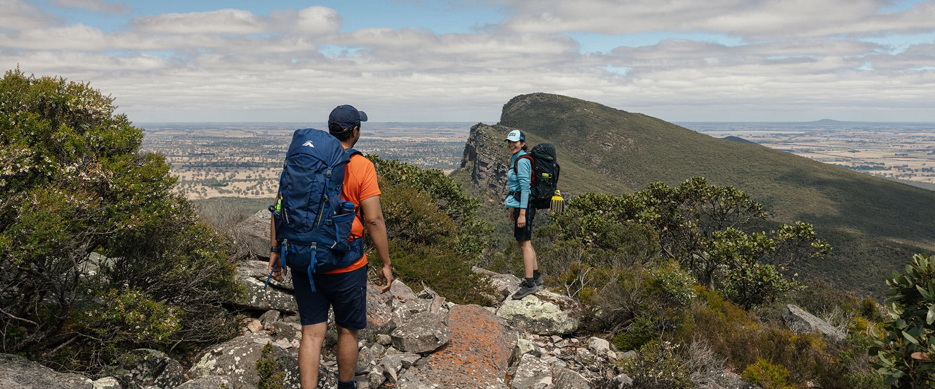
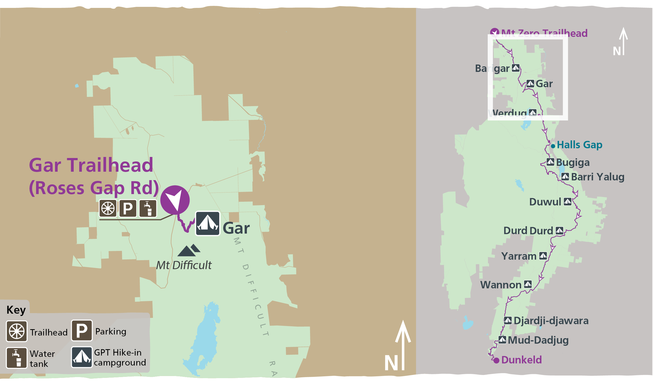
Gar
From Gar Trailhead, a gentle walk through dense bushland soon begins to climb along Dead Bullock Creek, passing by impressive seasonal waterfalls before opening up onto the rocky escarpment of Gar (Mt Difficult).
Enjoy breathtaking views before continuing to climb further, ending your day with a stunning sunset view at Gar Hike-in Campground. To enjoy an impressive sunrise, follow the track for 1.4km over steep rocky slabs to Gar summit. Return to your destination, Gar Trailhead by descending back to Gar Hike-in Campground first, and then follow the same GPT route from the previous day.
Grade: 4
Length: 15km Day 1: 7.5km Day 2: 7.5km
Start: Gar Trailhead (N2 on GPT Topographic map)
Finish: Gar Trailhead
Pick up and drop off: Park car at Gar Trailhead or arrange a bus transfer with Licensed Tour Operator; 30min each way.
Werdug
From the main car park in Halls Gap, walk past the pool, through the botanic gardens and head north towards Clematis Falls and Chatauqua Peak. From the saddle junction, the track climbs steeply transitioning from tall eucalypt forest into the dry rocky escarpments of the Mt Difficult Range.
Cross over Mt Difficult Road, where your perspective changes westerly. Navigate through the rocky escarpments to Werdug Hike-in Campground and enjoy breathtaking sunset views over Lake Wartook and the surrounding peaks. Return via the same route the following day.
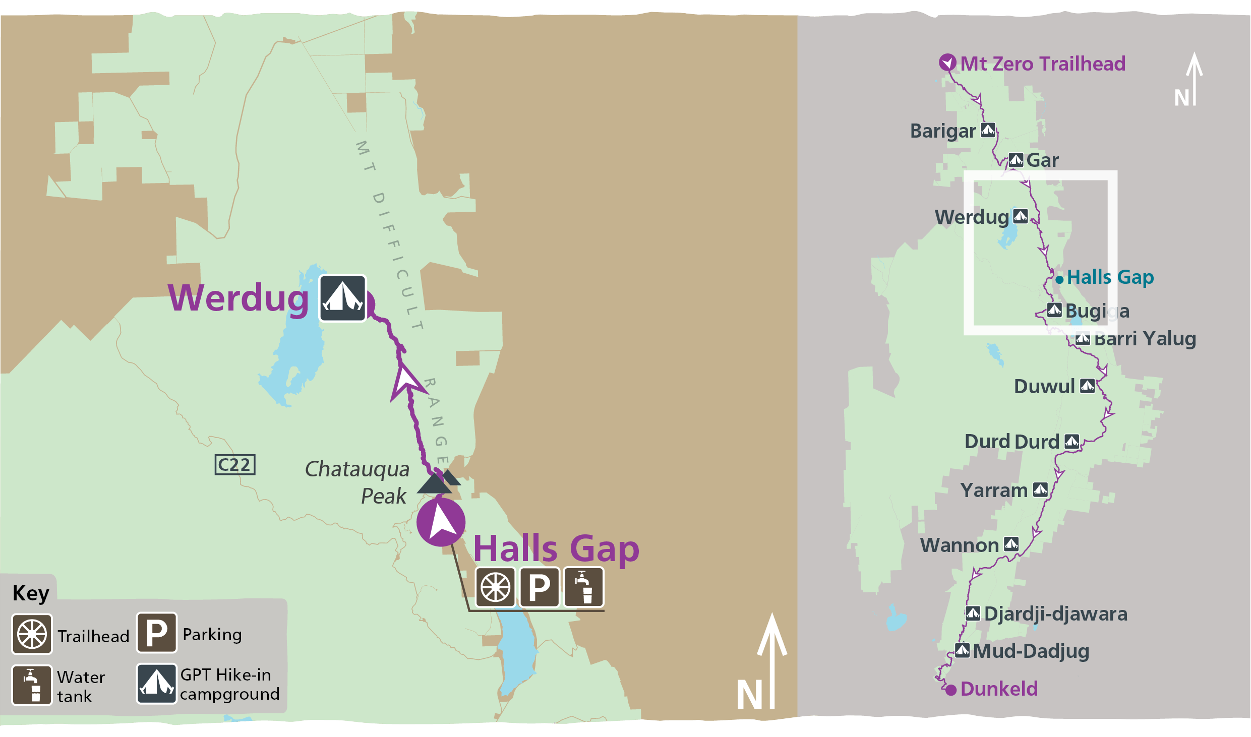
Grade: 4
Length: 26km Day 1: 13km Day 2: 13km
Start: Halls Gap (N4 on GPT Topographic map)
Finish: Halls Gap
Pick up and drop off: Main car park in Halls Gap, no additional transfers needed.
Bugiga
Start the morning in Halls Gap before traversing the Wonderland and northern section of the Serra Ranges on this overnight hike. Follow the cascading Stony Creek upstream through the Grand Canyon, climb to the Pinnacle and continue along the trail to camp below Mt Rosea at Bugiga Hike-in Campground. Wander through tall forest to rocky outcrops and incredible views on Mt Rosea, then take the long descent to the finishing point at Borough Huts Campground.
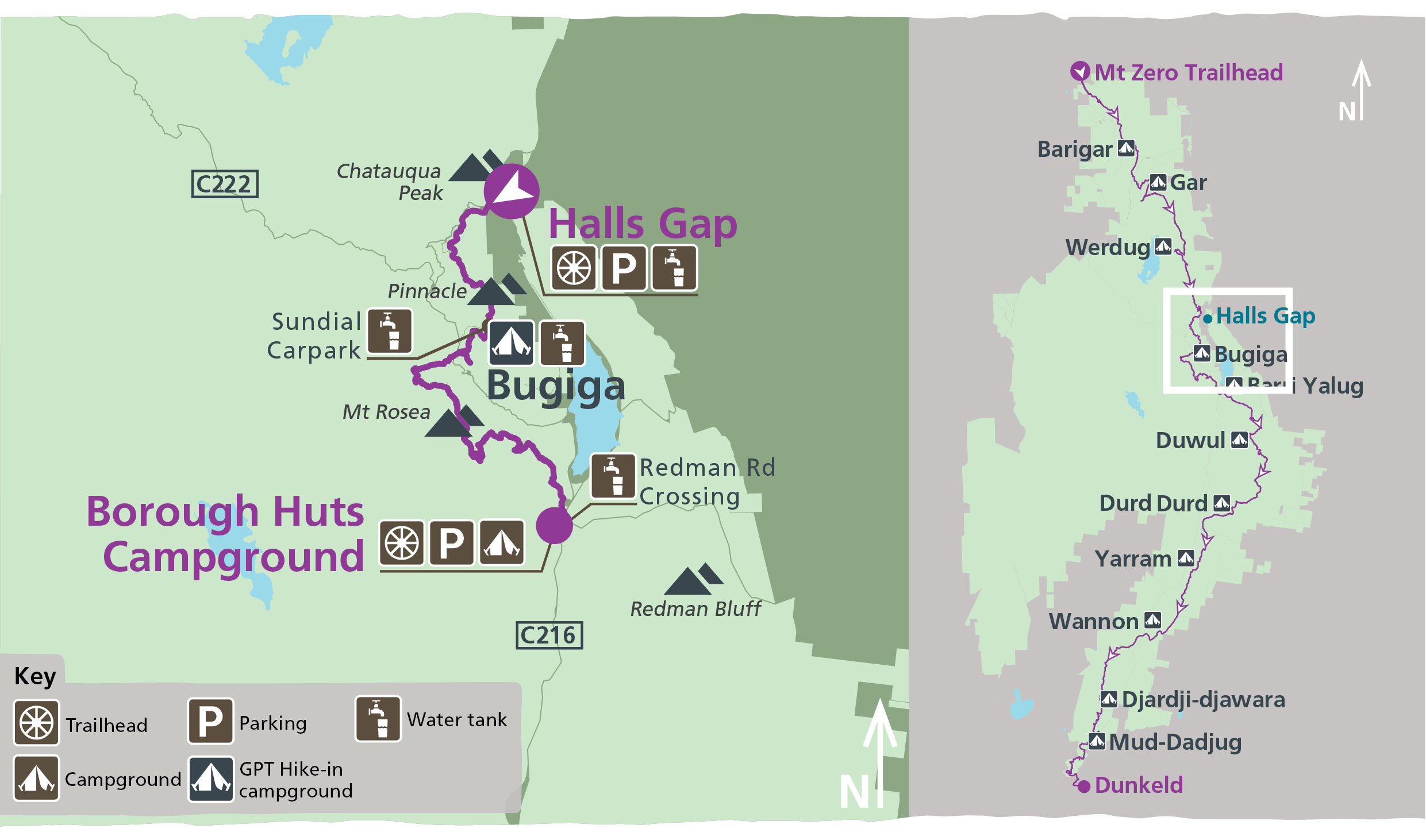
Grade: 4
Length: 22.3km Day 1: 9km Day 2: 13.3km
Start: Halls Gap (C1 on GPT Topographic map)
Finish: Borough Huts Campground (C2)
Pick up and drop off: Short vehicle shuffle from Borough Huts Campground back to Halls Gap or arrange a bus transfer with Licensed Tour Operator.
How to get there:
- From Melbourne (253km, 3hrs), drive west on the Western Highway (A8) to Ararat.
- From Ararat take the Ararat-Halls Gap Road (C222) for 48km through Moyston, Pomonal and onto Halls Gap.
Barri Yalug
Starting at Mount Rosea Carpark, follow the trail to Mt Rosea, heading south through tall forest then onto rocky escarpments. After climbing the summit (Bugiga Mirgani), head south towards Borough Huts Campground then on to Barri Yalug Hike-in Campground, with incredible views north over Lake Bellfield.
Day 2 on this hike provides a challenging climb over Seven Dials and Redman Bluff before arriving at Duwul Hike-in Campground, perched high on the Mt William Range. A short 1.2km walk from here takes you to the endpoint at Mt William Carpark.
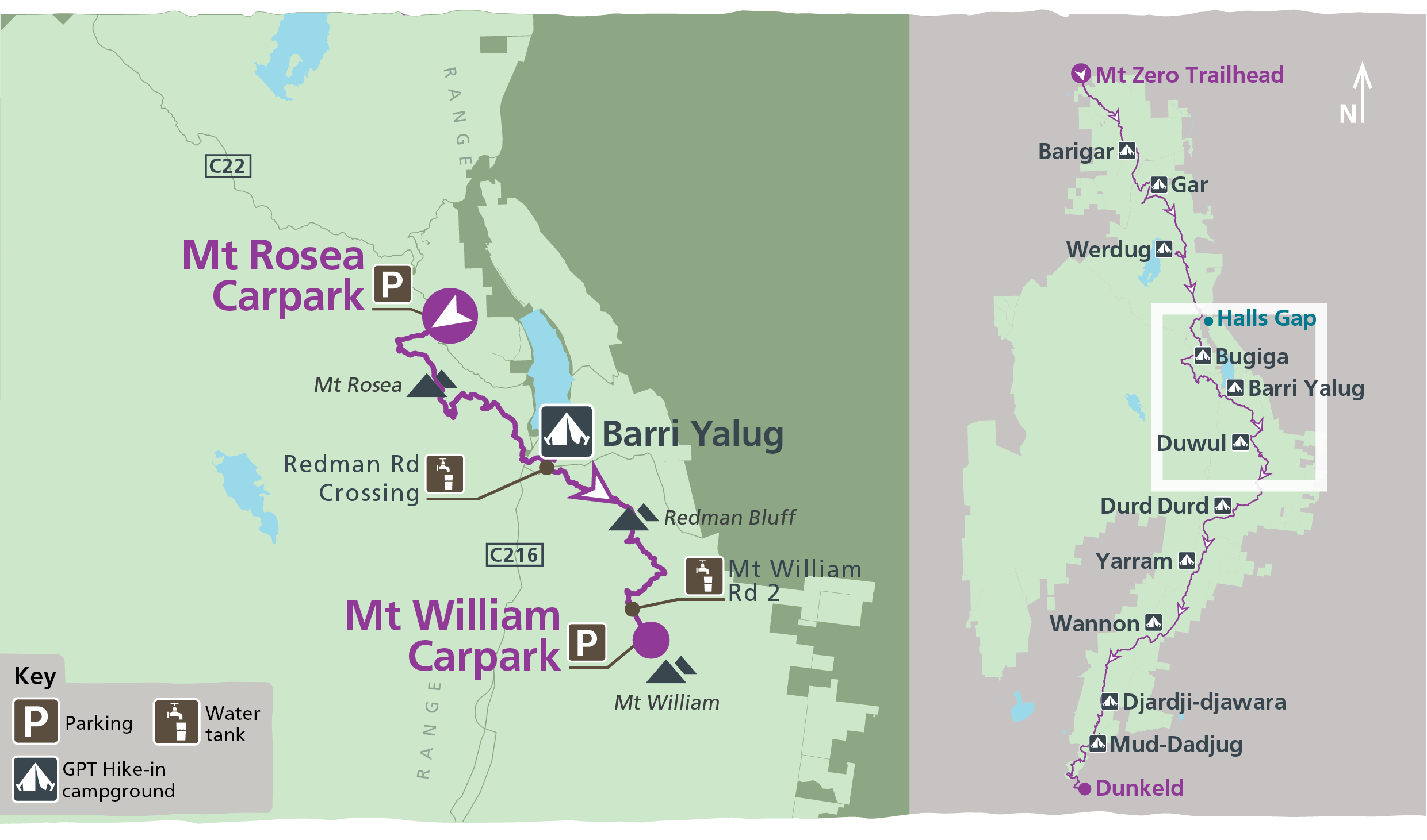
Grade: 4
Length: 28.4km Day 1: 14.0km Day 2: 14.4km
Start: Mount Rosea Carpark (C2 on GPT Topographic map)
Finish: Mount Rosea Carpark
Pick up and drop off:
Vehicle shuffle between Mount Rosea Carpark and Mt William Carpark (35 minutes each way) or arrange a transfer with a Licensed Tour Operator. Park your car at the Redman Road Trailhead.
Please note, Mount William and the Major Mitchell Plateau are exposed areas with fast changing weather. During winter and wet weather, hikers can expect heavy driving rain, sleet and strong winds. Snow may occur between May and October. In July, the average temperature is 5 degrees Celsius and 170mm rain. Walkers should be well prepared for these conditions and should reconsider their need to cross the Plateau in bad weather conditions.
Duwul
Starting at Redman Road Trailhead, the trail ascends through dense woodland then provides a challenging climb over Seven Dials and Redman Bluff before arriving at Duwul Hike-in Campground. Known for its impressive wildflowers and stunning mountain scenery from some of the highest mountain peaks of the park. Return via the same route the following day.
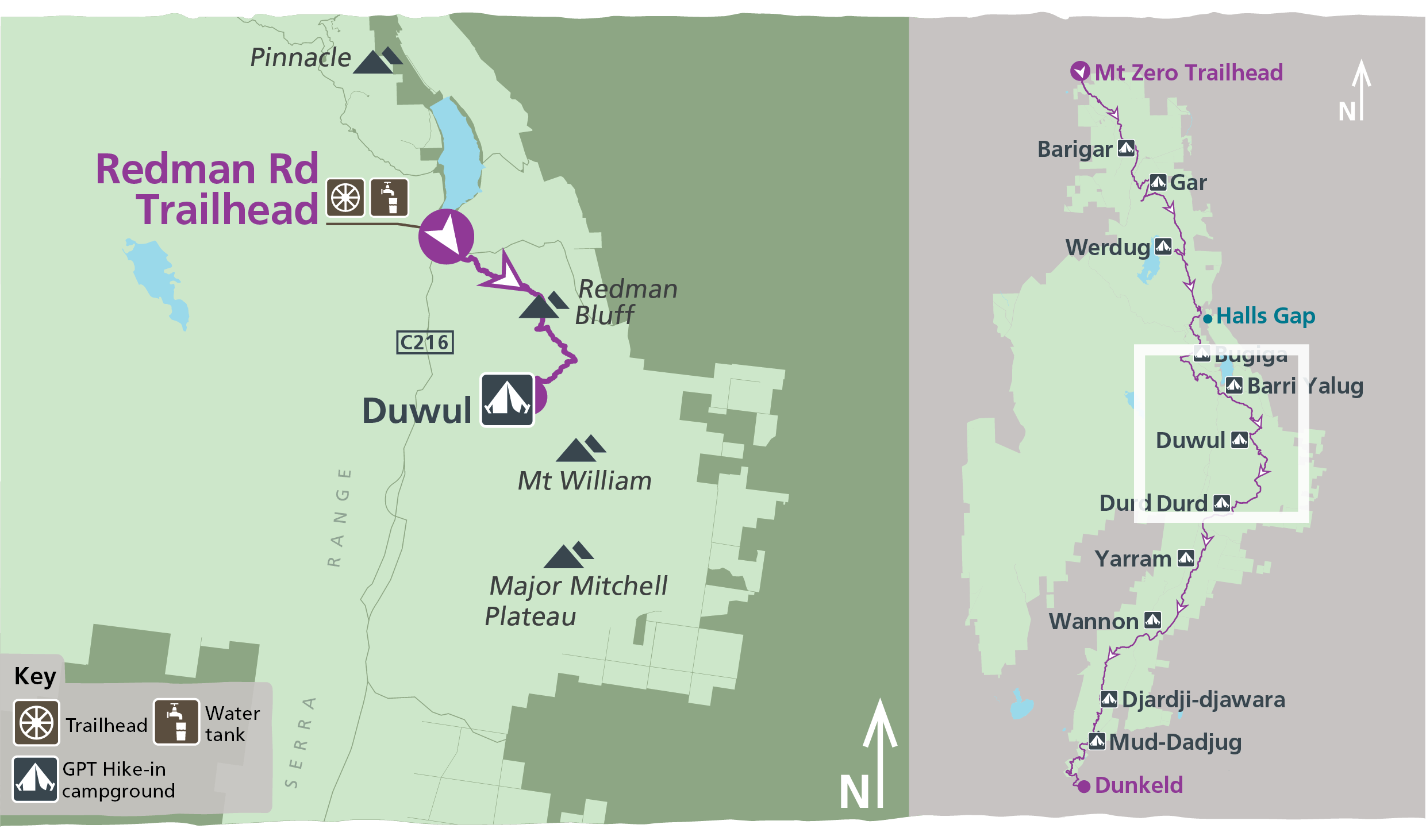
Grade: 4
Length: 26.4km Day 1: 13.2km Day 2: 13.2km
Start: Redman Road Trailhead (C3 on GPT Topographic map)
Finish: Redman Road Trailhead
Pick up and drop off:
Park your car at the Redman Road Trailhead.
Please note, Mount William and the Major Mitchell Plateau are exposed areas with fast changing weather. During winter and wet weather, hikers can expect heavy driving rain, sleet and strong winds. Snow may occur between May and October. In July, the average temperature is 5 degrees Celsius and 170mm rain. Walkers should be well prepared for these conditions and should reconsider their need to cross the Plateau in bad weather conditions.
Durd Durd
One of the most difficult sections (Grade 5) of the Grampians Peaks Trail – only suitable for very experienced and very fit hikers.
From the Mount William Carpark, follow the steep vehicle access road south-westerly toward the summit. At the towers take the gravel track southwards then drop steeply into Boundary Gap. Climb the steep exit and traverse across the Major Mitchell Plateau - the highest section of the trail. Enjoy the stunted sub alpine vegetation and far-reaching views before arriving at Durd Durd Hike-in Campground, nestled high on a west-facing gully. On day 2, a gentle decent takes you through towering trees to Jimmy Creek Campground, enjoying impressive mountain views along the way.
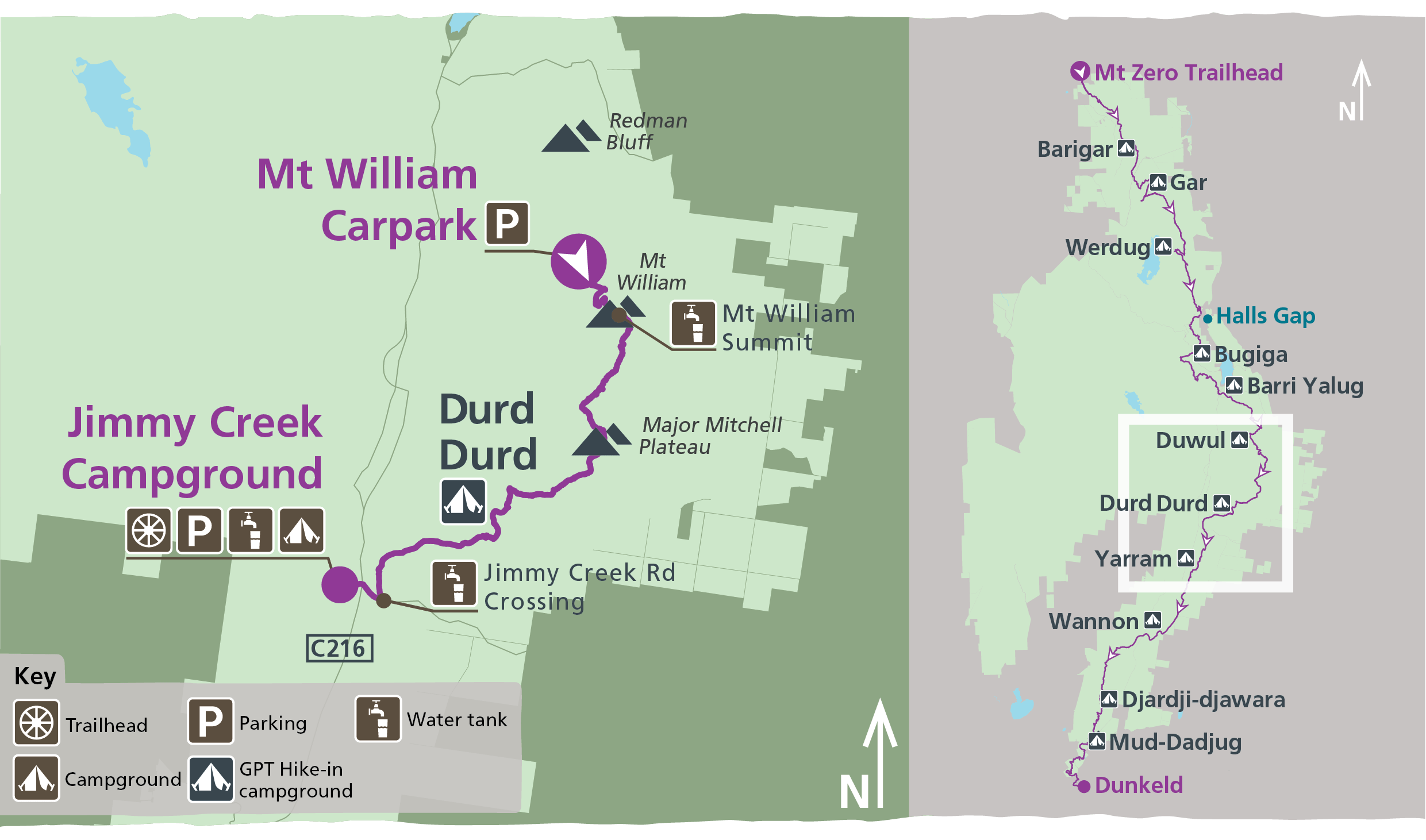
Grade: 5
Length: 20.6km Day 1: 13.3km Day 2: 7.3km
Start: Mount William Carpark (C4 on GPT Topographic map)
Finish: Jimmy Creek Campground (C5)
Pick up and drop off:
Vehicle shuffle between Mt William Carpark and Jimmy Creek Campground (25 minutes each way) or arrange a transfer with a Licensed Tour Operator.
Please note, Mount William and the Major Mitchell Plateau are exposed areas with fast changing weather. During winter and wet weather, hikers can expect heavy driving rain, sleet and strong winds. Snow may occur between May and October. In July, the average temperature is 5 degrees Celsius and 170mm rain. Walkers should be well prepared for these conditions and should reconsider their need to cross the Plateau in bad weather conditions.
Yarram
Starting at Jimmy Creek Campground, the upsloping trail criss-crosses the range, featuring sections of cross slope walking and rock hopping. Enjoy views over distant wetlands and farmland plains before passing a helipad and shortly after arriving at the stunning Yarram Hike-in Campground. Nestled in a gully amongst old stringybark forest enjoy peace and tranquillity and stunning night skies. Day 2 follows a steep descent through gullies and lower mountain slopes before arriving at Yarram Gap Road Trailhead.

Grade: 4
Length: 12.6km Day 1: 8.0km Day 2: 4.6km
Start: Jimmy Creek Campground (C5 on GPT Topographic map)
Finish: Yarram Gap Road Trailhead (S1)
Wannon
From Yarram Gap Road, walk parallel to the road through Callitris forest and climb onto the ridgeline. Rolling up and down through six knolls and saddles, you’ll see a series of wetlands to the east. Descend a spur into taller forest, before entering open grassland and arriving at Wannon Hike-in Campground. Follow the track through cleared land before crossing the Wannon River. Travel through swampy river flats and heathy under-storey before intercepting with Grampians Tourist Road. Meander up a gentle slope through sandy, heathy forest for 2.6km to Griffin Trailhead.
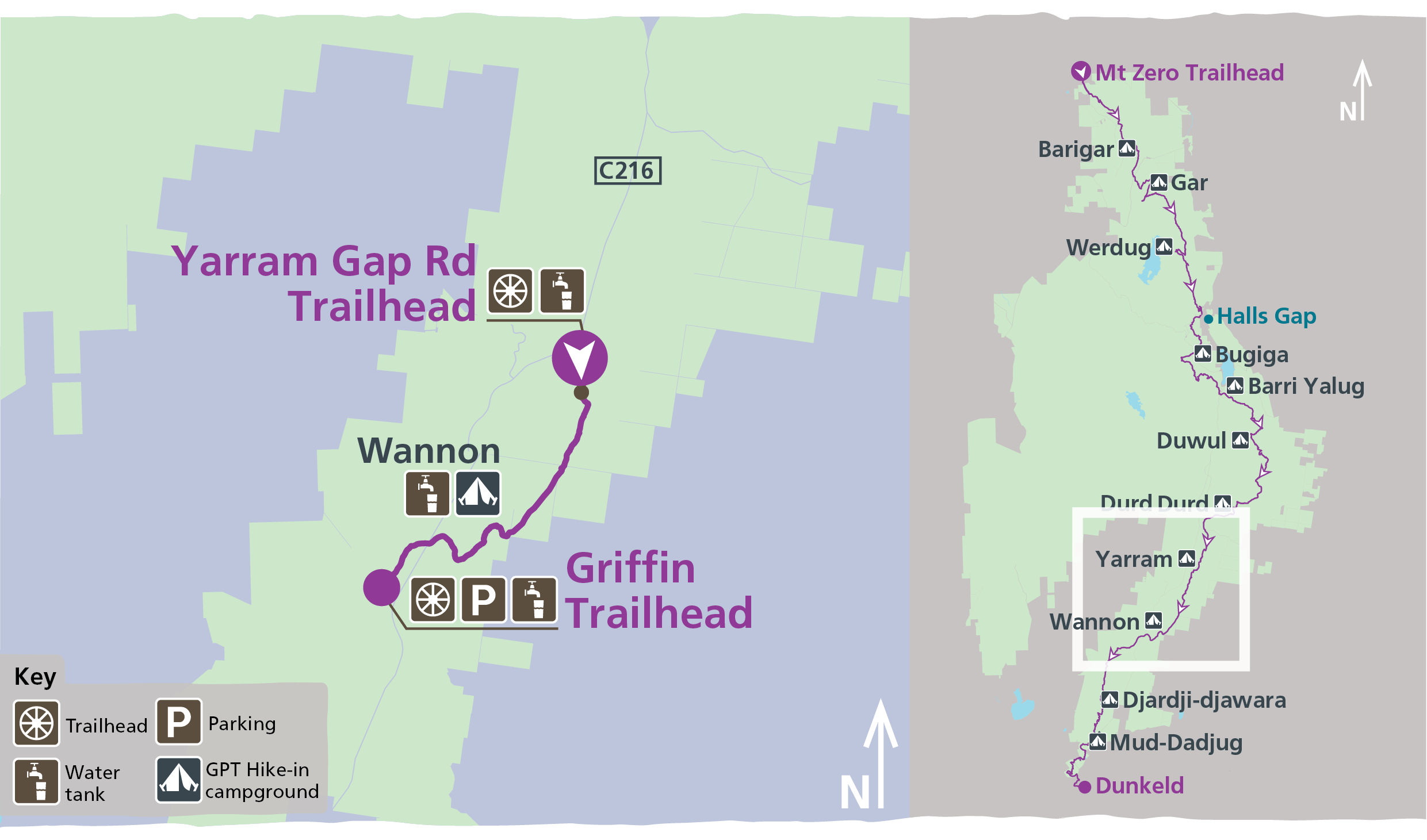
Grade: 4
Length: 12.1km Day 1: 6.5km Day 2: 5.6km
Start: Yarram Gap Road Trailhead (S1 on GPT Topographic map)
Finish: Griffin Trailhead (S2)
Mud-Dadjug
Starting from Cassidy Gap Road, hike uphill through rocky shrubland before climbing up to Signal Peak and across escarpments to the rocky exposed summit of Mud-Dadjug (Mt Abrupt). Enjoy sweeping views across the Serra Range and Southern Grampians, before arriving at Mud-Dadjug Hike-in Campground. On the second day cross over Bainggug (The Piccaninny) and take the steady climb up Wurgarri (Mt Sturgeon) before descending down the rocky slope to meander through an open Red Gum woodland. Cross bridges and follow directional signage into the small town of Dunkeld.
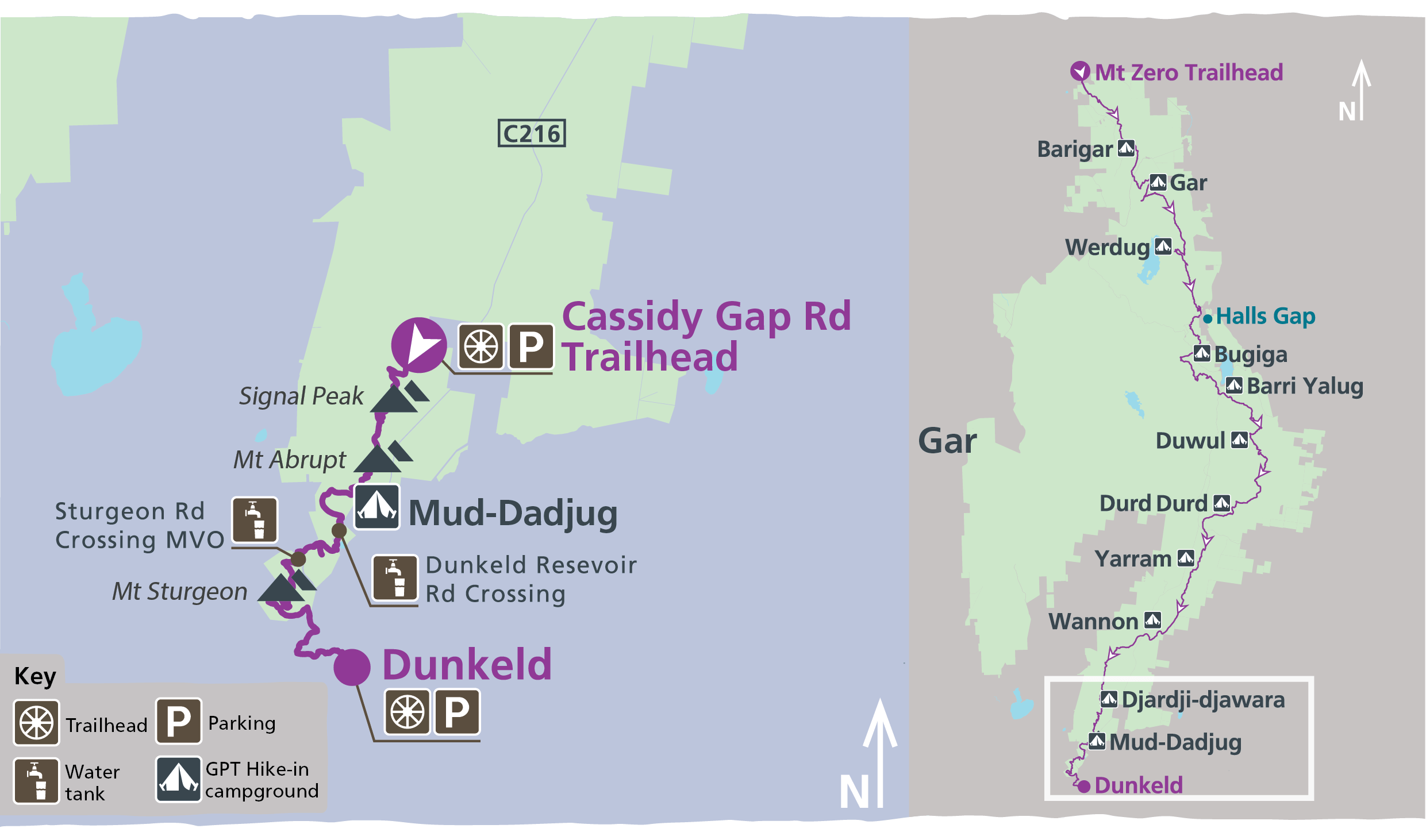
Grade: Grade 4
Length: 22.1 km Day 1: 7.3km Day 2: 14.8km
Start: Cassidy Gap Road Trailhead. Limited parking available, drop offs are encouraged.
Finish: Dunkeld
Pick up and drop off: Short vehicle shuffle between Dunkeld and Cassidy Gap Road or arrange a transfer with a Licensed Tour Operator. 15min round trip.
How to get there:
- From Melbourne (273km, 3hrs 20mins): Drive west on the Western Highway (M8) to Ballarat. From Ballarat take the Glenelg Highway (B160) west to Dunkeld. Turn north onto Victoria Valley Road (C216). Drive 2.6km and turn right on Grampians Tourist Road (C216) to Halls Gap. Drive 7.6km then turn left onto Cassidy Gap Road. Drive three minutes to the GPT trail crossing.
- From Dunkeld (10.8km, 13mins): Leave Dunkeld village to the east on the Glenelg Highway (B160). Drive 200m and turn north onto Victoria Valley Road (C216). Drive 2.6km and turn right on Grampians Tourist Road (C216) to Halls Gap. Drive 7.6km then turn left onto Cassidy Gap Road. Drive three minutes along the dirt road to the GPT trail crossing.
- From Halls Gap (54.5km, 40mins): Drive south on Grampians Tourist Road (C216) towards Dunkeld. After 54km turn right onto Cassidy Gap Road. Drive three minutes along the dirt road to the GPT trail crossing.
Water safety
Plan and prepare
Change of park conditions
During the summer of 2024-2025, widespread bushfires impacted over 135,000 hectares in the central, west and south-eastern sections of Grampians (Gariwerd) National Park. For up-to-date information on what’s open and closed along the Grampians Peaks Trail, view change of conditions on the Grampians (Gariwerd) National Park page. For further information on the phased fire recovery program in Grampians (Gariwerd) National Park please visit the Grampians (Gariwerd) National Park Fire Recovery page.
Grampians Peaks Trail Experiences
Grampians Peaks Trail
Gar and Werdug 3-day Hike
Bugiga and Barri Yalug 3-day Hike
Duwul and Durd Durd 3-day Hike
Yarram and Wannon 3-day Hike
Djardji-djawara and Mud-dadjug 3-day Hike
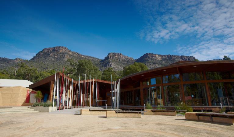
Brambuk The National Park and Cultural Centre
When you're there
Make Brambuk - The National Park and Cultural Centre in Halls Gap your first stop. Here you can explore what Gariwerd means to Aboriginal people and find information about visiting Grampians National Park.
Safety is your responsibility
- At lookouts, never climb over barriers. Your safety is more important than a social media post.
- There are steep cliffs in the park. Keep to the track, mind your footing and supervise children.
- Many walking tracks involve rock steps, uneven and slippery track surfaces, water crossings and rock hopping.
- Mobile phone service is unavailable in many areas of the park. Seek higher elevations for service.
- Plan your timing, return from walking well before dusk.
Emergency markers
In the event of an emergency, call Triple Zero 000 or 112 to access police and emergency services. Be aware that you may travel out of mobile phone range. Many of our parks feature emergency markers, which are special green signs with a unique code on them so emergency responders can pinpoint your exact location.
Need to know
Overnight Hikes
Walking track grades
Hikes along the Grampians Peaks Trail have been graded using the Australian walking track grading system, which is a primary means of informing people about the features of walking tracks, so they can gauge their suitability for a particular track. Under the system, walking trails are graded on a difficulty scale from grades one to five.
Grade 1: No bushwalking experience required. Flat even surface with no steps or steep sections. Suitable for assisted wheelchair users.
Grade 2: No bushwalking experience required. A hardened or compacted surface which may have gentle hill sections or occasional steps.
Grade 3: Suitable for most ages and fitness levels. Tracks may have short steep sections, a rough surface and many steps.
Grade 4: Bushwalking experience recommended. Tracks may be long, rough and very steep. Directional signage may be limited.
Grade 5: Very experienced bushwalkers with specialised skills, including navigation and emergency first aid. Tracks likely to be very rough, very steep and unmarked.
Be bushfire aware
The warmer months are the perfect time to experience regional Victoria. However, Victoria is one of the most fire-prone areas in the world. During summer in Victoria, the weather can be very hot and dry and the risk of summer lightning storms can increase the chance of bushfires.
Follow these bushfire safety tips to ensure that your experience is safe and enjoyable.
Change of Conditions
Nature being nature, sometimes conditions can change at short notice. It’s a good idea to check this page ahead of your visit for any updates.
-
The Fortress Walk (Victoria Range Remote and Natural Area, Grampians (Gariwerd) National Park)
The Fortress Walk and Hike-in Campground – Temporary closure
The Fortress Walk and The Fortress Hike-in Camp remain closed to visitors due to track damage from the 2024/25 summer bushfires.For more information on alternate walks in the western section of the Grampians (Gariwerd) National Park visit Brambuk the National Park and Cultural Centre in Halls Gap or call 03 8427 2058. -
The Chimney Pots Walk (Grampians (Gariwerd) National Park, Victoria Range Remote and Natural Area)
The Chimney Pots Walk – Temporary closure
The Chimney Pots Walk remains closed to visitors due to track damage from the 2024/25 summer bushfires.For more information on alternate walks in the western section of the Grampians (Gariwerd) National Park visit Brambuk the National Park and Cultural Centre in Halls Gap or call 03 8427 2058. -
Red Gum Walk (Grampians (Gariwerd) National Park)
Red Gum Walk – Temporary closure
The Red Gum Walk remains closed to visitors due to track damage from the 2024/25 summer bushfires.For more information on alternate walks in the western section of the Grampians (Gariwerd) National Park visit Brambuk the National Park and Cultural Centre in Halls Gap or call 03 8427 2058. -
Strachans Campground (Grampians (Gariwerd) National Park)
Strachans Campground –Temporary Closure – 13 April – 30 July 2026
Strachans Campground will be closed to visitors between 13 April and 30 July 2026 while major upgrade works are completed.For further information contact Brambuk the National Park and Cultural Centre in Halls Gap (Ph 8427 2058). -
Mackenzie Falls Day Visitor Area (Grampians (Gariwerd) National Park)
Mackenzie Falls (Migunang wirab) - Upcoming closure for major construction works – 9 February 2026 to the end of 2026
This update is to provide information for the planned construction work at Mackenzie Falls in the Grampians (Gariwerd) National Park, and closures while the works happen.The works at Mackenzie Falls precinct includes the construction of a new viewing platform at the base of the falls, upgrades to the carpark and the Bluff Lookout Walk and other important safety improvements to stabilise rock and improve walking tracks.
The Mackenzie Falls carpark and all walking tracks in the precinct including Broken Falls Walk, Mackenzie Falls Walk to the base (from the carpark), the Bluff Lookout Walk, and parts of Mackenzie Falls River Walk will close when construction starts on Monday, 9 February, 2026, and we anticipate that construction work will finish by the end of 2026.The carpark will be a construction site throughout the works period with large machinery operating and materials being stored on site. There will be no access for all vehicles or visitors at Mackenzie Falls Precinct during construction.Zumsteins Picnic AreaWhen construction works start at Mackenzie Falls precinct, parking at the popular Zumstein picnic area will be limited, especially for large vehicles (buses and caravans) during weekends and holiday periods.Zumsteins to Fish Falls – This popular walk to the beautiful Fish Falls is a 1.5 to 2 hour return walk (Grade 3) – walkers should have a reasonable fitness level, carry water and wear sturdy walking shoes as the track can be rocky with uneven surfaces and some steep sections.Mackenzie River WalkFrom May 2026 until works are complete, the base of Mackenzie Falls will not be accessible via the Mackenzie River Walk from Zumsteins Picnic Area.
For further information on the Mackenzie Falls (Migunang wirab) project visit https://www.parks.vic.gov.au/projects/western-victoria/mackenzie-falls-revitalisation
Popular day visitor sites such as Reeds Lookout, the Balconies, Boroka Lookout, Silverband Falls and various walks with large bus carparking will still be available. For further information on the Mackenzie Falls River Walk contact Brambuk the National Park and Cultural Centre in Halls Gap (Ph 8427 2058).Please keep up to date with closures through the Change of Conditions page for Grampians (Gariwerd) National Park. -
Grampians (Gariwerd) National Park
Grampians (Gariwerd) National Park - Roads Update 17.07.2026
The Grampians (Gariwerd) National Park has roads temporarily closed due to bushfire and weather impacts.Please observe road closures, hazard signage and always drive to conditions.Seasonal Road Closures are now in place from the 9 June 2026 to 29 October 2026.Please refer to the attached up-to-date road report below.Attachments: Grampians (Gariwerd) National Park - Road Report 17.07.2026 (230KB)
Temporary closure of a Glenelg River Road section – 25 May to 24 July 2026
The section of Glenelg River Road from the Stony Creek Road intersection to the Boreang Campground turn off will be closed from Monday 25 May 2026 to Friday 24 July 2026 for roadworks.The southern end of the closure can be accessed via Rose Creek Road. Paddy Castle Walk and Boreang Campground remain open, as does Glenelg River Road, south of Lodge Road.For further information please contact Brambuk the National Park and Cultural Centre Phone 8427 2058. -
Brambuk the National Park and Cultural Centre (Grampians (Gariwerd) National Park, Brambuk - The National Park and Cultural Centre Park)
Brambuk the National Park and Cultural Centre – Building Upgrades in 2026
The Cultural Centre is closed for refurbishment.Parks Victoria is working with a strategic partnership committee of Gariwerd Traditional Owners from Barengi Gadjin Land Council, Eastern Maar Aboriginal Corporation, and Gunditj Mirring Traditional Owners Aboriginal Corporation to ‘reimagine’ the future of Brambuk the National Park and Cultural Centre.Building upgrades are essential to ensure the centre meets current services requirements, accessibility, and compliance to current building regulation. New visitor experiences and activation opportunities including Aboriginal arts, community events and cultural exhibitions are being explored as Brambuk moves towards operation by a Gariwerd Traditional Owner entity.The National Park Information Centre and gift shop remain open.For up-to-date national park information, brochures, maps, permits and access advice contact information staff at Brambuk the National Park and Cultural Centre info@parks.vic.gov.au or phone 8427 2058For Junior Ranger School holiday programs visit https://www.parks.vic.gov.au/things-to-do/junior-rangersFor a list of Grampians (Gariwerd) National Park Licensed Tour Operators Visit https://www.parks.vic.gov.au/ltoFurther details on the Brambuk Reimagining project can be found on the Parks Victoria website https://www.parks.vic.gov.au/projects/western-victoria/brambuk-cultural-centre-upgrade
Similar experiences at other parks
Wilsons Promontory Northern Overnight Hikes
Wilsons Promontory Southern Circuit Overnight Hikes
Great South West Walk