
Mitchell River National Park is one of the jointly managed parks within Gippsland. The Joint Management agreement recognises the fact that the Gunaikurnai people hold Aboriginal Title and maintain a strong connection to Country. As custodians of the land, they are the rightful people who speak for their Country. These parks and reserves are cultural landscapes that continue to be part of Gunaikurnai living culture. For more information on Joint Management, please visit the Gunaikurnai Traditional Owner Land Management Board and the Gunaikurnai Land and Waters Aboriginal Corporation.
![]()
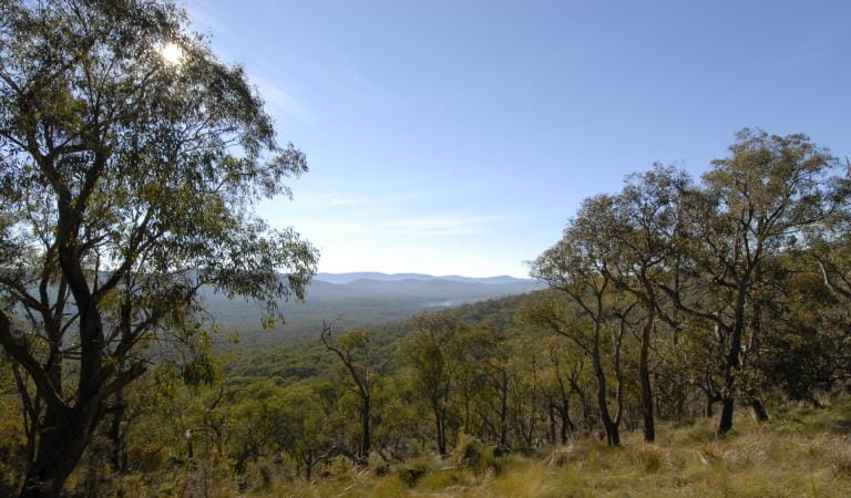
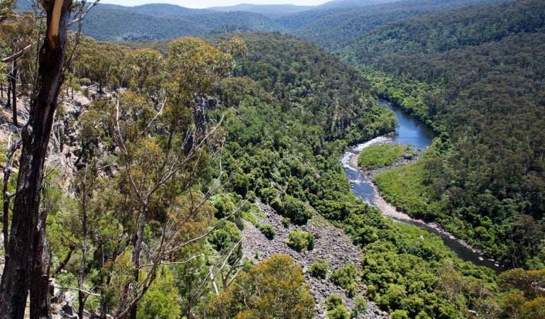
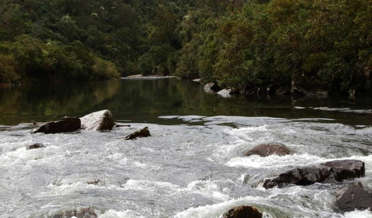
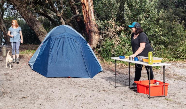
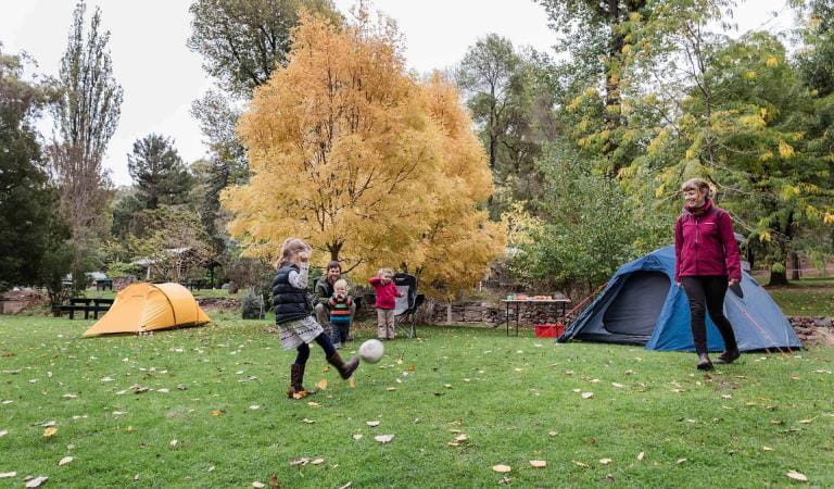
Billy Goat Bend is a popular camping and picnic spot with basic facilities and panoramic views of the Mitchell River Gorge and rapids. Vehicle access is available and there are toilets, fireplaces and picnic tables.
Angusvale camping area has easy car and river access, with toilets, fireplaces and picnic tables.
Rock Creek and Adam Track camping areas are 4WD access only. There are toilets at Rock Creek and fireplaces at Adam Track.
There is basic camping along the Mitchell River Walking Track at Rock Creek, Mitchell Road, Cobbannah Creek, Billy Goat Bend and Woolshed Creek. Please camp at least 20m away from the water and take all rubbish with you when you leave.
Things To Do
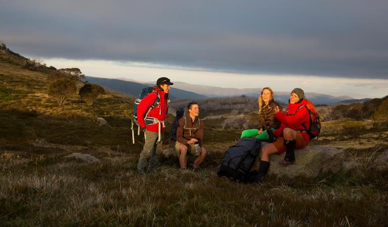
Walking in Mitchell River National Park
Cultural Heritage
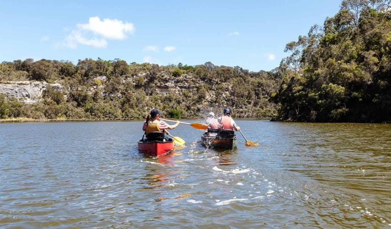
Canoeing and rafting at Mitchell River
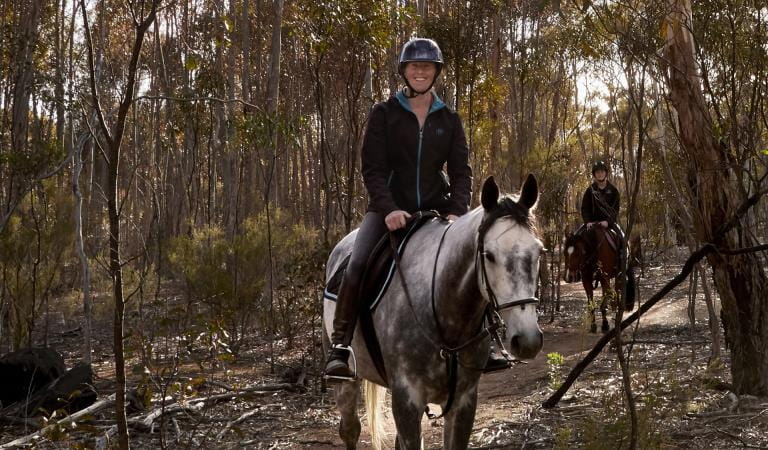
Horse riding in Mitchell River National Park
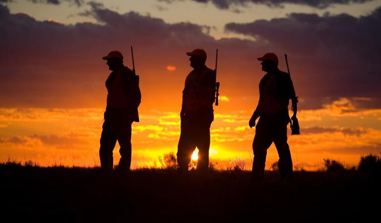
Hunting in Mitchell River National Park
How to get there
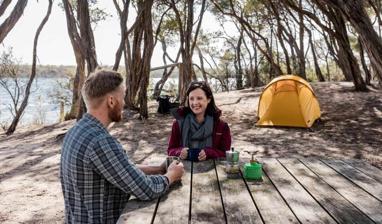
Camping
Heading west out of Bairnsdale on Main Street/Princes Highway/A1, turn right onto Bairnsdale-Dargo Road/C601 and follow for about 42 kilometres. You can turn right at Wallers Road and follow that to the end to reach the Den of Nargun picnic area. Forr access to Billy Goat Bend camping area, either turn left off Wallers Road and head north along Park Road, or turn right off the Bairnsdale-Dargo Road/C601 onto Billy Goat Bend Road, and follow the signs to the camping area.
Angusvale campground is located at the end of Mitchell River Road, further north along the Bairnsdale-Dargo Road/C601. Turn right off the C601 and follow the track for 16 kilometres.
To access the eastern side of the park, turn right off the C601 onto Lindenow-Glenaladale Road. Cross the bridge over the Mitchell River and turn left to stay on Lindenow-Glenaladale Road. Turn right at Weir Road and stay on it until you are continuing along Wattle Creek Road and see entry signs to the park.
To visit the Old Weir day visitor site, turn left off Weir Road onto Milton Park Road. Please be aware that the end of this road down into the day visitor site is rated as a Double-Black Diamond 4WD track, and is suitable for experienced four-wheel-drivers only. Visitors can access the site on foot - park your vehicle at the top of the hill and walk approximately one kilometre to the site. Please take plenty of water.
When you're there
Guidelines for sustainable camping
Set up campsites at least 20 metres away from waterways.
Digging steps into river banks is illegal and can cause erosion and landslides.
Camping is not permitted in day visitor areas or on licensed water frontages adjacent to private property.
Do not spray paint or attach signs to trees.
Chemical toilets are recommended. Please do not empty chemical toilets or other rubbish into public toilets or waterways.
Dogs and other pets are not permitted in the park.
Fires are permitted only:
- if it is not a day of Total Fire Ban;
- a three-metre area around it is cleared of anything flammable;
- an adult is in attendance at all times;
- at least 10 litres of water are available for immediate use,
- and if it is in a pit that must be maintained to 30cm deep.
Fires can also be no larger than 1m x 1m.
Put the fire out with water, not soil. When the campfire is cool to touch, it is safe to leave.
No campfires or solid fuel barbecues may be lit on a day of Total Fire Ban.
Portable gas or electric barbecues or camping stoves may be used, provided that the conditions above are met.
Help look after our parks
Please take all rubbish with you when you leave and do not dump rubbish or other waste items into toilets. Please consider the impacts of generators or loud music on other visitors.
To reduce the risk of your generator starting a bush fire, ensure your generator is: located in an area clear of fuels, dry grass or other combustibles; the generator is only refueled when the engine is cold; extension cords do not cross access tracks and are rated for outdoor use.
Camping Safety
Avoid camping or parking under or near large trees where possible as branches may fall and swing away from the tree at any time. Whole trees may fall without warning.
Please do not use rope swings as they damage trees and are difficult to safely remove.
Avoid camping close to waterways if rain or storms are forecast, as waters may rise quickly and trap you.
Mobile phone reception in the park is unreliable.
Bushfire safety is a personal responsibility. Check the Fire Danger Rating and for days of Total Fire Ban at www.emergency.vic.gov.au or call the VicEmergency Hotline on 1800 226 226.
Need to know
Camping
Accessibility
Visiting a park can be more of a challenge for people with disabilities, however in Victoria there are a wide range of facilities to help people of all abilities enjoy our wonderful parks around the state.
Assistance dogs are welcome in Parks Victoria parks and reserves. Entry requirements apply for parks and reserves that are usually dog prohibited, such as national parks.
Driving in the park
All roads and tracks within the park are gravel, with the Mitchell River Road and Wallers Road being readily accessible for most vehicles. All other tracks would require a 4WD to navigate, with varying levels of experience required. Find more safety tips on our Safety in nature page.
Mitchell River National Park Joint Management Plan
Mitchell River National Park is on the Country of the Brabralung clan. The park has a rich cultural history that tells of tribal conflict, ceremonies, food gathering, community life and local spirits. The Gunaikurnai and Victorian Government Joint Management Plan provides a description of joint management strategies and actions that are specific to Mitchell River National Park.
Change of Conditions
Nature being nature, sometimes conditions can change at short notice. It’s a good idea to check this page ahead of your visit for any updates.
-
Rock Creek (Mitchell and Wonnangatta Rivers Heritage River, Mitchell River National Park)
Angusvale Track/Horton’s Crossing Closure
Angusvale Track/Horton’s Crossing ClosureDue to storm events, the Angusvale Track past the Rock Creek Camp area has been subject to landslip.This Landslip now prevents vehicles from accessing the ford crossing through the Mitchell River between Angusvale Track and Hortons Track. Please do not attempt to cross the river from Hortons Track as there is no access to the West side of the park from this point.The Rock Creek Camp area is still currently accessible via Angusvale Track/Mitchell Views Track of the Mitchell River Road.
Similar experiences
Camping in Gippsland Lakes Coastal Park
Banksia Bluff Campground
Glenelg River Canoe Trail

Camping
The Lakes National Park
Falls to Hotham Alpine Crossing
Buchan Caves Reserve Campground