Browns Camping Area 2 (Barmah National Park)

Explore

Browns Camping Area 2 (Barmah National Park)

How to get there

Browns Camping Area 2 (Barmah National Park)

Need to know

Browns Camping Area 2 (Barmah National Park)

Warnings & Restrictions

Dogs

Dogs are not allowed

Restrictions

  • No horses
  • No drones without a permit
  • No dogs allowed
  • No firearms allowed
  • Not yet assessed

Warnings

  • Terrain hazards
    • Slippery road
  • Other warnings
    • Trees may fall take care
    • Limbs may fall take care
  • Water hazards
    • Submerged obstacles
    • Strong currents

Be Prepared

Stay safe and get the most out of your park visit by preparing for natural hazards and other outdoor risks in Victoria’s parks. You are responsible for your own safety and the safety of those in your care. Find out more.

Change of Conditions

Nature being nature, sometimes conditions can change at short notice. It’s a good idea to check this page ahead of your visit for any updates.

Barmah national park Access update

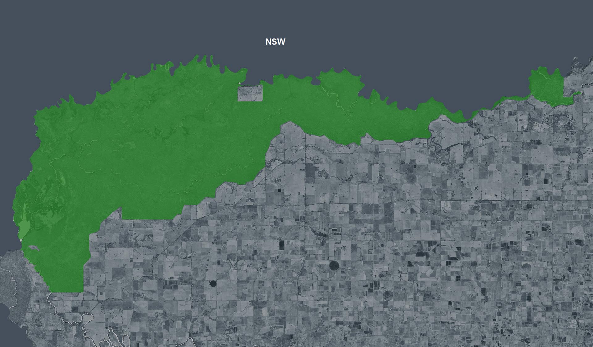
Some tracks are Closed to motor vehicles within Barmah National Park and the adjoining Proposed Murray River Park for public safety and to protect track conditions following rising flood water.
 
The following tracks are OPEN within Barmah National Park highlighted in Green on the map, although recommended 4WD only.
·        Sand ridge track, (up to bunyip track), providing access to the Dharnya centre, Lakes campground and day visitor area.
             Access is also open via Trickies Gate and Gowers gate providing access to; Trickies track, school track, and Bunyip track.
·        River Road from new Kynmer Ck regulator via Haynes Road Bearii. This entrance provides access to campsites along river down to Black Engine track. (Note one camp site down stream of Waisers beach is closed due to Hazardous tree)
Note: this is one way in, one way out, as all other internal tracks are closed due to flooding.
·        Ulupna Island remains OPEN.
·        The Ranch down stream of barmah.
 
See the attached map for tracks and entrances that are closed, highlighted in Red, and tracks recommended 4WD only highlighted in Green.
 
Conditions are subject to change at any time without notice.
 
For the latest access to Barmah Island, please visit:
 
 
For all of the latest change of conditions regarding Barmah National Park, please see https://www.parks.vic.gov.au/places-to-see/parks/barmah-national-park.
 
River flows from Yarrawonga weir remain at 14,500 megalitres. We will review access on a weekly basis and open the closed areas as soon as possible. Please take care on all tracks due to the wet conditions and if you can avoid using wet tracks, please do so for your safety and to prevent track damage.”
 

Attachments: access map BNP 20.11.24 (377KB)

X
By using our site you accept that we use and share cookies and similar technologies with certain approved third parties. These tools enable us to improve your website experience and to provide content and ads tailored to your interests. By continuing to use our site you consent to this. Please see our Privacy Policy for more information.
Confirm