Explore
Yarra Ranges National Park
Situated between Melbourne and the Victorian Alps, the Yarra Ranges National Park is a place of epic views, majestic rainforest scenery and fun-packed snowplay. Enjoy the panorama from Mount Donna Buang, or go deeper into the park on the Black Spur Drive, and wind through towering Mountain Ash forests to Lake Mountain.
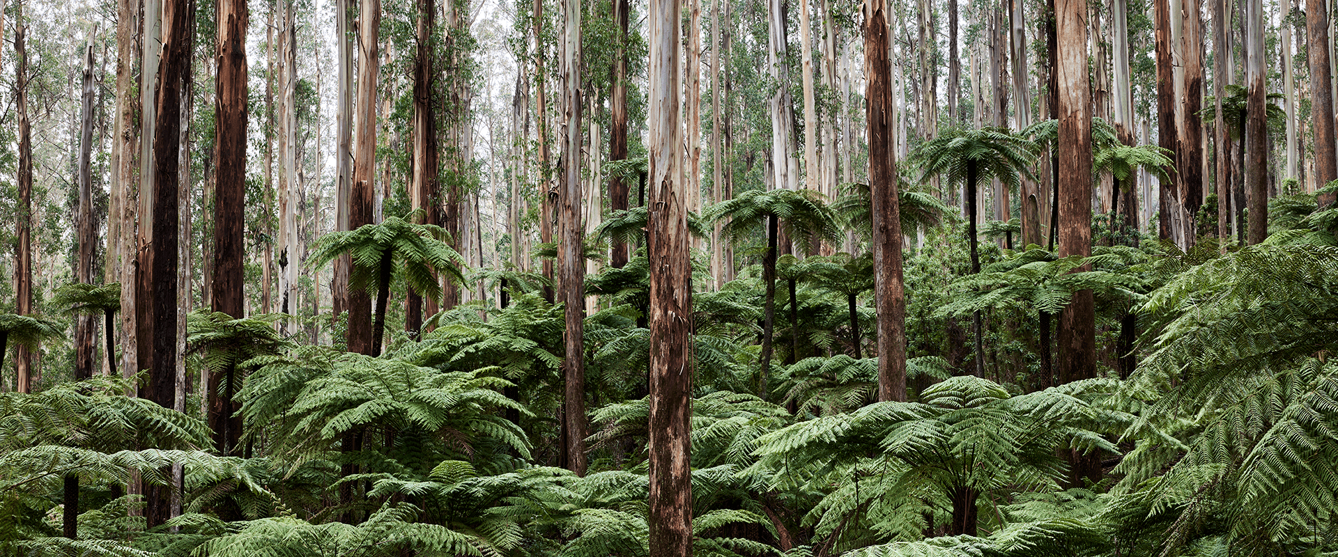
The Yarra Ranges spans an extensive, mountainous area of cool temperate forest around the three towns of Marysville, Healesville and Warburton. This national park is home to the world's tallest flowering tree, the Mountain Ash, which towers over lush tree ferns and mossy Myrtle Beech. Dark gullies are home to clear streams which feed the Yarra River and major reservoirs from which Melbourne draws its drinking water.
The Yarra Ranges boasts some stunning lookouts, one of the best being Mount Donna Buang. From here you can see awesome views of Westernport Bay and Port Phillip - or walk the Rainforest Gallery and see the Mountain Ash from a different perspective. In the winter, Mount Donna Buang is Melbourne's closest winter playground. Many Melburnians have enjoyed their first sight of snow here through the years.
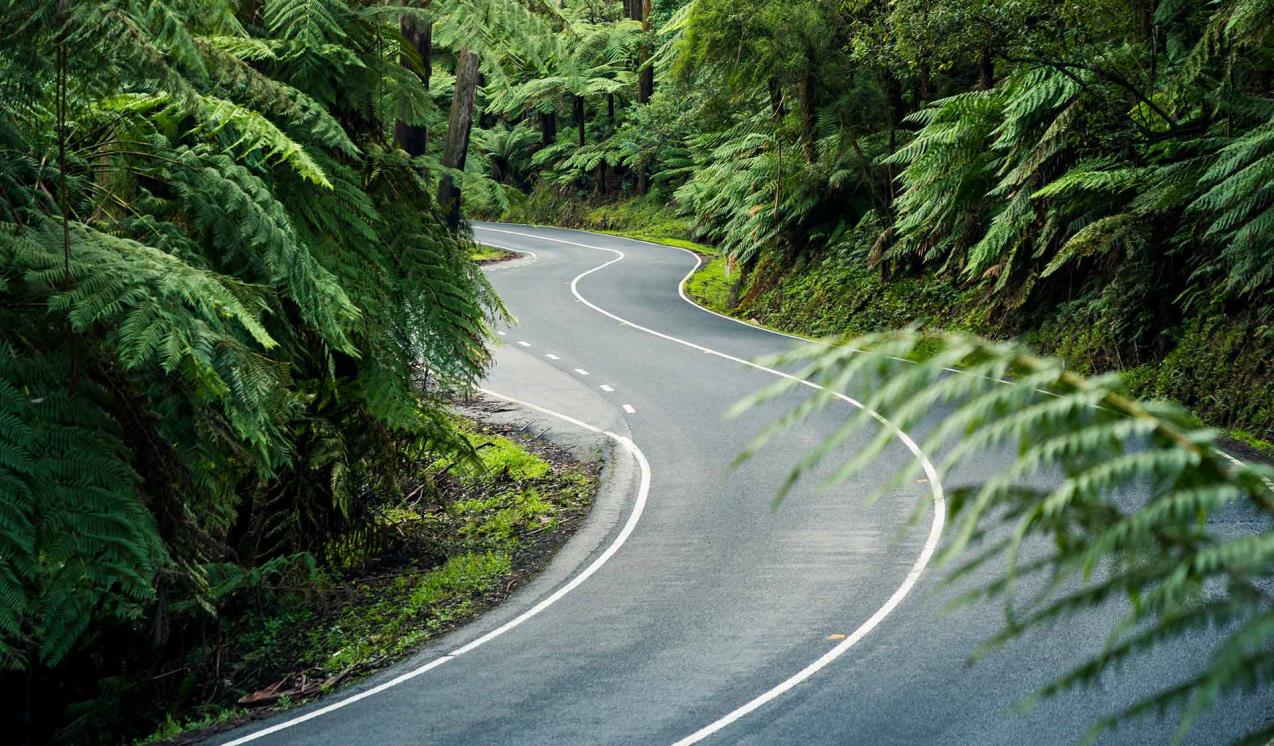
Healesville is the start of the Black Spur Drive, a short but beautiful scenic car journey. The road winds through majestic Mountain Ash forest to Narbethong, passing a number of pleasant walking trails and picnic areas, such as Donnelly’s Weir, Dom Dom Saddle and Maroondah Reservoir Park.


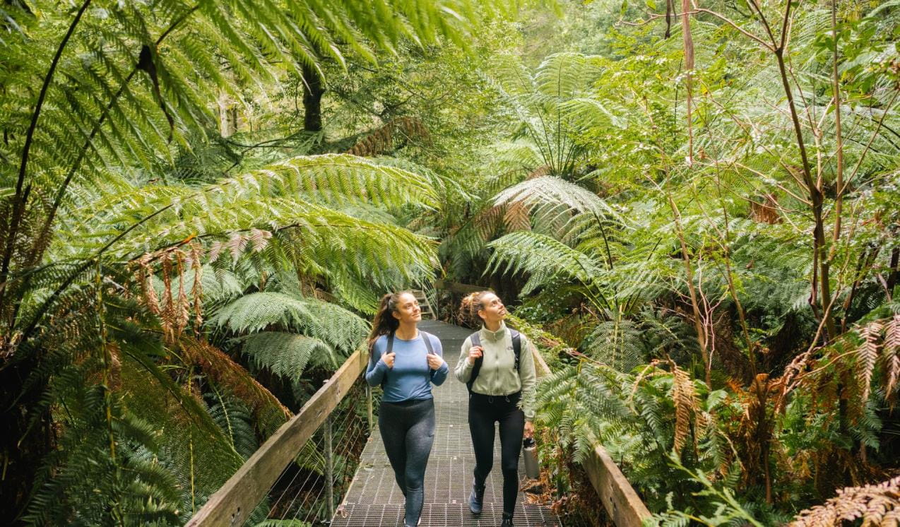
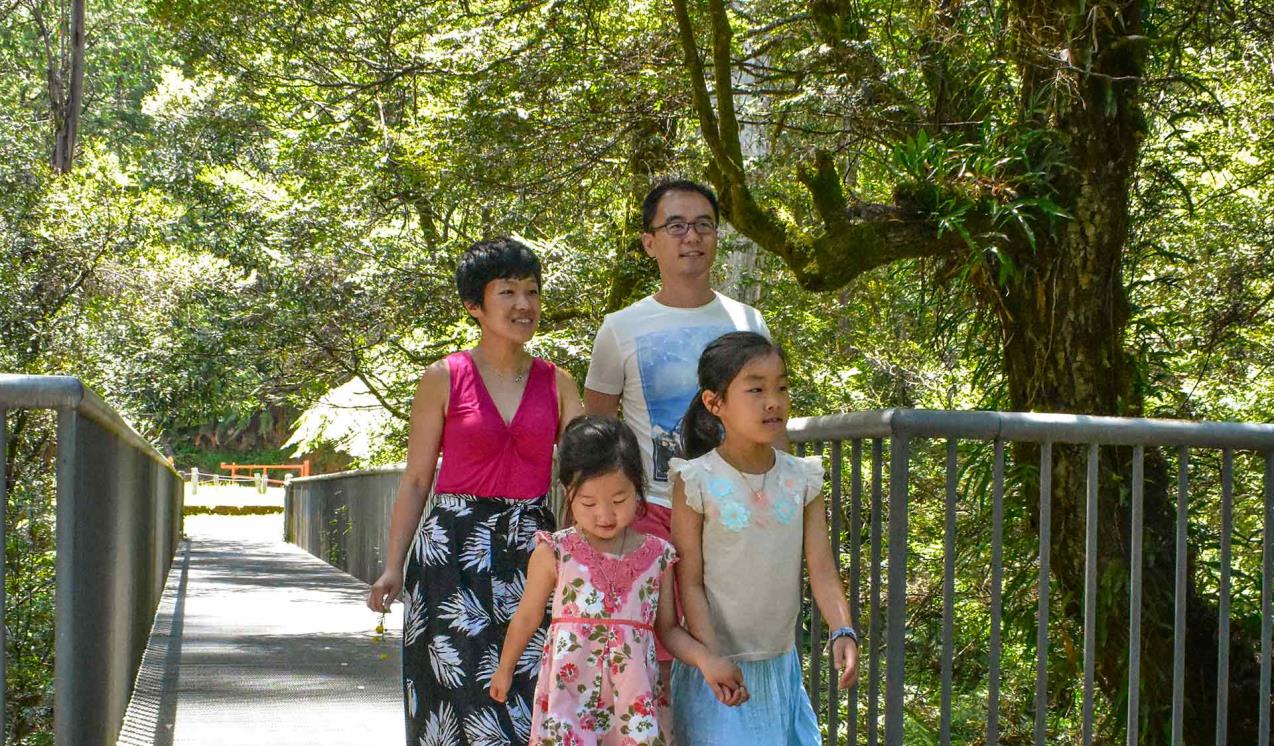
5 best beginner hikes near Melbourne
Immerse yourself in lush temperate rainforests with these five top beginner-friendly hikes and nature walks close to Melbourne.
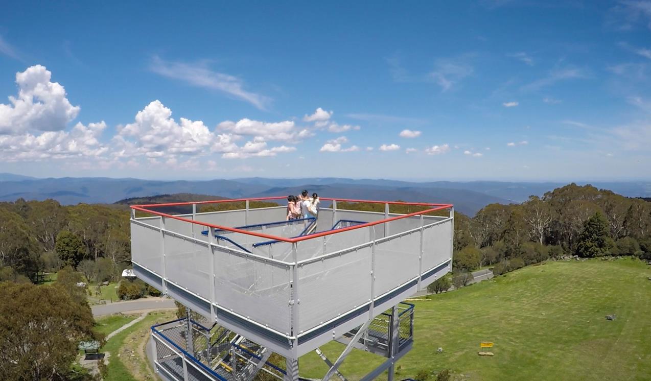
Mount Donna Buang
At an elevation of 1245 metres, the summit features a lookout tower which is 21 metres high and offers panoramic views over Melbourne, the Yarra Valley, Dandenong and Cathedral Ranges, Mount Baw Baw and the Alps. It is also a popular picnic area and starting point for walks on the mountain.
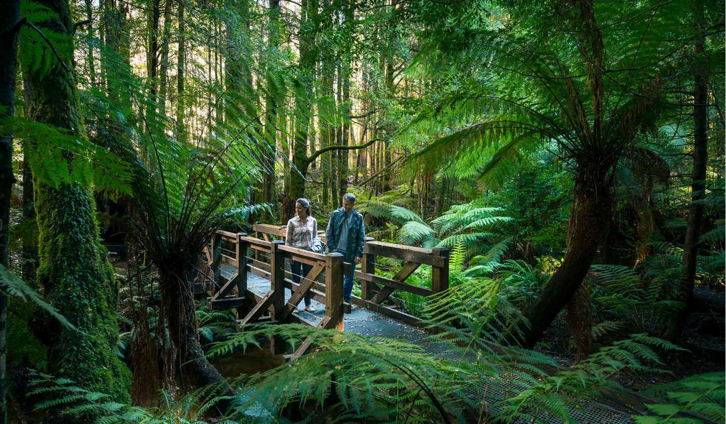
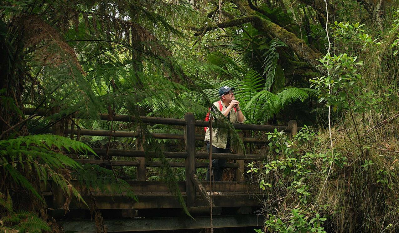
Rainforest Gallery
Set in a cool temperate rain forest, this elevated platform is perched 15 metres above the forest floor allowing visitors to take in the beauty of towering Mountain Ash.
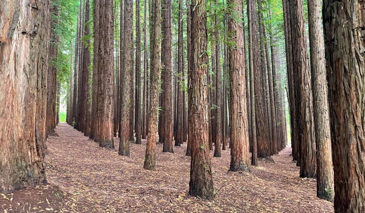
Redwood Forest
An hour and a half from Melbourne in the Yarra Ranges, you will find an enchanting Redwood Forest. Once a hidden gem, this forest has become a popular destination for its uniformly planted trees and tranquil natural surrounds.
Badger Weir
Known as one of the best picnic spots in the Yarra Ranges, Badger Weir also includes three lush, family-friendly walking tracks.
Lady Talbot Drive
The Lady Talbot Drive is a scenic rainforest car journey which passes a number of fantastic walks and waterfalls in the Yarra Ranges National Park. The drive from Melbourne includes the famous Black Spur Drive, another road known for its scenic beauty. Bring a picnic and escape the city for a day.
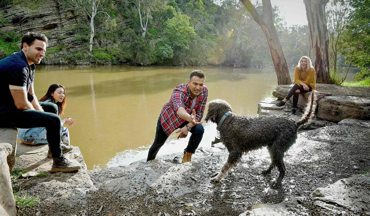
Dog friendly parks in Victoria
Find where dogs are allowed in parks across Victoria so you can enjoy the outdoors with your furry friend.
When you're there
Need to know
Yarra Ranges National Park
Accessibility
Visiting a park can be more of a challenge for people with disabilities, however in Victoria there are a wide range of facilities to help people of all abilities enjoy our wonderful parks around the state.
Assistance dogs are welcome in Parks Victoria parks and reserves. Entry requirements apply for parks and reserves that are usually dog prohibited, such as national parks.
Change of Conditions
Nature being nature, sometimes conditions can change at short notice. It’s a good idea to check this page ahead of your visit for any updates.
-
Dom Dom Saddle Picnic Area (Yarra Ranges National Park)
Dom Dom Saddle Picnic Area - Toilet Closure
Dom Dom Saddle Picnic Area toilets are permanently closed and will be removed in their entirety at a later date.The nearest toilets are at Fernshaw Picnic ground. -
Big Peninsula Picnic Area (Yarra Ranges National Park, Yarra River)
Big Peninsula Stepping Stones permanently closed due to erosion
Due to instability caused by erosion, the Big Peninsula Stepping Stones are permanently closed for visitor safety. -
Cambarville Picnic Area (Yarra Ranges National Park)
Partial walking track closure on Cumberland Circuit walk (South of Woods Point Road)
There is a partial closure in place on the Cumberland Circuit walk due to hazardous tree fall risk south of Woods Point Rd (see map attached)Attachments: Cambarville_A4_0412 (1,190KB)
Cambarville toilet block closed until further notice
Cambarville toilet block is closed until further notice due to water supply issues and structural problems -
Rainforest Gallery (Donna Buang) (Yarra Ranges National Park)
Rainforest Gallery Closed for Repairs
The Rainforest Gallery boardwalk is closed until further notice. Urgent repairs are required for visitor safety. -
Badger Weir Picnic Area (Yarra Ranges National Park)
Badger Weir BBQ's Closed
All of the BBQ hotplates at Badger Weir Picnic Area are currently closed due to repeated thefts of the BBQ Batteries, Hotplates and Gas Bottles. Due to this, and an associated arson attack on one of the picnic area's shelters, we are currently investigating increasing security to the park. These BBQ hotplates will remain closed until a solution can be found.If you have any information on these repeated thefts and arson events in Badger Weir Picnic Area, please contact Parks Victoria (13 1963) or Crime Stoppers (1800 333 000). -
Yarra Ranges National Park
Summit Loop Trail - Partial Closure - Lake Mountain Summit
The Summit Loop walking trail is partially closed at Lake Mountain until further notice.Attachments: Lake Mountain Summit Loop Partial Track Closure (562KB)
-
Notices Affecting Multiple Sites
Park Open Hours – Badger Weir and Donnellys Weir
Park Open HoursMaroondah Reservoir ParkBadger WeirDonnellys Weir8am to 8pm – Early October to Early April (Start of Daylight Savings Time to End of Daylight Savings Time)8am to 6pm – Early April (End of Daylight Savings Time) to end of April8am to 5pm – May to August8am to 6pm – September to Early October (Start of Daylight Savings Time)These parks and visitor sites are protected for water security purposes by automatic gates. The gates close at the above posted times, but they do allow for visitors to leave the park for 30 minutes after these times. From 30 minutes after the posted closing time however the after hours exit turns off and exit from the park is no longer possible. We are obliged to do this to help strengthen water resource security.If a visitor mistakenly gets caught behind the automatic gates after the park closing time, upon exit please drive to within two metres of the gate to activate the late exit trigger. If the gate does not open as the vehicle is leaving too late, please call Parks Victoria on 13 19 63 to ask them to assist. A late exit fee may apply.❄ Mt Donna Buang Snow Play: What to Know Before You Go ❄
❄ Mount Donna Buang Snow Play: What to Know Before You Go ❄Looking for snow near Melbourne this winter? Located just two hours away in Yarra Ranges National Park (Wurundjeri Country), the 1,245-metre summit of Mount Donna Buang typically sees snow from June to August.Access is completely free. When there is enough snow, you can enjoy three dedicated toboggan runs, build snowmen, and enjoy family snow fights. Because of its proximity to Melbourne, the mountain gets extremely busy on weekends and right after fresh snowfall.Here is how to plan a safe, enjoyable winter trip.1. Check Weather & Road ConditionsMountain weather changes rapidly. Be prepared for cold, wet, and windy conditions regardless of the morning forecast.- Pack
Essentials: Bring extra warm layers, spare dry clothes, food, and
water.
- Emergency
Kit: Travel with a full tank of fuel, blankets, and a torch in case of
traffic delays.
- Connectivity:
Mobile coverage is patchy. Download maps/guides before leaving and let
someone know your plans.
- Live
Updates: Check the Parks Victoria website for road closures and conditions changes before departing. The Waterwheel Visitor Information Centre in Warburton
also provides real-time local updates.
2. Time Your Departure & DrivingIf heading up after a fresh snowfall, always check the road conditions before setting out. Don't leave too early—give Dept. of Transport road crews time to grit and clear the ice.- Snow
Chains: While not mandatory, carrying chains is highly recommended.
Hire them in the valley before reaching Warburton. Watch Parks Victoria’s
two-minute online video: ‘how to
fit snow chains’.
- Drive
Time: From Warburton, the 17km drive up Mount Donna Buang Road takes
20–25 minutes in good weather. Drive slowly and carefully.
- Have
a Plan B: If the access road is temporarily closed due to overcrowding
or weather, head to Warburton to enjoy local cafes or the Riverside Walk while you wait.
3. Consider Carpooling & Mid-Week VisitsAs Melbourne’s closest free snow destination, the summit experiences extreme traffic congestion on weekends. To beat the crowds and reduce delays, carpool with friends or plan a mid-week trip.4. Enjoy Fun, Safe Tobogganing- Equipment:
Use plastic moulded toboggans only. Skis and snowboards are not permitted.
- Location:
Only toboggan in designated areas to protect the environment.
- Hire:
Toboggans can be hired in surrounding towns or at the summit on select
snow days.
Note on Variable Snow: Mount Donna Buang is lower than major alpine resorts. Snow melts quickly and tobogganing isn't always possible. Always check the daily snow report before packing the car.5. Leave Your Dogs at HomeBecause Mount Donna Buang is in a national park, dogs and pets are strictly prohibited to protect native wildlife.Other Places to See Snow in VictoriaIf Mount Donna Buang is crowded or lacking snow, consider these alternative winter destinations:DestinationBest ForDrive from MelbourneLake Mountain Alpine Resort(Taungurung Country)Fully managed snow play, tobogganing, cross-country skiing, and nearby rainforest walks.2–3 hoursMount St Gwinear(Gunaikurnai & Wurundjeri Country)Free park entry, family-friendly snow play, snowshoeing, and tobogganing.3 hoursMount Buffalo National Park(Taungurung Country)4–5 hoursDinner Plain, Alpine National Park(Taungurung and Gunaikurnai Country)Near Mount Hotham Resort, quaint alpine village atmosphere, snow play and cross-country skiing.5–6 hoursMount Donna Buang BBQ's closed
The Mount Donna Buang BBQ's will be closed for the foreseeable future. We apologise for any inconvenience.Portable BBQ's and Heat Bead BBQ's are allowed to be used on site, so please bring your own. We ask that you take home any resulting waste items, including used heat beads.No campfires are allowed however, due to the resulting ground fire scar. - Pack
Essentials: Bring extra warm layers, spare dry clothes, food, and
water.
Tours and adventure experiences in parks
One of the best ways you can get into nature is with a Licensed Tour Operator.
There are more than 400 Licensed Tour Operators across Victoria who are ready and waiting to help you experience and connect with Victoria’s spectacular parks and waterways.
Discover more than 60 different types of nature-based experiences including hiking, mountain biking, boating, four-wheel driving, indigenous culture tours, birdwatching, surfing, diving and so much more.
Licensed Tour Operators know all the best places to go and will plan and prepare your visit to ensure you are safe and can enjoy your nature-based adventure to the fullest.
How we keep it special
Yarra Ranges National Park Management Plan
The Management Plan for Yarra Ranges National Park directs all aspects of management in the park until the plan is reviewed.
Parks Victoria is proud to be a key partner in the implementation of the Yarra Strategic Plan, Burndap Birrarung burndap umarkoo. Delivering the plan is a Victorian Government commitment to protect our treasured Yarra River, Birrarung, and its parklands for future generations.
Warburton MTB Destination
Parks Victoria is working in partnership with the Shire of Yarra Ranges, Department of Energy, Environment and Climate Action (DEECA) and Melbourne Water to construct a world-class mountain bike destination around Warburton.
Cement Creek Redwood Forest Facility upgrades
To improve access for diverse visitors to the Warburton Redwoods Forest a range of improvements are being undertaken. These include a new accessible public toilet, trails, boardwalks and viewing platforms, a shelter, increased carparking, environmental protection works and revegetation.