Explore
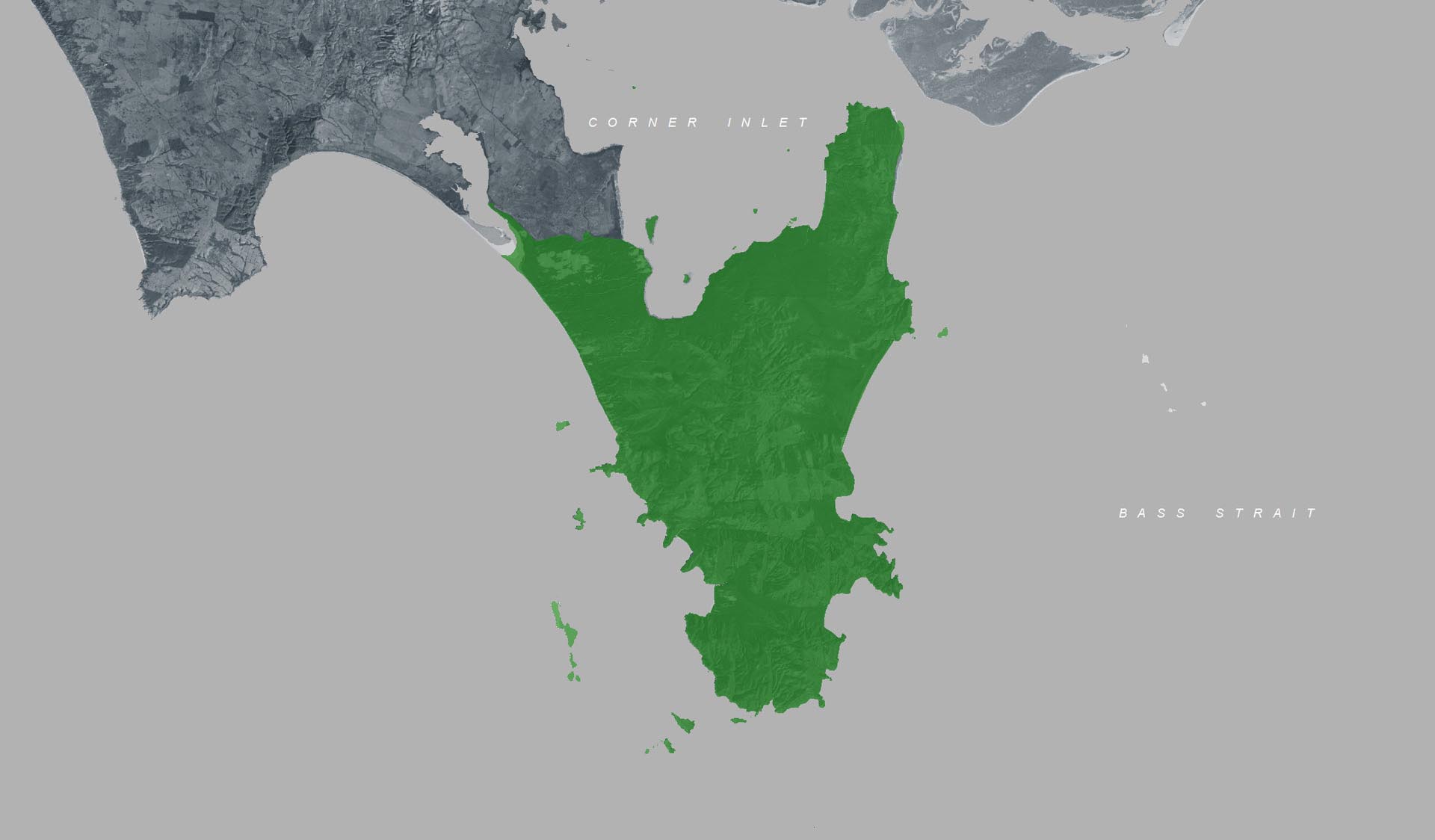
Sealers Cove to Refuge Cove Walking Track (Wilsons Promontory National Park, Southern Wilsons Promontory Remote and Natural Area)
This Grade 4 trail has steep rocky sections and uneven surfaces and is 6.4km, 2 hours one way.
For overnight stays, advanced bookings are required. Toilets and untreated water are available at Sealers Cove and Refuge Cove Camping Areas. Treat or boil water before use.
How to get there
Sealers Cove to Refuge Cove Walking Track (Wilsons Promontory National Park, Southern Wilsons Promontory Remote and Natural Area)
Need to know
Sealers Cove to Refuge Cove Walking Track (Wilsons Promontory National Park, Southern Wilsons Promontory Remote and Natural Area)
Safety in nature
You can benefit both mind and body when you get outdoors to explore and experience Victoria's natural places. Before you go, take a look at our safety tips and check our changed conditions and closures information for a great visit.
Accessibility
Visiting a park can be more of a challenge for people with disabilities, however, in Victoria there are a wide range of facilities to help people of all abilities enjoy our wonderful parks around the state. Parks Victoria provides a range of a equipment, including all-terrain and beach wheelchairs, facilities, accommodation and accessibility information and programs to help you plan and enjoy your visit to Victoria's parks.
Assistance dogs are welcome in Parks Victoria parks and reserves. Entry requirements apply for parks and reserves that are usually dog prohibited, such as national parks.
Warnings & Restrictions
Dogs
Restrictions
- No vehicles
- No dogs allowed
- No drones without a permit
- No firearms allowed
- No generators
- No bicycles
- No fires permitted
- No horses
Warnings
-
Terrain hazards
- Uneven ground
- Slippery surface
-
Other warnings
- Limbs may fall take care
- Trees may fall take care
- No mobile phone reception
-
Animals and pests
- Beware European wasps
Be Prepared
Change of Conditions
Nature being nature, sometimes conditions can change at short notice. It’s a good idea to check this page ahead of your visit for any updates.
Stockyard Campground & Toilet Block Closed
Sealers Cove boardwalk is closed
Invasive Species Control Programs 2025 - 2027
By removing introduced hog deer and rabbits, we are reducing grazing pressure on the incredible variety of native plants and plant communities, including some that are nationally threatened. By targeting foxes and feral cats, we are reducing the threat of predation for native species such as the Southern Brown Bandicoot, Long-nosed Potoroo, Ground Parrot, New Holland Mouse, Eastern Pygmy Possum and the Hooded Plover.
All animal control programs are carried out under strict conditions, compliant with all relevant legislation, Codes of Practice and Standard Operating Procedures, designed to ensure safe, effective, and humane practices are implemented.
For further information, please visit Prom Sanctuary.