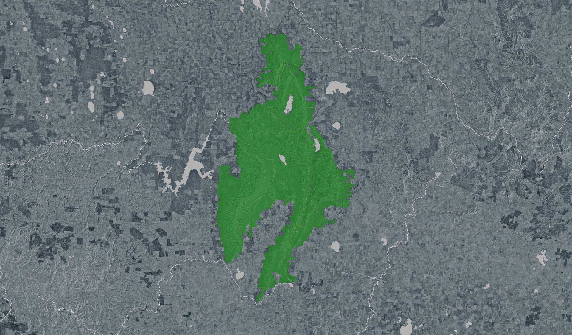
The Pinnacle Walk (Grampians (Gariwerd) National Park)

Explore

The Pinnacle Walk (Grampians (Gariwerd) National Park)

Climb through rocky woodland to the Pinnacle Lookout for unrivalled views over Lake Bellfield and the Mount William Range. This challenging hike winds through the unique terrain of the Grand Canyon and Silent Street. 

How to get there

The Pinnacle Walk (Grampians (Gariwerd) National Park)

Need to know

The Pinnacle Walk (Grampians (Gariwerd) National Park)

Warnings & Restrictions

Dogs

Dogs are not allowed

Restrictions

  • No fishing
  • No motorised vehicles, including electric bikes or scooters allowed on management vehicle only paths, tracks or roads
  • No vehicles
  • No firearms allowed
  • No generators
  • No bicycles
  • No camping
  • No fires permitted
  • No horses
  • No dogs allowed

Warnings

  • Terrain hazards
    • Uneven ground
    • Unstable cliffs
    • Slippery rocks
    • Steep track
  • Other warnings
    • Trees may fall take care
    • Limbs may fall take care

Be Prepared

Stay safe and get the most out of your park visit by preparing for natural hazards and other outdoor risks in Victoria’s parks. You are responsible for your own safety and the safety of those in your care. Find out more.

Change of Conditions

Nature being nature, sometimes conditions can change at short notice. It’s a good idea to check this page ahead of your visit for any updates.

Rock climbing closures due to Grampians-Yarram Gap Bushfire

Due to recent bushfires in the area and ongoing efforts to suppress them, designated rock climbing sites 63-91 in the Wonderland and Serra Range are temporarily closed to climbers and visitors.

This includes:  
63. The Elephants Hide
64. Wild Geese Wall
65. Mackeys Peak
66. The Tower of Paine
67. Crock Wall
68. Blockbuster Buttress
69. Wil Flower Wall
70. Point Sunshine
71. The Upper Goon
72. The Lower Goon
73. Signal Peak
74. Frenchmans Beret
75. Grand Canyon
76. The Underworld
77. The Wall of China
78. Neurology Wall
79. Bellfield Peak
80. Wurzelgammage
81. Lookout Point Wall
82. Lake View Wall
83. The Bleachers (Sundial Peak) (Bouldering Area)
84. Equinox Walls (RNA)
85. Western Wall
86. Stoney Peak
87. Bundaleer
88. Calecstasia Walls
89. Tower Hill
90. Rosea Far Right
91. Mount Rosea

Grampians (Gariwerd) National Park - Roads Update 10.01.2025

The Grampians (Gariwerd) National Park has many roads temporarily closed due to the recent bushfire. Please be aware the movement of visitors in parts of the national park is restricted.

Temporary Road & Seasonal Road Closures
This is a long list due to the recent bushfire. Please refer to the attached up-to-date road report below.

Seasonal Roads
Seasonal Roads reopened on Thursday 31st October 2024.

The following seasonal roads require further management and remain closed:
·      Moora Track
·      Launders Track
·      Mt Cassell Fireline
Seasonal road closures are necessary to maintain water quality, protect public safety and prevent erosion during the wetter months, making them vulnerable to damage.

Please see the latest road report attachment for full road and track details at the bottom of this page.

Attachments: Grampians (Gariwerd) National Park - Road Report - 10.01.2025 (223KB)

Reopening of Grampians (Gariwerd) National Park - Southern Section

Parts of Grampians (Gariwerd) National Park have now reopened following the containment of the Yarram Gap Bushfire. 
 
Some sections of the park will remain closed for the time being while fire suppression works are ongoing.
 
 
Visitor sites in the Southern Grampians area which will REOPEN on 10 January include:
- Mt Abrupt (Mud-Dadjug)  
- Mt Sturgeon (Wurgarri)  
- Piccaninny (Baingugg)  
- Signal Peak  
- Buandik (Jadawadjali) Falls 
- Chimney Pots  
- Billimina Art Shelter  
- Manja Art Shelter 
- Red Rock Picnic Area 
- Strachans Campground 
- Buankdik Campground 
- Grampians Peaks Trail: South Section S4-S5 - Dunkeld to Cassidy Gap Road (including Dunkeld Trailhead, Victoria Valley Road Trailhead, Bainggug (Picaninny) Trailhead, Mud-Dadjug hike in campground, Djardji-Djawara hike in campground (End Point - no access north of the campground), Cassidy Gap Trailhead)
- Victoria Range Overnight Hike (including Fortress remote overnight Hike-in campground) 
 
Visitor sites to remain CLOSED: 
- Paddys Castle  
- Tower Hill 
- Burrong Falls 
- Moora Moora area   

Reopening of Grampians (Gariwerd) National Park - Central Section

Parts of Grampians (Gariwerd) National Park have now reopened following the containment of the Yarram Gap Bushfire.
Some sections of the park will remain closed for the time being while fire suppression works are ongoing. 
 
Visitors can view a Grampians (Gariwerd) National Park Closure Map here. 

Visitor sites in the Central Grampians area which will REOPEN on 10 January include:
- Brambuk the National Park and Cultural Centre 
- Brambuk Wetland loop 
- Fyans Creek (Barri Yalug) loop  
- Boronia Peak  
- Venus Baths 
- Bullaces Glen 
- Chatauqua Peak (Bim) 
- Clematis Falls  
- MacKenzie Falls  
- Broken Falls 
- Mackenzie Falls Bluff Lookout walk 
- Fish Falls, Mackenzie River/Bun-nah Trail 
- Zumsteins Picnic Area and Historic walk 
- Boroka Track and Lookout 
- Lake Wartook Lookout 
- Smiths Mill Campground  
- Plantation Campground (State Forest) 

Visitor sites to remain CLOSED: 
- Reeds Lookout 
- Balconies Lookout  
- Pinnacle walks from Halls Gap, Wonderland and Sundial car parks 
- Wonderland Loop from Halls Gap 
- Mackey’s Peak  
- Grand Canyon Loop 
- Wonderland Forest Loop  
- Turret Falls  
- Splitters Falls   
- Lakeview Lookout 
- Sundial Peak  
- Viewpoint 
- Sundial 4x4 track access from Lake Bellfield 
- Mt Rosea day walk 
- Stony Creek camp link 
- Bundaleer    
- Burma Track loop 
- Borough Huts campground to Mt Rosea  
- Tunnel Walking Track  
- Terraces Fireline around Lake Bellfield 
- Pomonal Fireline 
- Mt William Summit Walk 
- Sheep Hills 
- Kalymna Falls 
- Mafeking Picnic Area 
- Brownings Loop Historic Walk  
- Teddy Bear Gap Walk 
- Borough Huts Campground 
- Stony Creek road bush camps 
- Moora and Vic Valley bush camps 
- Kalymna Campground 
- Wannon Crossing Campground 
- Boreang Campground
- Jimmy Creek Campground 
- Grampians Peaks Trail: Section N4 – S3 - Halls Gap to Cassidy Gap Road (including Bugiga Hike-in campground, Barri Yalug Hike-in campground, Duwul Hike-in campground, Durd Durd Hike-in campground, Yarram Hike-in campground, Wannon Hike-in campground, Wonderland carpark access, Sundial carpark access, Rosea carpark access, Redman Road Trailhead, Mt William Carpark, Jimmy Creek Road Trailhead, Yarram Gap Road Trailhead, Griffin Trailhead)  
- Mt William Overnight Hike – Boundary Gap/First Wannon remote hike in campground 

Reopening of Grampians (Gariwerd) National Park - Northern Section

Parts of Grampians (Gariwerd) National Park have now reopened following the containment of the Yarram Gap Bushfire.

Some sections of the park will remain closed for the time being while fire suppression works are ongoing.
 
Visitors can view a Grampians (Gariwerd) National Park Closure Map here. 

Visitor sites in the Northern Grampians area which will REOPEN on 10 January include:
- Mount Zero (Mura Mura)  
- Mount Stapylton (Gunigalg) summit and loop  
- Flat Rock viewpoint  
- Hollow Mountain (Wudjub Guyan)  
- Gulgurn Manja Art Shelter  
- Ngamdjidj Art Shelter  
- Golton Gorge 
- Beehive Falls 
- Briggs Bluff walk 
- Mt Difficult (Gar)  
- Waterfalls of Gar  
- Brim Springs Picnic area 
- Heatherlie Quarry  
- Stapylton Campground 
- Troopers Creek Campground  
- Coppermine 4x4 Campground 
- Grampians Peaks Trail North Section N1- N3 - Mt Zero to Halls Gap (including, Mt Zero Trailhead, Coppermine Group Camp, Longpoint West Group Camp, Barigar Hike-in campground, Gar Trailhead, Gar Hike in-campground, Werdug Hike-in campground, Halls Gap Trailhead)

X
By using our site you accept that we use and share cookies and similar technologies with certain approved third parties. These tools enable us to improve your website experience and to provide content and ads tailored to your interests. By continuing to use our site you consent to this. Please see our Privacy Policy for more information.
Confirm