Explore
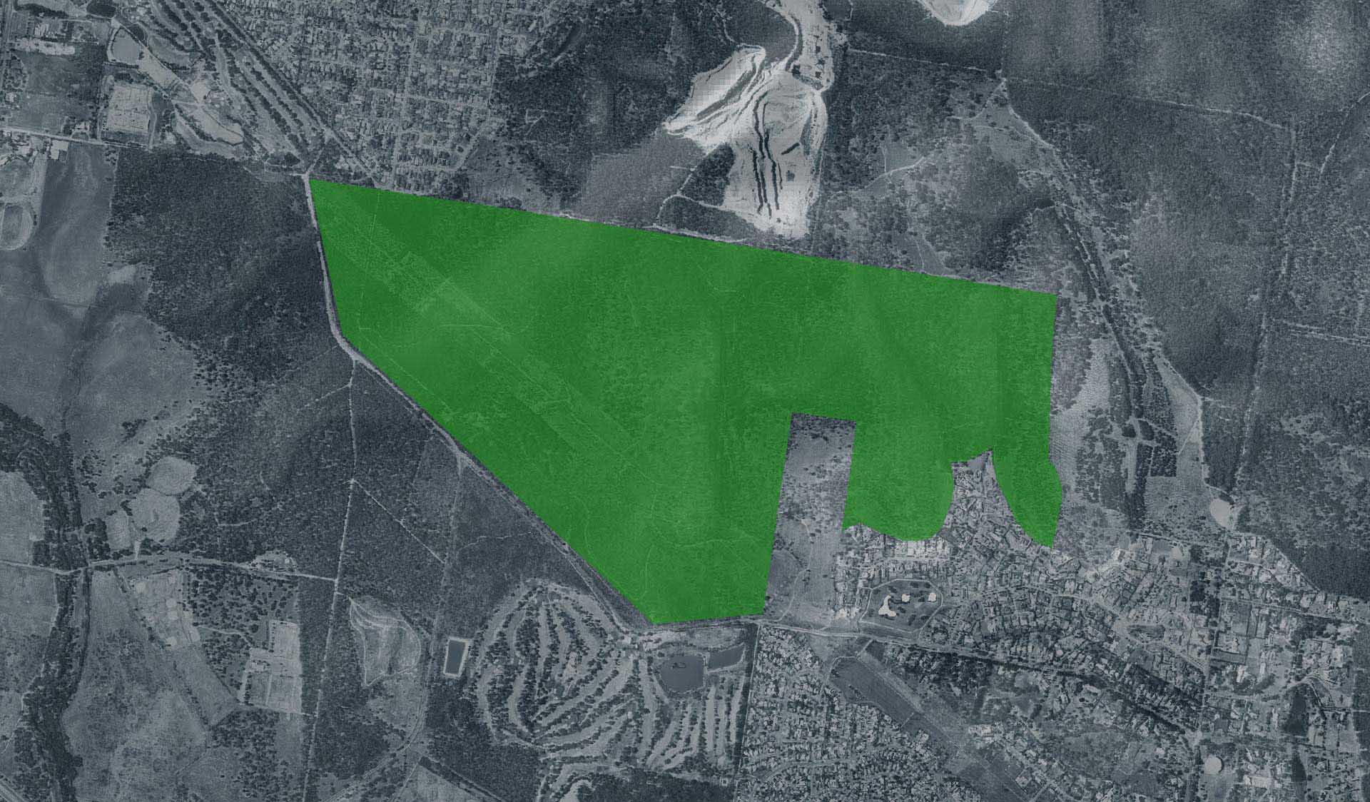
Trig Point Lookout Trail (Churchill National Park, Lysterfield Park)
The return walk or ride from the Churchill Picnic Ground to Trig Point Lookout follows old aqueduct along the Stonemasons Track before opening to spectacular 360 degree views of Melbourne. This track provides opportunities for wildlife viewing as visitors often spot Eastern-grey kangaroos, wallabies, echidnas or many of the bird species that reside within the environment. Keep a close eye on the tree tops, looking out for a Powerful Owl roosting amongst the eucalypts.
Trig Point lookout is 3.4km one-way Grade 2 trail
How to get there
Trig Point Lookout Trail (Churchill National Park, Lysterfield Park)
Need to know
Trig Point Lookout Trail (Churchill National Park, Lysterfield Park)
Safety in nature
You can benefit both mind and body when you get outdoors to explore and experience Victoria's natural places. Before you go, take a look at our safety tips and check our changed conditions and closures information for a great visit.
Accessibility
Visiting a park can be more of a challenge for people with disabilities, however, in Victoria there are a wide range of facilities to help people of all abilities enjoy our wonderful parks around the state. Parks Victoria provides a range of a equipment, including all-terrain and beach wheelchairs, facilities, accommodation and accessibility information and programs to help you plan and enjoy your visit to Victoria's parks.
Assistance dogs are welcome in Parks Victoria parks and reserves. Entry requirements apply for parks and reserves that are usually dog prohibited, such as national parks.
Warnings & Restrictions
Dogs
Restrictions
- No dogs allowed
- Restricted opening hours
Warnings
-
Animals and pests
- Snakes
Be Prepared
Change of Conditions
Nature being nature, sometimes conditions can change at short notice. It’s a good idea to check this page ahead of your visit for any updates.