Explore
Churchill Island Marine National Park
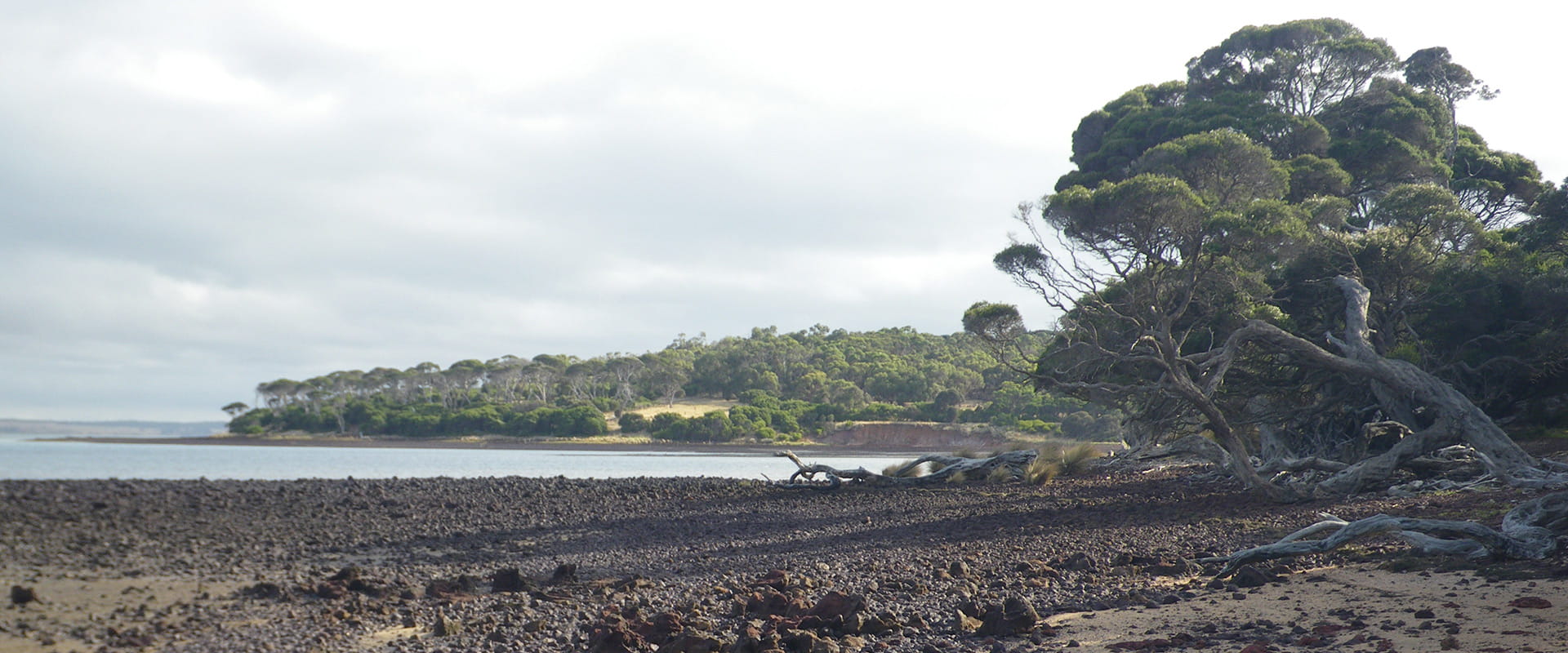
Protected from the wind and waves of Bass Strait by Phillip Island the Churchill Island Marine National Park (670 ha) is one of three Marine National Parks in Western Port and is located south of Rhyll on the eastern shore of Phillip Island.
Churchill Island Marine National Park protects its saltmarsh and mangrove fringes, cobble and shingle beaches, extensive sheltered intertidal mudflats, seagrass beds, subtidal soft sediments, and deep tidal channels. These habitats support a wide variety of support algae, invertebrates, fish, and bird communities that depend on the parks sheltered environment.
Churchill Island Marine National Park is heavily influenced by tidal activities that expose and submerge large expanses of mudflats and associated seagrass beds. These provide a foraging habitat for migratory waders with the park forming part of the Western Port Ramsar Site and the East Asian-Australasian Flyway, recognising it as a wetland of international significance for migratory birds. The surrounding saltmarsh and mangroves provide roosting areas for a wide range of seabirds and shorebirds.
The majority of the Marine National Park is subtidal soft sediments covered in shallow areas with dense beds of seagrass and algae. Fish associated with the subtidal sediments and channels include stingrays, perch, flathead, and gobies.
Within the deeper sections of the park dense populations of the highly unusual and rare ‘living fossil’ lampshell or brachiopod Megalania flavescent are found on the subtidal sediments and in tidal channels which also provide a habitat for a range of fish and invertebrate species, including a high abundance of the sea pen Sarcostyles grandis.
Things To Do
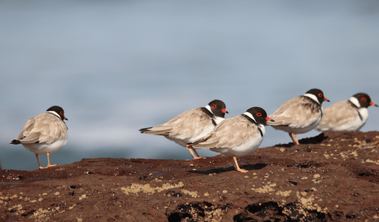
Churchill Island birdwatching
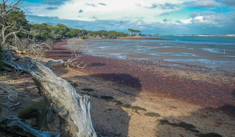
Tide watching at Churchill Island
Wildlife
Tours and adventure experiences in parks
One of the best ways you can get into nature is with a Licensed Tour Operator.
There are more than 400 Licensed Tour Operators across Victoria who are ready and waiting to help you experience and connect with Victoria’s spectacular parks and waterways.
Discover more than 60 different types of nature-based experiences including hiking, mountain biking, boating, four-wheel driving, indigenous culture tours, birdwatching, surfing, diving and so much more.
Licensed Tour Operators know all the best places to go and will plan and prepare your visit to ensure you are safe and can enjoy your nature-based adventure to the fullest.
How to get there
Churchill Island Marine National Park
When you're there
Download the Churchill Island Marine National Park map.
Need to know
Churchill Island Marine National Park
Accessibility
Visiting a park can be more of a challenge for people with disabilities, however in Victoria there are a wide range of facilities to help people of all abilities enjoy our wonderful parks around the state.
Safety
Keep clear of bird feeding or roosting areas.
Beware of sudden changes in weather, especially when boating or canoeing on open water.
Wear adequate protective footwear when exploring coastal environments. Beware of large tidal variations of up to three metres in Western Port. Stay away from cliff edges and bases.
How we keep it special
We aim to ensure that our valued parks, and the natural assets and cultural heritage they hold, can be enjoyed now and by future generations.
The management plan for Churchill Island Marine National Park directs management for the park until it is reviewed.
The Western Port and South-east Melbourne Conservation Action Plan provides directions for environmental conservation management across the diverse landscape, including Churchill Island Marine National Park. This covers the varied ecosystems across the area which range from heathlands to woodlands, wetlands and other marine environments.
Within Churchill Island Marine National Park a Special Protection Area for Natural Values covers the saltmarsh and mangrove areas, extending seaward from the high-water mark to the edge of the intertidal vegetation. This covers 20ha (3 %) of the Marine National Park and public access is prohibited including all vessels.
Fishing in the Right Place
Download the Victorian Recreational Fishing Guide app which has a boundary locator, using a smart phone's internal GPS to determine whether the user is in, or approaching, or outside a Marine National Park or Sanctuary.