Explore
Wingan Inlet Campground
Nestled on the western shores of Wingan Inlet, among tall Bloodwood trees, Wingan Inlet Campground offers a peaceful camping experience in one of the most secluded corners of Victoria. Jump in a canoe or kayak, or follow Fly Cove Walk to access the pristine sandy beaches of Croajingolong National Park.
Wingan Inlet is one of Victoria's quaint escapes, nestled on the western-edge of the Sandpatch Wilderness Zone. The secluded campsites hide among tall Bloodwood trees not too far from the shores of Wingan Inlet.
Come prepared with a canoe or kayak and explore the Wingan River. Upstream, the river follows a winding course through sea rushes and paperback thickets to a towering littoral rainforest and the stunning Wingan River Rapids. Crystal clear water trickles through lichen-covered granite boulders and curious water dragons peer out from behind colourful wildflowers. Downstream, the river leads to the mouth of the inlet where sandbars give way to the wild ocean swells of Fly Cove.
A small network of rocky islands just off the white sands of Fly Cove are home to a colony of Australian and New Zealand Fur Seals. Listen carefully and you might be lucky enough to hear pups calling for their mothers.
Along with the Wingan River Rapids, Fly Cove can be accessed by foot from the camsites. Follow the Fly Cove Walk. The beginning of the Wingan Rapids walk begins from Boundary Track, a short drive from the campsites.
If you're a keen angler, try your luck fishing and you might just catch dinner. Tailor, bream, perch and salmon are some of the species found in the inlet. If you're fishing from a boat, please note that Wingan Inlet has a 20 hp motor size limit.BOOK NOW
Things To Do
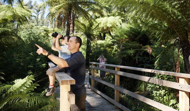
Bird watching
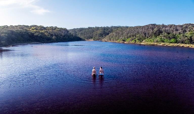
Elusive Lake
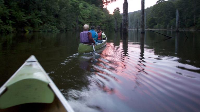
Canoeing and Kayaking
How to get there
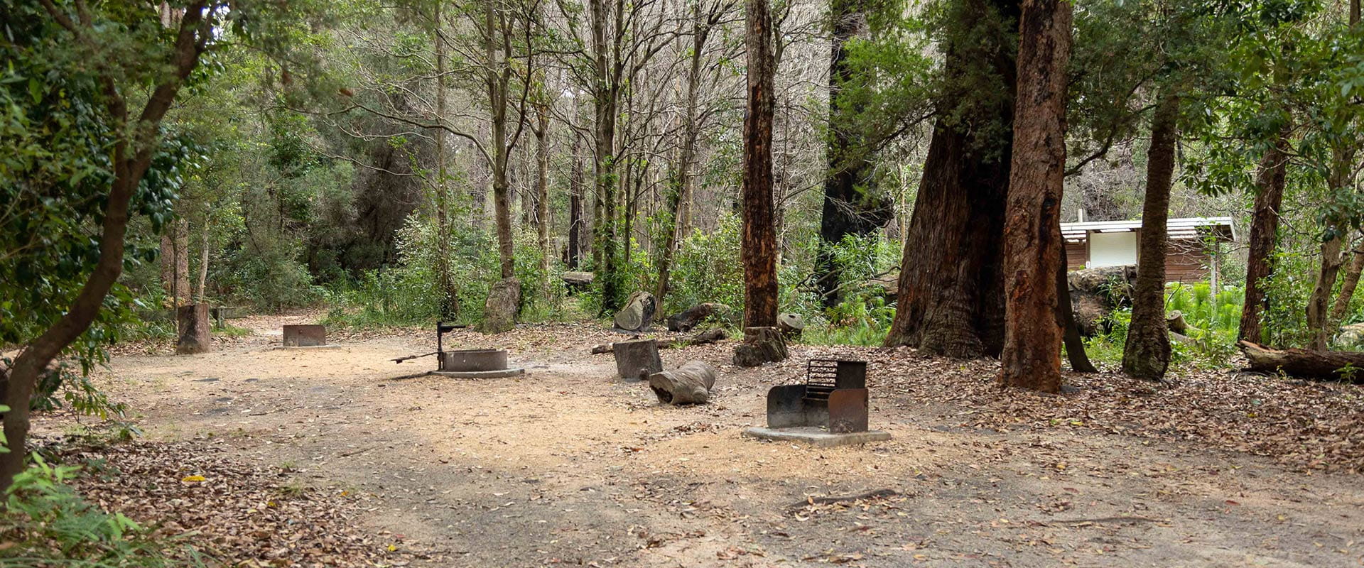
Wingan Inlet Campground
Sites
When you're there
When to go
Flathead, whiting, yellowfin, bream and perch are most likely to bite from late spring to autumn. Throughout winter large schools of Black Bream make their way into the estuary. And tailor, salmon and trevally are also known to bite throughout June, July and August.
Need to know
Wingan Inlet Campground
Accessibility
Wingan Inlet contains a number of campsites that are relatively flat set in clear, open areas. But note that there's a lack of accessible toilets and the trails leading down to Fly Cove are narrow and steep in some sections.
Be prepared and stay safe
Croajingolong National Park is in the East Gippsland fire district. Bushfire safety is a personal responsibility. Anyone entering the park during the bushfire season needs to stay aware of forecast weather conditions. Check the Fire Danger Rating and for days of Total Fire Ban at emergency.vic.gov.au, on the Vic Emergency App or call the Vic Emergency Hotline 1800 226 226.
No fires may be lit on Total Fire Ban days. On Catastrophic Fire Danger Rating days this park will be closed for public safety. Closure signs will be erected but do not expect an official warning.
Change of Conditions
Nature being nature, sometimes conditions can change at short notice. It’s a good idea to check this page ahead of your visit for any updates.
-
Allan Head (Croajingolong National Park)
Allan Head Jetty Closure
The Allan Head jetty is temporarily closed for public safety. Visitors are advised that the Allan Head day visitor area remains open, however access onto the jetty is restricted. -
Notices Affecting Multiple Sites
Tracks and areas closed in the Croajingolong National Park
The following areas are closed because of the 2019/2020 bushfires and coastal erosion caused by heavy rainfall. Parks Victoria continue to maintain surveillance and security of these areas as works continue to reinstate access.· Point Hicks Lightstation· Saros Track· Sledge TrackThe Wilderness Coast Walk is open all the way from Bemm River to Mallacoota. Staff have recently marked sections of the track however, combined flood and fire damage have made some areas more difficult to negotiate. Hikers must be able to self-navigate with a map and compass.The following walking track is closed:· Wingan Inlet Rapids WalkThe following jetties around Mallacoota are closed:· Kingfish Point. Goanna BayThe following tracks remain closed due to storm damage· Miners TrackPeachtree Creek Camp Closed for Upgrades - June to August 2026
Peachtree Creek Creek campground is closed from 30 April 2026 whilst upgrades are being completed.No access to the boat ramp, jetty or toilet block is possible whilst works are underway.Works are expected to be completed by end of August 2026.Alternative access to Tamboon Inlet is available via the boatramp at Furnell Landing at the end of Tamboon Rd. See here for map.Ground shooting operations targeting deer
Control operations (ground shooting) targeting deer are undertaken in this area. The Park will remain open to visitors during these operations.For more information about Parks Victoria deer control to protect biodiversity, please visit: https://www.parks.vic.gov.au/get-into-nature/conservation-and-science/conserving-our-parks/feral-animals/deer -
Kingfish Point (Croajingolong National Park)
Kingfish Point Jetty Closure
The Kingfish Point Jetty is closed for public safety. Visitors are advised that the Kingfish Point day visitor area remains open. -
Genoa Peak (Croajingolong National Park)
Genoa Peak Road and Genoa Peak Walking Track Closure
Genoa Peak Road and Genoa Peak Walking Track will be temporarily closed to public access from the 2nd June 2026 to the 1st September 2026 to allow for hazardous tree treatment and road maintenance works. -
Croajingolong National Park
Area closed in Croajingolong National Park
Water Inundation is currently impacting Croajingolong National Park and Mueller Inlet Camp
The following campsites will be closed until water levels recede which are currently impacting campsites:
- Mueller Inlet Camp
For alternative camping arrangements please book at Thurra River (Croajingolong National Park) -
Captain Creek (Croajingolong National Park)
Captain Creek Jetty Closure
The Captain Creek Jetty is temporarily closed for public safety due recent vandalism requiring a section of decking to be repaired. The Captain Creek Day Visitor area remains open. -
Notices Affecting Multiple Parks
Ground shooting operations targeting foxes
Control operations (ground shooting) targeting foxes are undertaken in this area. The Park will remain open to visitors during these operations.For more information about Parks Victoria deer control to protect biodiversity, please visit: https://www.parks.vic.gov.au/get-into-nature/conservation-and-science/conserving-our-parks/feral-animals