Reopening flooded areas is no walk in the park
Monday 13 February, 2023
We know you love spending time in parks and we love helping people get into nature. That’s why we’re working hard to reopen parks that were closed due to damage from recent storms and floods.
The flood and storm events in late 2022 were no ordinary weather event. Reopening parks safely for visitors takes time and resources.
More than 80 parks have been impacted across the state, so we’ve focused efforts on the most popular visitor areas and those that can be reopened safely. Gradually we are working to re-open all affected parks.
Visitors can expect changed park conditions at some of their favourite destinations for some months, even years – particularly along the Murray River. Before planning your next adventure, check the latest park conditions on the Parks Victoria website.
The Victorian floods
Persistent low-pressure weather systems linked to an unusually intense ‘La Nina’ cycle led to Victoria's wettest October in recent memory.
In October 2022, heavy rainfall across the state resulted in flash flooding across large catchment areas and major flooding along waterways, mostly in central and north-central Victoria.
Hundreds of homes, farms, businesses, infrastructure and public land have since been impacted, across the state.
Many Parks Victoria staff were deployed to assist with Victoria’s emergency response, some of whom were personally affected by flooding or storm damage.
Closures and immediate risks
After heavy rain, it can take many weeks for the water to recede from rivers and the floodplains adjacent to them. The flooding is a natural and normal occurrence.
Once the water has passed, some impacted parks and other public land may stay closed for what seems like a long time. But, there are many steps Parks Victoria staff are taking to assess and open your favourite park, so you can get back into nature safely.
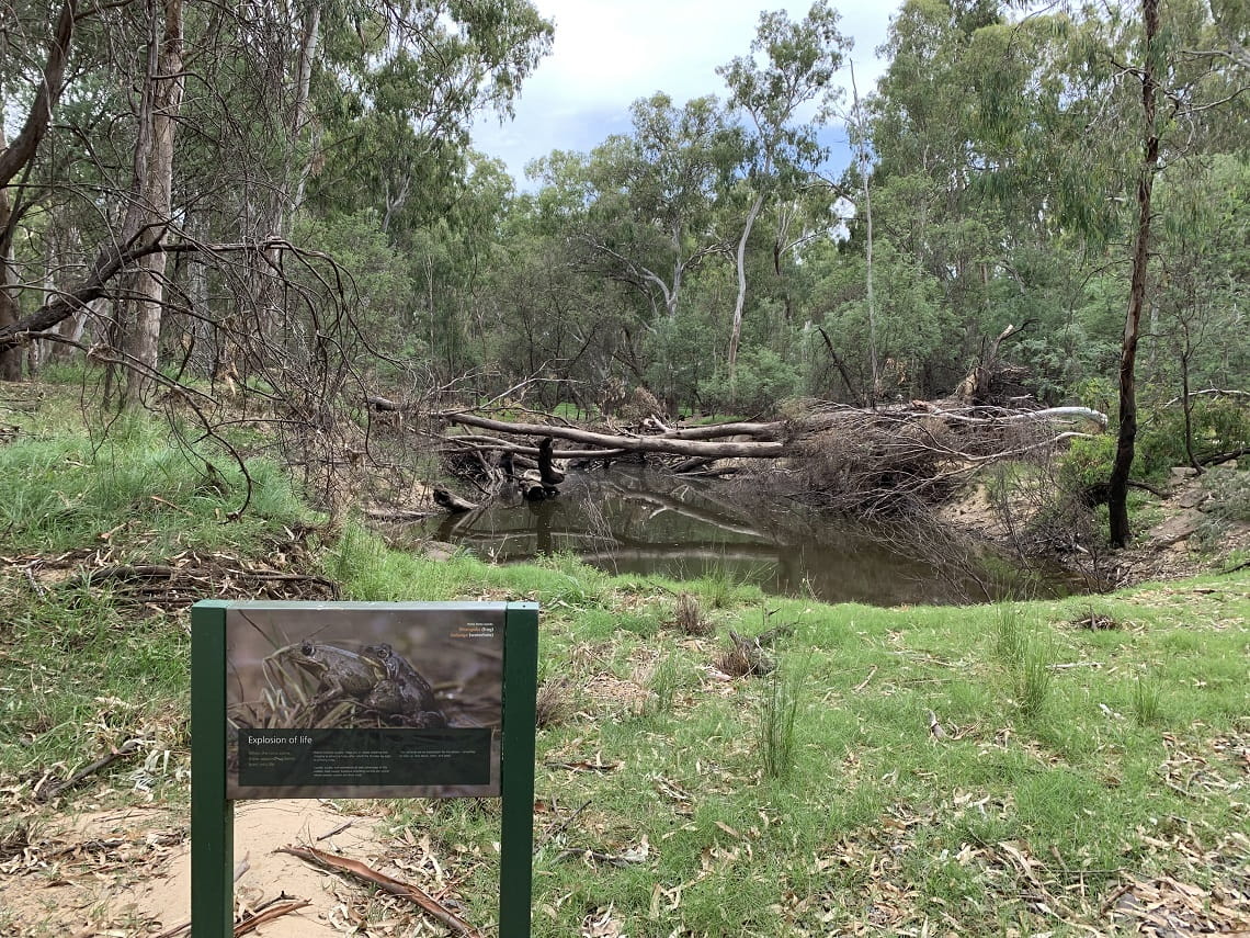
Tree fall risk
During the emergency response and for many weeks after, we saw an increase in trees uprooting and falling as well as falling tree limbs. This can be due to the rain soaked ground making the tree’s root system unstable.
Falling trees and tree limbs can be deadly. Hundreds of thousands of trees were affected by the recent flood and storms. Many were directly hit by thousands of litres of floodwater, fierce winds and pounding rain, and many were submerged in water up to 2 metres deep for several weeks.
All these impacts make trees more likely to fall or drop limbs without warning.
We’ve noticed that as the weather warms and the ground dries out, fewer trees and limbs are falling. However, even parks that haven’t experienced flooding events can have trees and branches fall at any time.
Where possible, always camp under clear skies and avoid parking or sitting under trees. If you plan to camp near trees, look up at trees for any signs of leaning and hanging or broken branches and at the base of the tree for any signs of soil movement that may indicate a lack of stability in the tree. If you see these signs, do not camp near the trees.
The path to reopening
There are multiple stages Parks Victoria is undertaking to reopen flood and storm affected parks. There is a long list of parks and sites to assess as more than 80 parks were impacted by the 2022 floods.
1. Assessment
Our aim is to protect visitors and staff from known and foreseeable risks. To safely reopen visitor areas, we need to gain safe access to the site, assess the damage and identify any issues.
Site assessments include looking at hazards, infrastructure, landscape impact, heritage, engineering and insurance.
Once assesements are complete, local teams undertake recovery and rehabilitation works so that visitor areas can be safely reopened.
Hazard assessments
Flood recovery teams are visiting each site to look for the following hazards:
- Site access: can visitors get into the visitor area safely and without causing harm to the track or road?
- Dangerous trees: We inspect potentially hazardous trees and their surrounding area, particularly focusing on root ball heave, crown damage, undercutting and similar signs of erosion.
- Flood affected wastewater: toilets and amenity blocks may be damaged or show signs of failure. This can cause significant risks to the environmental and human health.
- Landform hazards: Have any dangerous pot holes, landslips or sinkholes been created as a result of flooding or storms?
- Damage to signage: Are signs with critical information clean and legible? E.g. safe drinking water, bridge weight limits, environmental hazard warnings and campsite numbers.
- Asset damage: Have any buildings or bridges been visibly damaged? Do they require assessment by an engineer?
- Asbestos: Has any asbestos been uncovered or damaged?
Aboriginal cultural heritage protection
Many of the flood affected areas are rich with tangible evidence of Aboriginal use and occupancy including middens, scar trees and Ancestral resting places.
These places have great social, spiritual, and ceremonial significance both for Aboriginal people and for the broader Victorian community. A dedicated team has been put in place and is working around the clock to ensure recovery efforts cause no further harm to Aboriginal cultural heritage.
To learn more about our commitment to protecting and conserving Aboriginal cultural values, visit the Managing Country Together section of our website.
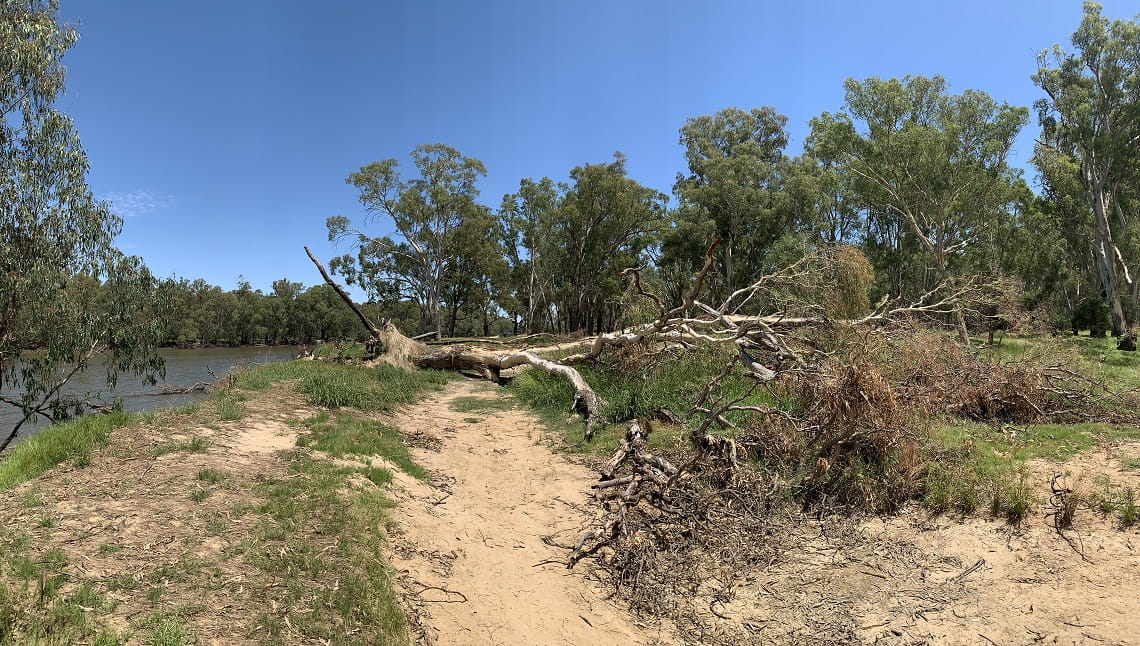
As the volume of floodwater eroded the banks of the Murray River, this 30-metre tall gum tree fell onto a dispersed camping site near popular Forges Beach No. 1 in Yarrawonga Regional Park.
2. Recovery and rehabilitation works
Once assessments are completed, our staff can begin to work on recovery, repair and rehabilitation.
Our staff have the tools and expertise to carry out many recovery tasks themselves:
- Working alongside Traditional Owner groups and agencies for cultural heritage rehabilitation
- Cleaning and restoring signage
- Clearing debris from tracks and visitor sites
- Managing some hazardous trees
- Repairing or replacing broken assets (tables and signage)
- Weed spraying
After floodwaters receded, the interpretive signage at Quinns Island, Cobram Regional Park, was covered in a muddy brown film. All signs on the island have been cleaned so visitors have the information they need when enjoying this park.
Some tasks can only be undertaken by qualified contractors with specialised machinery. The impacts of recent significant weather have placed these contractors in high demand, and efforts in residential and community recovery will always take precedence.
Independent contractors with specialised machinery are needed for:
- Grading roads (the process to smooth out unsealed roads and tracks)
- Pumping out flooded toilets
- Managing difficult hazardous trees
- Complex asset repair (buildings and bridges)
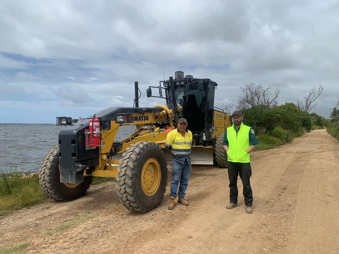
Repairs to the road at Mitchell River Silt Jetties Reserve have been completed. The park has now reopened – a favourite fishing destination for locals and visitor alike, and important to the local tourism industry.
Photo taken by Recovery Project Officer, Shamis on 9 December 2022.
3. Let visitors in!
Once the assessments and recovery works are complete, we can let visitors back in!
We reopen parks in several stages, depending on the impacts and needs of each park.
Partial reopening: We will reopen visitor areas within parks if identified risks can be contained (e.g. let visitors into safe areas and restrict access to unsafe areas). However if the identified risks can’t be managed (e.g. if it’s impractical to restrict access to the unsafe areas), the whole visitor area must remain closed.
Full reopening: We will reopen an entire park when all identified risks in visitor areas have been managed and they are deemed safe.
Take a walk in a park
As of February 2023, Parks Victoria has now reopened or partially reopened more than 75% of flood and storm affected parks.
While we are working to reopen all affected parks, some of your favourite places may be closed, partially closed, or have changed conditions.
Visit the Flood and Storm Affected Parks page for a list of sites with a closure in place.
Some parks have been severely impacted and may stay closed for months or even years. Thank you for keeping out of closed areas.
Before you leave home, check the Parks Victoria website and search for the park you’d like to explore then scroll to the Change of Conditions section at bottom of the page.
Please be patient and kind when talking with Parks Victoria staff, they love these parks as much as you do.
We look forward to safely reopening Victoria’s precious places for everyone to enjoy.
A note on climate change
Climate change is causing our weather and ecosystems to change.
In the last few years, Victorians have experienced unprecedented storm events, altered fire regimes, changes to rainfall and access to fresh water. These events are expected to occur more often. The flood and storm events in 2022 are another example of extreme weather, and the impacts to communities and landscapes are long lasting.
Parks Victoria will continue to put the safety of all Victorians first, working alongside Traditional Owners, communities and the wider Victorian Government.
Related news
Enjoy Victoria's parks this long weekend
Victoria’s parks will remain open and welcoming this long weekend, and we encourage visitors to get out and enjoy the outdoors from Friday 5 June to Tuesday 9 June 2026.

Portsea Pier to undergo major maintenance works in July
Major maintenance works will begin in July 2026 to restore and strengthen Portsea Pier following significant storm damage in 2024. The pier will be closed will work is underway.

Reconstructed Dee Slip Bridge open for visitors once again
In the misty foothills of Yarra Ranges National Park near Warburton, the historic Dee Slip Bridge along the renowned O'Shannassy Aqueduct Trail has reopened following extensive repair works.