Explore
Coppermine Campground
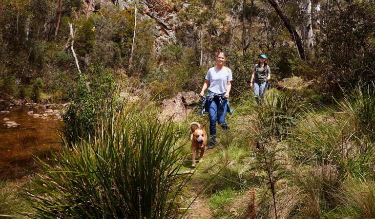
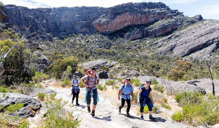
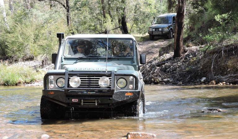
Located in the northern Grampians and accessible by 4WD only, Coppermine Campground is perfect for the adventurous camper.
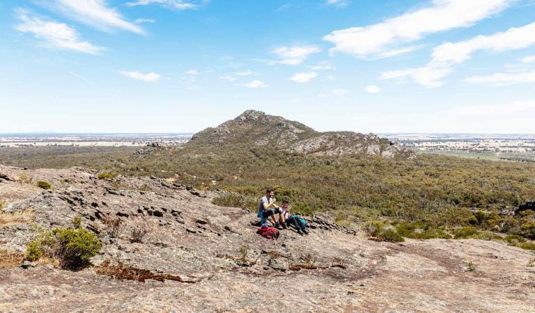
Set high on the range with views out over the plains, this campground is ideal for those looking to get off the beaten track and experience some of the most beautiful and lesser known areas of the Grampians.
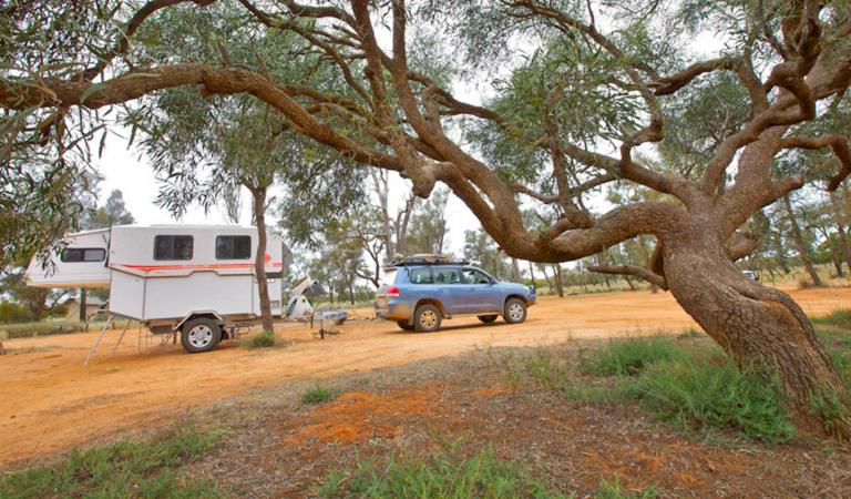
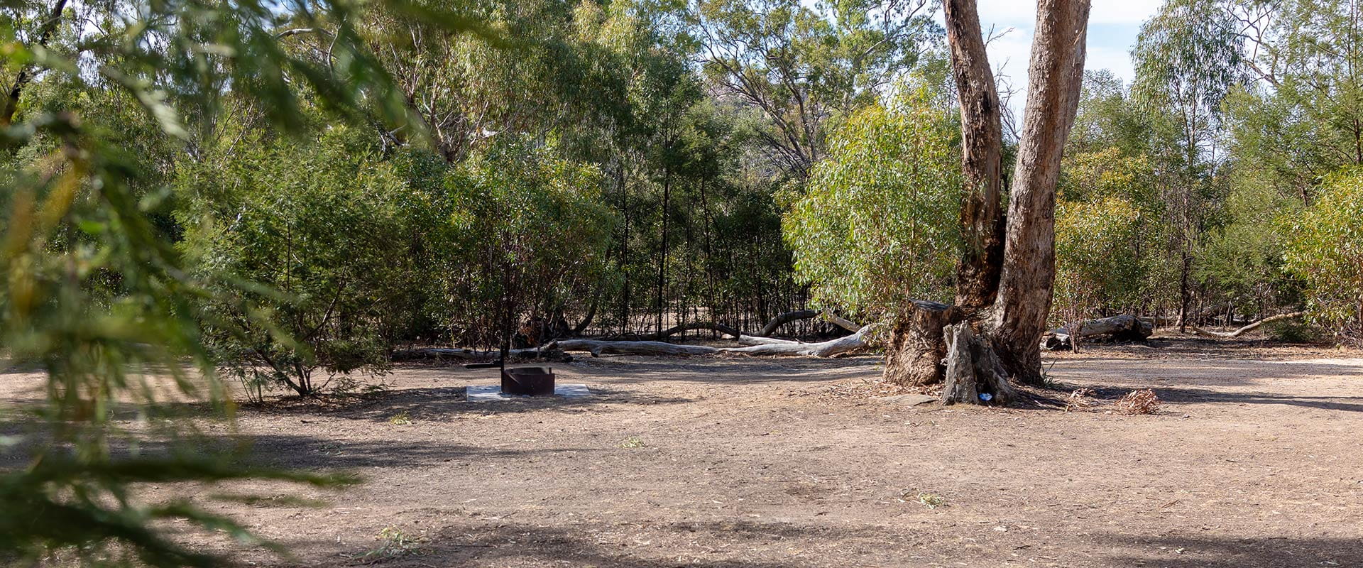
Accessible by 4WD only, this small campground offers four campsites, each accommodating up to six people. Sites are suitable for camper trailers, campervans or tents. Advanced bookings and payment are required year-round.
The campground features shared fireplaces and pit toilets and there is untreated tank-water available, however bring drinking water and firewood with you.
Things To Do
Mount Zero
Mount Stapylton Loop Walk
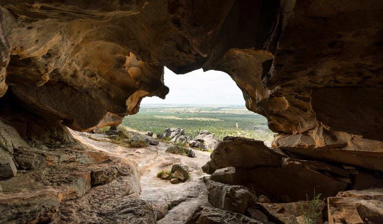
Hollow Mountain
How to get there
Coppermine Campground
When you're there
Need to know
Coppermine Campground
Safety tips for a great visit
Stay safe and get the most out of your park visit by preparing for natural hazards and other outdoor risks in Victoria’s parks. You are responsible for your own safety and the safety of those in your care.
Accessibility
Visiting a park can be more of a challenge for people with disabilities, however in Victoria there are a wide range of facilities to help people of all abilities enjoy our wonderful parks around the state.
Bushfire awareness
Coppermine Campground in the Grampians National Park is in the Wimmera fire district. Bushfire safety is a personal responsibility. Anyone entering the park during the bushfire season needs to stay aware of forecast weather conditions. Check the Fire Danger Rating and for days of Total Fire Ban at emergency.vic.gov.au, on the Vic Emergency App or call the Vic Emergency Hotline 1800 226 226.
No fires may be lit on Total Fire Ban days. On Catastrophic Fire Danger Rating days this park will be closed for public safety. Closure signs will be erected but do not expect an official warning.
Change of Conditions
Nature being nature, sometimes conditions can change at short notice. It’s a good idea to check this page ahead of your visit for any updates.
-
Notices Affecting Multiple Sites
Grampians Peaks Trail – Hike-in Campground Closures (sections C3-C5 & S1-S2)
The central and southern sections of the Grampians Peaks Trail (C3-C5 and S1-S2) re-opened for day walking only on the 10th of November 2025.These sections were heavily impacted by the 2024/25 Summer bushfires and incorporate the trail from Borough Huts Campground to Griffin Trailhead (including section S1 –S2 Yarram Gap Road to Griffin Fireline).Barri Yalug, Duwul, Durd Durd, Yarram and Wannon Hike-in Campgrounds and facilities remain closed, as works take place to repair damaged toilets, water tanks, elevated walkways, tent platforms, shelters, and signage.Please note:- Drinking water is available
at serviced water tanks only, located at Grampians Peaks Trail Road
crossings. Important: drinking water is not available at the
Hike-in Campgrounds. Hikers must adjust accordingly and carry sufficient
drinking water.
- Toilet facilities are
available at Borough Huts, Jimmy Creek, Kalymna and Wannon Crossing
campgrounds.
- Mt William Road is closed
until further notice, and vehicle access to the Mount William carpark is
unavailable.
- Please see the Plan and
Prepare Guide for more information on how to plan and prepare, before
accessing the Grampians Peaks Trail.
Please remember, this fire affected landscape is fragile. Stay on formed tracks and be mindful that walking track and surrounding forest conditions have changed.Visit our fire recovery project web page for relevant upgrade information.Check what's open and closed in Grampians (Gariwerd) National Park on the change of conditions web page. If you are visiting the area and require more detailed local information, visit Brambuk the National Park and Cultural Centre at 277 Grampians Rd Halls Gap, open 9am to 4pm, 7 days a week. Alternatively, you can call (03) 8427 2258 or email brambuk@parks.vic.gov.au - Drinking water is available
at serviced water tanks only, located at Grampians Peaks Trail Road
crossings. Important: drinking water is not available at the
Hike-in Campgrounds. Hikers must adjust accordingly and carry sufficient
drinking water.
-
Sundial Peak Walk (Grampians (Gariwerd) National Park)
Sundial Peak Walk and The Bleachers (Sundial Peak) – Temporary closure
Sundial Peak Walk and The Bleachers (Sundial Peak) – Temporary closureSundial Peak Walk and The Bleachers (Designated Climbing Area – Bouldering (Site 83) both remain closed due to track damage from the 2024/25 summer bushfires.Alternative walks from Sundial carpark including The Pinnacle Walk and the Lakeview Lookout Walk.For more information visit Brambuk the National Park and Cultural Centre in Halls Gap or call 03 8427 2058 -
Mackenzie Falls Day Visitor Area (Grampians (Gariwerd) National Park)
Mackenzie Falls (Migunang wirab) – Closed for major construction works – 9 February 2026 to midyear 2026
Construction work at Mackenzie Falls in the Grampians (Gariwerd) National Park is underway and the carpark and precinct is closed to visitors.The works at Mackenzie Falls precinct includes the construction of a new viewing platform at the base of the falls, upgrades to the carpark and the Bluff Lookout Walk and other important safety improvements to stabilise rock and improve walking tracks.
The Mackenzie Falls carpark and all walking tracks in the precinct including Broken Falls Walk, Mackenzie Falls Walk to the base (from the carpark), the Bluff Lookout Walk, and parts of Mackenzie Falls River Walk are closed. We anticipate that construction work will finish in the second half of the year.The carpark will be a construction site throughout the works period with large machinery operating and materials being stored on site. There will be no access for all vehicles or visitors at Mackenzie Falls Precinct during construction.Zumsteins Picnic Area ParkingDuring construction parking at the popular Zumstein picnic area will be limited. It is not recommended for large passenger coaches and long caravans to visit during construction. Similarly, they should not travel between Mackenzie Falls and Zumsteins due to the narrow winding road.A small amount of parking for campervans, small motorhomes and cars with trailers is available opposite the Zumsteins Picnic Area car park, however, may not be available on busy weekends and public holidays.Zumsteins to Fish Falls – This popular walk to the beautiful Fish Falls is a 1.5 to 2 hour return walk (Grade 3) – walkers should have a reasonable fitness level, carry water and wear sturdy walking shoes as the track can be rocky with uneven surfaces and some steep sections.Access to Fish Falls and the base of Mackenzie Falls will remain possible from the Zumsteins Picnic Area up to and including the Autumn School Holidays. However, there will need to be a full closure of Zumsteins and Mackenzie Falls for one week prior to the Autumn School Holidays due to helicopter operations. From May 2026 until works are complete, the base of Mackenzie Falls will be inaccessible. Fish Falls will still be accessible from Zumsteins Picnic Area.Mackenzie River Walk – This is a 2 to 3 hour return walk (grade 3). Start at Zumsteins Picnic Area and follow the track to Fish Falls and then to the base of Mackenzie Falls. Walkers require a reasonable fitness level, need to wear sturdy walking shoes as the track can be rocky with uneven surfaces including steep sections and steps. Please ensure you carry plenty of water and be aware mobile phone service is limited. Access to the steps at the base of Mackenzie Falls to the Mackenzie Falls carpark will be closed to walkers, return by the same route to Zumsteins Picnic Area.For further information on the Mackenzie Falls (Migunang wirab) project visit https://www.parks.vic.gov.au/projects/western-victoria/mackenzie-falls-revitalisationPopular day visitor sites such as Reeds Lookout, the Balconies, Boroka Lookout, Silverband Falls and various walks with large bus carparking will still be available. For further information on the Mackenzie Falls River Walk contact Brambuk the National Park and Cultural Centre in Halls Gap (Ph 8427 2058).Please keep up to date with closures through the Change of Conditions page for Grampians (Gariwerd) National Park. -
Grampians (Gariwerd) National Park
Grampians (Gariwerd) National Park – What’s Open What’s Closed Update 11.02.2026
During the summer of 2024/2025 the southern and western areas of Grampians (Gariwerd) National Park and the central section of Grampians Peaks Trail were impacted by multiple bushfires. Since then, a staged re-openings have taken place with many popular visitor areas re-opened in the Northern, Wonderland and Southern areas of the park. However, some visitor sites and roads remain closed in the Sundial, Mount William, Victoria Range, Victoria Valley and Wallaby Rocks areas.For up-to-date information please refer to the Road Report on the change of conditions listings.For more detail on “What’s Open What’s Closed”Please refer to the attached “What’s Open What’s Closed” February 11, 2026, Park Update. It provides a park wide compilation of the staged fire recovery reopenings in 2025/2026.For further information, visit Brambuk the National Park and Cultural Centre in Halls Gap, call Parks Victoria on 131963 or go to parks.vic.gov.auAttachments: GGNP_Park Update_Whats Open-Closed_Feb 11 2026 (1,098KB)
Grampians (Gariwerd) National Park - Roads Update 13.02.2026
The Grampians (Gariwerd) National Park has roads temporarily closed due to bushfire and flood impacts.Please be aware the movement of visitors in parts of the National Park is restricted.Please refer to the attached up-to-date road report below.Attachments: Grampians (Gariwerd) National Park - Road Report - 13.02.2026 (223KB)
-
Brambuk the National Park and Cultural Centre (Grampians (Gariwerd) National Park, Brambuk - The National Park and Cultural Centre Park)
Brambuk the National Park and Cultural Centre – Closures throughout 2026
· Cultural tours, activities and venue hire currently unavailable.· Park information centre and gift shop remain open.Parks Victoria is working with a strategic partnership committee of Gariwerd Traditional Owners from Barengi Gadjin Land Council, Eastern Maar Aboriginal Corporation, and Gunditj Mirring Traditional Owners Aboriginal Corporation to ‘reimagine’ the future of Brambuk the National Park and Cultural Centre.The reimagining project aims to renew Traditional Owner management arrangements of the Brambuk precinct and includes careful consideration of the tourism and visitor experiences, commercial opportunities, cultural education and training programs that may be available in the future. As part of this project, there are also building upgrades and refurbishments that require the Cultural Centre to be closed during 2026. However, the park information centre, gift shop and self-guided walks remain available.For Junior Ranger School holiday programs visit https://www.parks.vic.gov.au/things-to-do/junior-rangersFor a list of Grampians (Gariwerd) National Park Licensed Tour Operators Visit https://www.parks.vic.gov.au/ltoFor up-to-date national park information, brochures, maps, permits and access advice contact information staff at Brambuk the National Park and Cultural Centre info@parks.vic.gov.au or phone 8427 2058Further details on the Brambuk Reimagining project can be found on the Parks Victoria website https://www.parks.vic.gov.au/projects/western-victoria/brambuk-cultural-centre-upgrade
Similar experiences
4WD in Alpine National Park