A beautiful coastal walk following the Great Ocean Road through sections of forest between Kennett River and Wye River townships. Enjoy coastal views to Cape Otway and over Bass Straight while hugging the steep edge of the Otway Ranges and treading the line between forest and ocean.
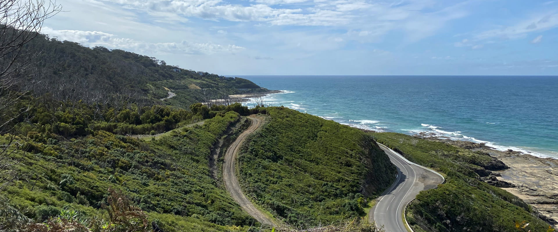
This undulating 4.6km coastal track with steps and creek crossings links the townships of Wye River and Kennett River. High points of the track offer views through tall eucalypts to the Southern Ocean beyond. Learn about the history of the area through storyboards and listen for birdlife as you walk through forest above the Great Ocean Road.
Commencing at the Wye River hotel and winding through the streets of the township, the trail begins at the top of Morely Avenue. A meandering track with some challenging steep sections, this walk follows the coastline above the Great Ocean Road before descending into Kennett River.
Kennett - Wye River is located in Great Otway National Park 15 minutes east of Lorne. The coastal and forest setting is less developed than nearby Lorne providing a quieter and more relaxed atmosphere. There are a small number of areas to camp, walk or take in the sites along the Great Ocean Road. Facilities in this area are more basic.
Wildlife
How to get there
Wye to Kennett River Walk
When you're there
Download a visitor guide for the area for information and a detailed map.
Need to know
Wye to Kennett River Walk
Accessibility
Visiting a park can be more of a challenge for people with disabilities, however in Victoria there are a wide range of facilities to help people of all abilities enjoy our wonderful parks around the state.
Assistance dogs are welcome in Parks Victoria parks and reserves. Entry requirements apply for parks and reserves that are usually dog prohibited, such as national parks.
Change of Conditions
Nature being nature, sometimes conditions can change at short notice. It’s a good idea to check this page ahead of your visit for any updates.
-
Notices Affecting Multiple Sites
Great Otway National Park Flood Closures
Severe thunderstorms and flash flooding on 16 January 2026 has caused significant damage across parts of the eastern Great Otway National Park.For public safety, the following areas are closed until further notice while assessments and clean-up works are undertaken:Closures included but are not limited to :Erskine falls is limited to the top viewing platform. Access to the base of the falls and along the river track is closed.
Roads & TracksWye RdCurtis TrackGodfrey TrackJamieson Track
Walking tracks
St George
Phantom falls
Lemonade ck
Kalimna
Henderson
Cumberland
Cumberland Garvey Link
Kalimna Garvey LinkCora LynnErskine Falls Walking TrackWon WondahAlternative walking tracks can be found at:Moggs Creek picnic areaDistillery Creek picnic areaOcean TrackCastle RockSheoak Falls to Swallow cavesMany roads, tracks and visitor facilities are impacted by debris, flooding and unstable conditions.The Great Ocean Road has been impacted,Always follow safety signage and directions from response crews, and do not enter any closed areas.Thank you for your patience and understanding as works are undertaken to make these popular areas safe to visit again.Planned burn Hurst Road
Planned burning operations are scheduled in the Great Otway National Park which will result in closure of Hurst Road Anglesea, the Eumeralla MTB tracks and the adjoining section of the Surf Coast Walk from the time the burn is approved for ignition until the area is declared safe.Ignition of the burn is scheduled from Thursday 14 May 2026 and is subject to favorable weather. -
Great Otway National Park
Planned burning Boonah/Retreat Rd
Planned burning operations are scheduled in the Great Otway National Park which will result in closure of Gentle Annie and Moggs Ck Track from the time the burn is approved for ignition until the area is declared safe.Ignition of the burn is scheduled from Friday 15 May 2026 and is subject to favorable weather. -
Anglesea Perimeter Walk - West (Anglesea Foreshore Reserve, Great Otway National Park, Great Otway National Park GORCAPA)
Planned Burning Closures
Parts of the Anglesea perimeter walk bordering Harvey st and Odonohues St are closed for planned burning operations.
Please adhere to all signage within the area.