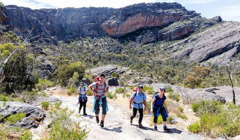
Hattah Nature Walk – 1.2km, 40 minutes return
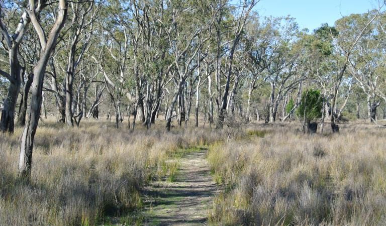
This gentle walk begins from the carpark near the park entrance off the Hattah-Robinvale Road. Interpretative signs highlight Mallee ecosystem.
Warepil Lookout Walk – 600m, 30 minutes return
Start from the Old Calder Highway carpark and take a short stroll up the steady incline to the lookout tower. You will be rewarded with great views of the surrounding Mallee Region. Look north-west and see the vast Murray Sunset National Park. This is a great place to witness the magnificent Mallee sunsets.
Woodlands Walk – 2.5km, 1 hour one way
This walk starts at the Hattah- Kulkyne National Park Visitor Centre carpark and connects to the Camel Pad Track. It allows you to walk the 8km to Lake Mournpall Campground avoiding the car traffic on Mournpall Track.
Mournpall Lake Loop – 9.5km, 3 hours circuit
Starting at the Lake Mournpall camping area, this loop walk follows the northern edge of Lake Mournpall before circling north around Lake Konardin passing through River Red Gum flood plains and Mallee dunes. The walk showcases the dramatic changes in vegetation, as you get closer and further away from water. Keep an eye also for the abundant wildlife. Kangaroos and emus can frequently be spotted, as well as a variety of birds, including wedge-tailed eagles, whitebellied sea eagles and whistling kites.
Download the Hattah-Kulkyne Visitor Guide for a map of the walks in the park.
How to get there
Walking in Hattah-Kulkyne National Park
Facilities
Need to know
Walking in Hattah-Kulkyne National Park
Change of Conditions
Nature being nature, sometimes conditions can change at short notice. It’s a good idea to check this page ahead of your visit for any updates.
-
Hattah - Kulkyne National Park
Stockyard Track closed due to flooding
Due to floodwaters Stockyard Track is now closed for public safety.Rim Crossing closed due to flooding
Due to flooding of the Hattah lake system , Rim Crossing is now closed for public safety.Yerang Track closed due to flooding
Due to flooding of the Hattah lake system, Yerang Track is now closed for public safety.Lockie Track closed due to flooding
Due to flooding of the Hattah lake system , Lockie Track is now closed for public safety.Boolungal Crossing closed due to natural watering event
Due to flood waters, Boolungal Crossing is now closed for public safety.River Track Closed Due To Flooding
Due to floodwaters River Track is now closed for public safety.Bugle Ridge Walking Track closed due to flooding
Due to flooding of the Hattah lake system , Bugle Ridge Walking Track is now closed for public safety.Mournpall Track Closed Due to Flooding
Due to flooding of the Hattah lake system , Mournpall Track is now closed for public safety.Chalka Creek Track closed due to flooding
Due to floodwaters Chalka Creek Track is now closed for public safety.Murray River Dispersed Camping Limited Access Due to Flooding
Due to the Murray River continuing to rise, all river access traditionally accessible for dispersed camping in Murray Kulkyne Park is either inaccessible (Closed) or limited access due to flood water. Please ensure you take caution when assessing the river for camping during this period. Flood waters are predicted to peak first week of Dec 22. Conditions can change daily.Conservation Management Program Hattah Kulkyne National Park Closed 12/02/23
Please be advised that a pest animal control program using firearms will be conducted in Hattah Kulkyne National Park.The program will be conducted from 0800 to 1600 on Sunday the 12th February 2023.During such time the Park will be closed for public safetyClosure signs will be in place on all main entry points into the park.Blue Green Algae detected within Hattah Lakes
Blue Green Algae is confirmed to be resent within the Hattah Lakes system.Contact with the affected water may cause harm to humans and animals.For your safety, we recommend not to drink the water, no contact on skin, no swimming and limit recreational activities on the water.Contact with affected water can cause skin irritation, mild respiratory effects and hayfever-like symptoms. -
Lake Mournpall Camping Area (Hattah - Kulkyne National Park)
Mournpall Campground closed due to flooding
Due to flooding of the Hattah lake system, Lake Mournpall Campgrounds is now closed for public safety
-
Notices Affecting Multiple Parks
Emmerts, Firemans Bend Boat Ramps Closed Due to Flooding
Emmerts and Firemans Bend Boat Ramps are closed for public safety due to flooding of the Murray RiverIncreased risk of mosquito-borne diseases
Large numbers of mosquitoes in Northern Victoria have increased the risk of mosquito-borne diseases, particularly around rivers and other water bodies.For information about how to protect yourself and your loved ones from mosquito bites before you head outdoors, visit the Don't Wing It!- Better Health Website or see our visitor safety tips. -
Lake Mournpall Walk (Hattah - Kulkyne National Park)
Mournpall Loop Walking Track closed due flooding
Due to flooding of the Hattah lake system , Mournpall Loop Walking Track is now closed for public safety. -
Lake Hattah Camping Area (Hattah - Kulkyne National Park)
Lake Hattah Campground closed due to flooding
Due to flooding of the Hattah lake system, Lake Hattah Campgrounds are now closed for public safety.