
Lake Tyers State Park is one of the jointly managed parks within Gippsland. The Joint Management agreement recognises the fact that the Gunaikurnai people hold Aboriginal Title and maintain a strong connection to Country. As custodians of the land, they are the rightful people who speak for their Country. These parks and reserves are cultural landscapes that continue to be part of Gunaikurnai living culture. For more information on Joint Management, please visit the Gunaikurnai Traditional Owner Land Management Board and the Gunaikurnai Land and Waters Aboriginal Corporation.
The still waters, shady banks and sandy beaches around Lake Tyers and along Ninety-Mile Beach provide great opportunities for fun in the water.
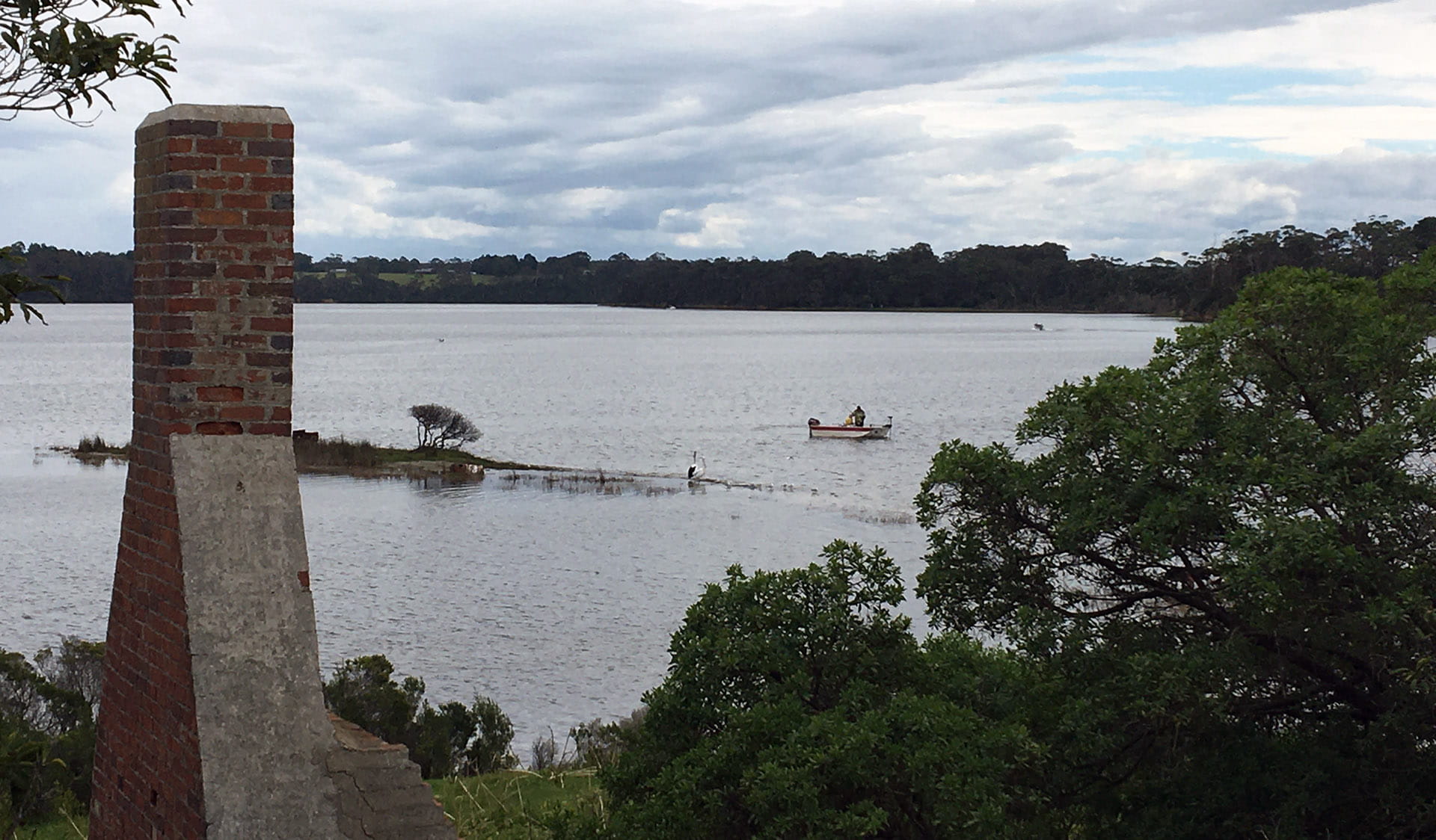
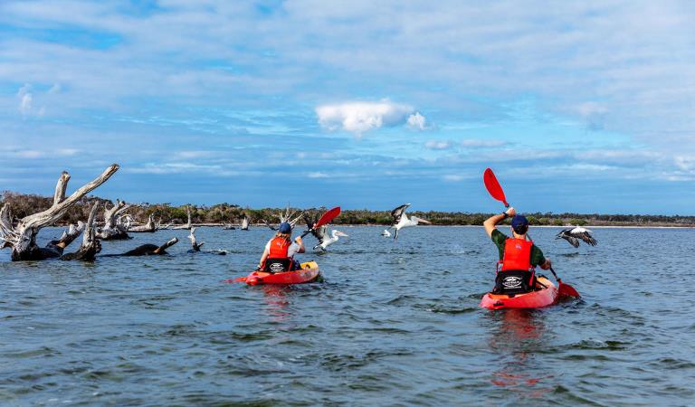
Lake Tyers is a popular location for fishing. There is a boat ramp located at the township of Lake Tyers. Boats can also be loaded from the Trident Arm day area, from the shoreline. There is no formalized ramp here. Check www.transportsafety.vic.gov.au to ensure you have the appropriate boat driving licence and vessel registration. Smaller vessels such as rafts, canoes and kayaks can also be launched from the end of Happy Valley day visitor area. The tranquil waters of the numerous arms are ideal for canoeing where many species of birds can be observed. Water skiing is only permitted in the lower lake. Boating on rivers and lakes demands special care.
Burnt Bridge, Long Point, Crystal Bay and Cherry Tree are all very popular fishing spots. Surf fishing is popular on the ocean beach at Pettmans and Gibbs Beaches. A recreational fishing licence is required to take fish (including bait and shellfish) in all Victorian marine, estuary and fresh waters. Visit vfa.vic.gov.au and check the Recreational Fishing Guide for Fishing Licences and Regulations. Some species you may catch in the lake include Flathead, Bream and Poddy Mullet. You will often see or hear a Poddy Mullet leap spectacularly from the water.
.
Things To Do
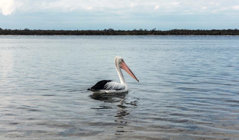
This area is well known for its wildlife. Keep an eye out for:
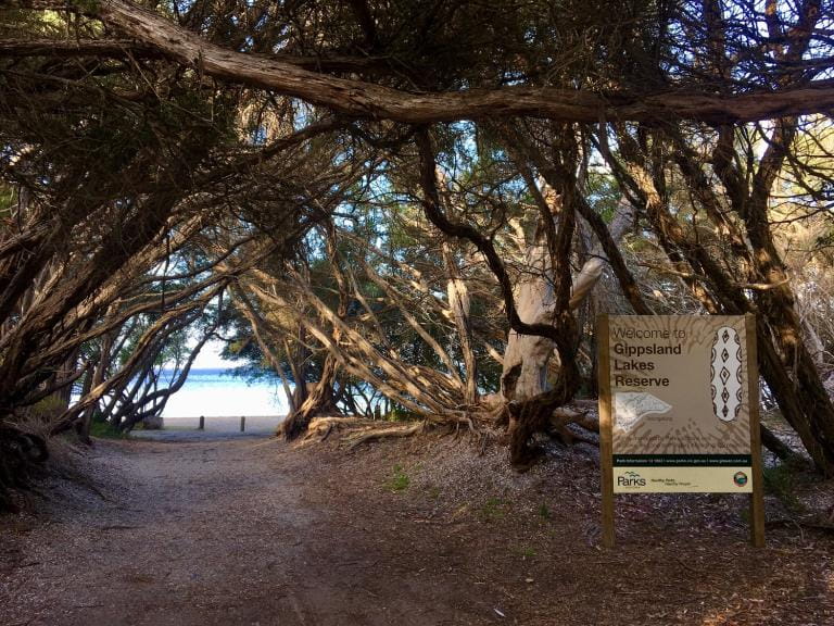
How to get there
Water activities
When you're there
Download the Lake Tyers State Park visitor guide for more information about the park and a map.
Play it safe by the water:
- Boating on rivers and lakes demands special care. Obstacles like submerged trees and sandbars may not be visible, and currents and other conditions are constantly changing.
- Play it safe and observe local speed limits.
- Always wear a lifejacket.
- Water skiing is only permitted in the lower lake.
- Take care when driving, parking or standing under large trees as branches may fall at any time and swing away from the tree. Rope swings are not recommended.
- The Lake may has fast currents, underwater objects, and deep holes which can be hazardous, especially after heavy rain.
- Always enter the water slowly, feet first. Do not dive or jump in to the lake. Submerged objects can cause neck or spinal injuries.
- Never swim alone or in flood waters.
- Drinking alcohol significantly increases the risk of drowning.
- Always actively supervise children in or near water. Children under ten should always be within sight. Children under five should always be within reach. Lifejackets and flotation devices are recommended.
Need to know
Water activities
Need to know
Check www.transportsafety.vic.gov.au to ensure you have the appropriate boat driving licence and vessel registration.
Visit vfa.vic.gov.au and check the Recreational Fishing Guide for Fishing Licences and Regulations.
Accessibiltiy
Visiting a park can be more of a challenge for people with disabilities, however, in Victoria there are a wide range of facilities to help people of all abilities enjoy our wonderful parks around the state. Parks Victoria provides a range of a equipment, including all-terrain and beach wheelchairs, facilities, accommodation and accessibility information and programs to help you plan and enjoy your visit to Victoria's parks.
Assistance dogs are welcome in Parks Victoria parks and reserves. Entry requirements apply for parks and reserves that are usually dog prohibited, such as national parks.
Lake Tyers State Park Joint Management Plan
Lake Tyers State Park is on the Country of the Krauatungalung clan and Bung Yarnda (Lake Tyers) was an important meeting place for Gunaikurnai groups throughout the area. It was a neutral place, rich in food and materials, and there are many recorded sites, including scar trees, artefact scatters, birthing places and burial sites. It is the place many Aboriginal people lived when forcibly removed from their homelands by European settlers, and the catchment area surrounding the Lake Tyers mission is also very significant. The Gunaikurnai and Victorian Government Joint Management Plan provides a description of joint management strategies and actions that are specific to Lake Tyers State Park.
Change of Conditions
Nature being nature, sometimes conditions can change at short notice. It’s a good idea to check this page ahead of your visit for any updates.
-
Camerons Arms No. 2 (Lake Tyers State Park)
Track closures in Lake Tyers State Park
Cameron's arm number 2, Morass Break Track, Reedy Arm Number 1 and 2 and Happy Valley Track have been closed due to the impact of severe weather.Lake Tyers State Park is an iconic part of Victoria and an important focal point for many visitors. With a large number of visits per year, it’s very popular for outdoor activities such as camping, hiking, boating and walking.Unfortunately, sometimes we must close unsafe tracks, sites and infrastructure, we do so in the interests of public safety and/or environmental protection, and to ensure that no one gets hurt and environmental impacts are avoided and/or managed. -
Marsdenia Rainforest Walk (Lake Tyers State Park)
Marsdenia Rainforest Walk Closure
Marsdenia Rainforest Walk is currently closed due to the need to upgrade bridges and boardwalks which have been deemed unsafe.Victorians love getting into nature, and we want to ensure people can do so safely while managing the park estate sustainably.Unfortunately, sometimes we must close unsafe sites and infrastructure, we do so in the interests of public safety and/or environmental protection, and to ensure that no one gets hurt and environmental impacts are avoided and/or managed.Before visiting, Visitors should always check the Parks Victoria website for the latest information about their destination. -
Notices Affecting Multiple Parks
Ground shooting operations targeting deer
Control operations (ground shooting) targeting deer are undertaken in this area. The Park will remain open to visitors during operations.
Similar Experiences
Gippsland Lakes Coastal Park
Raymond Island Gippsland Lakes Reserve