Explore
Pritchards Campground
Pritchards Campground has all the modern conveniences you need for a relaxing riverside getaway.
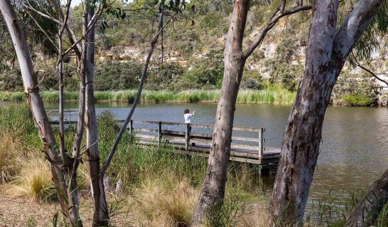
Park the caravan at camp and launch your boat, canoe or kayak to explore the serene river. Paddle to Skipworth Spring for a picnic or relax at camp and go fishing for bream off the jetty. Follow the Great South West Walk to explore the rich hinterland of Lower Glenelg National Park.
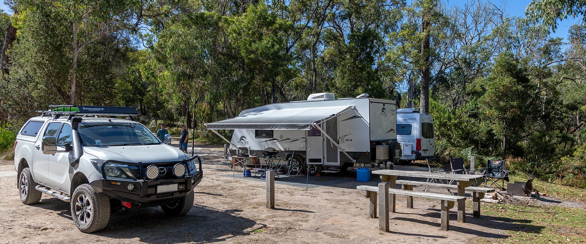
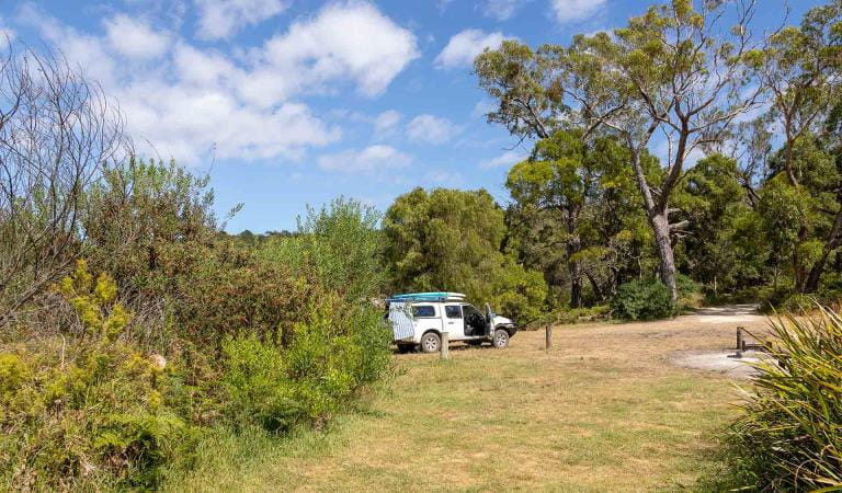
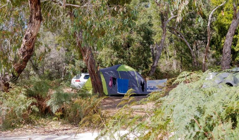
Pritchards Campground offers 20 unpowered campsites, each accommodating up to six people. Site 9 is suitable for tents only, while all remaining sites are suitable for camper trailers, campervans, caravans, mobile homes and tents.
Campground facilities include toilets, fireplaces, picnic tables and non-potable water. Advanced bookings and payment are required year-round.
Things to do in the area
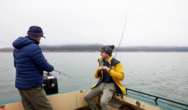
Fishing
Glenelg River Canoe Trail
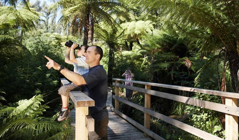
Bird watching
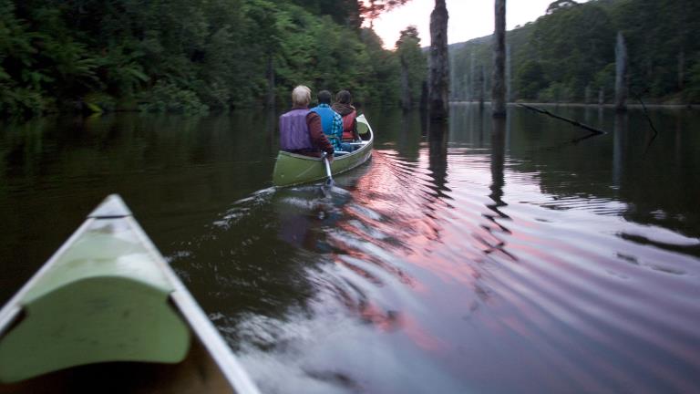
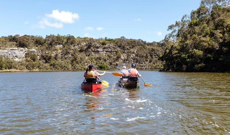
Canoeing and Kayaking
How to get there
Pritchards Campground
The major access roads into the park are Portland - Nelson Road for south of the river or Wanwin Road for north of the river. Pritchards Campground is 2WD accessible from Winnap Road.
Sites
When you're there
Download the Lower Glenelg National Park Visitor Guide for more information and things to do.
Canoeists undertaking the Glenelg River Canoe Trail, paddling consecutive sections of the trail with overnight stops, should camp at the Glenelg River Canoe Trail campsites.
Need to know
Pritchards Campground
Accessibility
Visiting a park can be more of a challenge for people with disabilities, however in Victoria there are a wide range of facilities to help people of all abilities enjoy our wonderful parks around the state.
Be prepared and stay safe
Lower Glenelg National Park is in the South West fire district. Bushfires can occur during the warmer months. It is your responsibility to check current and forecast weather conditions. Campfires cannot be lit on days of Total Fire Ban, however gas cookers can be used for preparing food.
Check the Fire Danger Rating and for days of Total Fire Ban at emergency.vic.gov.au, on the Vic Emergency App or call the Vic Emergency Hotline 1800 226 226.
Change of Conditions
Nature being nature, sometimes conditions can change at short notice. It’s a good idea to check this page ahead of your visit for any updates.
-
Notices Affecting Multiple Sites
Planned Burning Lower Glenelg National Park
Parks Victoria and Forest Fire Management Victoria will be conducting Planned Burning in the Lower Glenelg National Park.A Planned Burn is scheduled to take place adjacent to Sapling Creek Boat Ramp along Glenelg Drive.The timing of the burn will be dependent on weather conditions, however it is expected to be undertaken between the 19th March and 30th March 2026.While burning operations are being conducted there will be certain road and track closures in place.Glenelg Drive will be closed from the start of Glenelg Drive (Western end) through to the Bulley Range Track.River Rd will also be closed from the North Nelson Rd Carpark through to Glenelg Drive.These track closures are marked as a red line on the attached map.The burn area is identified also as the highlighted blue area.The Great South West Walk will remain open between Battersbys Camp and Pattersons Walkers Camp.All campsites will remain open.Smoke may be visible in the area.Crews will be patrolling the area.Sapling Creek Boat Ramp will be closed. Other boat ramps are available within Nelson Township as well as Pritchards, Saunders, Sandy Waterholes and Wilson Hall.It is intended to complete this burn before Easter and School Holidays.Stay up to date with Planned Burning by visiting https://plannedburns.ffm.vic.gov.au/Attachments: Glenelg Dve Burn Area and Road Closures March 2026 (281KB)
Planned Burning in Lower Glenelg National Park
Parks Victoria and Forest Fire Management Victoria will be conducting Planned Burning in Lower Glenelg.A Planned Burn will be undertaken adjacent to Sapling Creek Boat Ramp and the surrounding area.It is anticipated that this burn will be conducted between the 19th March and 31st March 2026.The timing will be dependent on weather conditions.When the burn is commenced, there will be several road closures in place.Glenelg Drive will be closed from the start of Glenelg Drive (Western end) to the Bulley Range Track.River Rd will be closed from the Nth Nelson Road Carpark and Glenelg Drive.These are marked on the attached map in red.The burn area is marked in blue.The Great South West Walk will be still accessible between Battersbys and Pattersons Walkers Camp.Sapling Creek Boat Ramp will be closed.Alternative boat ramps are available within Nelson Township, Pritchards, Saunders, Sandy Waterholes and Wilson Hall.Smoke will be visible and present in the area.Stay up to date with Planned Burning across Victoria by checking the following website.https://plannedburns.ffm.vic.gov.au/Attachments: Glenelg Dve Burn Area and Road Closures March 2026 (281KB)
Glenelg River estuary blocked causing some water based assets (Jetties and Landings) to become submerged
Currently the river mouth and estuary of the Glenelg River is closed by a sand bank due to natural processes.This is causing the water level of the Glenelg River to rise and in doing so is beginning to inundate some of the Jetties, Landings and Boat Ramps that are attached to campsites and visitor nodes to become submerged.This is affecting sites located in the Lower Glenelg National Park and some assets around the river mouth/estuary area of Discovery Bay Coastal Park.Park users need to be aware that some water-based assets may be underwater, or may become underwater with passing boat wash, and that extra care needs to be taken whilst using them as they may become slippery.Campsites are not currently affected, only the waterway assets such as the jetties, landings, and boat ramps.
Similar experiences
Forest North Campground
Battersby Campground