A small valley amongst snow gums and occasionally visited by the plateau's resident alpine dingo population, Dingo Dell is aptly named.
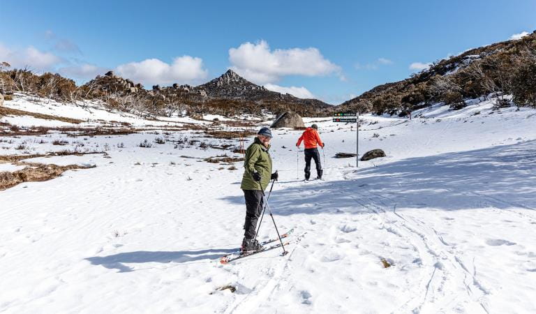
Dingo Dell in winter is the ideal location for toboganning, snow play and snow shoeing. In summer it is possible to walk up the old ski slopes to the top of the ridge for views across the plateau.
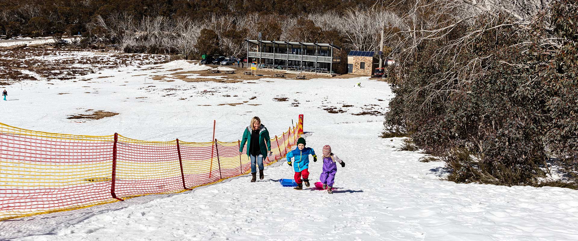
Dingo Dell is one of two toboggan and snow play areas located at Mt Buffalo. Its wide, gentle slopes offer a range of safe and enjoyable snow experiences.
Facilities at Dingo Dell include a designated toboggan slope, open areas for snow play, first aid room, take away food and drinks, toilets, and a marked snowshoe track to the hilltop above.
Things To Do
Tobogganing
The dedicated toboggan area is only available when there is adequate snow and is marked with fencing and signage.
All toboggan users must walk up the side of the slope to avoid being hit by those coming down the hill.
Conditions on the toboggan slope can deteriorate late in the day due to freezing, making the snow very fast and rock hard.
Only moulded plastic toboggans are allowed.
Check the daily snow report in the Change of Conditions section below.
How to get there
Dingo Dell
Travel from Porepunkah up the mountain and follow the signs at Tucker Box Corner to Dingo Dell. Turn right at the car park area and follow the small access road down to the café building. At the turning circle drive back out the way you came in and park on the left-hand side of the road. Once this access road is full of parked vehicles the road will be closed and all other vehicles must either continue to Cresta Valley or head back down the road to another site in the park. Do not park in the main car park.
Need to know
Dingo Dell
Accessibility
Vehicle access for disabled visitors can be organised once in the park by speaking with staff at the Dingo Dell car park.
Change of Conditions
Nature being nature, sometimes conditions can change at short notice. It’s a good idea to check this page ahead of your visit for any updates.
-
Mount Buffalo National Park
Planned aerial shooting operations targeting deer – Mt Buffalo National Park
Parts of Mt Buffalo National Park will be closed while aerial shooting operations targeting deer are undertaken (See attached map for details).The closures will apply during the following dates:24-28 March 2025Visitors are advised to check the Change of conditions listing prior to arrival for up to date information and maps.For more information about the program please visit this link.Attachments: Mt Buffalo NP aerial ops information (444KB)
-
Rocky Creek Hike-in Camping Area (Mount Buffalo National Park)
Rocky Creek Track Access - Changing Track Conditions
Rocky Creek Track and Campground ClosureThe Rocky Creek Track and Campground will be closed on weekdays from Tuesday the 11th of March to Friday the 28th of March, 2025.
During this period bookings are available for Saturday nights and public holidays.Visitors are advised to stay alert to changing conditions and adhere to any closures.Rocky Creek Track – Change of ConditionsPlanned repairs to storm-damaged sections of Reservoir Road will start on Monday, March 3, 2025, and are expected to be completed by Spring 2025.
During this time, the Rocky Creek Track is not accessible via Reservoir Road on weekdays (Monday to Friday). Access via Reservoir Road is open on weekends and public holidays.
Alternative access routes include:
- Long
Plain Track (approximately 3.7 km to Rocky Creek Track)
- Long
Plain Track and Macs Point Track (approximately 5.1 km to Rocky Creek
Track)
Refer to attached map.Attachments: VG_MtBuffaloNP_Map2_RockyCk (3,142KB)
- Long
Plain Track (approximately 3.7 km to Rocky Creek Track)
-
Mt McLeod Hike-in Camping Area (North Buffalo Remote and Natural Area, Mount Buffalo National Park)
Mt McLeod Track – Changing Track Conditions
Repair works on storm-damaged sections of Reservoir Road from Monday the 3rd of March 2025 will close access to the Mt McLeod Track for walkers and mountain bikers on weekdays (Monday to Friday).
Alternative access routes to the track includes:- Long
Plain Track, Rocky Creek Track, Five Acre Track, and Og Gog & McGog
Track (approximately 7.5 km to Mt McLeod Track)
Refer to attached map.
Mt McLeod Campground Closure
The Mt McLeod Campground will be closed Monday to Friday due to access restraints from Reservoir Rd.Bookings are available for Saturday nights.
Visitors are advised to stay alert to changing conditions and adhere to any closures.Attachments: VG_MtBuffaloNP_Map2_MtMcleod (3,178KB)
- Long
Plain Track, Rocky Creek Track, Five Acre Track, and Og Gog & McGog
Track (approximately 7.5 km to Mt McLeod Track)
-
Notices Affecting Multiple Sites
Reservoir Road – Closure for repair
Reservoir Road will be closed for storm damage repairs starting Monday the 3rd of March 2025, with completion expected by Spring 2025.Reservoir Road will be closed to walkers, mountain bikers, and vehicles on weekdays (Monday to Friday) due to operational construction activities including large machinery repairing damaged sections.The road will open to walkers and mountain bikers on weekends and public holidays.Alternative access to Mt McLeod, Rocky Creek, Eagle Point, and Og Gog & McGog is available via Long Plain Track.Visitors are advised to stay alert to changing conditions and adhere to any closures.Attachments: Reservior_Rd_Closure_Map (334KB)
-
Notices Affecting Multiple Parks
Ground shooting operations targeting deer
Control operations (ground shooting) targeting deer are undertaken in this area. The Park will remain open to visitors during operations.