
Explore
Point Danger Marine Sanctuary
Point Danger Marine Sanctuary (21.7 hectares) extends from the high water mark around the prominent limestone headland of Point Danger between the townships of Torquay and Jan Juc. It extends offshore for about 600m to the east and 400m to the south.
This coastline is exposed to strong winds and large swell (mostly from the south and south west) and within the Marine Sanctuary the seafloor is predominantly less than 7m deep.
The main habitats protected by the sanctuary include intertidal and subtidal soft sediment, intertidal and subtidal reefs, and the water column.
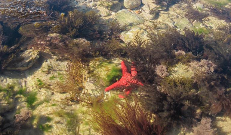
The intertidal limestone platform is home to twenty six species of marine plants. The brown algae Neptune’s Necklace (Hormosira banksii) is a key habitat forming algae on the limestone intertidal reef. Patches of small red corallines, filamentous algae and the green sea lettuce are common on the intertidal platform. The sanctuary is home to more than forty four species of intertidal invertebrates which are mostly found underneath rocks on the intertidal reef.
The shallow subtidal rocky reefs are home to a mixture of brown algae, while extensive areas of the seagrass (Amphibolis antarctica) can be found growing over reef and sediment in the more sheltered areas.
The sanctuary is particularly recognised for its diverse sea slug (opisthobranch) fauna found on both intertidal and subtidal reefs with ninety six species having been recorded, many of which are endemic.
Often isolated from the beach by a sandy channel the reef lies just offshore of the point, and is fully exposed only on the lowest summer tides. The top of the reef is covered with a network of small boulders, seaweed beds, crevices and pools. Key-hole limpets, crabs and mussels are abundant. Banded Brittle-stars and carnivorous worms emerge from under rocks to feed at nightly high tides while Eagle Rays are often seen patrolling the sandy areas of the park.
Things To Do
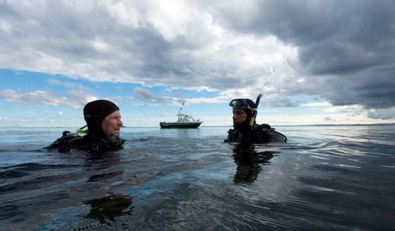
Diving and snorkelling at Point Danger
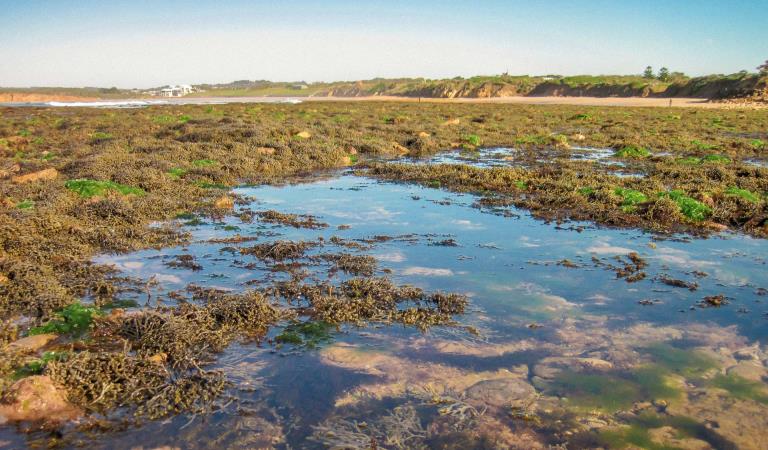
Rockpooling in the marine sanctuary
Walking at Point Danger
Point Danger Marine Sanctuary
This area is well known for its wildlife. Keep an eye out for:
Tours and adventure experiences in parks
One of the best ways you can get into nature is with a Licensed Tour Operator.
There are more than 400 Licensed Tour Operators across Victoria who are ready and waiting to help you experience and connect with Victoria’s spectacular parks and waterways.
Discover more than 60 different types of nature-based experiences including hiking, mountain biking, boating, four-wheel driving, indigenous culture tours, birdwatching, surfing, diving and so much more.
Licensed Tour Operators know all the best places to go and will plan and prepare your visit to ensure you are safe and can enjoy your nature-based adventure to the fullest.
How to get there
Point Danger Marine Sanctuary
When you're there
Download the Point Danger Marine Sanctuary map.
Need to know
Point Danger Marine Sanctuary
Accessibility
Visiting a park can be more of a challenge for people with disabilities, however in Victoria there are a wide range of facilities to help people of all abilities enjoy our wonderful parks around the state.
Assistance dogs are welcome in Parks Victoria parks and reserves. Entry requirements apply for parks and reserves that are usually dog prohibited, such as national parks.
Safety
Diving should only be undertaken by trained and experienced divers. Beware of sudden changes in weather, especially when boating on open water. Beware of strong currents and undertows when snorkelling or at the beach.
Wear shoes that grip well when walking on rock platforms. Watch where your hands are going at all times to avoid potentially dangerous creatures. Be aware of large unexpected waves when walking on shore, especially on rock platforms. Stay away from cliff edges and bases.
How we keep it special
We aim to ensure that our valued parks, and the natural assets and cultural heritage they hold, can be enjoyed now and by future generations.
The management plan for Point Danger Marine Sanctuary directs management for the park until it is reviewed.
Fishing in the Right Place
Download the Victorian Recreational Fishing Guide app which has a boundary locator, using a smart phone's internal GPS to determine whether the user is in, or approaching, or outside a Marine National Park or Sanctuary.