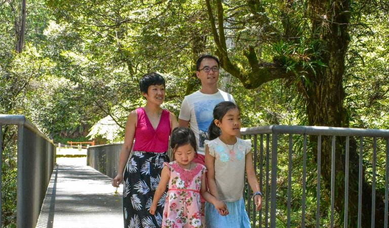
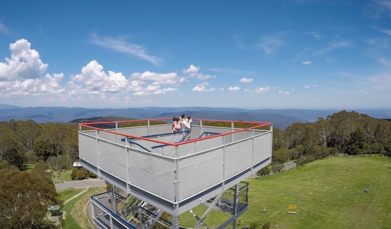
Mount Donna Buang is a fantastic all-seasons playground. In spring, summer and autumn, the picnic area is a great base for walks up the mountain and views across to Melbourne and beyond. The Rainforest Gallery has a spectacular observation platform and walkway allowing you to stroll among the treetops.
Rising to 1245m, Mount Donna Buang often receives frequent snowfalls in the winter. Many Melburnians have enjoyed their first taste of snow play and tobogganing here over the years.
On the way up to Donna Buang from Healesville, Ben Cairn is a popular spot for rock climbing and there is also a take-off site for hang gliders.
One of the most popular walks in the Yarra Ranges is the Redwoods. In contrast to the Mountain Ash that are such a feature of the Yarra Ranges, the trees here are introduced from California. Californian Redwoods are a type of conifer and are the tallest of all plant species in the world, while Mountain Ash are the tallest flowering plant in the world.
Warburton is a popular centre for cycling, with the iconic 40km Lilydale-Warburton Rail Trail ending here. The 30km O'Shannassy Aqueduct Trail is suitable for cyclists of all ages and can be tackled in shorter sections. More energetic road cyclists like to climb to the summit of Mount Donna Buang.
Things to do in the area
The park provides habitat for 120 species of native birds. Hollow-using species found here are the Sooty Owl, Powerful Owl and Barking Owl. Other important species include the Pink Robin, Yellow-tailed Black Cockatoo, Australian King-Parrot and Grey Goshawk. Crimson Rosellas are common.
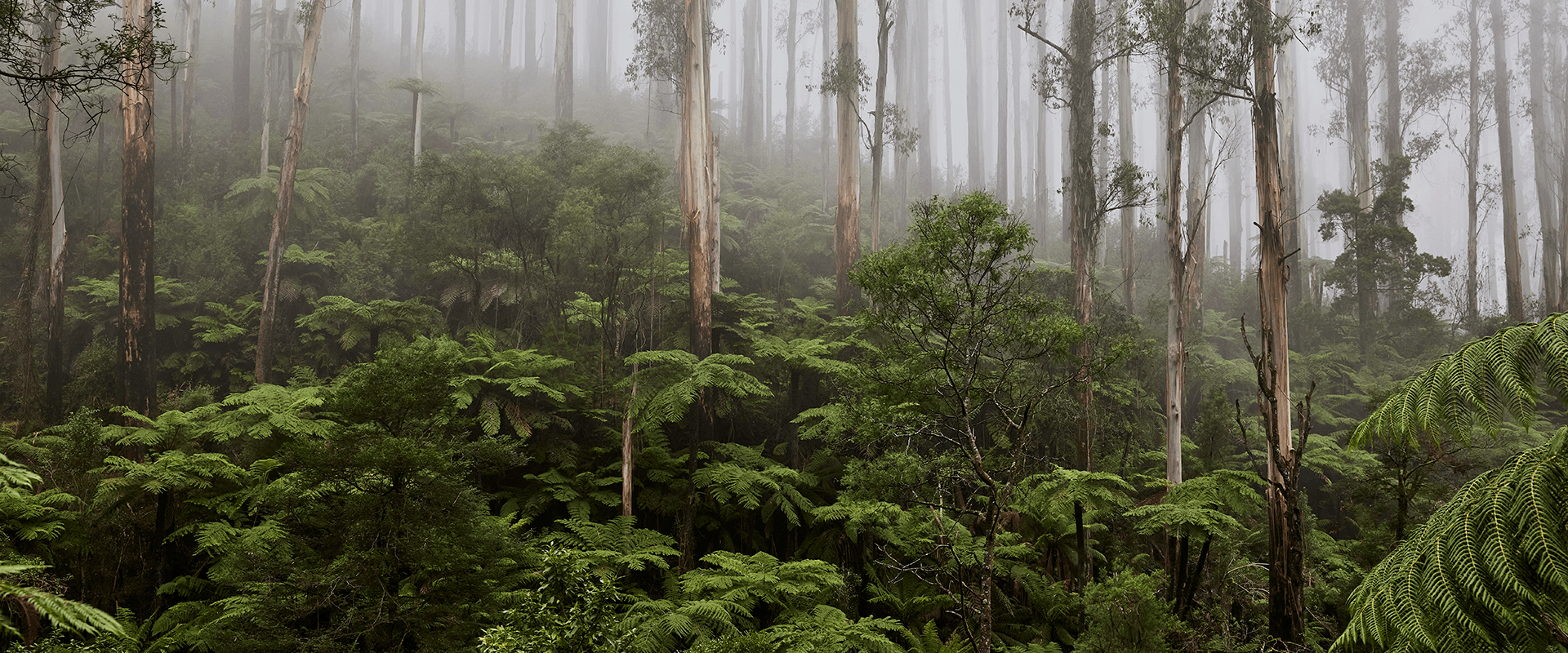
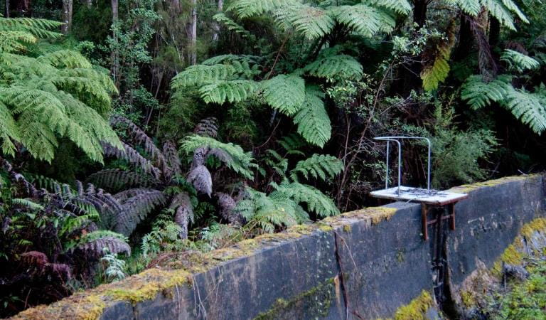
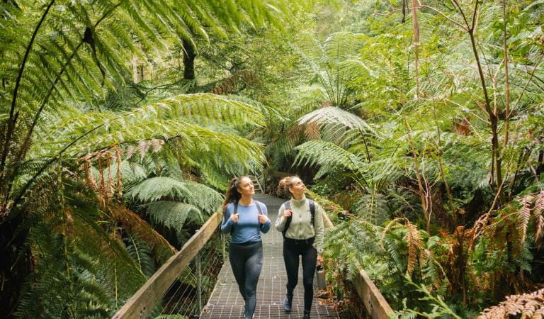
The park features tall Mountain Ash forests, with an understorey of tree ferns, and gullies of cool temperate rainforest. Large pristine areas of these and other vegetation types are of national and state botanical significance. Damp river valleys are home to stands of Myrtle Beech festooned with mosses, ferns and lichens.
The highest elevations, such as Lake Mountain and Mount Donna Buang, are characterised by sub-alpine vegetation, and receive regular snowfalls over the winter months.
Fourteen plant species occurring in the park have been identified as being rare or threatened, including the Slender Tree-fern and Tree Geebung.
10 Mile Turntable
Mount Donna Buang
OShannassy Aqueduct Trail
Rainforest Gallery
How to get there
Warburton Donna Buang and the Upper Yarra
When you're there
In winter, following sufficient snow, Mount Donna Buang becomes a very popular family friendly snow playground. You might experience long delays in reaching the summit.
Car parking is available at the summit through the day, however the summit gate is locked when there is snow. At these times car parking is available at the gate and the summit can be accessed by a 300m walk along the road.
Need to know
Warburton Donna Buang and the Upper Yarra
Accessibility
Visiting a park can be more of a challenge for people with disabilities, however in Victoria there are a wide range of facilities to help people of all abilities enjoy our wonderful parks around the state.
Assistance dogs are welcome in Parks Victoria parks and reserves. Entry requirements apply for parks and reserves that are usually dog prohibited, such as national parks.
Change of Conditions
Nature being nature, sometimes conditions can change at short notice. It’s a good idea to check this page ahead of your visit for any updates.
-
Rainforest Gallery (Donna Buang) (Yarra Ranges National Park)
Rainforest Gallery Closed for Repairs
The Rainforest Gallery boardwalk is closed until further notice. Urgent repairs are required for visitor safety. -
Dom Dom Saddle Picnic Area (Yarra Ranges National Park)
Dom Dom Saddle Picnic Area - Toilet Closure
Dom Dom Saddle Picnic Area toilets are permanently closed and will be removed in their entirety at a later date.The nearest toilets are at Fernshaw Picnic ground. -
Cambarville Picnic Area (Yarra Ranges National Park)
Partial walking track closure on Cumberland Circuit walk (South of Woods Point Road)
There is a partial closure in place on the Cumberland Circuit walk due to hazardous tree fall risk south of Woods Point Rd (see map attached)Attachments: Cambarville_A4_0412 (1,190KB)
Cambarville toilet block closed until further notice
Cambarville toilet block is closed until further notice due to water supply issues and structural problems -
Yarra Ranges National Park
Summit Loop Trail - Partial Closure - Lake Mountain Summit
The Summit Loop walking trail is partially closed at Lake Mountain until further notice.Attachments: Lake Mountain Summit Loop Partial Track Closure (562KB)
-
Big Peninsula Picnic Area (Yarra River, Yarra Ranges National Park)
Big Peninsula Stepping Stones permanently closed due to erosion
Due to instability caused by erosion, the Big Peninsula Stepping Stones are permanently closed for visitor safety. -
Notices Affecting Multiple Sites
❄ Mt Donna Buang Snow Play: What to Know Before You Go ❄
❄ Mount Donna Buang Snow Play: What to Know Before You Go ❄Looking for snow near Melbourne this winter? Located just two hours away in Yarra Ranges National Park (Wurundjeri Country), the 1,245-metre summit of Mount Donna Buang typically sees snow from June to August.Access is completely free. When there is enough snow, you can enjoy three dedicated toboggan runs, build snowmen, and enjoy family snow fights. Because of its proximity to Melbourne, the mountain gets extremely busy on weekends and right after fresh snowfall.Here is how to plan a safe, enjoyable winter trip.1. Check Weather & Road ConditionsMountain weather changes rapidly. Be prepared for cold, wet, and windy conditions regardless of the morning forecast.- Pack
Essentials: Bring extra warm layers, spare dry clothes, food, and
water.
- Emergency
Kit: Travel with a full tank of fuel, blankets, and a torch in case of
traffic delays.
- Connectivity:
Mobile coverage is patchy. Download maps/guides before leaving and let
someone know your plans.
- Live
Updates: Check the Parks Victoria website for road closures and conditions changes before departing. The Waterwheel Visitor Information Centre in Warburton
also provides real-time local updates.
2. Time Your Departure & DrivingIf heading up after a fresh snowfall, always check the road conditions before setting out. Don't leave too early—give Dept. of Transport road crews time to grit and clear the ice.- Snow
Chains: While not mandatory, carrying chains is highly recommended.
Hire them in the valley before reaching Warburton. Watch Parks Victoria’s
two-minute online video: ‘how to
fit snow chains’.
- Drive
Time: From Warburton, the 17km drive up Mount Donna Buang Road takes
20–25 minutes in good weather. Drive slowly and carefully.
- Have
a Plan B: If the access road is temporarily closed due to overcrowding
or weather, head to Warburton to enjoy local cafes or the Riverside Walk while you wait.
3. Consider Carpooling & Mid-Week VisitsAs Melbourne’s closest free snow destination, the summit experiences extreme traffic congestion on weekends. To beat the crowds and reduce delays, carpool with friends or plan a mid-week trip.4. Enjoy Fun, Safe Tobogganing- Equipment:
Use plastic moulded toboggans only. Skis and snowboards are not permitted.
- Location:
Only toboggan in designated areas to protect the environment.
- Hire:
Toboggans can be hired in surrounding towns or at the summit on select
snow days.
Note on Variable Snow: Mount Donna Buang is lower than major alpine resorts. Snow melts quickly and tobogganing isn't always possible. Always check the daily snow report before packing the car.5. Leave Your Dogs at HomeBecause Mount Donna Buang is in a national park, dogs and pets are strictly prohibited to protect native wildlife.Other Places to See Snow in VictoriaIf Mount Donna Buang is crowded or lacking snow, consider these alternative winter destinations:DestinationBest ForDrive from MelbourneLake Mountain Alpine Resort(Taungurung Country)Fully managed snow play, tobogganing, cross-country skiing, and nearby rainforest walks.2–3 hoursMount St Gwinear(Gunaikurnai & Wurundjeri Country)Free park entry, family-friendly snow play, snowshoeing, and tobogganing.3 hoursMount Buffalo National Park(Taungurung Country)4–5 hoursDinner Plain, Alpine National Park(Taungurung and Gunaikurnai Country)Near Mount Hotham Resort, quaint alpine village atmosphere, snow play and cross-country skiing.5–6 hoursMount Donna Buang BBQ's closed
The Mount Donna Buang BBQ's will be closed for the foreseeable future. We apologise for any inconvenience.Portable BBQ's and Heat Bead BBQ's are allowed to be used on site, so please bring your own. We ask that you take home any resulting waste items, including used heat beads.No campfires are allowed however, due to the resulting ground fire scar. - Pack
Essentials: Bring extra warm layers, spare dry clothes, food, and
water.