Flood and storm recovery continues for parks across Victoria
Friday 24 November, 2023

In October and November 2022, Victoria was hit by some of the biggest floods in recent memory. Heavy rainfall and storms brought widespread devastation across the state, including many beloved parks from the banks of the Murray to the coast of Gippsland.
Thanks to the hard work of Parks Victoria rangers and contractors, the vast majority of flood-impacted parks and sites have reopened. But the road to recovery is a long one. Rangers will continue works throughout the summer of 2023 and into 2024.
Parks Victoria has worked closely with Emergency Recovery Victoria (ERV) following the October 2022 Victorian floods. ERV leads state and regional recovery coordination, and state relief, on behalf of the Victorian Government.
Emergency Recovery Victoria have supported clean-up of debris following the floods, planned for the replacement of complex assets and assessed places of Aboriginal cultural significance in flood-affected areas, .
This article gives a snapshot of what has been done across the Parks Victoria estate so far.
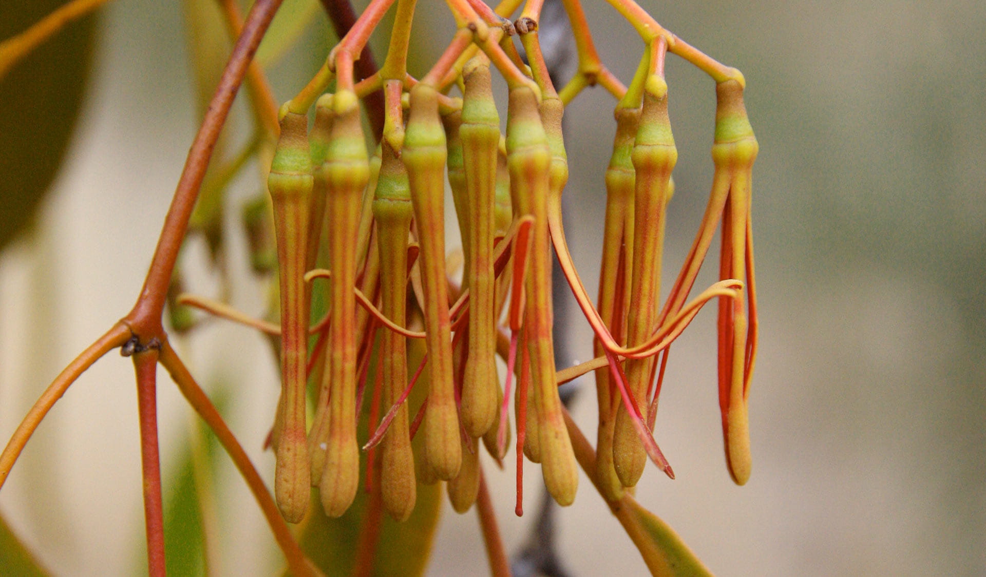
Flood damage in the Kings Billabong park near Mildura. Credit: Parks Victoria
North
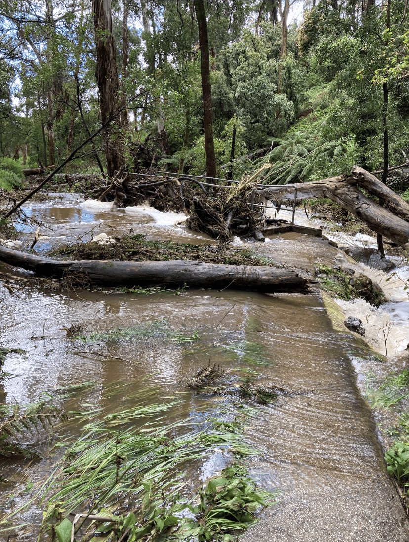
The river systems of Northern Victoria and their wetlands are naturally prone to flooding. Often with flooding comes closures to many Parks Victoria sites along the riverbanks. But the October and November 2022 floods were exceptional.
“We’re used to dealing with floods and high rivers here, but this was something else,” says acting Regional Director Charlotte Bisset. “It wasn’t just the Murray, Goulburn or the other rivers. We saw parks like Castlemaine Diggings, which is better known for its mine sites and bush, become inundated.”
The impact of the floods will continue to be felt across the region for some time. While 97 per cent of parks in the north were reopened, many campsites along the Murray remain closed.
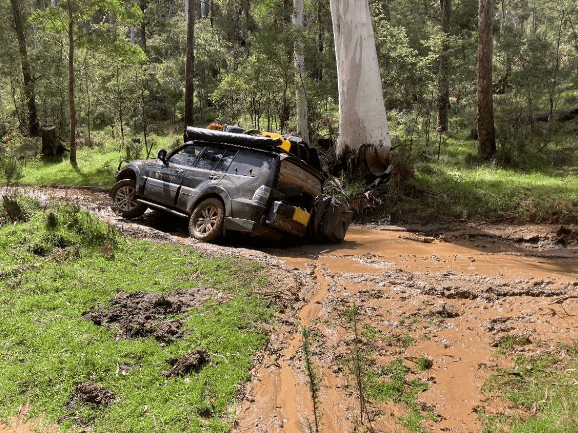
Some of the damage across parks included major road and track erosion which needs significant gravel and heavy machinery to repair, restore access and improve drainage.
Heavily rutted tracks make it impossible for most people to safely access a park. Some areas along the Murray and particularly in the Murray-Sunset National Park, usually connected by an extensive range of tracks, were still only reachable by boat in August.
“The access tracks in the park got washed away and spent months under water,” says Parks Victoria’s North West District Manager Don Arnold.
“With the river high again this winter, you could only get to the islands by boat and our rangers have been out there to monitor conditions and check on facilities. In the summer we will start repairing and restoring the tracks, but it will cost a significant amount of money and resources to get this done.”
There was also extensive damage to toilet blocks and other visitor facilities. Toilet treatment systems were flooded and toilet buildings across the northern region were submerged under the flood water for days, weeks and in some cases months.
Kings Billabong Park on the Murray is a good example. “Kings Billabong is next to Mildura and it’s very popular with local visitors,” says Don Arnold. “The floods caused enormous damage to the facilities, including the picnic areas, toilets and campsites.”
“Recommissioning the toilet block is not a pleasant task to say the least. But thanks to the work we did over the past few months the toilets are up and running again. We’ve been able to repair much of the track damage at Kings Billabong thanks to a partnership with the local Catchment Management Authority. The campsite is open and ready for people to enjoy.”
The impact of floods was not limited to the river country. Parks Victoria’s Northern Region stretches from Mildura to Wodonga, but also from the Murray to Alexandra, Lake Eildon and the Cathedral Range.
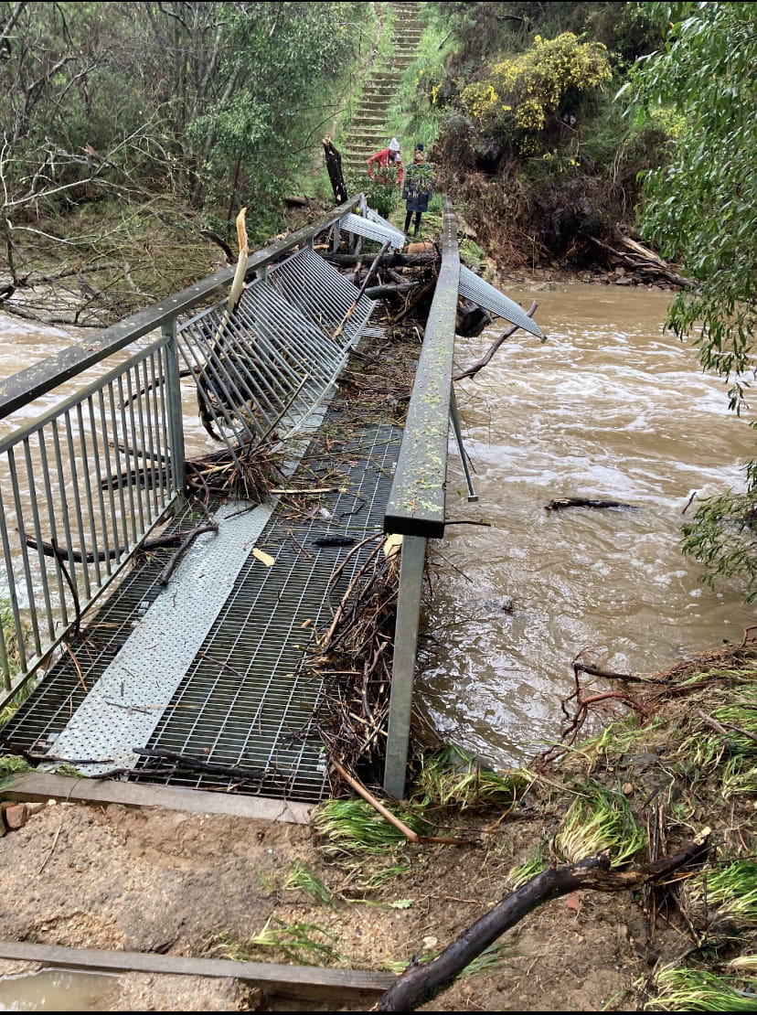
The Cathedral Range saw some of the worst track damage. As one of the most popular hiking spots in the state, reopening was a priority.
“The Little River Road was completely washed away. There were trees down all over the place and the campsite was flooded,” says Area Chief Ranger Andrew Sawicki.
“We spent $240,000 repairing the most significant damage and making the park safe. We saw even more heavy rain this winter. Fortunately, because of the repair works we had done the road has stood up better this time.”
As well as receiving funding from the Government to pay for recovery works, Parks Victoria is pursuing insurance claims for many sites and pieces of infrastructure. Once this money has come through works will ramp up once again.
Emergency Recovery Victoria also undertook complex feature surveys, including the 17-kilometre long Torrumbarry levee.
The levee, in the culturally significant River Red Gum landscapes, is in the middle of a survey that will record and document both impacted and new cultural heritage values exposed by the flood. Sites at Gunbower, Nyah, Hattah and Murray Sunset will also be surveyed.
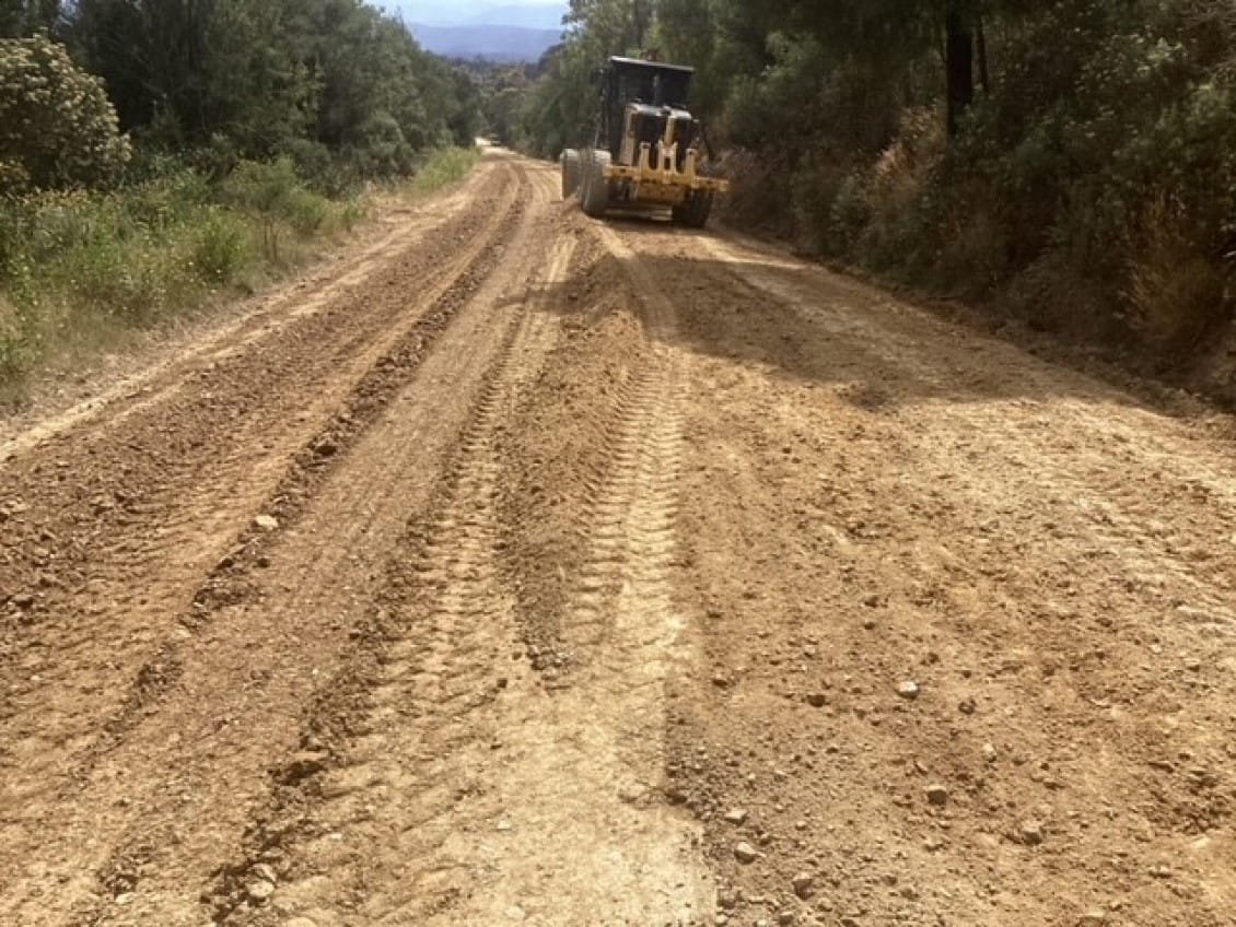
Road repairs in Mitchell River National Park. Credit: Parks Victoria
East
The east of Victoria was hit by storms in June 2022, quickly followed up by the October and November floods. In the mountainous Alpine terrain, many roads were washed out and badly damaged.
One of the most popular places cut off by flood damage was Raymond Creek Falls, in Snowy River National Park outside Orbost.
“Raymond Creek is really popular with four-wheel drive enthusiasts and campers,” says Parks Victoria’s Recovery Operations Manager Hamish Hancock. “From the campground, you can walk about 30 minutes to the falls, where there is a beautifully clear and deep pool.”
Raymond Creek was hit by the Black Summer bushfires, and then by two successive floods in April and October 2022. The floods caused major washouts and rutting along the Moorsford Road, which provides access to Raymond Creek.
Contractors repaired the road by grading, laying new gravel and clearing out or replacing culverts and drains.
It was a similar story across much of the east, with the one-two combination of floods coming on top of the bushfires.
“We received State Government funding to start work on the roads as soon as possible, and that’s helped us get a lot done,” says Eastern Regional Director Kerri Villers. “We focused on restoring access to campgrounds and picnic areas.”
The Thurra River Bridge, which was destroyed by the 2019-20 fires and then heavily impacted by the floods and storms, will be rebuilt by the Department of Energy, Environment and Climate Action (DEECA). A tender process for the construction of the new bridge is underway.
The bridge will restore access and allow upgrades for the Point Hicks Visitor Precinct and lighthouse. In the meantime, works to rebuild the Thurra River Campground will get underway, so that it can reopen to the public once the bridge is complete.
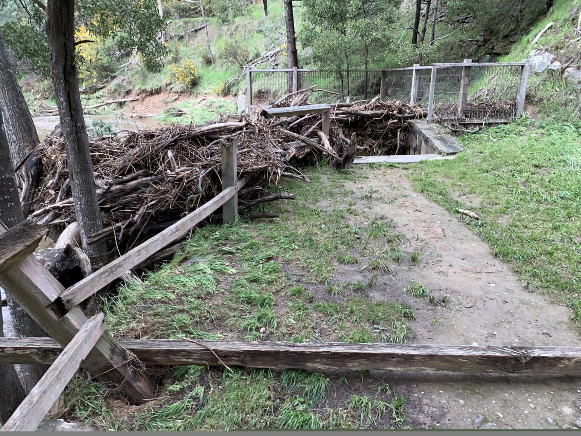
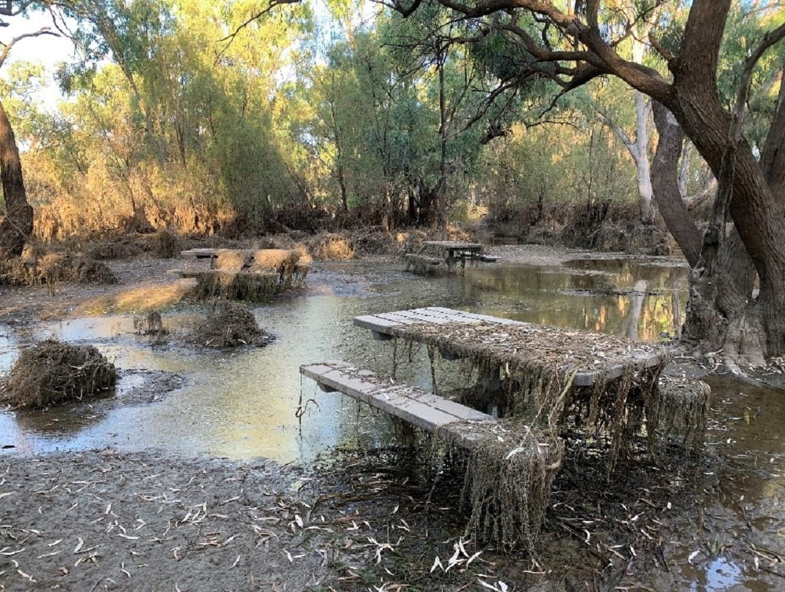
Flood damage in Tipperary Springs. Credit: Parks Victoria
West
Park Victoria's western region stretches from the South Australian border to Mt Macedon and includes the spectacular Grampians and Great Otway National Parks, the famous Great Ocean Road, the old goldfields around Ballarat and popular places just outside Melbourne like Lerderderg State Park.
These rugged bushlands, hills and forests were hit differently by the storms and floods compared to the river country of the north.
Bridges damaged by surging creeks swept debris down from the hills, washing out roads and tracks, destroying campsites and toilets. This led to a large-scale clean-up of 20 parks across the region, of which only eight now have partial closures in place.
One of the most badly damaged areas was Hepburn Regional Park, outside the popular spa and tourist town of Daylesford on Dja Dja Wurrung Country.
“That first day on our long road to recovery, when the rains finally stopped and make safe works could begin, was difficult to process,” reflects Ranger Team Leader, Kyra Winduss.
“Buried under layers of debris and hundreds of fallen trees, were the ruins of seven visitor areas and eight walking trails within the park.”
“You have to remember, this was our biggest hit to the park after months of bad weather – much of which had already triggered other, temporary closures.”
Parks Victoria and Djarra have worked together to repair and successfully restore access to:
- Tipperary Springs Day Visitor Area
- The Blowhole (including the carpark and viewing platforms)
- Golden Spring to Hepburn Mineral Springs Reserve (via Jacksons Lookout)
- Hepburn Mineral Springs Reserve to Argyle Spring
- Bryces Flat Visitor Area (via Bald Hill Road)
- Twin Bridges Visitor Area
- Mount Franklin (Lalgambuk) Day Visitor Area and Camping Area (including the circuit walk)
- Sailors Falls Picnic Area, Viewing Area and steps to the Falls
- Goldfields Track (north of Jacksons Lookout and South of Twin Bridges)
“While Hepburn Regional Park is open to visitors, sections of Goldfields Track (between Twin Bridges and Golden Spring on both sides of the creek), Sailors Falls Loop and Blowhole Walks remain closed,” says Kyra Winduss. “Heavy rains weakened the soil and caused a severe loss of structural integrity that could cause landslips without warning.”
“We need to take the time to get our planning right, to ensure repairs will stand the test of time and better withstand future climate events.”
Moving further west to Grampians (Gariwerd) National Park, visitors have returned to this beautiful landscape in their thousands.
Heavy rain and winds in early October brought down hundreds of trees across the park, which caused extensive damage to several roads and walking tracks.
“Once safe and possible, we began engineering, geotechnical and hazardous tree assessments, focusing our efforts where fierce floodwaters had washed away stepping stones at three river crossings and caused damaged to the Parks Victoria office in Halls Gap,” recalls Charlie Richardson, Area Chief Ranger for the Grampians.
"I’m really proud of our team of rangers, emergency response personnel and experienced contractors, who banded together to promptly restore access to and reopen one of Victoria’s most loved parks.”
“We're currently working on plans to repair Mount William Picnic Ground Road, which provides access to Kalymna Falls and the adjacent Campground.”
“Kalymna Falls is particularly beautiful when Mount William Creek and the surrounding areas are full of water. Unfortunately, the heavy October rains brought such an overflow of water to the road that it caused significant damage to both Parks Victoria and Council assets.”
“This site is very popular among locals and visitors alike. It remains our top priority for re-opening sites in the Grampians (Gariwerd) National Park.”
As repairs progress, our rangers are continuing to work with Traditional Owners across western Victoria to ensure recovery efforts cause no further harm to Aboriginal cultural heritage.
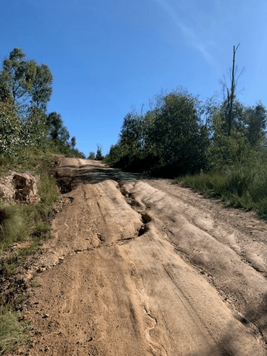
Flood damage and repairs in the Snowy River National Park
This road was severely damaged by floods in 2022 and has since been repaired by Parks Victoria
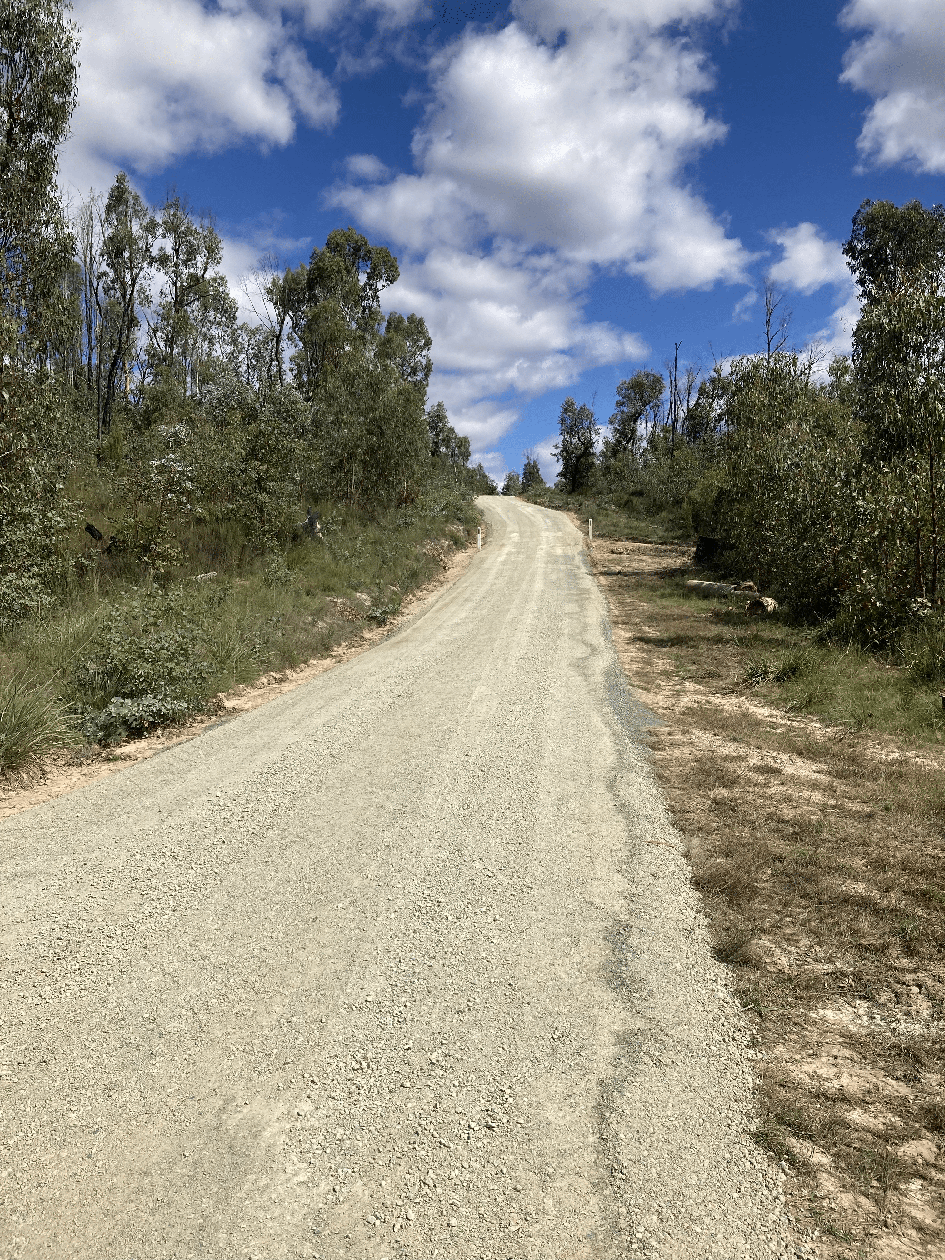
Road repair in Snowy River National Park
Roads repaired by Parks Victoria
Related news

New operator set to improve Tidal River General Store
Wilsons Promontory Cruises has been chosen as the new operator of the store following an extensive Expression of Interest process. This continues their long-standing connection with the Prom.
Enjoy Victoria's parks this long weekend
Victoria’s parks will remain open and welcoming this long weekend, and we encourage visitors to get out and enjoy the outdoors from Friday 5 June to Tuesday 9 June 2026.

Portsea Pier to undergo major maintenance works in July
Major maintenance works will begin in July 2026 to restore and strengthen Portsea Pier following significant storm damage in 2024. The pier will be closed will work is underway.