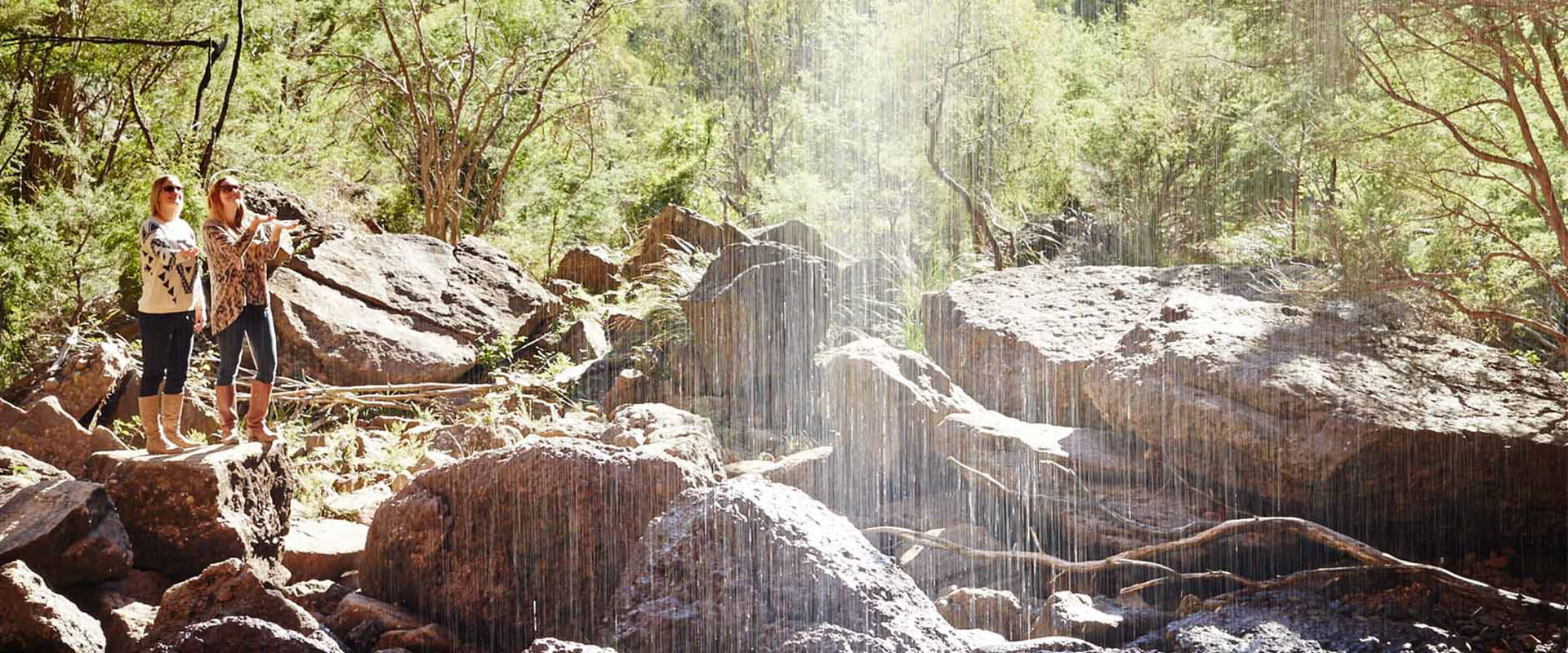
The Mitta Mitta River carves its way through the heart of the Alpine National Park. Fed by fast flowing waters from the Bundara, Cobungra and Big Rivers, the Mitta Mitta snakes its way from Anglers Rest, through the Omeo Valley, and into Lake Dartmouth at Lower Tableland. The region offers ample fishing, camping, rafting, walking and four-wheel drive opportunities, complimented by the rich gold mining history of Omeo and Mount Wills Historic Area.
Surrounded by national park and nestled in the beautiful Mitta Mitta Valley, Lake Dartmouth is a favourite of anglers and water sport enthusiasts. Brown and Rainbow Trout are plentiful within Lake Dartmouth, the Mitta Mitta river, and its tributaries. Just down from the dam wall, at Six Mile Creek, boat launching facilities provide access to the lake and the remote campgrounds located around the lake.
Further upstream the Mitta Mitta is well known as one of Victoria’s best white-water rafting locations, fed by spring snow melt from the Bogong high plains. Rafters and kayakers can launch at Big River camping area, Middle Creek picnic area, and Bundara picnic area, with Hinnomunjie bridge the most popular take-out point.
For scenic adventures on land, step out on the epic long distance Australian Alps Walking Track as it passes over the granite-strewn summit of Mount Wills, and continues in either direction towards Mt Bogong to the south-west, and the NSW border at Cowombat Flat to the north-east. For a shorter, but just as scenic option, take a stroll on the 5km loop track located at the Anglers Rest camping area. This fantastic walk takes you along the banks of the Cobungra river before climbing uphill to a spectacular lookout over the mighty Mitta Mitta river.
For four-wheel drive enthusiasts the epic Davies Plain Drive ventures through some of Victoria’s most isolated and scenic landscapes. Accessible via Omeo or Corryong, the multi-day four-wheel drive journey takes in the commanding peaks of Mount Anderson and Mount Pinnibar, the historic Davies Plain Hut, and Tom Groggin Station. Take in the beauty of the Snowy Mountains and the landscape that inspired Banjo Paterson’s iconic poem, The Man From Snowy River.
In addition to legendary cattlemen huts, this region is rich with gold mining history. The remote and mountainous town of Omeo struck gold in the mid-1800s and serves as a reminder of Gippsland’s goldrushes. Although its discoveries were less rich than those of Victoria’s central goldfields, Omeo survived through the years where other gold mining towns, such as Boggy Creek, Bingo and Jericho faltered and became ghost towns. Relics of the height of Omeo’s goldrush can be found littered throughout the region.
Things To Do
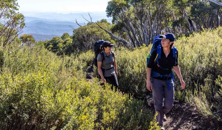
Hiking in Alpine National Park
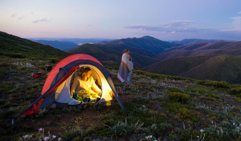
Dispersed camping in Alpine National Park
Walking
How to get there
Omeo and Mitta Mitta
When you're there
When to go
Need to know
Omeo and Mitta Mitta
Accessibility
Visiting a park can be more of a challenge for people with disabilities, however in Victoria there are a wide range of facilities to help people of all abilities enjoy our wonderful parks around the state.
Assistance dogs are welcome in Parks Victoria parks and reserves. Entry requirements apply for parks and reserves that are usually dog prohibited, such as national parks.
Change of Conditions
Nature being nature, sometimes conditions can change at short notice. It’s a good idea to check this page ahead of your visit for any updates.
-
Alpine National Park
TRACK CLOSURE: Little Cobbler Track, Alpine National Park
Due to the poor condition of the Little Cobbler Track, it is closed. The track has suffered significant impacts from multiple flood and storm events that has left deep ruts that are not trafficable, making use of the track unsafe.There are multiple 4WD options for alternate routes between Lake Cobbler Road and Speculation Road areas. Options include;- via Cobbler Lake Track. Turn off Lake Cobbler Rd onto Cobbler Lake Track thru to Speculation Road.
- via Wild Horse Gap Track. Turn off Lake Cobbler Rd onto Wild Horse Gap Track, turn onto Burnt Top Track and follow thru to Pineapple Flat. From Pineapple Flat take King Basin Road thru to Speculation Road.
- via Basin Track. Turn off Upper Rose River Rd onto Basin Track, turn onto Burnt Top Track and follow thru to Pineapple Flat. From Pineapple Flat take King Basin Road thru to Speculation Road.
Please contact Parks Victoria on 13 19 63 if you need further assistance with journey planning in this area to assist with navigating around this closure.Cobberas, Ingeegoodbee and Macfarlane Flat Track closures.
The following tracks have been significantly damaged by storms and floods and are currently closed to motor vehicles to ensure public safety and environmental protection:- Cobberas Track
- Macfarlane Flat Track
- Ingeegoodbee Track
The tracks are likely to remain closed to motor vehicles until detailed site assessments have been completed. It is difficult to predict when planning approvals will be obtained to allow for repairs to commence.
Before visiting, visitors should check the Parks Victoria website for the latest information about their destination.Attachments: FAQs for Cobberas ingeegoodbee and mcfarlane tks (128KB)
Wonnangatta Complex Fire - Area and Road Closures - North East
Closed sites/tracks include:- Rileys, Humffray River, Whites & Water Spur Tracks.Open areas:- Access to the Wonnangatta Valley via East Buffalo Road, East Riley, Zeka Spur and Wonnangatta Tracks.- West Buffalo, Harry Shephards, & Penny Track- West Humffray River Track- Australian Alps Walking Track- King Hut- King Billy Track through to Howitt Road- Cobbler Lake Track, Speculation Rd & Lake Cobbler- The Bogong High Plains- Mt Feathertop and Mt Loch areas- Mt Bogong- Walking tracks between Falls Creek and Mt Hotham- Mt Buffalo- Visitor sites accessed from the Omeo Highway- Howqua Hills- Lake Cobbler- Beveridges Station- Twins Tk, Selwyn Ck Tk, Mt Murray South Track
Please see FFM closure map for https://www.ffm.vic.gov.au/permits-and-regulations/closures-of-parks-and-forests -
Notices Affecting Multiple Sites
Wonnangatta Complex Fire - Area and Road Closures - Gippsland Alps
Certain Tracks and Sites in the Alpine National Park and Grant Historic Area remain CLOSED - Due to the Dargo Wonnangatta complex fires in the area
Closed Sites/Tracks:
- McMillans walking track within the closure area
- National Horse Trail from Wonnangatta Valley to Dargo within the closure area
- Pinnacles Day visitor area and viewing platform. Closed at junction of Pinnacles Road and Billy Goat Bluff Track Intersection.
- Certain Areas within the Grant Historic Area.
- Pioneer Racecourse Camping Areas (Alpine National Park)
- CLOSED Tracks include: Hern Spur Track, Scrubby Creek Track, Mccarthy Spur Track, Castleburn Track, Black Range Track, 65 Fire Trail Track, Junction Spur Track
Open areas
Open areas include:
- Wonnangatta Valley including access from Dargo
- Wellington Campsites on Tamboritha Road
- Wellington River Trailhead to Lake Tali Karng
- Thomastown Camping area, Kelly Hut, McMichaels Hut
- King Spur Track into Mayford
- Alpine National Park beyond Hotham Heights to the north and to Omeo
- Avon Wilderness Park
- Howitt Road
- Tamboritha Road
- King Billy Track
- Mt Howitt Carpark
- Vallejo Gantner Hut
- Macalister Springs
- Mount Howitt Walking Track
- Howitt Hut
- Bryces Gorge
- Horseyard Flat
- MacFarlane Saddle access to Tali Karng northern trail network.
- Moroka Hut
- Blue Rag Range
- Dargo High Plains including Mayford.
- Billy Goat Bluff Track
- Talbotville Camping Ground via McMillans Road
- McMillans Road from Dargo High Plains Rd to Talbotville Camping Area.
- Eaglevale Camping Area.
Please see FFM closure map https://www.ffm.vic.gov.au/permits-and-regulations/closures-of-parks-and-forestsMARATHON ROAD CLOSURE
Marathon Road is currently closed at New Place Creek whilst culvert replacement works take place. Access around this closure and works site for through traffic is still available, for four wheel drive only, by following Rim Track.Roading works Howitt Rd, Moroka Rd and Tamboritha Rd
Road works are taking place on Howitt Road, Moroka Road and Tamboritha Road. Heavy machinery will be present including traffic management points. Please drive to the conditions and comply with road safety signage and traffic management direction. -
Notices Affecting Multiple Parks
Planned aerial shooting operations targeting deer
Control operations (aerial shooting) targeting deer are planned for this area. During operations parts of the Park will be closed to visitors. More information on closures will be posted a minimum of 4 weeks prior to commencement.Visitors are advised to check the Change of conditions listing prior to arrival for up to date information and maps.For more information about deer control to protect biodiversity, please visit this link.Ground shooting operations targeting deer
Control operations (ground shooting) targeting deer are undertaken in this area. The Park will remain open to visitors during operations.
For more information about deer control to protect biodiversity, please visit our Deer page.
Wonnangatta Complex Fire - Debris and Fallen Trees
Due to the recent Wonnangatta Complex Fire – Park Visitors may experience increased amount of debris and fallen trees along the track and road network.Whilst every effort will be made to keep tracks open and safe, post bushfire conditions may mean that tracks and roads may change in condition quickly.Please be aware and suitably prepared if visiting opened areas within the fire effected areas.