Explore
Alpine National Park
The Alpine National Park is an adventure-lover’s dream. Hike Victoria’s highest mountain ranges, explore wildflower draped landscapes on horseback or head out on world-class mountain bike trails. Run wild rapids on white-water rafting trips, four-wheel drive the secluded reaches of the park or cross-country ski through tangled snow gum forests.
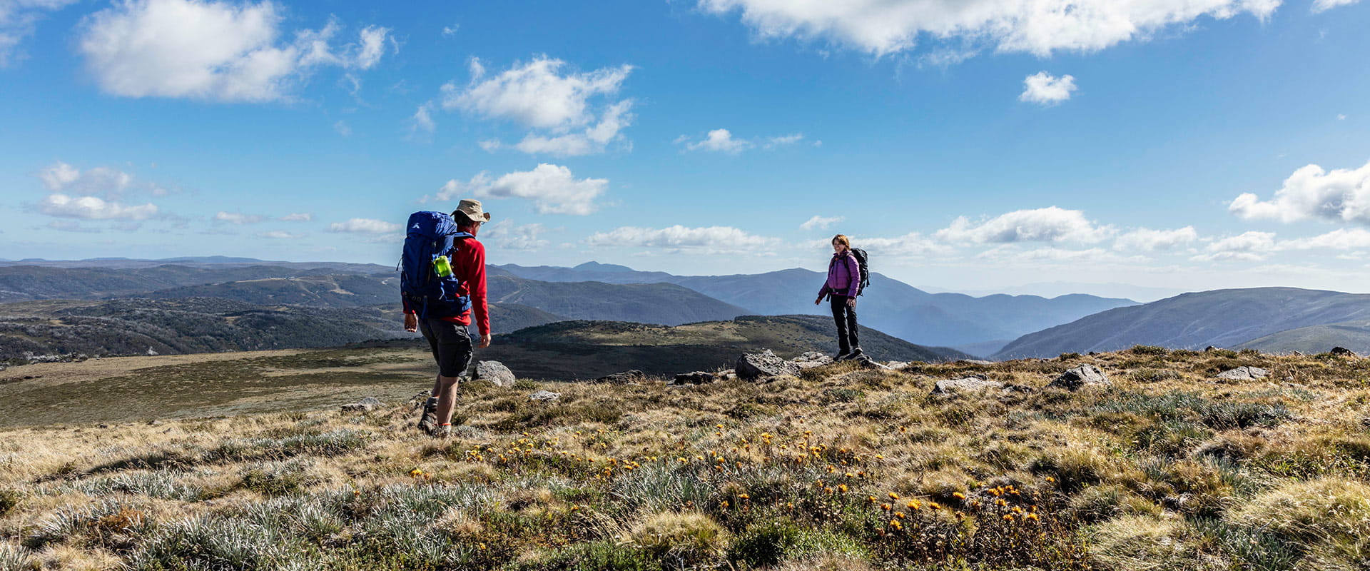
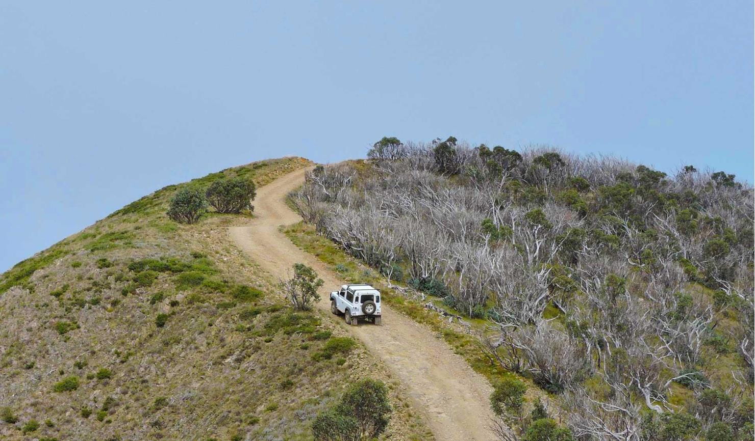
Head out on the Falls to Hotham Alpine Crossing and hike over towering alpine ridgelines, through lush river valleys and unforgettable alpine scenery. Discover the history and heritage of the High Country as you tour through rugged bushland and unforgettable mountain scenery along the Wonnangatta Four-wheel Drive.
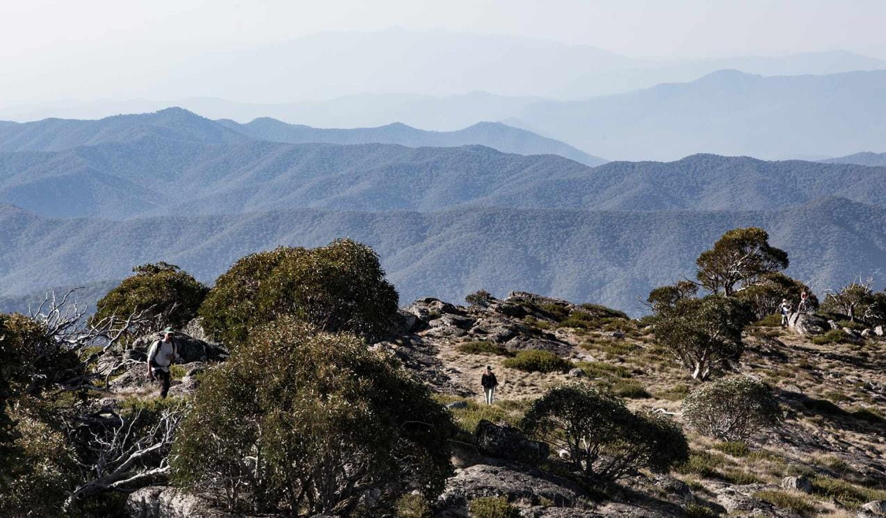
You can follow the sharp spine of The Razorback to Victoria’s second highest peak, Mount Feathertop and take in the stunning panoramas over the Great Dividing Range. Or conquer Victoria’s highest peak, Mt Bogong.
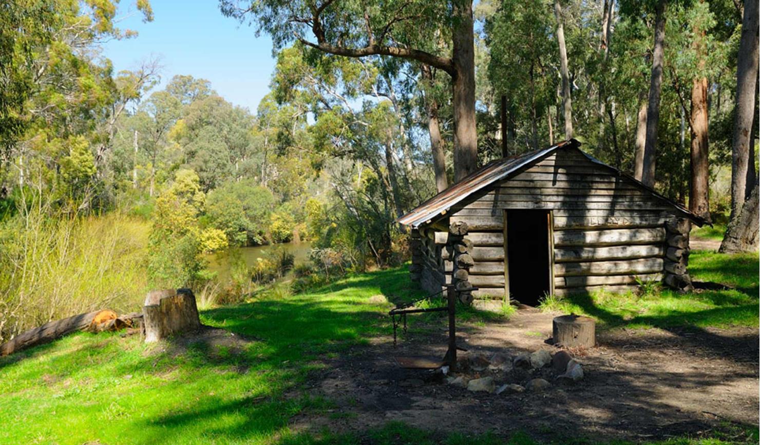
Find historic huts that legendary cattlemen called home scattered throughout the Bogong High Plains or get the adrenaline pumping on a white-water rafting trip down the Mitta Mitta River. The Alpine National Park boasts some of the best ski touring opportunities in Victoria – from well-defined downhill runs to remote cross-country skiing trails and backcountry terrain ready to be carved up.
Mansfield and Whitfield
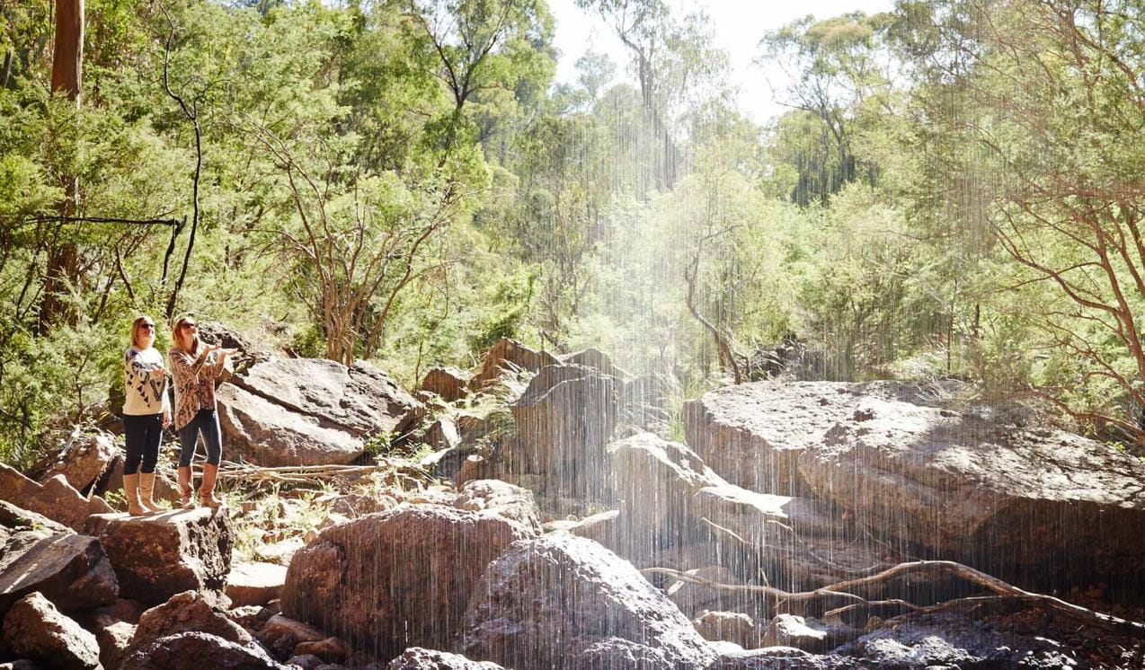
See Victoria’s tallest waterfall, Dandongadale Falls, plunge 255 metres over a sheer cliff face and disappear into the Ross River below. Visit Paradise Falls, where a fine silver mist spills over a red conglomerate ledge or the quaint Little Falls nestled in a narrow fern-laden gully.
Mount Beauty and Bogong High Plains
Nestled in the heart of the Alpine National Park, Mount Beauty and the Bogong High Plains offer a plethora of activities for thrill-seekers. Ski the seemingly endless runs and ride the world-class mountain bike trails of Falls Creek, set out on an overnight adventure along the Falls to Hotham Alpine Crossing or tackle Victoria’s highest peak, Mount Bogong.
Omeo and Mitta Mitta
The Mitta Mitta River carves its way through the heart of the Alpine National Park. Its lower reaches stretch from Lake Dartmouth to Anglers Rest where it splits into the Cobungra and Big Rivers. Among ample fishing, camping and four-wheel drive opportunities, the rich gold mining history of Omeo and Mount Wills Historic Area provides plenty of excitement.
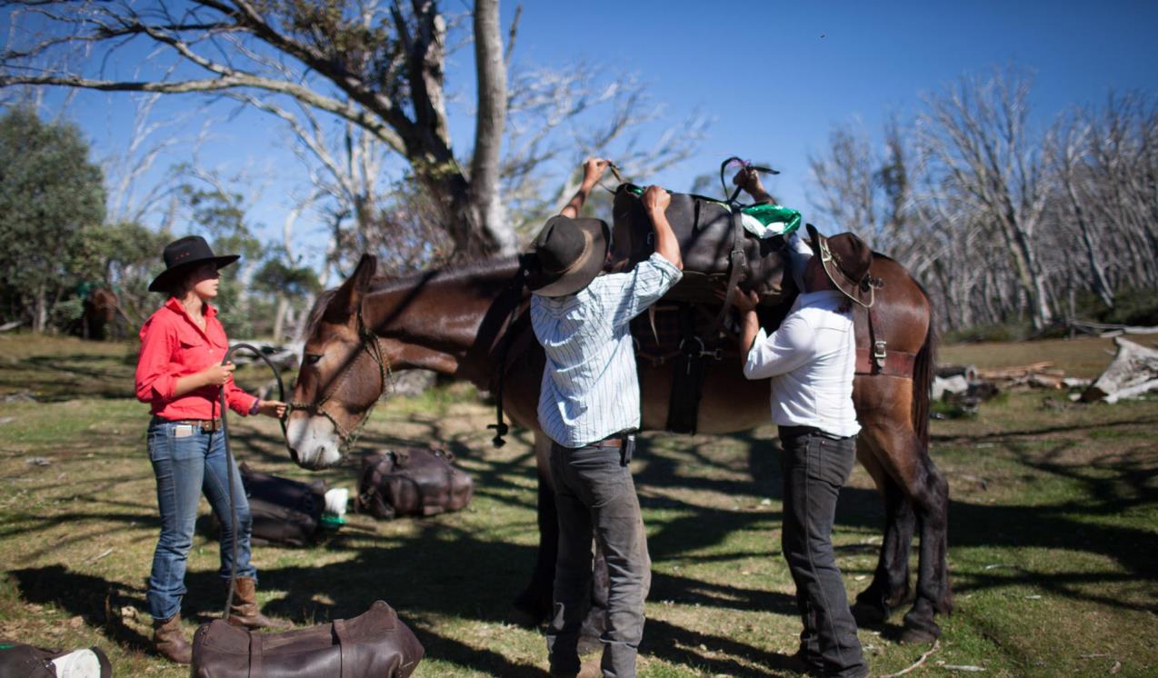
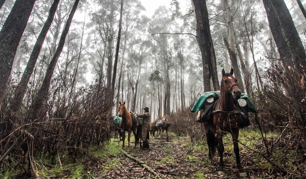
Camping with your horse in the Bogong High Plains
The Alpine National Park and Howqua Hills Historic Area provide a unique and stunning backdrop for multi-day horse rides. Horse riding’s long association with the region started in the 1840s when European explorers and miners used horses in their search for gold and summer pastures.
Camping with your horse in the Howqua Hills
This old gold mining area on the Howqua River is set in a beautiful, secluded valley, once busy with gold miners but now popular for picnics, bushwalking, four-wheel driving, and horse riding. Selected areas in the Howqua Hills Historic Area and some sections of the Alpine National Park have horse yards that can be reserved in advance.
Falls to Hotham Alpine Crossing
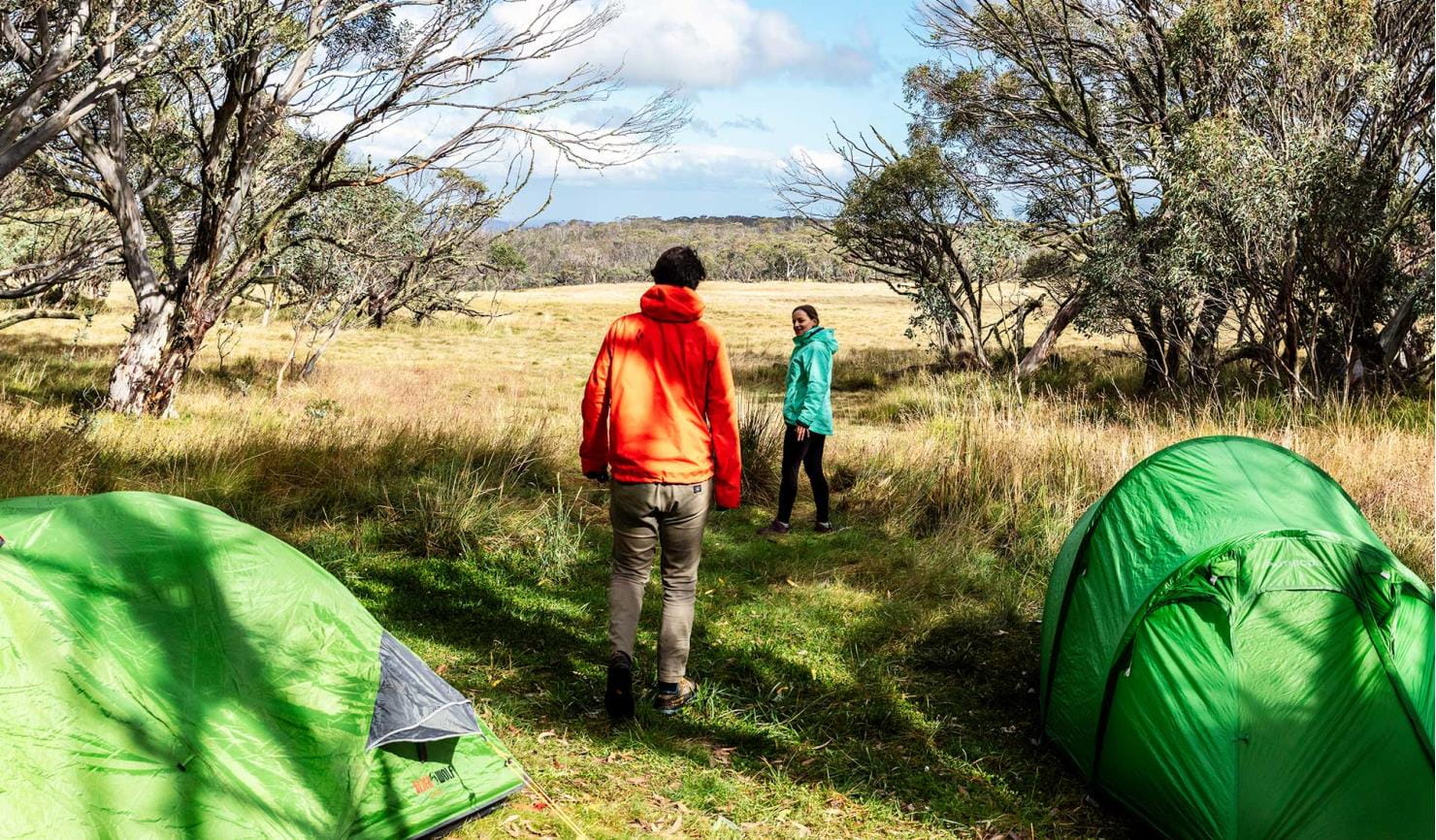
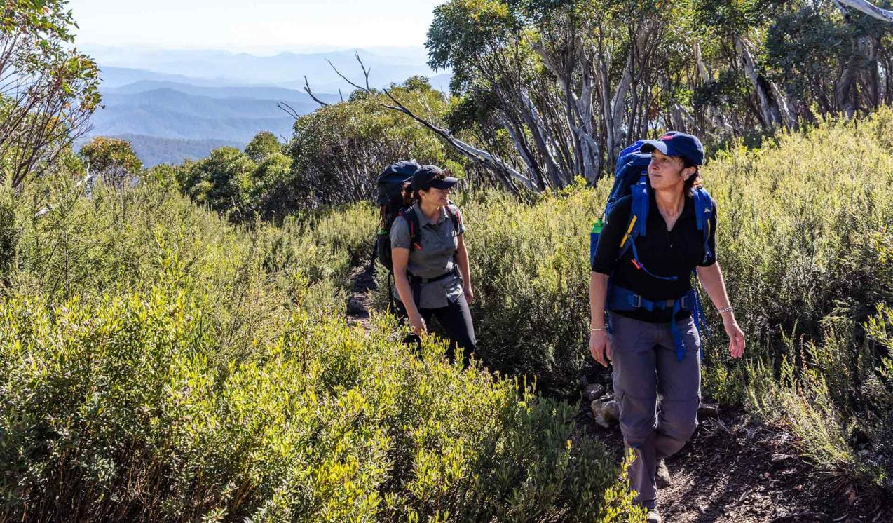
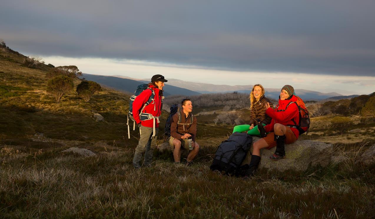
The Falls to Hotham Alpine Crossing is a 37km three-day hike through the Alpine National Park from Falls Creek to Mt Hotham. Enjoy spectacular views of mountain ridges from 2000m above sea level, walk through beautiful Snow Gum woodland and camp near two historic huts.
When you're there
The Alpine National Park stretches from central Gippsland all the way to the New South Wales border where it adjoins Kosciuszko National Park. Within the park are some of Australia’s most stunning alpine landscapes, including mountain peaks, escarpments and grassy high plains. See Visitor Guides for further information.
Need to know
Alpine National Park
Accessibility
Visiting a park can be more of a challenge for people with disabilities, however in Victoria there are a wide range of facilities to help people of all abilities enjoy our wonderful parks around the state.
Assistance dogs are welcome in Parks Victoria parks and reserves. Entry requirements apply for parks and reserves that are usually dog prohibited, such as national parks.
Alpine back country winter safety
Safe backcountry travel in Victorian Alpine areas during winter requires training and experience. You control your risk by choosing how, when and where you travel, and the activities you participate in.
Subscribe to Parks Victoria
Sign up to receive the latest ideas, inspiration and news delivered right to your inbox.
Change of Conditions
Nature being nature, sometimes conditions can change at short notice. It’s a good idea to check this page ahead of your visit for any updates.
-
Beveridge Station Camping Area (UNKNOWN, Alpine National Park)
Change of Condition Alpine NP – Road & Track Closures:
Dargo High Plains Road, Blue Rag Range Track, Basalt North Track, Twins Track, Twins Jeep Track, Mount Murray Track North and Gunns Track.Due to current weather conditions at alpine elevations and in the interest of public safety Victoria Police, Department of Energy Environment and Climate Action (DEECA) and Parks Victoria will be closing the above-mentioned high elevation alpine roads and tracks in State Forest and the Alpine NP. These tracks will now remain closed until seasonal closure openings on the 29th of October 2026. -
Alpine National Park
Cobberas, Ingeegoodbee and Macfarlane Flat Track closures.
The following tracks have been significantly damaged by storms and floods and are currently closed to motor vehicles to ensure public safety and environmental protection:- Cobberas Track
- Macfarlane Flat Track
- Ingeegoodbee Track
The tracks are likely to remain closed to motor vehicles until detailed site assessments have been completed. It is difficult to predict when planning approvals will be obtained to allow for repairs to commence.
Before visiting, visitors should check the Parks Victoria website for the latest information about their destination.Attachments: FAQs for Cobberas ingeegoodbee and mcfarlane tks (128KB)
Alpine National Park: road and track closures
These roads and tracks are closed due to current weather conditions at alpine elevations:
- Dargo High Plains Road
- Blue Rag Range Track
- Basalt North Track
- Twins Track
- Twins Jeep Track
- Mount Murray Track North
- Gunns Track
These tracks will remain closed until seasonal closure openings on 29 October 2026.In the interest of public safety, Victoria Police, Department of Energy Environment and Climate Action (DEECA) and Parks Victoria closed these high elevation alpine roads and tracks in State Forest and the Alpine National Park.Ground shooting operations targeting deer
Control operations (ground shooting) targeting deer are undertaken in this area. The Park will remain open to visitors during these operations.For more information about Parks Victoria deer control to protect biodiversity, please visit: https://www.parks.vic.gov.au/get-into-nature/conservation-and-science/conserving-our-parks/feral-animals/deer
Tours and adventure experiences in parks
One of the best ways you can get into nature is with a Licensed Tour Operator.
There are more than 400 Licensed Tour Operators across Victoria who are ready and waiting to help you experience and connect with Victoria’s spectacular parks and waterways.
Discover more than 60 different types of nature-based experiences including hiking, mountain biking, boating, four-wheel driving, indigenous culture tours, birdwatching, surfing, diving and so much more.
Licensed Tour Operators know all the best places to go and will plan and prepare your visit to ensure you are safe and can enjoy your nature-based adventure to the fullest.
How we keep it special
Falls to Hotham Alpine Crossing project planning
The Falls to Hotham Alpine Crossing is a proposed multi-day 57-kilometre walk through the spectacular Alpine region from Falls Creek to Mt Hotham. Stage 1 of the project involves doing track upgrades and creating up to two overnight campgrounds including roofed accommodation options.
Management Plan for Greater Alpine National Park
The Management Plan for Greater Alpine National Park directs all aspects of management of the park until the plan is reviewed.
Protection of the Alpine National Park: Feral Horse Action Plan 2021
The Victorian Government released the Protection of the Alpine National Park: Feral Horse Action Plan 2021 on 1 November 2021, to outline the approach to manage feral horses in the Alpine National Park and adjacent state forests over a ten-year period. The alpine landscape is extremely rare, representing just 0.3% of the Australian land area. Its survival is threatened by the impacts of introduced animals such as deer, pigs and horses.