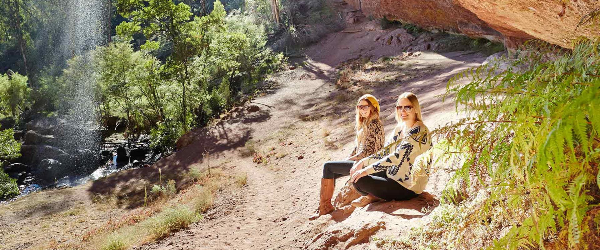
Located in the stunning Alpine National Park, Paradise Falls cascades an uninterrupted 31 metres from a conglomerate rock formation. The walk to the viewing platform is a well-made but steep stepped track. From here, you can take in the spectacular falls and watch the stream wind down through the landscape.
Paradise Falls is in the heart of the King Valley in Alpine National Park. The falls are most spectacular in spring, early summer or after rain, so plan your visit accordingly if you're keen to see the water at its most impressive.
A pleasant 500m walk from the car park takes you to the falls viewing platform, where you can watch the falls drop from a breathtaking conglomerate rock ledge formation. The path allows you to follow the contours of this rock formation on stone steps. For your safety, please stay on the designated walking track to avoid unstable rocks and minimise damage to native vegetation.
In the Day Visitor Area you'll find picnic tables and designated fireplaces with barbecue plates – an ideal destination for a day trip with the family. Toilets are located at the rear of the car park, but you'll need to bring your own drinking water. Make sure you extinguish your fire with water after using the fireplaces, and take all your rubbish out with you.
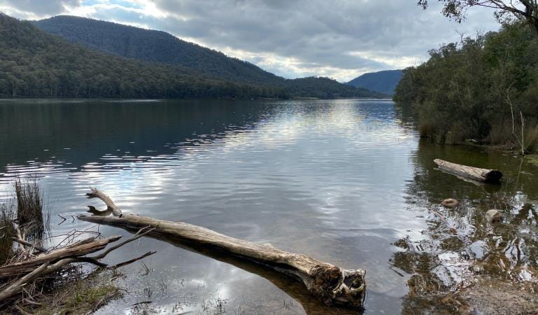
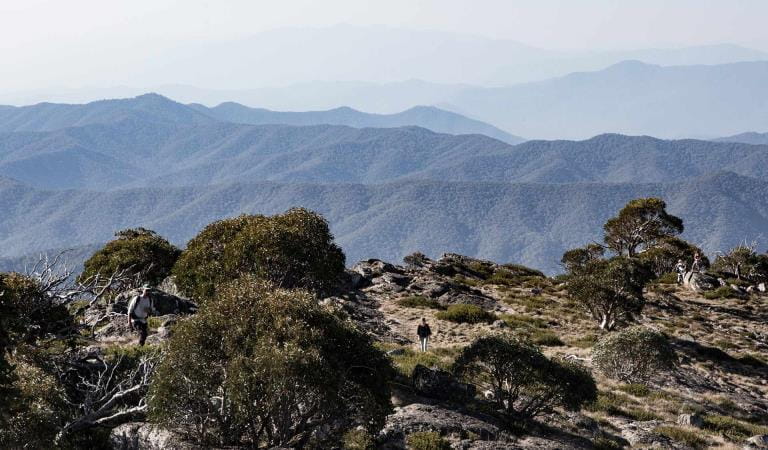
For the more adventurous, take the Falls Walking Track from the car park to Wobonga Plateau: a 7km return trip that will take you up to McMillan's Track Lookout, perched on a rocky escarpment. Absorb the breathtaking views of the Upper King River and Lake William Hovel, as well as the rolling hills stretching towards the peaks of Mount Stirling and Mount Buller.
Things to do in the area
Lake Cobbler
Cobbler Lake Camping Area
Lake William Hovell
Mount Cobbler Walk
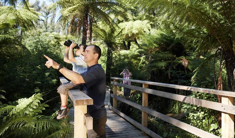
Bird watching
How to get there
Paradise Falls
When you're there
Please note that camping is not permitted at the Paradise Falls Day Visitor Area. You can find some excellent free and 2WD accessible camping spots nearby at Bennies and Dandongadale that are accessible all year round.
For 4WD and camping during the warmer months, check out the Upper King River, Sandy Flat, Top Crossing and Buckland Spur areas. Note that these areas are subject to seasonal road closures.
Help us protect Alpine National Park by adhering to the park's visitor guidelines:
Need to know
Paradise Falls
Accessibility
Visiting a park can be more of a challenge for people with disabilities, however in Victoria there are a wide range of facilities to help people of all abilities enjoy our wonderful parks around the state.
Assistance dogs are welcome in Parks Victoria parks and reserves. Entry requirements apply for parks and reserves that are usually dog prohibited, such as national parks.
Change of Conditions
Nature being nature, sometimes conditions can change at short notice. It’s a good idea to check this page ahead of your visit for any updates.
-
Alpine National Park
Cobberas, Ingeegoodbee and Macfarlane Flat Track closures.
The following tracks have been significantly damaged by storms and floods and are currently closed to motor vehicles to ensure public safety and environmental protection:- Cobberas Track
- Macfarlane Flat Track
- Ingeegoodbee Track
The tracks are likely to remain closed to motor vehicles until detailed site assessments have been completed. It is difficult to predict when planning approvals will be obtained to allow for repairs to commence.
Before visiting, visitors should check the Parks Victoria website for the latest information about their destination.Attachments: FAQs for Cobberas ingeegoodbee and mcfarlane tks (128KB)
Alpine National Park: road and track closures
These roads and tracks are closed due to current weather conditions at alpine elevations:
- Dargo High Plains Road
- Blue Rag Range Track
- Basalt North Track
- Twins Track
- Twins Jeep Track
- Mount Murray Track North
- Gunns Track
These tracks will remain closed until seasonal closure openings on 29 October 2026.In the interest of public safety, Victoria Police, Department of Energy Environment and Climate Action (DEECA) and Parks Victoria closed these high elevation alpine roads and tracks in State Forest and the Alpine National Park.Ground shooting operations targeting deer
Control operations (ground shooting) targeting deer are undertaken in this area. The Park will remain open to visitors during these operations.For more information about Parks Victoria deer control to protect biodiversity, please visit: https://www.parks.vic.gov.au/get-into-nature/conservation-and-science/conserving-our-parks/feral-animals/deer -
Beveridge Station Camping Area (Alpine National Park, UNKNOWN)
Change of Condition Alpine NP – Road & Track Closures:
Dargo High Plains Road, Blue Rag Range Track, Basalt North Track, Twins Track, Twins Jeep Track, Mount Murray Track North and Gunns Track.Due to current weather conditions at alpine elevations and in the interest of public safety Victoria Police, Department of Energy Environment and Climate Action (DEECA) and Parks Victoria will be closing the above-mentioned high elevation alpine roads and tracks in State Forest and the Alpine NP. These tracks will now remain closed until seasonal closure openings on the 29th of October 2026.