Sugarloaf Saddle

Explore

Sugarloaf Saddle

Cathedral Range State Park

Rock climbing/ hiking/ picnic area, parking, toilets. 
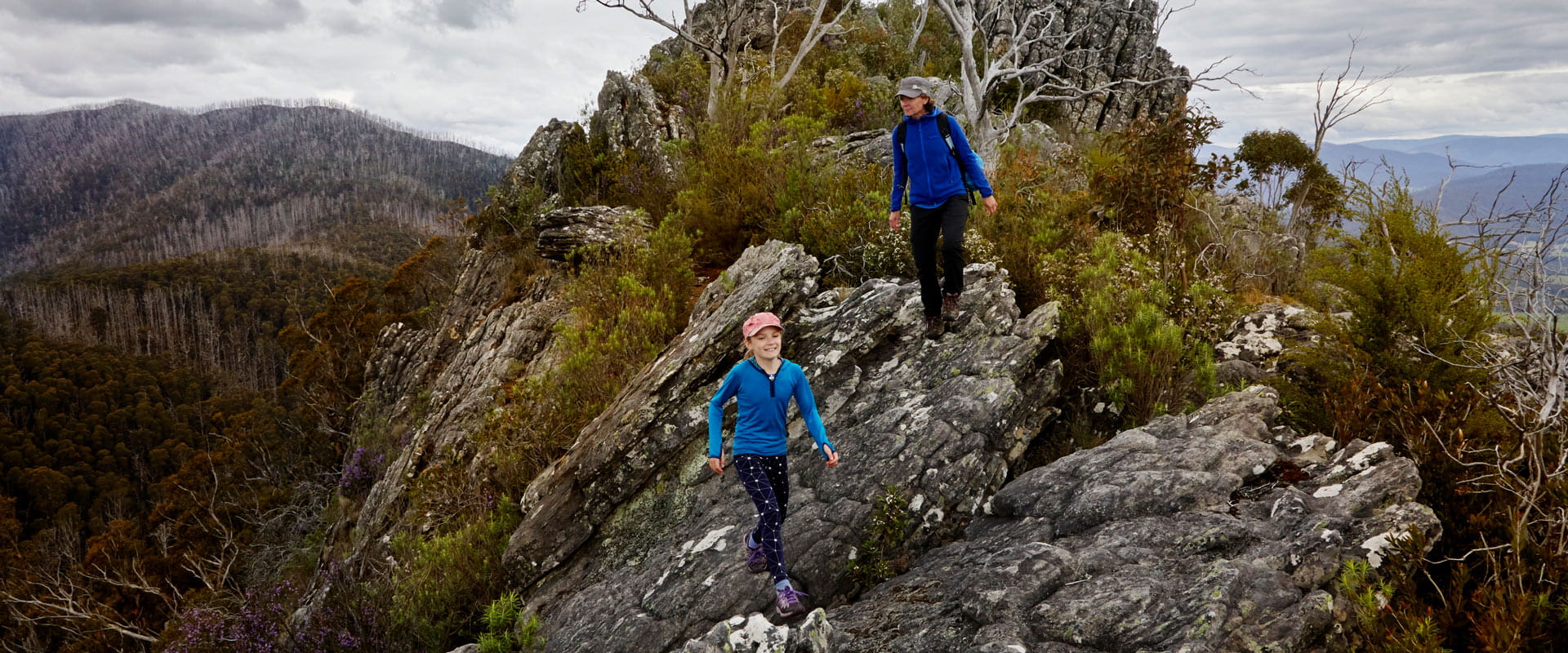
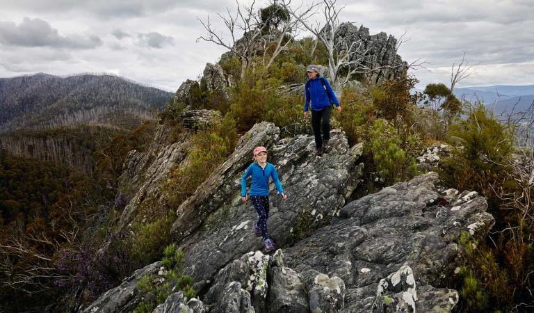
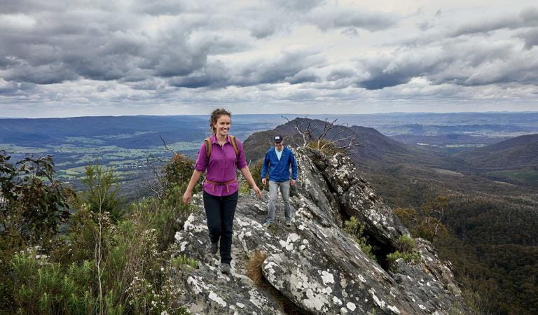
Bring your family for a picnic at the Sugarloaf Saddle Day Visitor Area. Fit and experienced walkers can tackle the short but difficult scramble up to Sugarloaf Peak to enjoy views from the highest point in Cathedral Range. 

Bring the family and enjoy a picnic at the Sugarloaf Saddle Day Visitor Area. Please note there are no bins provided – please take your rubbish home with you for recycling or disposal. 

Around Sugarloaf Saddle there are rock climbing areas available for all levels of ability from the beginners’ area at The Boulders near Sugarloaf Saddle, to the many challenging climbing routes on North Jawbone. Please contact a licensed rock climbing guide for more information

If you are after a walk, there are several walks ranging in difficulty including the moderately steep track that winds through dense messmate forest, connecting Sugarloaf Saddle Day Visitor Area to Cooks Mill via Tweed Spur Road.

For more information about safety and how to prepare for this walk, download the Visitor Guide below.

Things to do in the area

 
Two Grandparents and a mother sit by the camp fire while a young child plays in the background.

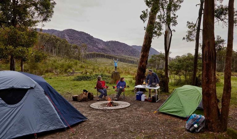
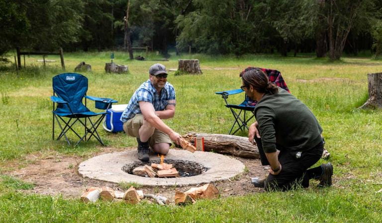
Cooks Mill Camping Area

The camping area is located at the start of Lowerson Track off Little River Road just before it crosses the river. This shady campground is located among tall trees on the banks of Little River.

Neds Gully Camping Area

The camping area is located by crossing the bridge off Little River Road towards Neds Gully Track. The campground is situated 50 meters from the car park.
A mother and young daughter walk across Sugarloaf Saddle in magnifficent panoramic views either side of them.

Razorback Trail

This track links The Farmyard to Sugarloaf Peak. It crosses exposed rocky outcrops. Look for the markers to help you keep to the track This walk is rated hard with an expected duration of two hours.
A woman leads her partner across the Razorback track surrounded by stunning views of the Rubicon Valley.

The Farmyard

This campground is accessible to hikers only. It is located off the unsealed Razorback Ridge Track at the base of South Jawbone Peak.

How to get there

Sugarloaf Saddle

Need to know

Sugarloaf Saddle

Change of Conditions

Nature being nature, sometimes conditions can change at short notice. It’s a good idea to check this page ahead of your visit for any updates.

  • Cathedral Range State Park

    Cerberus Road, to Sugarloaf Saddle Carpark and Jawbone Carpark

    Cerberus Road, to Sugarloaf Saddle Carpark and Jawbone Carpark,  is currently in very poor condition.
    It is not recommended for two-wheel-drive, or low-clearance all-wheel-drive, vehicles.

    Tweed Spur Road, to Messmate Walking Track and Blue Range Road

    Tweed Spur Road, to Messmate Walking Track and Blue Range Road, is closed to vehicles due to storm impacts.
    It will remain closed to vehicles until road repairs are made.
    Walkers are permitted, and are advised to use caution due to changed road conditions. 

X
By using our site you accept that we use and share cookies and similar technologies with certain approved third parties. These tools enable us to improve your website experience and to provide content and ads tailored to your interests. By continuing to use our site you consent to this. Please see our Privacy Policy for more information.
Confirm