Explore
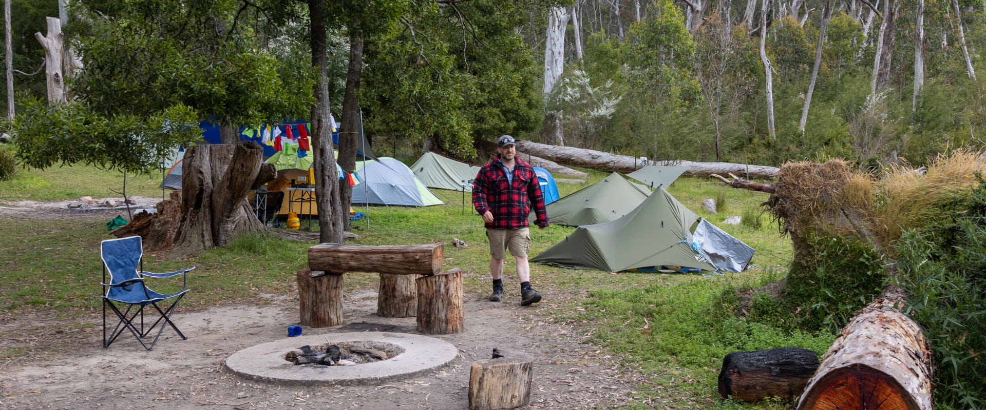
Cooks Mill Camping Area
Tucked away next to the Little River on the site of an old timber mill, Cooks Mill Camping Area is shaded by Peppermint, Blackwood and Red Stringybark gum trees.
Cooks Mill Camping Area sits on the site of an old sawmill that operated in the 1940s to 1950s. Explore the nearby Heritage Site or meander through Manna Gum forest along the Friends Nature Trail or Little River Walk where you might spot a koala snoozing above.
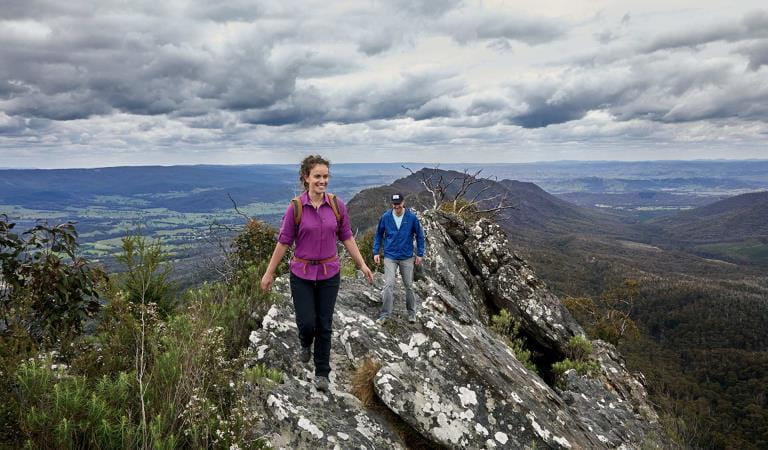
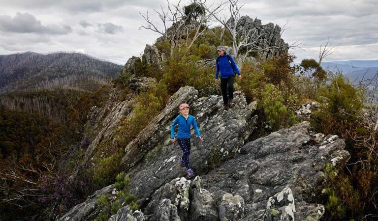
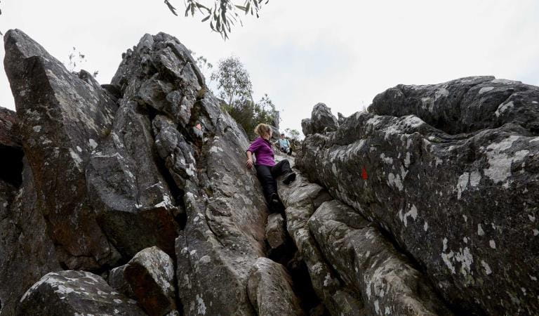
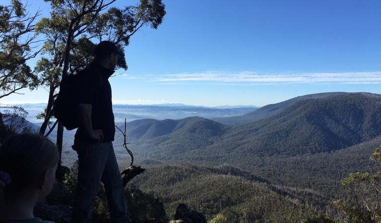
Fit hikers can try one of the harder walks up to the peaks of the North or South Jawbone for unforgettable views over the Cathedral Range. There is also great rock climbing at nearby North Jawbone, South Jawbone and Sugarloaf Peak.
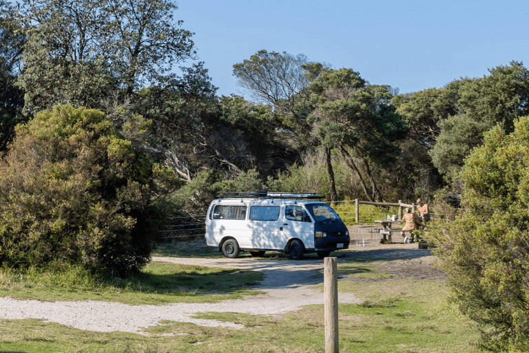
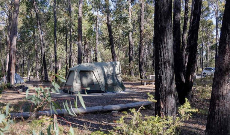
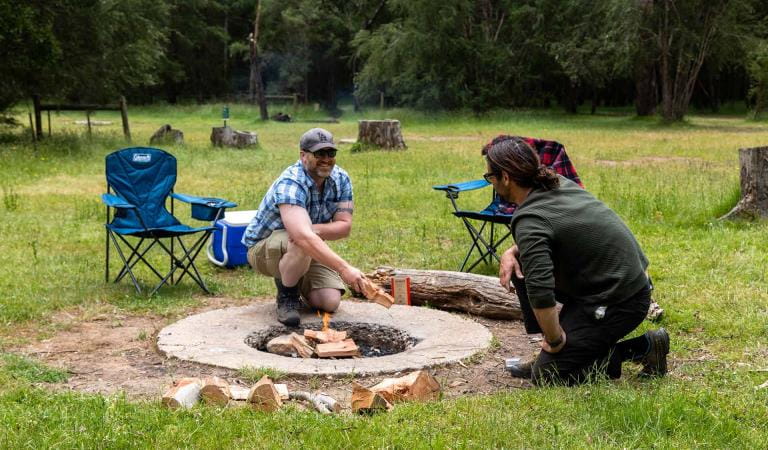
Individual campsites cannot be reserved, please select your campsite within the campground on arrival. Sites are not marked but are large enough for tents, with a limited area suitable for camper trailers, campervans and caravans.
Advanced bookings and payment are required year-round.
Campground features include non-flush toilets, picnic tables, communal fireplaces and a shelter.
Cooks Mill main camping area is open year-round. The section of Cooks Mill camping area along Tweed Spur Road is open for the warmer months, and seasonally closed to protect campsites which become water-logged in the wetter months. The seasonal closure for the section along Tweed Spur Road is implemented in line with seasonal road closures, following the Kings Birthday long weekend in June and re-open before Melbourne Cup Weekend in November, but may be extended if conditions are not suitable to safely re-open.
BOOK NOWThings To Do
Easy walks for families - The Friends Nature Walk, Little River Walk, Messmate Walk, St Bernards Track
Short steep walks - Neds Gully Track, Neds Peak Track, Cathedral Peak Walk, Little Cathedral Track, Jawbone Creek Track
More challenging hikes - Cathedral Range Circuit Walk, Cathedral Range Northern Circuit Walk, Cathedral Range Southern Circuit Walk, South Jawbone Peak Walk, North Jawbone Peak Walk, Razorback Track. The Canyon Track and Wells Cave Track are not recommended for children, or anyone with a fear of heights and exposed cliffs.
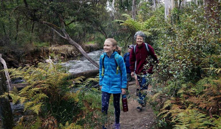
Friends Nature Trail
Razorback Trail
Sugarloaf Saddle
Wells Cave Track
How to get there
Cooks Mill Camping Area
From Melbourne follow the Maroondah Highway to Buxton. Continue past Buxton for 9.5km and turn right into Cathedral Lane to find the park entrance 2.5km on your right.
Continue past Neds Gully and Cooks Mill Camping Area is located at the start of Lowerson Track off Little River Road just before it crosses the river.
Sites
When you're there
Download the Cathedral Range State Park visitor guide for more information about the park and the plethora of experiences to be had within its borders.
Cathedral Range State Park is in the North Central fire district. Bushfire safety is a personal responsibility. Anyone entering parks and forests during the bushfire season needs to stay aware of forecast weather conditions.
Check the Fire Danger Rating and for days of Total Fire Ban in the ‘Prepare and Get Ready’ tab at emergency.vic.gov.au, on the VicEmergency smartphone app or call the VicEmergency Hotline on 1800 226 226.
Need to know
Cooks Mill Camping Area
Accessibility
Visiting a park can be more of a challenge for people with disabilities, however in Victoria there are a wide range of facilities to help people of all abilities enjoy our wonderful parks around the state.
Be prepared and stay safe
Cathedral Range State Park is in the Central fire district. Bushfire safety is a personal responsibility. Anyone entering the park during the bushfire season needs to stay aware of forecast weather conditions. Check the Fire Danger Rating and for days of Total Fire Ban at emergency.vic.gov.au, on the Vic Emergency App or call the Vic Emergency Hotline 1800 226 226.
No fires may be lit on Total Fire Ban days. On Catastrophic Fire Danger Rating days this park will be closed for public safety. Closure signs will be erected but do not expect an official warning.
Change of Conditions
Nature being nature, sometimes conditions can change at short notice. It’s a good idea to check this page ahead of your visit for any updates.
-
Cathedral Range State Park
Upcoming roadworks and road closures - Cathedral Range State Park
Weekday roadworks will be happening in Cathedral Range State Park between June and July -- Little River Road will remain open during weekday roadworks, with traffic management in place - please expect delays.
- Cerberus Road will be fully closed to all users during weekday roadworks, including being closed to walkers. There will be no access via Cerberus Road to Jawbone Carpark, and there will be no access via Cerberus Road to Sugarloaf Saddle Carpark. Walkers will need to change their plans during the weekday closures to avoid routes that use Cerberus Road. Dates of this full closure will be published here once dates are known (subject to weather).
- Remaining campground availability has been restricted for weekdays during the last three weeks of June, to reduce impacts on campers. This campground availability will be re-released should dates for roadworks change. This will be published here once dates are known (subject to weather).
Similar experiences
Best Alternatives to Popular Victorian Campgrounds
Smiths Mill Campground
Neds Gully Camping Area