Blessed with Victoria's warmest winter temperatures and cool ocean breezes in summer, the coastal township of Mallacoota is one of Victoria’s great escapes. Surrounded by the magnificent wilderness of Croajingolong National Park and coastal headland of Cape Howe, this corner of Victoria is just begging to be explored.
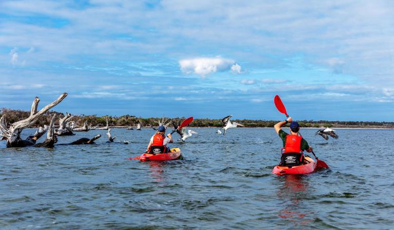
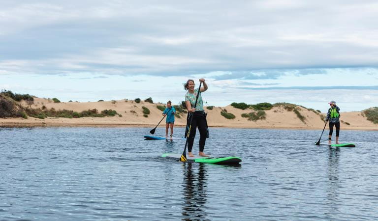
There is no better way to enjoy the charm of Mallacoota Inlet than from the water. Bring your own boat, canoe or kayak, or hire from a local provider. The inlet is the perfect escape for fishing enthusiasts and many competitions are held here year round. Catch bream, mulloway, tailor and flathead and cook them on the BBQ.
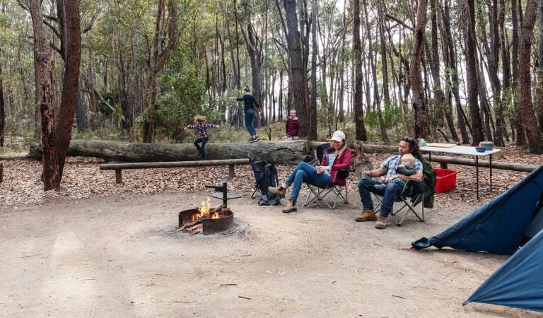
If fishing isn’t your forte, pack a picnic and cruise the endless expanses of the Top and Bottom Lakes. Spot pelicans, little terns, herons scouting for their next meal, and if you’re lucky, the White-bellied Sea Eagle. Pull up at one of the ten jetties and picnic areas around the lake for a scenic picnic or bbq or refreshing swim.
Things To Do
Cape Howe Wilderness Zone
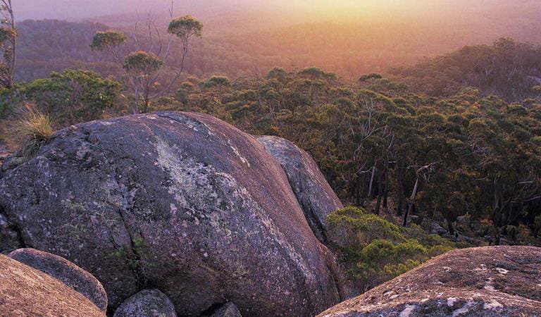
Genoa Peak
Shipwreck Creek
How to get there
Cape Howe and Mallacoota
To access Mallacoota, turn off the Princes Highway at Genoa on to Mallacoota-Genoa Road. Cape Howe is a designated wilderness zone and can only be accessed on foot. For more information on accessing this area contact the Mallacoota Parks Office. Any overnight hikes in the Cape Howe Wilderness needs to be booked via the NSW National Parks Service Merimbula Office.
When you're there
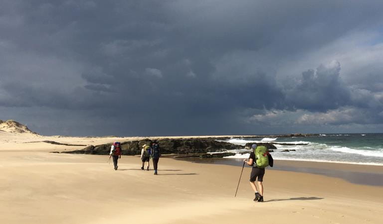
Shipwreck Creek Beach Walk
10mins, 500m one way
Walk to the secluded beach featuring the picturesque Shipwreck Creek surrounded by spectacular rocky outcrops. The walk commences at the Shipwreck Creek Day Visitor Area and concludes at the communal cooking area.
Shipwreck Creek to Centre Track via Old Coast Road
2 hours, 6.5km one way
This walk provides spectacular views as it meanders through heathland along the coast. It also offers an excellent opportunity for bird watching. The track commences at the Day Visitor Area and concludes at a car park on Centre Track.
Shipwreck Creek to Seal Creek
2 hours, 6km return
Follow the creek to the secluded Seal Creek Beach where there are impressive rock pools to explore. The track to Seal Creek is accessed from the south-western side of the beach.
Warning: There are no signposts or track markers and attempts to return via the rocky coastline are not recommended as large waves and high tides may prevent access.
Heathland Walk
30 minutes, 2 km return
The Heathland Walk commences at the Shipwreck Creek Day Visitor Area and concludes at the communal cooking area. During spring and summer there is an amazing variety of wildflowers, some of which are classified as rare or threatened. Keep your eyes open for orchids.
When to go
Flathead, whiting, yellowfin, bream and perch are most likely to bite from late spring to autumn. Throughout winter large schools of Black Bream make their way into the estuary. And tailor, salmon and trevally are also known to bit throughout June, July and August.
Need to know
Cape Howe and Mallacoota
Accessibility
Visiting a park can be more of a challenge for people with disabilities, however in Victoria there are a wide range of facilities to help people of all abilities enjoy our wonderful parks around the state.
Assistance dogs are welcome in Parks Victoria parks and reserves. Entry requirements apply for parks and reserves that are usually dog prohibited, such as national parks.
Change of Conditions
Nature being nature, sometimes conditions can change at short notice. It’s a good idea to check this page ahead of your visit for any updates.
-
Allan Head (Croajingolong National Park)
Allan Head Jetty Closure
The Allan Head jetty is temporarily closed for public safety. Visitors are advised that the Allan Head day visitor area remains open, however access onto the jetty is restricted. -
Notices Affecting Multiple Sites
Tracks and areas closed in the Croajingolong National Park
The following areas are closed because of the 2019/2020 bushfires and coastal erosion caused by heavy rainfall. Parks Victoria continue to maintain surveillance and security of these areas as works continue to reinstate access.· Point Hicks Lightstation· Saros Track· Sledge TrackThe Wilderness Coast Walk is open all the way from Bemm River to Mallacoota. Staff have recently marked sections of the track however, combined flood and fire damage have made some areas more difficult to negotiate. Hikers must be able to self-navigate with a map and compass.The following walking track is closed:· Wingan Inlet Rapids WalkThe following jetties around Mallacoota are closed:· Kingfish Point. Goanna BayThe following tracks remain closed due to storm damage· Miners TrackPeachtree Creek Camp Closed for Upgrades - May / June 2026
Peach Tree Creek campground will be closed from April 30 2026 whilst upgrades to the campground are being completed.No access to the boat ramp, jetty or toilet block is possible.Works are expected to be completed by end of June 2026.Alternative access to Tamboon Inlet is available via the boat ramp at Furnell Landing, Tamboon Rd. See map here. -
Goanna Bay (Croajingolong National Park)
Goanna Bay Jetty Closure
The Goanna Bay Jetty is temporarily closed for public safety. Visitors are advised that the Goanna Bay day visitor area remains open, however access onto the jetty is restricted. -
Kingfish Point (Croajingolong National Park)
Kingfish Point Jetty Closure
The Kingfish Point Jetty is closed for public safety. Visitors are advised that the Kingfish Point day visitor area remains open. -
Notices Affecting Multiple Parks
Peachtree Creek Camp Closed for Upgrades - May / June 2026
Peachtree Creek Creek campground is closed from 30 April 2026 whilst upgrades are being completed.No access to the boat ramp, jetty or toilet block is possible whilst works are underway.Works are expected to be completed by end of June 2026.Alternative access to Tamboon Inlet is available via the boatramp at Furnell Landing at the end of Tamboon Rd. See here for map.Planned aerial shooting operations targeting deer
Control operations (aerial shooting) targeting deer are planned for this area. During operations parts of the Park will be closed to visitors. More information on closures will be posted a minimum of 4 weeks prior to commencement.Visitors are advised to check the Change of conditions listing prior to arrival for up to date information and maps.For more information about deer control to protect biodiversity, please visit this link.Ground shooting operations targeting deer
Control operations (ground shooting) targeting deer are undertaken in this area. The Park will remain open to visitors during operations.
For more information about deer control to protect biodiversity, please visit our Deer page.
-
Croajingolong National Park
Planned aerial shooting operations targeting deer
Control operations (aerial shooting) targeting deer are planned for this area. During operations parts of the Park will be closed to visitors.Partial closure of Croajingolong NP from June 9 - June 12 2026 (inclusive).Attachments: Information_CapeHowe_Aerial_9-12Jun (252KB)
-
Genoa Peak (Croajingolong National Park)
Genoa Peak Road and Walking Track Temporary Closure
Genoa Peak Road and Genoa Peak walking track will be temporarily closed from Tuesday the 2nd June 2026 to Tuesday the 2nd July 2026 to allow for hazardous tree treatment works and road maintenance and repairs.Genoa Peak Road and Walking Track closure
Genoa Peak Road and Genoa Peak Walking Track will be temporarily closed to public access from the 2nd June 20026 to the 2nd July 2026 to allow for hazardous tree treatment and road maintenance works.Genoa Peak Road -4WD only
The Genoa Peak Road is open to 4WD vehicles only and is NOT advised for 2WD vehicles.The road has had major flood damage resulting in wash outs and deep rutting.Genoa Peak Walking Track remains open. -
Mueller Camp (Croajingolong National Park)
Mueller Inlet Camp closed due to flooding
Mueller Inlet camp is closed due to flooding. The river inlet is currently shut and all sites and the carpark are flooded.Alternative camping is available nearby at Thurra River Camp.Rangers will monitor the flooding and update this page as soon as camping is available.
Similar Experiences
Gippsland Lakes Coastal Park
Cape Conran Coastal Park