Explore
Thurra River Campground
Thurra River Campground reopened for summer
Thurra River Campground is open to campers with bookings, and day visitors until 1 February 2026. Some parts of the campground are inaccessible due to ongoing restoration work.
More than 20 campsites are available following significant efforts to remove vegetation and waste since the reopening of the Thurra Bridge in September 2025.
Temporary toilets are in use and barbecue facilities are unavailable until permanent toilet facilities, fire pits and onsite barbecues are reinstated.
Fires are currently prohibited at this campground.
The campground will close on 2 February 2026 for the completion of renewal works in time to reopen for Easter.
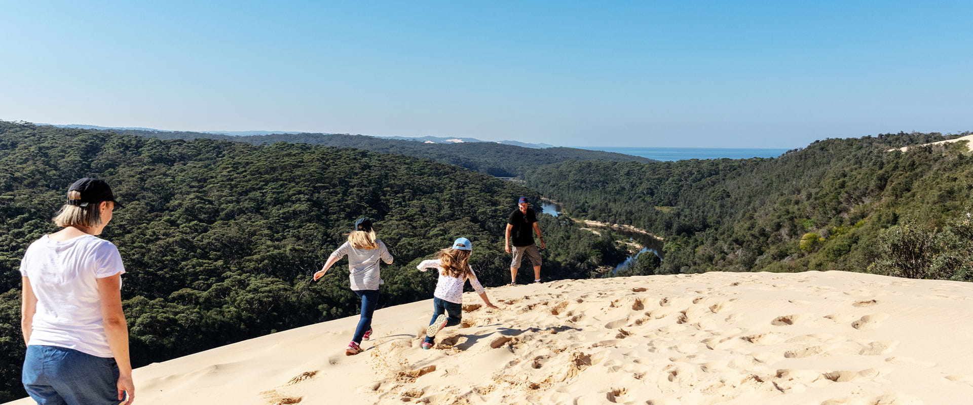
Bookings for the new nearby Thurra North Camping Area are also open. This small campground offers sweeping views of the ocean, Thurra River, and surrounding dune systems. There are 7 non-powered campsites available, along with a day visitor area.
Book Thurra River and Thurra North Camping Area
Perfectly positioned to explore nearby Point Hicks and the Thurra River Dunes, the large Thurra River Campground sits in the surrounds of stately eucalypt trees. Explore the seemingly endless stretch of pristine coastline, walk to the nearby dunes and discover the rich history of Point Hicks Lightstation.
The area has bounced back from the devastating fires of 2020 and the 2022 floods which destroyed the Thurra River Bridge. A new bridge opened in September 2025.
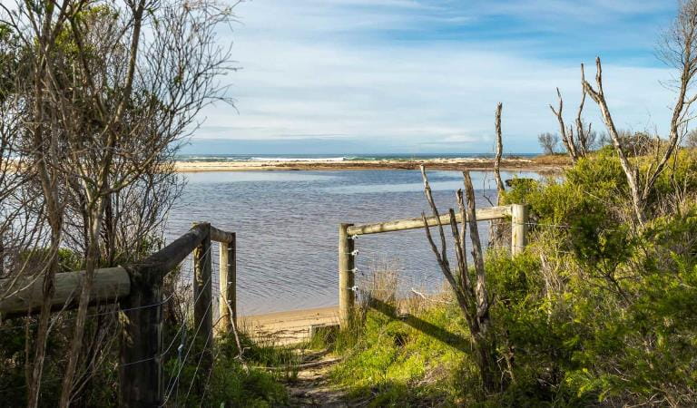
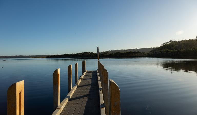
Set between the calm Thurra River and wild Southern Ocean swells, the spacious Thurra River Campground is the perfect base for a great family escape.
Things To Do
Mueller Inlet Campground
Peachtree Creek Reserve
How to get there
Thurra River Campground
Thurra River Campground is approximately 7 hours drive east of Melbourne. Follow the Princes Highway to Cann River. Here, turn south off the highway onto Tamboon Road before turning left onto Point Hicks Road. The campground lies just over the Thurra River.
Please note that campfires are only allowed in designated fireplaces and it is recommended that you bring your own drinking water on visiting Thurra River Campground.
Sites
When you're there
Download our Thurra River Campground map to view where the campsites and amenities are located.
Download the Croajingolong National Park visitor guide for more information about the park and the plethora of experiences to be had within its borders.
Need to know
Thurra River Campground
Accessibility
Visiting a park can be more of a challenge for people with disabilities, however in Victoria there are a wide range of facilities to help people of all abilities enjoy our wonderful parks around the state.
An all-abilities accessible toilet is available for visitors. The toilet is located opposite site 39 at Thurra River Campground. Please contact the Parks Victoria on 13 19 63 if you wish to enquire further about booking this particular campsite.
Be prepared and stay safe
Croajingolong National Park is in the East Gippsland fire district. Bushfire safety is a personal responsibility. Anyone entering the park during the bushfire season needs to stay aware of forecast weather conditions. Check the Fire Danger Rating and for days of Total Fire Ban at emergency.vic.gov.au, on the Vic Emergency App or call the Vic Emergency Hotline 1800 226 226.
No fires may be lit on Total Fire Ban days. On Catastrophic Fire Danger Rating days this park will be closed for public safety. Closure signs will be erected but do not expect an official warning.
Change of Conditions
Nature being nature, sometimes conditions can change at short notice. It’s a good idea to check this page ahead of your visit for any updates.
-
Thurra River (Croajingolong National Park)
Thurra River Campground Closure
Bushfire recovery works have recommenced at Thurra River Campground. The campground is currently closed and will reopen in time for Easter.Campsites at Thurra River North Campground will be closed for road works between Monday the 2nd of February and Sunday the 14th of February 2026.Nearby campgrounds Mueller Inlet Campground and Peachtree Campground remain open. -
Goanna Bay (Croajingolong National Park)
Goanna Bay Jetty Closure
The Goanna Bay Jetty is temporarily closed for public safety. Visitors are advised that the Goanna Bay day visitor area remains open, however access onto the jetty is restricted. -
Kingfish Point (Croajingolong National Park)
Kingfish Point Jetty Closure
The Kingfish Point Jetty is closed for public safety. Visitors are advised that the Kingfish Point day visitor area remains open. -
Genoa Peak (Croajingolong National Park)
Genoa Peak Road -temporarily 4WD only
Access to Genoa Peak walking track and lookout via Genoa Peak Road is temporarily 4WD vehicles only and not suitable for 2WD due to severe rutting of the road surface. Parks Victoria will undertake road repairs as soon as possible.
Genoa Peak Road
Access to Genoa Peak walking track and lookout, via Genoa Peak Road is currently only accessible by 4WD vehicle due to deep rutting of the road surface. Parks Victoria will be undertaking road repair works to reinstate 2WD access as soon as possible.
-
Notices Affecting Multiple Sites
Tracks and areas closed in the Croajingolong National Park
The following areas are closed because of the 2019/2020 bushfires and coastal erosion caused by heavy rainfall. Parks Victoria continue to maintain surveillance and security of these areas as works continue to reinstate access.· Point Hicks Lightstation· Saros Track· Sledge TrackThe Wilderness Coast Walk is open all the way from Bemm River to Mallacoota. Staff have recently marked sections of the track however, combined flood and fire damage have made some areas more difficult to negotiate. Hikers must be able to self-navigate with a map and compass.The following walking track is closed:· Wingan Inlet Rapids WalkThe following jetties around Mallacoota are closed:· Kingfish Point. Goanna BayThe following tracks remain closed due to storm damage· Miners TrackFire Closure
Parts of the Croajingolong National Park are current closed due to the Mallacoota-Lake Barracoota fire which started on the 9th January 2026 due to lightning. The following areas/ sites are temporarily closed: the park to the east of Mallacoota Inlet including: Lakeview Track, Barracoota Link Track, Howe Flat Track and Howe Flat walking track, Cemetery Bight Day Visitor Area and jetty, Spotted Dog Mine walking track, Brokewells Hut jetty and Allans Head Day Visitor Area and jetty. The Wilderness Coast Walk to the east of Mallacoota is also temporarily closed. -
Notices Affecting Multiple Parks
Ground shooting operations targeting deer
Control operations (ground shooting) targeting deer are undertaken in this area. The Park will remain open to visitors during operations.Planned aerial shooting operations targeting deer
Control operations (aerial shooting) targeting deer are planned for this area. During operations parts of the Park will be closed to visitors. More information on closures will be posted a minimum of 4 weeks prior to commencement.Visitors are advised to check the Change of conditions listing prior to arrival for up to date information and maps.For more information about deer control to protect biodiversity, please visit this link.