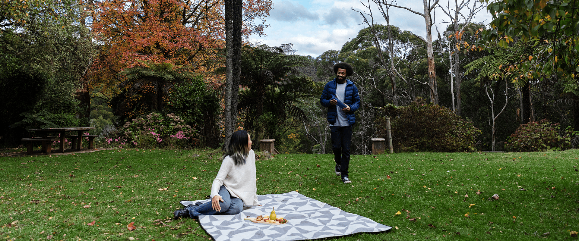
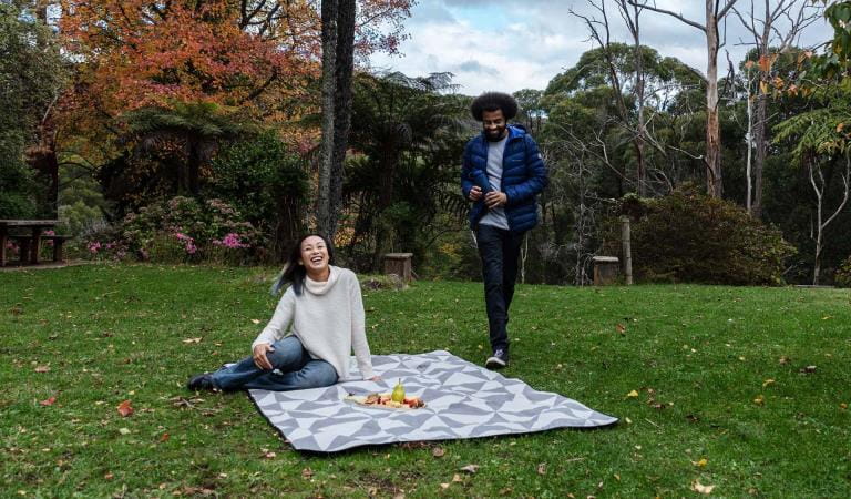
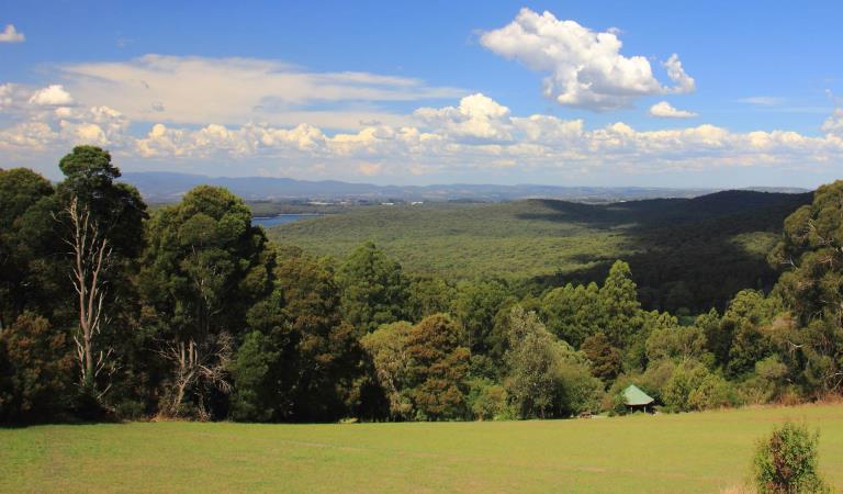
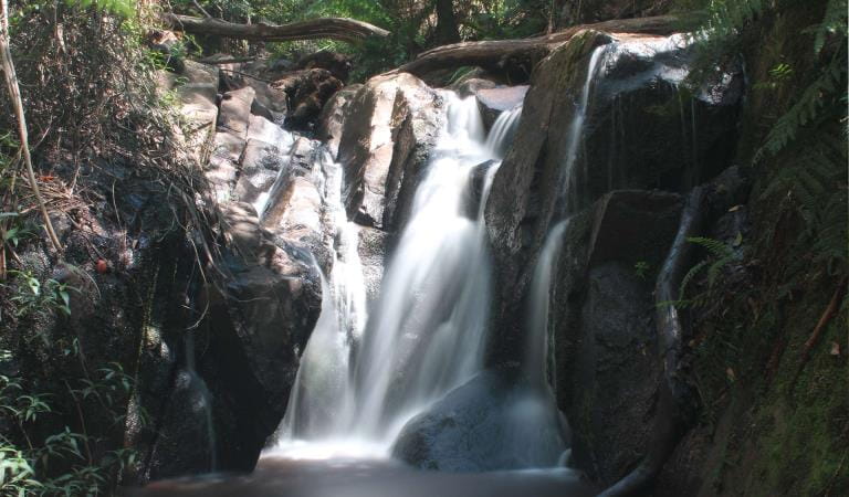
The north of the Dandenong Ranges National Park includes the area's highest peak, Mount Dandenong. This is a popular area for walks and picnics. Here you will find the historic site of the former Doongalla Homestead among beautiful gardens, magnificent Olinda Falls and stunning views from Burkes Lookout and Kalorama.
Escape to this wonderful cool temperate rainforest on Melbourne's doorstep. The northern Dandenong Ranges is a place of majestic scenery, stunning views, beautiful gardens and noisy, colourful wildlife.
Enjoy forest walks under the canopy of the world's tallest flowering plant, the Mountain Ash Tree. Take a moment to rest quietly and you might see a lyrebird scratching in the soil or a wallaby browsing in the undergrowth.
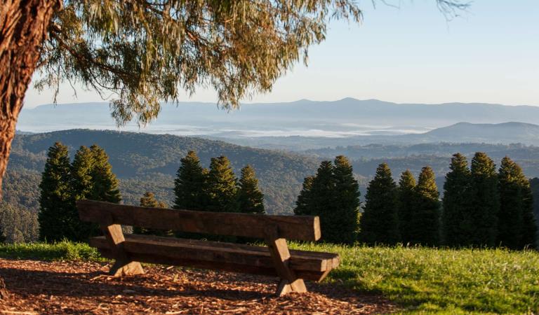
One of the best views in the Dandenongs is from Burkes Lookout, from where you can see the Kinglake Ranges, Mt Macedon, the You Yangs, Port Phillip and the Bellarine and Mornington Peninsulas on a clear day. Kalorama Lookout offers another great view – across to Silvan Reservoir.
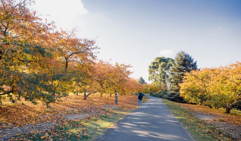
Olinda has always been known for its gardens. The Dandenong Ranges Botanical Garden is hugely popular in spring when Rhododendrons bloom and cherry trees blossom, while the Mount Dandenong Arboretum is spectacular in autumn.
The Dandenong Ranges is a place where a spot of rain means you are more likely to see the natural wonders of the area. After a shower, the lyrebirds come out to feed, Olinda Falls flows more – and you might see a rainbow over the verdant hills.
Things To Do
Dandenong Ranges Botanic Garden
Chelsea Australian Garden at Olinda
Doongalla Homestead
Kalorama Park
Olinda-Falls
RJ Hamer Arboretum
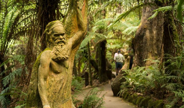
William Ricketts Sanctuary
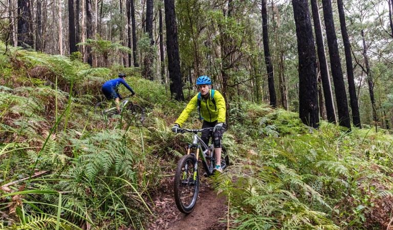
Mountain bike trails in Dandenong Ranges National Park
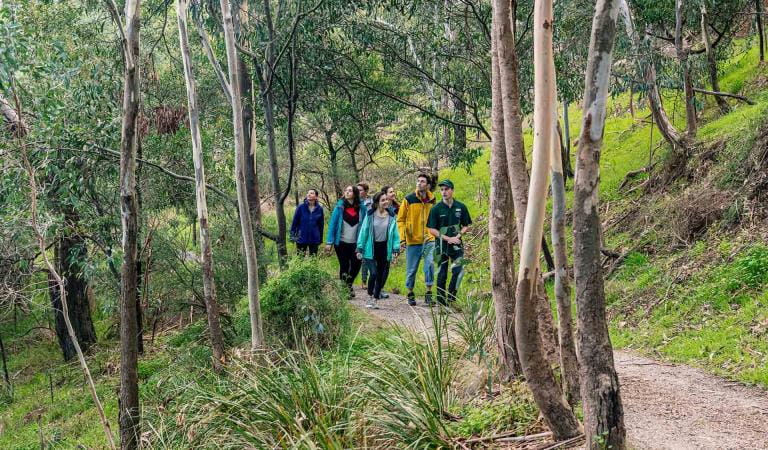
Guided Park Walks
How to get there
Dandenong Ranges National Park North
Facilities
When you're there
Dandenong Ranges National Park is open every day, including weekends and public holidays.
Kalorama Park, Doongalla Homestead Site and Stables picnic ground, Eagle Nest picnic ground, Valley picnic ground, and Silvan Reservoir Park close at 4:00 pm.
This park is closed on days of Extreme Fire Danger Rating or severe weather events.
Check this page before your visit and download the Dandenong Ranges National Park north visitor guide for more information about this part of the park.
Need to know
Dandenong Ranges National Park North
Accessibility
Visiting a park can be more of a challenge for people with disabilities, however in Victoria there are a wide range of facilities to help people of all abilities enjoy our wonderful parks around the state.
Assistance dogs are welcome in Parks Victoria parks and reserves. Entry requirements apply for parks and reserves that are usually dog prohibited, such as national parks.
Change of Conditions
Nature being nature, sometimes conditions can change at short notice. It’s a good idea to check this page ahead of your visit for any updates.
-
Notices Affecting Multiple Sites
Olinda/ Silvan Area- Georges Track pedestrian access only
Due to unstable ground from a damaged underground culvert, temporary fences have been installed at Georges Track and Herman Track intersection prohibiting vehicle access.This portion of the track is pedestrian use and horse riding only. Parks Victoria and DEECA are working to fix this issue to reinstate full access.Margaret Lester Forest Walk Condition Update
The Margaret Lester Walk at Grants Picnic Ground has historically provided visitors with an accessible forest experience through the Dandenong Ranges National Park.Due to the age and condition of the trail surface and associated infrastructure, the walk no longer meets the expected standard of an all abilities trail. Visitors may encounter uneven surfaces, drainage issues and sections of trail that may be difficult for some users to safely navigate.Planning work has been undertaken for a future upgrade of the trail, however delivery timeframes are still being confirmed.Until improvement works are completed, visitors are encouraged to assess whether the current trail conditions are suitable for their individual needs and abilities.Parks Victoria acknowledges the importance of accessible visitor experiences and appreciates the community’s patience while future options for the Margaret Lester Walk are progressed.Temporary Closure of Grants Picnic Ground Cafe
Grants Picnic Ground Café is temporarily closed while Parks Victoria works through an Expression of Interest process to secure a long-term and appropriate lease for the site. In the meantime, a mobile coffee van will be operating on-site from Tuesday to Saturday for the duration of the process.