Explore
Lake Elizabeth Campground
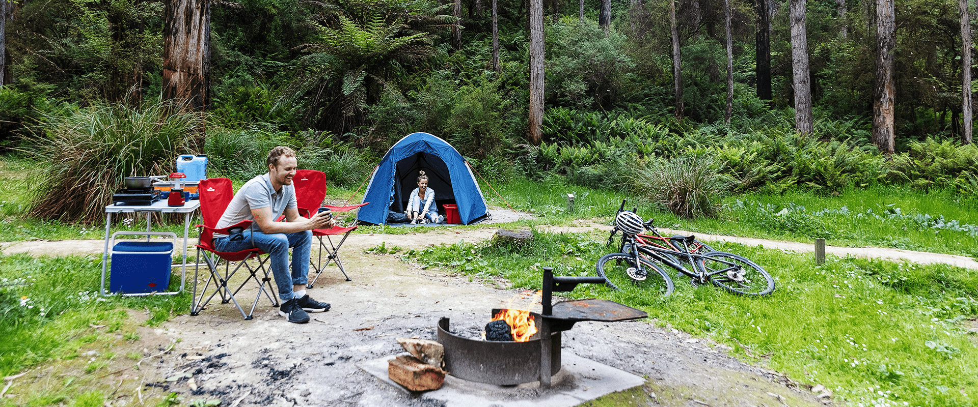
Lake Elizabeth Campground is a dogs-on-lead camping area. Sheltered by tall eucalypt trees it nestles beside the small Barwon River. Lake Elizabeth is a short 1km walk away. Forrest Mountain Bike Trailhead is at the Day Visitor Carpark. Pitch a tent in the small campground. Look and listen for Satin Bowerbirds and inquisitive Superb Fairy-wrens and Eastern Yellow Robins.
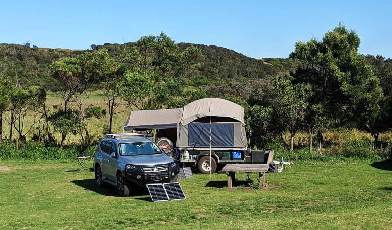
There are 20 campsites accommodating up to six people per site. All campsites are unpowered and are suitable for tents only. There is no direct vehicle access to the campsites. A 15-minute unloading bay is located close by and a separate carpark is located above and behind the campground just a two minute walk away.
Non flush toilets, shared fireplaces and picnic tables are provided. Dogs are permitted on-lead.
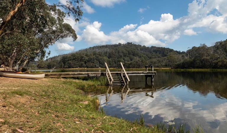
Once you're unpacked and set up, walk the 1km to beautiful Lake Elizabeth. Flooded after a landslip created a natural dam, the lake is scattered with the still-upright trunks of dead trees, giving an eerie atmosphere to the valley. Platypus are sometimes seen early morning and at dusk in the still waters. A host of birds live in the area and Satin Bowerbirds (the male dark satin blue and the female is olive green) are often seen near the camping round. Wrens, robins and grey shrike thrush also visit regularly. You may see glowworms beside this track after dark.
Dogs should be kept on-lead to reduce their impact on native wildlife and to preserve their health and your dogs as snakes are common in this area and its walks. There is poor mobile phone reception here.
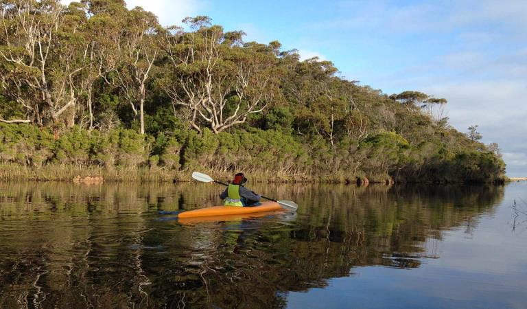
Explore the area by walking, canoeing, mountain biking and four-wheel driving. Birdwatching is popular here. The village of Forrest is nearby for supplies and is a major mountain bike trailhead for the area's cycling network.
As rivers, lakes and reservoirs are natural environments, you may encounter hazards. Follow our water safety advice to make sure your day out at Lake Elizabeth is a safe and enjoyable one.
Things to do
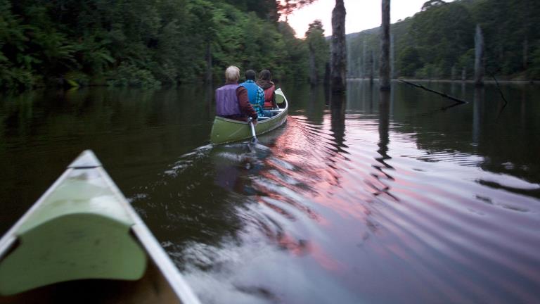
Canoeing and Kayaking
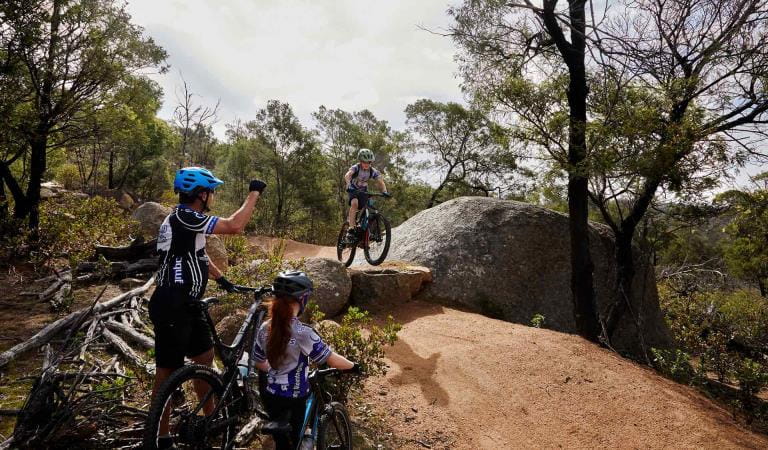
Mountain biking
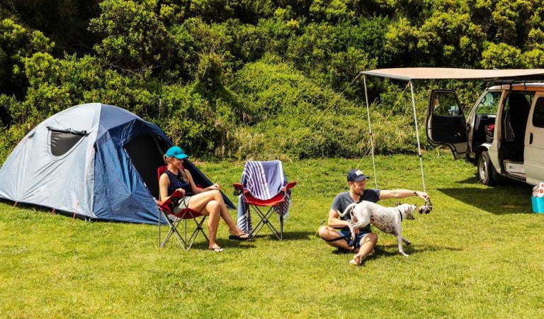
Dog friendly camping
How to get there
Lake Elizabeth Campground
When you're there
A 40-minute drive south takes you to the Great Ocean Road and the many waterfalls and other attractions along this famous drive. Forrest itself is a mountain bike trailhead hub. You can ride to it from the campground via the Baridjaru Trail. Download the visitor guide before you go.
Need to know
Lake Elizabeth Campground
Accessibility
Lake Elizabeth Day Visitor and Camping facility has all ability access. Forested areas generally are more difficult grade walks often with steps and minor creek crossings. Lake Elizabeth Loop Walk Grade 3. the walk has some steps, uneven surfaces and is not an all abilities walk.
Be prepared and stay safe
Lake Elizabeth Campground is in the Great Otway National Park in the South West fire district. Bushfires can occur during the warmer months. It is your responsibility to check current and forecast weather conditions. Campfires cannot be lit on days of Total Fire Ban, however gas cookers can be used for preparing food.
Check the Fire Danger Rating and for days of Total Fire Ban at emergency.vic.gov.au, on the Vic Emergency App or call the Vic Emergency Hotline 1800 226 226.
Change of Conditions
Nature being nature, sometimes conditions can change at short notice. It’s a good idea to check this page ahead of your visit for any updates.
-
Aire River West Campground (Aire River Heritage River, Great Otway National Park GORCAPA)
Aire West Campground – Partial Seasonal Closure
Visitors are advised that sites 17–40 at Aire West Campground in Great Otway National Park are temporarily closed from 29 May to 25 September 2026 due to seasonal conditions.What to expect:Sites 17–40 are closed and unavailable for camping or vehicle access during this periodRemaining sites may still be accessible, subject to conditionsImportant information:The closure period may be extended if conditions remain too wet to safely support camping and vehicle accessVisitors are asked to follow any on-site signage and avoid closed areas to prevent damage to the campground and ensure safety.The Great Ocean Walk hike in camp site is not impacted.Entering into or camping within closed areas is subject to National Park regulationsWe appreciate your cooperation in helping protect the park during these conditions. -
Aire River East Campground (Aire River Heritage River, Great Otway National Park GORCAPA)
Aire East Campground – Seasonal Closure
Aire East Campground in Great Otway National Park will be closed from 29 May to 25 September 2026 as part of the annual seasonal winter closure.This closure is necessary to protect the campground and access tracks during periods of wet weather, when conditions are highly susceptible to damage from vehicle use and camping activity.What to expect:No visitor or vehicle access to the campground during the closure period.Campground and toilet facilities will be unavailable.Important information:The closure period may be extended if conditions remain too wet to safely support vehicle access and camping.Visitors are encouraged to plan ahead and consider alternative campgrounds.We appreciate your cooperation in helping protect the park environment during this time. -
Notices Affecting Multiple Sites
Great Otway Natonal Park - flood damge impact
Severe thunderstorms and flash flooding on 16 January 2026 caused significant damage across parts of the eastern Great Otway National Park.Recovery works are ongoing.We are pleased to advise that some areas have now reopened, while others remain closed to ensure public safety during assessment and repair work.The following areas are now open to visitors:- Moggs Creek Picnic Area
- Distillery Creek Picnic Area
- Ocean Track
- Castle Rock
- Sheoak Falls to Swallow Cave Track
Parks Victoria has reopened sections of the Kalimna Falls Walking Trail, providing:
- Access from Sheoak Picnic Ground
- Walking access to Lower Kalimna Falls
- Return via the same route or continuing through to Garvey Track
✅ Open sections are marked in green on park signage/maps
❌ Closed sections remain in red and must not be enteredVisitors should remain on marked open tracks and follow all onsite signage.
⚠️ Important Visitor Advice- Always follow posted signage and staff directions
- Stay within reopened (green-marked) track sections
- Do not enter closed areas under any circumstances
- Conditions may change without notice
-
Great Otway National Park
Wye Road Closure
Due to recent storm and flood damage, Wye Road will remain closed until the end of winter to allow for road maintenance and repair works.
Similar experiences
Lake Catani Campground
Aire River East Campground