Shadbolts Picnic Area

Explore

Shadbolts Picnic Area

Greater Bendigo National Park

Womin-Dji-Ka (Welcome)

Greater Bendigo National Park is one of six jointly managed parks in Central West Victoria by the Dja Dja Wurrung Clans Aboriginal Corporation and Parks Victoria. For more information on Joint Management, please visit the Dja Dja Wurrung Clans Aboriginal Corporation and Dhelkunya Dja Land Management Board who oversee implementation of the Joint Management Plan 2018 - see relevant strategy and resources documents.

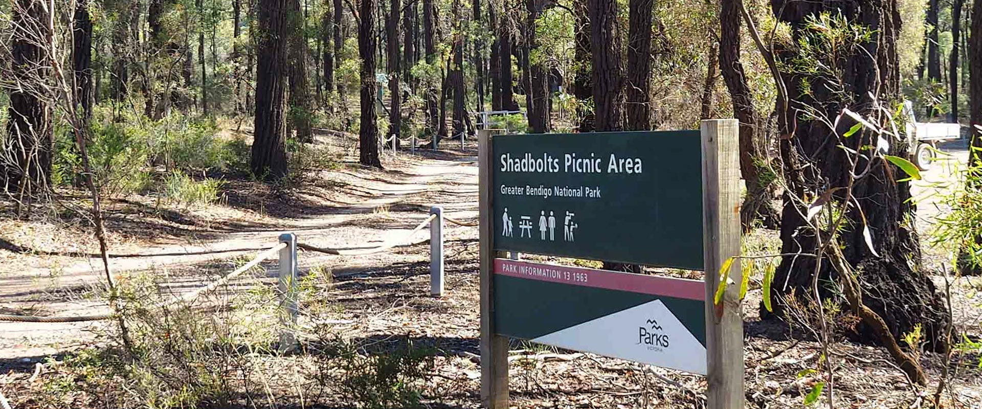
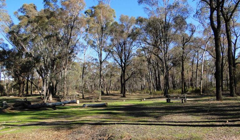
A popular family day trip from Melbourne, Shadbolt Picnic Area is perfect for exploring a little of the Greater Bendigo National Park. Set up at the tables or pick a grassy patch near the dam and enjoy a picnic on sunny days. Parking and toilets are nearby, but remember to bring your own water.

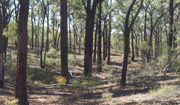
Bring good walking shoes, if you plan on getting a bit deeper into nature. The Flagstaff Hill Loop Walk (1.1km) is easy to follow and suitable for all ages. Take in the scenery of vibrant wildflowers, Box-Ironbark and mallee bushland, historic remnants of the 1850s gold rush and a panoramic lookout view.

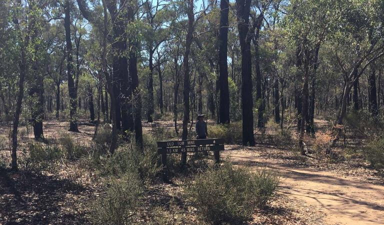
Visitors who want to explore more of the local mining history can take the 5.3km (2 hour) Old Tom Mine Walk, and even try fossicking and prospecting for gold themselves. Learn more on the Fossicking and Prospecting page.

As well as being a historic gold rush landscape, this was also the site of the first eucalyptus distillery in the area, owned by Jack Shadbolt, which supplied eucalyptus oil to the Red Cross in World War One. A few non-native plants at the start of the Flagstaff Hill track are all that remains of the Shadbolt’s family garden.

If you would like to stay a little longer, the nearby Notley Campground offers a wide, grassy campsite area with parking and amenities.

Things To Do

Flagstaff Hill Loop Walk

An easy walk from the Shadbolt Day Visitor Area gives visitors a small taste of the natural environment of the Whipstick Block of the Greater Bendigo National Park. Pass by remnants of the 1800s gold mining and enjoy panoramic views over the Mallee landscape.
Notley Picnic Ground in the Greater Bendigo National Park

Notley Campground and Picnic Area

A grassy campground surrounded by Box-Ironbark and mallee, Notley is a great spot for semi-bush camping among the wildlife. Amenities include toilets, a fireplace and a large picnic shelter with tables. Take the Old Tom Mine Track nearby, explore the native bushland and even try fossicking for gold.
A man walks back along the path from Old Tom Mine in the Greater Bendigo National Park.

Old Tom Mine Walk

Take a walk through history. Starting from either the Shadbolts Day Visitor area or Notley Camping area, this loop walk takes you through Box-Ironbark Forest to reach the Old Tom mine site, where you can see the original reef mine, ‘puddler’ and water race; all that remains from those exciting Gold Rush days.
A boy crouches at the waters panning for gold in a river.

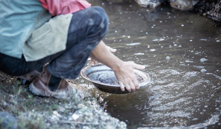
Fossicking and prospecting

Many of the world’s largest gold nuggets have been found in Victoria. Try your luck at fossicking and prospecting and find out what's required before you start sifting for gold.

How to get there

Shadbolts Picnic Area

Access is via the unsealed Neilborough Road. The road and parking area are suitable for caravans and campervans and small buses.

Need to know

Shadbolts Picnic Area

Change of Conditions

Nature being nature, sometimes conditions can change at short notice. It’s a good idea to check this page ahead of your visit for any updates.

  • Greater Bendigo National Park

    planned burn

    Planned burning operations are scheduled in the Greater Bendigon National Park which will result in parts of the park near Nuggety Road being closed from the time a burn is approved for ignition until the area is declared safe. Ignition of the burn is scheduled from 14 -15 April and is subject to favourable weather. 

    Please see attached neighbour letter for more information, including maps.
     
    Burn name:               LM-MGF-BGO-0524 Whipstick - Nuggety Rd, Size194.19 ha, Location: 6.5km West of Huntly
    Scheduled Date:      Monday 15 April - Tuesday 16 April 2024  (weather conditions permitting)
     
    For more information

    Attachments: LM-MGF-BGO-0524_Whipstick - Nuggety Rd_Neighbour letter (DJAARA) 8-04-24 (348KB)

    Planned burn near Tennyson Road

    Planned burning operations are scheduled in the Greater Bendigo National Park which will result in parts of the park near Tennyson Road being closed from the time a burn is approved for ignition until the area is declared safe. Ignition of the burn is scheduled from Saturday 27 April - Friday 3 May 2024 and is subject to favourable weather. 

    Please see attached neighbour letter for more information, including maps.
     
    Burn name:               LM-MGF-BGO-1321 Kamarooka - Tennyson Rd, Size: 290.47 hectares, Location: 7km Southeast of Kamarooka
    Scheduled Date:       Saturday 27 April - Friday 3 May 2024 (weather conditions permitting)
     
    For more information

    Planned burn - near Tennyson Road

    Planned burning operations are scheduled in the Greater Bendigo National Park which will result in parts of the park near Tennyson Road being closed from the time a burn is approved for ignition until the area is declared safe. Ignition of the burn is scheduled from Saturday 27 April - Friday 3 May 2024 and is subject to favourable weather. 

    Please see attached neighbour letter for more information, including maps.
     
    Burn name:               LM-MGF-BGO-1321 Kamarooka - Tennyson Rd, Size: 290.47 hectares, Location: 7km Southeast of Kamarooka
    Scheduled Date:       Saturday 27 April - Friday 3 May 2024 (weather conditions permitting)
     
    For more information

  • Notices Affecting Multiple Parks

    closure due to planned burn

    Planned burning operations are scheduled in the Greater Bendigo National Park which will result in parts of the park near Brights Lane being closed from the time a burn is approved for ignition until the area is declared safe. Ignition of the burn is scheduled from 18 April - 24 April 2024 and is subject to favourable weather. 

    Please see attached neighbour letter for more information, including maps.
     
    Burn name:               LM-MGF-BGO-0855 Whipstick – Brights Lane, Size19.92 hectares, Location: 7.4km North of Eaglehawk  
    Scheduled Date:       Thursday 18 April - Wednesday 24 April 2024  (weather conditions permitting)
     
    For more information

X
By using our site you accept that we use and share cookies and similar technologies with certain approved third parties. These tools enable us to improve your website experience and to provide content and ads tailored to your interests. By continuing to use our site you consent to this. Please see our Privacy Policy for more information.
Confirm