Explore
Greater Bendigo National Park
Womin-Dji-Ka (Welcome)
Greater Bendigo National Park is one of six Aboriginal Title parks in Central West Victoria, jointly managed by the Dja Dja Wurrung Clans Aboriginal Corporation and Parks Victoria. For more information on Joint Management, please visit the Dja Dja Wurrung Clans Aboriginal Corporation and Dhelkunya Dja Land Management Board who oversee implementation of the Joint Management Plan 2018 - see relevant strategy and resources documents.
Greater Bendigo National Park is part of the traditional lands of the Dja Dja Wurrung People. The Dja Dja Wurrung People’s rights were recognised through a Recognition and Settlement Agreement with the State of Victoria in March 2013. The Dja Dja Wurrung People maintain a close and continuing connection to Djandak, their traditional Country.
Djandak is a cultural landscape that includes both tangible objects such as scarred trees, mounds, wells and stone artefact scatters; and intangible stories. Djandak is a living entity, which holds stories of creation and histories that cannot be erased. Parks Victoria pays our respects to Dja Dja Wurrung Elders, past, present, and future, and asks visitors to do the same. Aboriginal artefacts are protected by law, and it is prohibited to disturb them in any way.
Greater Bendigo National Park, along with Kara Kara National Park, Hepburn Regional Park, Kooyoora State Park, Paddy’s Ranges State Park and Wehla Nature Conservation Reserve, is jointly managed by the Dja Dja Wurrung Clans Aboriginal Corporation and Parks Victoria.
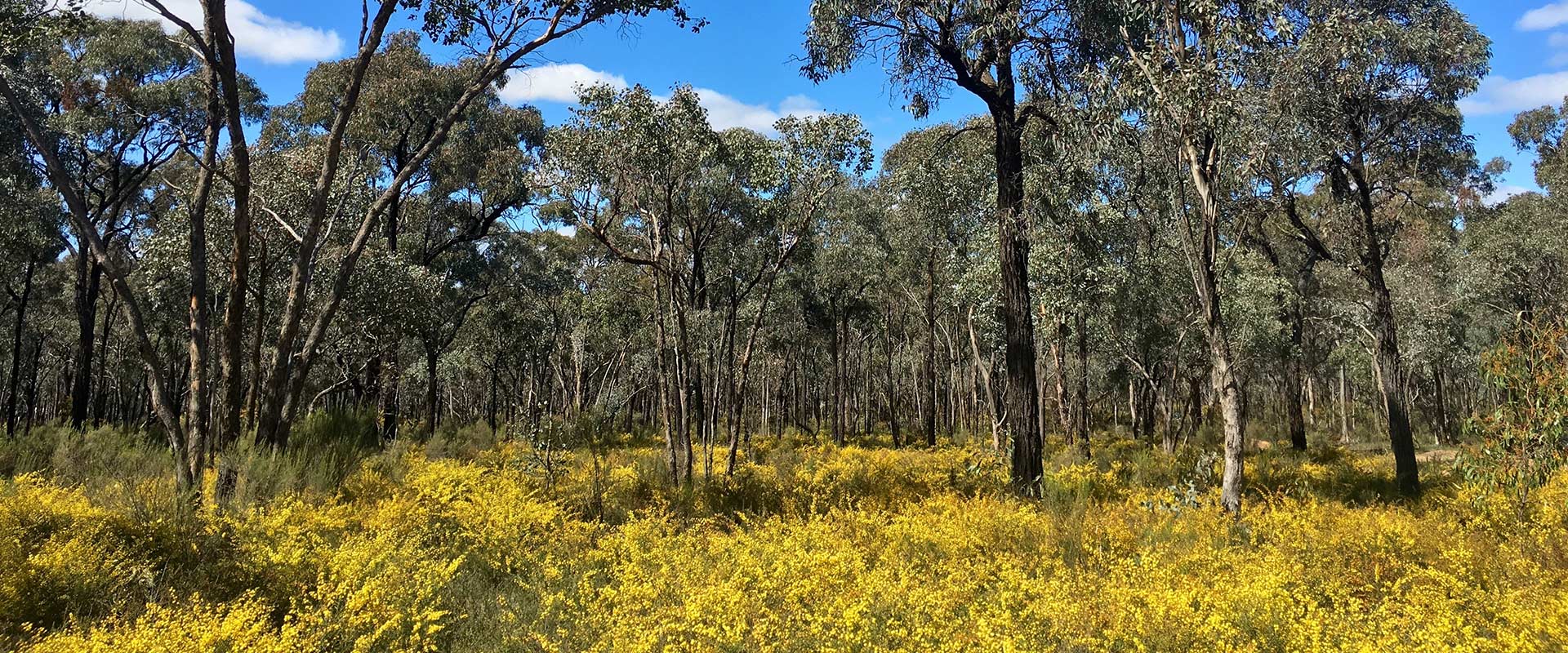
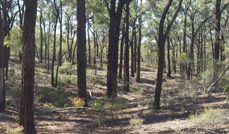
The park protects an area of high-quality Box-Ironbark forest, as well as broombush mallee, grassy woodlands and Kamarooka mallee. The park comes alive with native wildflowers in Spring, and is home to an array of wildlife including Swift Parrots and other bushland birds.
Notley Campground is a popular base for exploring the loop tracks and longer bushland trails through the forest, and the One Tree Hill Lookout offers a spectacular sunset view.
Visitors can discover Victoria’s gold rush history along the Old Tom Mine Walk and even try their luck at fossicking. Learn more about fossicking and prospecting.
Things To Do
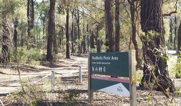
Shadbolts Picnic Area
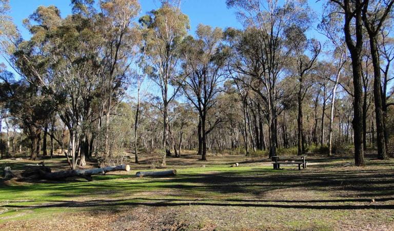
Notley Campground and Picnic Area
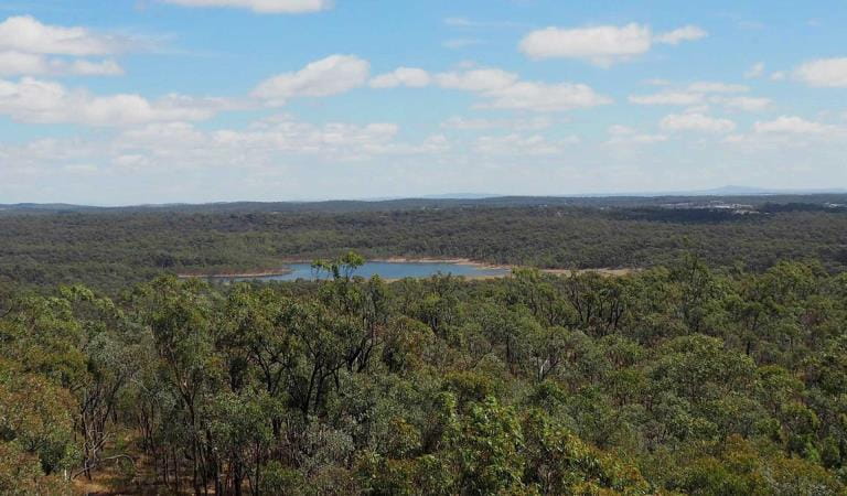
One Tree Hill Lookout and Picnic Area
Flagstaff Hill Loop Walk
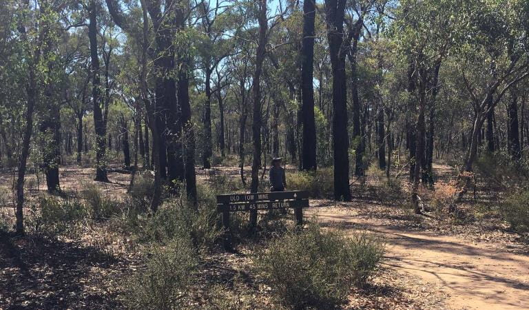
Old Tom Mine Walk
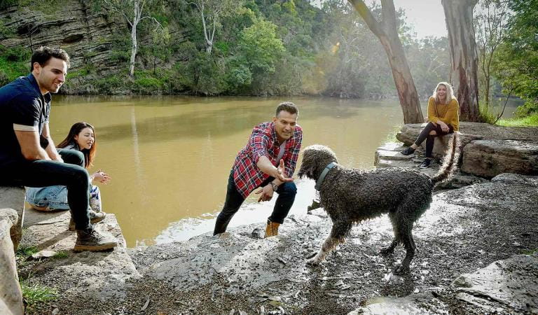
Dog friendly parks
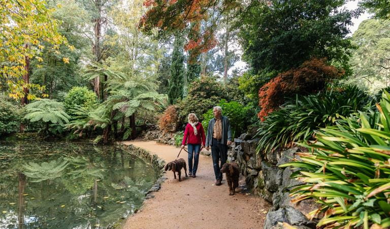
Your A-Z guide to Victoria's dog-friendly walking trails
The park is well known for Box-Ironbark, wildflowers, broombush mallee, grassy woodlands and Kamarooka mallee.
Keep an eye out for Swift Parrots and other bushland birds, as well as:
Tours and adventure experiences in parks
One of the best ways you can get into nature is with a Licensed Tour Operator.
There are more than 400 Licensed Tour Operators across Victoria who are ready and waiting to help you experience and connect with Victoria’s spectacular parks and waterways.
Discover more than 60 different types of nature-based experiences including hiking, mountain biking, boating, four-wheel driving, indigenous culture tours, birdwatching, surfing, diving and so much more.
Licensed Tour Operators know all the best places to go and will plan and prepare your visit to ensure you are safe and can enjoy your nature-based adventure to the fullest.
How to get there
Greater Bendigo National Park
The Greater Bendigo National Park is approximately 188km north of Melbourne. There are several different access routes to the park leading from the Loddon Valley Highway, Midland Highway and the Calder Freeway.
When you're there
Download the Greater Bendigo National Park park note for a detailed map and more information about the park.
Dogs are allowed on-lead on specified roads and trails in the One Tree Hill section of the park. Dog walking off these roads and trails is not permitted. Nearby Bendigo Regional Park and State Forests permit dog walking. For more information, view the Dog walking in parks and forests around Bendigo map (PDF).
Native plants and animals are protected, so please do not disturb them in any way.
Collecting firewood is not allowed, as woody debris provides important habitat for many animals that live in the park. You must bring your own firewood, and fires are permitted only in the campground fireplace provided and it is not a day of Total Fire Ban.
Find out where you can go prospecting and what you need to know beforehand on our fossicking and prospecting page. Prospectors must hold a current Miner's Right.
Drones are not allowed within the park.
Bins are not provided, so please take your rubbish away with you when you leave.
Vehicles, including motorcycles and bicycles, must not be driven off formed roads.
When to go
Need to know
Greater Bendigo National Park
Accessibility
Visiting a park can be more of a challenge for people with disabilities, however in Victoria there are a wide range of facilities to help people of all abilities enjoy our wonderful parks around the state.
Assistance dogs are welcome in Parks Victoria parks and reserves. Entry requirements apply for parks and reserves that are usually dog prohibited, such as national parks.
Safety in nature
To ensure that you and your companions stay safe, always remember that the natural environment can be unpredictable. Before you go, take a look at our safety tips and check our changed conditions and closures information for a great visit.
Visitors are reminded not to park or rest under or near large trees, as trees and branches may fall at any time.
Certain areas are heavily mined landscapes with ongoing hazards, including uneven ground, mine tailings, dams, unstable slopes and mineshafts. Visitors with a keen interest in exploring the many former mine sites in the area should consider hiring a licensed guide.
Subscribe to Parks Victoria
Sign up to receive the latest ideas, inspiration and news delivered right to your inbox.
How we keep it special
The Dja Dja Wurrung People have Aboriginal Title over six parks and reserves within their settlement area, which are jointly managed, including Greater Bendigo National Park. These parks are jointly managed and overseen by the Dhelkunya Dja Land Management Board. A Joint Management Plan for the Dja Dja Wurrung parks is in place.