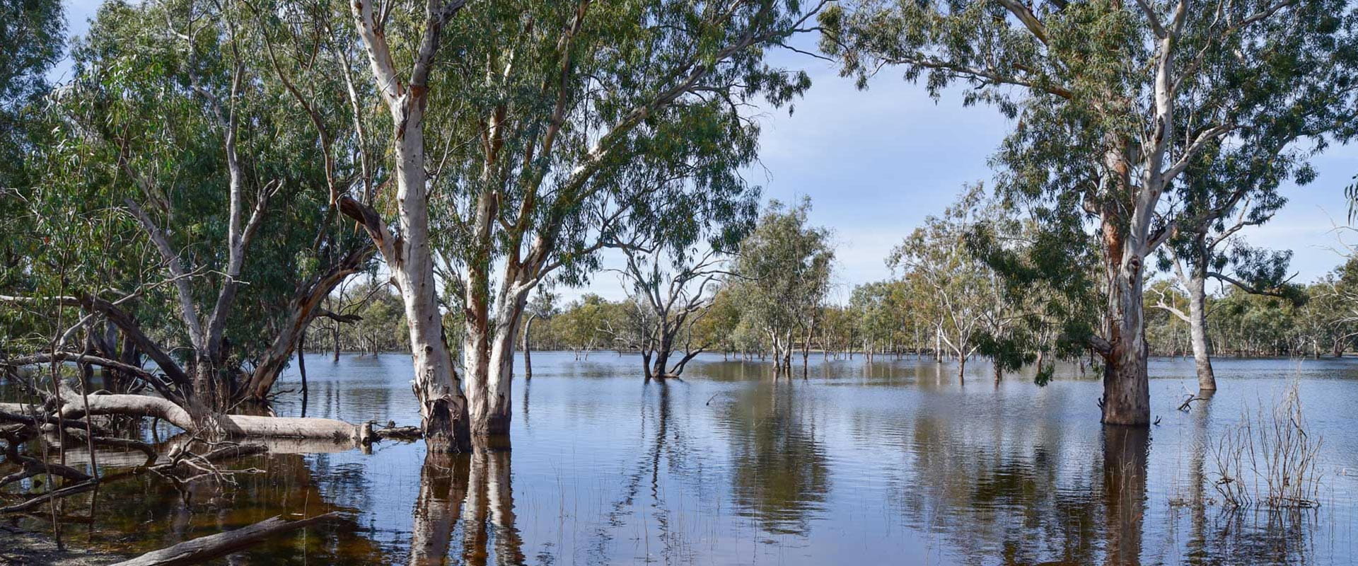
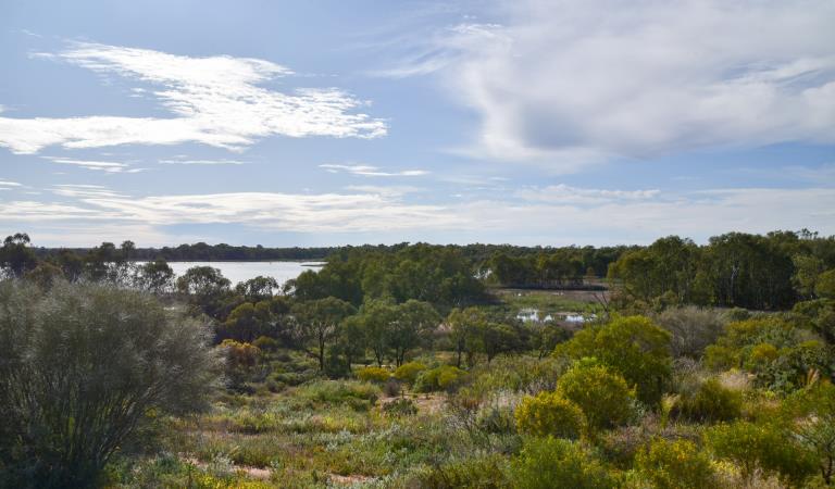
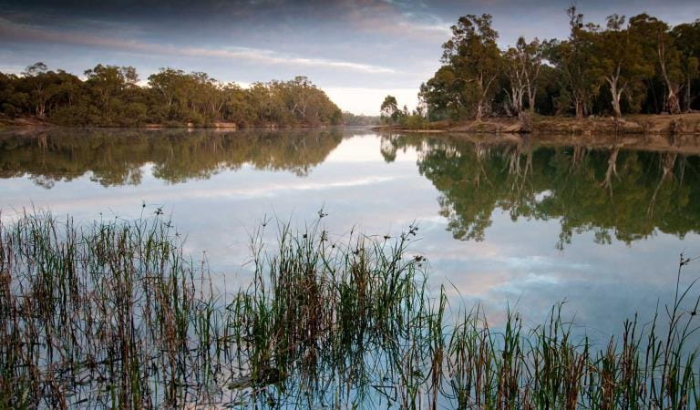
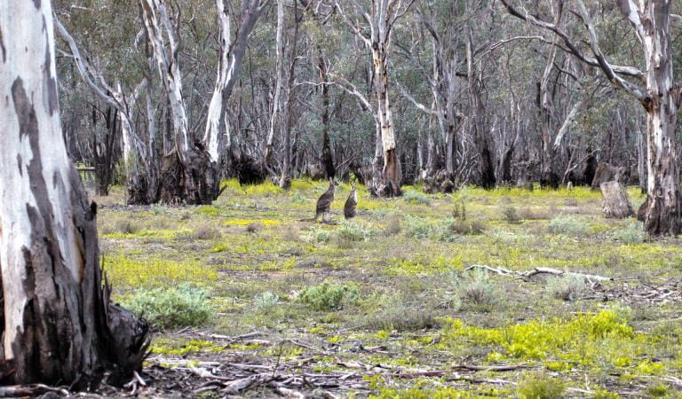
Passing through the dry Mallee, the Murray River and its wetlands provide a haven for wildlife. The landscape is relatively flat and open, offering easy access to the river and its sandy beaches, except where it passes through the dramatic Red Cliffs near Mildura. Campers can spend peaceful nights gazing up at the stars after days delighting in the river.
Lindsay, Walpolla and Mulcra Islands, part of Murray-Sunset National Park, lie between Mildura and the South Australian border. There are many remote and secluded camping area along the sandy bends of the river suitable for self-sufficient campers with 4WD vehicles. Relax, fish or swim at a secluded campsite beside a river, or head out on a birdwatching or canoeing adventure along the many creeks and billabongs, or visit the historic Lock 9 Millewa Pumps.
Near Mildura, Kings Billabong Park and Merbein Common in the proposed Murray River Park have a network of walking tracks with many water birds and other wildlife to appreciate, as well as great fishing and canoeing opportunities. Look out for signs about local heritage, such as the Psyche Bend Pumps. Dispersed Camping is permitted along the river. Kings Billabong Lookout and the Red Cliffs Scenic Reserve and boardwalk are not to be missed for fantastic views of the wetlands and the striking Red Cliffs.
Murray-Kulkyne Park lies between the Murray River and Hattah-Kulkyne National Park, offering the best of both river and Mallee country. Nature lovers flock to the Hattah Lakes for their abundant birds and other wildlife – an oasis among dry bushland – also popular for canoeing. Murray-Kulkyne offers dispersed bush camping suitable for self-sufficient campers in 4WD vehicles.
The river is wide and slow-moving downstream of Swan Hill. It is shallower with many snags and best suited to slower boating and vessels with a shallow draft. Waterskiing is popular in suitable stretches, such as near Robinvale and Mildura.
All riverside campsites are free, no bookings required. For more information about the different sites along this reach of the river, including what regulations apply (for example whether dogs and campfires are allowed), click on the links below the map. Check out additional advice on campfire regulations and safety.
When you’ve decided where to visit, please check the change of condition notices in the need to know section. Visitor sites along the Murray are sometimes closed for your safety due to floods or damaged roads and amenities.
Things to do
Kings Billabong Park
Lindsay, Mulcra and Walpolla Islands
Murray-Kulkyne Park
Karadoc Nature Nature Conservation Reserve
Gadsen Bend Park
How to get there
South Australia border to Piangil
Mildura is 550km from Melbourne via the M79/A79 and 400km from Adelaide via the A20. Robinvale is 465km north-west of Melbourne via the M79 then the Calder, Loddon Valley and Murray Valley Highways.
When you're there
When to go
Need to know
South Australia border to Piangil
Accessibility
Visiting a park can be more of a challenge for people with disabilities, however in Victoria there are a wide range of facilities to help people of all abilities enjoy our wonderful parks around the state.
Assistance dogs are welcome in Parks Victoria parks and reserves. Entry requirements apply for parks and reserves that are usually dog prohibited, such as national parks.
Bushfire safety
All the parks and reserves along the Victorian side of the river between the South Australian border and Piangil are in the Mallee fire district..
Bushfire safety is a personal responsibility. Anyone entering parks and forests during the bushfire season needs to stay aware of forecast weather conditions. Check the Fire Danger Rating and for days of Total Fire Ban at www.emergency.vic.gov.au, on the VicEmergency smartphone app or call the VicEmergency Hotline on 1800 226 226. There is limited or no mobile reception away from towns along the river, so check the forecast before you set out and tune into local radio stations for updates.
No fires may be lit on Total Fire Ban days. On Catastrophic Fire Danger Rating days many parks close for public safety. Do not enter parks. If you are already in a park, leave the night before or as early as possible in the morning. Check below for park closures or call 13 1963.
Read more about campfire safety and regulations.
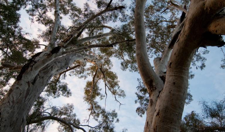
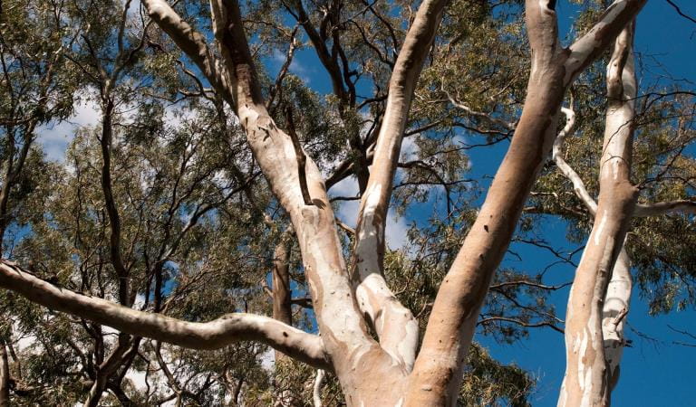
Tree safety
Do not park, camp or rest under or near large trees, like River Red Gums. Branches may fall at any time and swing away from the tree. Whole trees can also fall without warning. Rope swings are not recommended.
Water safety
Rivers may have fast currents, cold water, low visibility, underwater objects, slippery rocks, shallow areas, unstable banks, drop offs and deep holes. Always enter the water slowly, feet first. Do not dive or jump in. Submerged objects can cause neck or spinal injuries. Never swim alone or in flood waters. Drinking alcohol significantly increases the risk of drowning. Always actively supervise children in or near water: children under ten should always be within sight; children under five should always be within reach. Lifejackets and flotation devices are recommended.
When the river is in flood, some areas of the River Murray Reserve may be closed for public safety. Check below for the latest conditions and respect closures and signage. Do not walk, ride, or drive through flooded areas.
Mosquitoes
Mosquito-borne diseases, including Ross River Fever and Barmah Forest Virus occur in the area. Avoid being bitten by using repellent and wearing long sleeves and pants, particularly around dawn and dusk.
Change of Conditions
Nature being nature, sometimes conditions can change at short notice. It’s a good idea to check this page ahead of your visit for any updates.
-
Notices Affecting Multiple Parks
Murray River Adventure Trail
Stage One of the Murray River Adventure Trail proposes new canoe and kayak launches, pedestrian links and new facilities at key visitor sites from Barmah National Park to Koondrook. Stage One will pass through Echuca, Murray River Reserve, Gunbower National Park and Lower Goulburn National Park. Find out more about the project.