River Murray Reserve
Explore
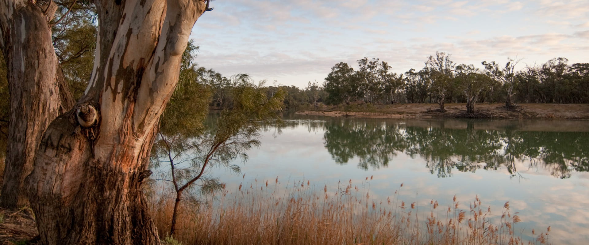
River Murray Reserve
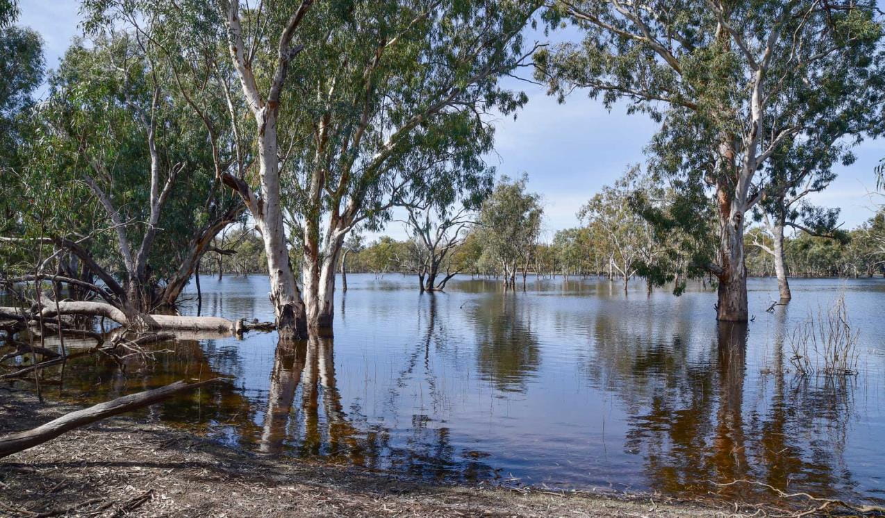
Parks and reserves along the majestic Murray River protect significant Aboriginal cultural heritage, towering river red gums, sandy beaches, colourful red cliffs, diverse permanent and seasonal wetlands and a rich array of wildlife.
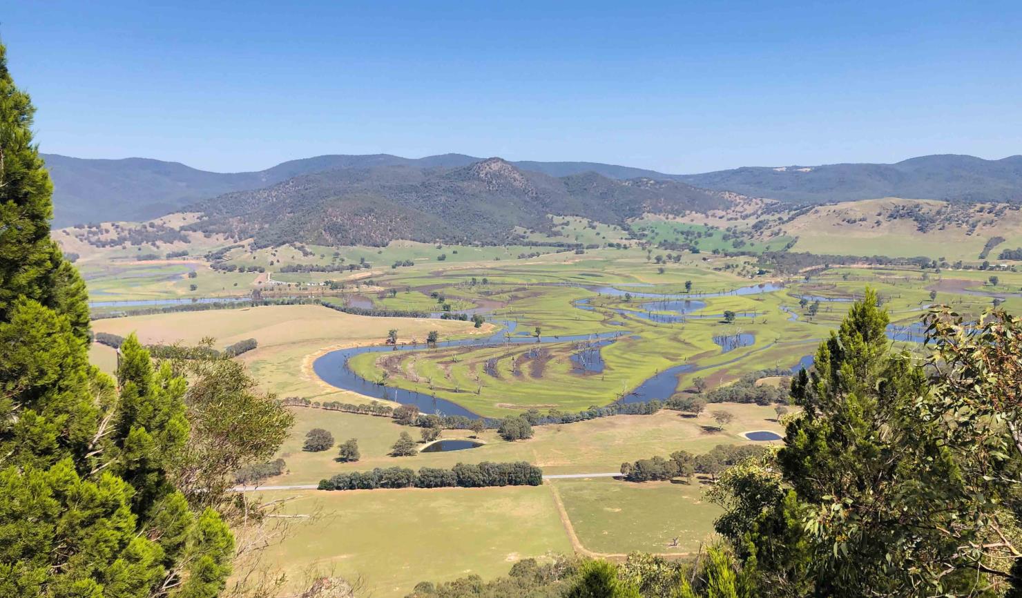
From its source in the Australian Alps, the Murray River twists and turns through alpine grasslands, rugged mountains, and rolling farmland before flowing into Lake Hume. On its way, it passes Burrowa-Pine Mountain National Park, Mount Lawson and Mount Granya State Parks and the River Murray Reserve, changing from a clear mountain stream with gravel bars to the iconic Murray River of the floodplains.
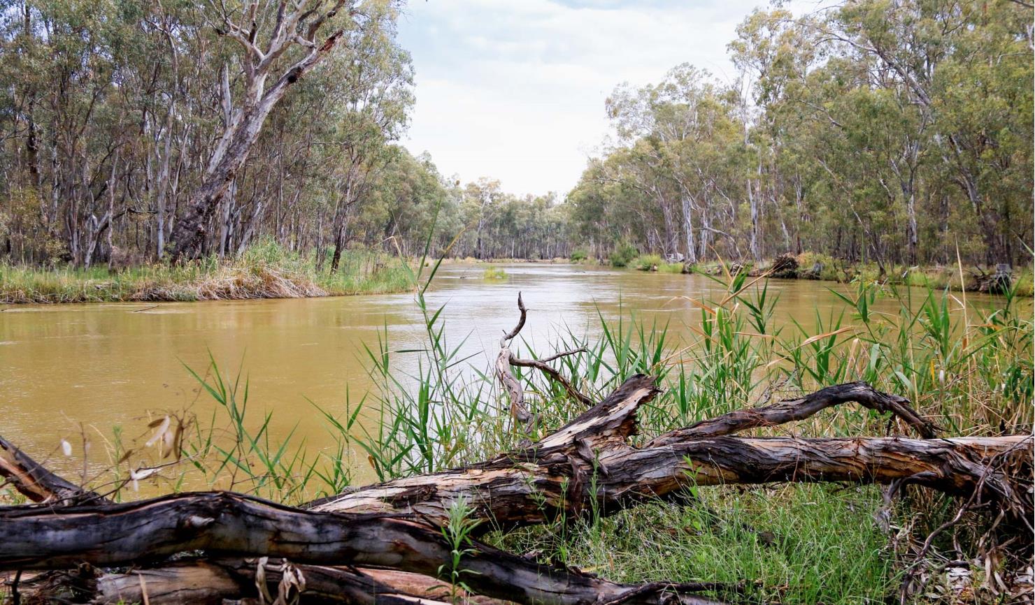
Below Lake Hume, the Murray meanders down through gentle hills and on to extensive floodplains supporting River Red Gum forests and countless lakes and wetlands. The Barmah and Gunbower Forests, Kerang Lakes, and Hattah Lakes, are internationally significant RAMSAR wetlands, renowned for their waterbirds and other wildlife.
The river becomes wider and shallower as it passes through Mallee bushland, providing an oasis for plants and wildlife in this semi-arid landscape. As it approaches Mildura, it cuts through dramatic red cliffs before spilling out into the wetlands of Kings Billabong and Merbein Common. Finally, it winds through Walpolla, Mulcra and Lindsay Islands, part of Murray-Sunset National Park – a remote landscape of starry nights and wide horizons – before reaching the border with South Australia.
From bushwalking and birdwatching, to fishing and watersports, the Murray River offers something for everyone. Its sandy beaches are very popular over the summer and Easter holidays, but there are many secluded riverside camping and picnic sites. Most have few facilities other than occasional picnic tables, fireplaces and boat ramps.
See below to learn more about the different parks, reserves and experiences along each reach of the river, and which visitor sites may be open or closed.
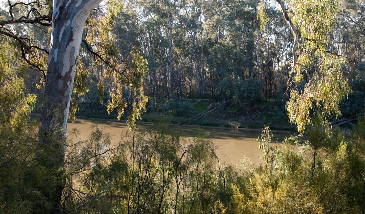
South Australia border to Piangil
Meandering through the dry Mallee, the Murray River is an oasis in an otherwise arid landscape. Its wetlands provide a haven for wildlife and visitors alike. Spend peaceful nights camping under star-filled skies. Swim, fish, paddle or relax on a sandy beach, or explore the natural and cultural history of Nyah Vinifera, Kings Billabong and Merbein Common.
Related Sites
-
�
-
A
-
B
- Barra Bend Camping Area 2 (River Murray Reserve)
- Betha Bend Camping Area Site 2 (River Murray Reserve)
- Barmah Willows (River Murray Reserve, Proposed Murray River Park (part))
- Bouchiers Beach (River Murray Reserve, Proposed Murray River Park (part))
- Betha Bend Camping Area Site 1 (River Murray Reserve)
- Burnanga Bend Camping Area Site 3 (River Murray Reserve)
- Betha Bend Camping Area Site 3 (River Murray Reserve)
- Buchanans Bend 2 Camping Area (River Murray Reserve)
- Braund Bend Camping Area site 3 (River Murray Reserve)
- Bruce's Bend Boat Ramp (River Murray Reserve, Kings Billabong Park)
- Benwell camping area 4 (River Murray Reserve, BENWELL STATE FOREST)
- Barmah Island Central Camping Area (River Murray Reserve, Proposed Murray River Park (part))
- Baillieu Bend Camping Area 2 (Baillieu Lagoon Wildlife Reserve (hunting), River Murray Reserve)
- Bruces 1 High Bank (River Murray Reserve)
- Buchanans Camping Area (River Murray Reserve)
- Burra Camping Area (River Murray Reserve)
- Brookes Lane Camping Area (River Murray Reserve)
- Benwell camping area 5 (River Murray Reserve)
- Burrowye Bend Visitor Site (River Murray Reserve)
- Bruces Hidaway Camping Area (River Murray Reserve)
- Burnanga Bend Camping Area site 2 (River Murray Reserve)
- Boundary Track Camping Area (Piambie) (River Murray Reserve)
- Bourkes Bend Beach no. 2 Camping Area (River Murray Reserve, Proposed Murray River Park (part))
- Barra Bend Camping Area 1 (River Murray Reserve)
- Baillieu Bend Camping Area 1 (River Murray Reserve, Baillieu Lagoon Wildlife Reserve (hunting))
- Billy Goat Camping Area (Proposed Murray River Park (part), River Murray Reserve)
- Burnanga Bend Camping Area Site 4 (River Murray Reserve)
- Braund Bend Camping Area site 1 (River Murray Reserve)
- Boundary Bend Straight Camping Area (River Murray Reserve)
- Bruces Bend Mooring Zone Day Visitor Area (River Murray Reserve)
- Bourkes Lagoon Camping Area (River Murray Reserve, Proposed Murray River Park (part))
- Boundary Bend Camping Area (River Murray Reserve)
- Braund Bend Day visitor area (River Murray Reserve)
- Barham Mill Bend camping area 1 (River Murray Reserve)
- Baldwin Bend camping area (River Murray Reserve)
- Billabong Track camping area 2 (River Murray Reserve)
- Bourkes Beach Camping Area No. 1 (River Murray Reserve, Proposed Murray River Park (part))
- Brentalls Beach (Proposed Murray River Park (part), River Murray Reserve)
- Boomagong (River Murray Reserve)
- Beggs Bend Camping Area (River Murray Reserve)
- Buxtons Bend Camping Area (River Murray Reserve, Proposed Murray River Park (part))
- Broken River Bend Camping Area (River Murray Reserve)
- Benwell camping area 3 (River Murray Reserve, BENWELL STATE FOREST)
- Billabong Track Camping Area (River Murray Reserve)
- Bourkes Bend No. 3 Beach Camping Area (Proposed Murray River Park (part), River Murray Reserve)
- Burnanga Bend Camping Area site 1 (River Murray Reserve)
- Barmah Island North Camping Area (Proposed Murray River Park (part), River Murray Reserve)
- Benwell camping area 1 (BENWELL STATE FOREST, River Murray Reserve)
- Black Swamp camping area (River Murray Reserve)
- Barham Mill Bend camping area 2 (River Murray Reserve, GUNBOWER STATE FOREST)
- Bonnie Doon Bend Camping Area (River Murray Reserve)
- Buchanans Bend 1 Camping Area (River Murray Reserve)
- Baillieu Bend Camping Area 4 (River Murray Reserve)
- Baggot Creek camping area (River Murray Reserve)
- Bruces Beach No. 2 Camping Area (Proposed Murray River Park (part), River Murray Reserve)
- Barmah Island South Camping Area (River Murray Reserve, Proposed Murray River Park (part))
- Braund Bend Camping Area site 2 (River Murray Reserve)
- Billabong Track camping area 1 (River Murray Reserve, GUTTRAM STATE FOREST)
- Benwell camping area 2 (River Murray Reserve, BENWELL STATE FOREST)
- Breens Beach Camping Area (River Murray Reserve, Proposed Murray River Park (part))
- Bottom Beach (Proposed Murray River Park (part), River Murray Reserve)
- Baillieu Bend Camping Area 3 (River Murray Reserve)
- Bruces Beach No. 1 Camping Area (River Murray Reserve)
-
C
- Carp Hole Camping Area (Belsar Island) (River Murray Reserve)
- Colignan Mooring Zone (River Murray Reserve)
- Centre Track Camping Area (Nurrung) (Proposed Murray River Park (part), River Murray Reserve)
- Cobrawonga Beach No. 2 Camping Area (River Murray Reserve)
- Customs House (River Murray Reserve)
- Crossman Bend Camping Area 2 (River Murray Reserve)
- Cobrawonga Beach Camping Area No. 1 (Proposed Murray River Park (part), River Murray Reserve)
- Cobrawonga Creek Camping Area (River Murray Reserve)
- Casey Bend Camping Area Site 2 (River Murray Reserve, River Murray Reserve (non-PV))
- Clump Bend camping area (River Murray Reserve)
- Casey Bend Camping Area site 1 (River Murray Reserve (non-PV), River Murray Reserve)
- Chalmers Pump Camping Area (River Murray Reserve)
- Crossman Bend Camping Area 1 (River Murray Reserve, River Murray Reserve (non-PV))
- Cods Head Reef (Yungera Island) Camping Area (River Murray Reserve)
- Colclough Bend Camping Area (River Murray Reserve)
- Cray Point Camping Area (River Murray Reserve)
- Caelli Lane Loddon Floodway Camping Area (Proposed Murray River Park (part), River Murray Reserve)
- Cod Hole Camping Area (River Murray Reserve)
-
D
- Duffty's Beach No. 1 (River Murray Reserve)
- Dry Creek Camping Area (River Murray Reserve, Proposed Murray River Park (part))
- Dicks Bend Camping Area (River Murray Reserve, Proposed Murray River Park (part))
- Dead River Bend Camping Area (Proposed Murray River Park (part), River Murray Reserve)
- Duffty's Beach No. 2 (River Murray Reserve)
- Dead River Beach (River Murray Reserve, Proposed Murray River Park (part))
- Doctors Bend Camping area (River Murray Reserve, Proposed Murray River Park (part))
- Dead Mans Hole Camping Area (River Murray Reserve)
- Doolans Bend (River Murray Reserve)
- Doctors Beach Camping Area (River Murray Reserve, Proposed Murray River Park (part))
- Davies Beach (River Murray Reserve, Proposed Murray River Park (part))
- Dry Creek Camping Area West (Nurrung) (Proposed Murray River Park (part), River Murray Reserve)
-
E
-
F
- Five Sleeper Camping Area 2 (River Murray Reserve)
- Forest Bend Track Camping Area 2 (River Murray Reserve)
- Forest Bend Track Camping Area 1 (River Murray Reserve)
- Farley Bend Camping Area Site 3 (River Murray Reserve)
- Five Sleeper Camping Area 1 (GUNBOWER STATE FOREST, River Murray Reserve)
- Farley Bend Camping Area Site 1 (River Murray Reserve)
- Fig Tree Camping Site (River Murray Reserve)
- Farley Bend Camping Area Site 2 (River Murray Reserve)
- Farley Bend Camping Area Site 9 (River Murray Reserve)
- Forest Beach Camping area (River Murray Reserve, Proposed Murray River Park (part))
- Farley Bend Camping Area Site 5 (River Murray Reserve)
- Farley Bend Camping Area Site 6 (River Murray Reserve)
- Farley Bend Camping Area Site 7 (River Murray Reserve)
- Farley Bend Camping Area Site 4 (River Murray Reserve)
- Farley Bend Camping Area Site 8 (River Murray Reserve)
-
G
- Granthams Bend Camping Area (River Murray Reserve, Proposed Murray River Park (part))
- Greens Beach (River Murray Reserve, Proposed Murray River Park (part))
- Glasshouse Sandbar Camping Area (River Murray Reserve, Proposed Murray River Park (part))
- Guttrum camping area 2 (River Murray Reserve)
- Gona Bend Camping Area 1 (River Murray Reserve)
- Guttrum camping area 3 (River Murray Reserve)
- Gear Box Loop Camping Area 1 (River Murray Reserve)
- Goose Neck Camping Area (Pile Bend) (River Murray Reserve, Proposed Murray River Park (part))
- Grassy Beach (River Murray Reserve, Proposed Murray River Park (part))
- Graveyard Bend Camping Area (Kenley) (River Murray Reserve)
- Graces Bend Camping Area (River Murray Reserve)
- Gear Box Loop Camping Area 2 (River Murray Reserve, Proposed Murray River Park (part))
- Gundagai Bend Camping Area (Kenley) (River Murray Reserve)
- Gravel Bend Beach (Proposed Murray River Park (part), River Murray Reserve)
- Gona Bend Camping Area 2 (River Murray Reserve)
- Guttrum camping area 1 (River Murray Reserve)
-
H
- Horseshoe Bend Camping Area 4 (River Murray Reserve)
- Happy Valley Landing Camping Area (Proposed Murray River Park (part), River Murray Reserve)
- Hopcroft Camping Area (River Murray Reserve)
- Horseshoe Bend Camping Area 2 (River Murray Reserve)
- Hideaway Camping Area (River Murray Reserve)
- High Bank Camping Area ( Beggs Bend) (River Murray Reserve)
- Horseshoe Bend Camping Area 3 (River Murray Reserve)
- Happy Valley Reef Camping Area (Proposed Murray River Park (part), River Murray Reserve, Gadsen Bend Park)
- Hungry Dog Point (River Murray Reserve)
- Horseshoe Bend Camping Area 1 (River Murray Reserve)
- Horseshoe Bend Camping Area - Iraak (River Murray Reserve)
- Hiskins Bend (River Murray Reserve)
-
I
-
J
- Jimmy's Island camping Area (River Murray Reserve)
- Jones Bend Camping Area 5 (River Murray Reserve)
- Jones Bend Camping Area 1 (River Murray Reserve)
- Jones Bend Camping Area 2 (River Murray Reserve)
- Johnsons Bend Camping Area (River Murray Reserve)
- Jones Bend Camping Area 4 (River Murray Reserve)
- Jones Bend Camping Area 6 (River Murray Reserve)
- Junction Park Track Camping Area (Piambie) (Proposed Murray River Park (part), River Murray Reserve)
- Jones Bend Camping Area 3 (River Murray Reserve)
-
K
- Karadoc Mooring Zone Day Visitor Area (River Murray Reserve)
- Kenley Camping Area (Piambie) (River Murray Reserve)
- Korpy's Crossing Camping Area (River Murray Reserve)
- Kiln Loop Track Camping Area 2 (Proposed Murray River Park (part), River Murray Reserve)
- Karadoc Sandbar Camping Area (River Murray Reserve)
- Killers Beach Camping Area (River Murray Reserve)
- Knights Bend Camping Area (River Murray Reserve)
- Kellys Pump Camping Area (River Murray Reserve)
-
L
- Latterns Bend Camping Area (River Murray Reserve)
- Lock 10 Day Visitor Area (River Murray Reserve)
- Long Beach Camping Area (Proposed Murray River Park (part), River Murray Reserve)
- Lagoon Camping Site (River Murray Reserve)
- Loddon Floodway - Eastern Bend Camping Area (River Murray Reserve, Proposed Murray River Park (part))
- Langi oonah Camping Area (River Murray Reserve, Proposed Murray River Park (part))
- Local Haven Camping Area (River Murray Reserve)
- Loddon Floodway - Middle Bend Camping Area (Proposed Murray River Park (part), River Murray Reserve)
-
M
- Masters Bend Camping Area (River Murray Reserve)
- Murrumbidgee Camping Area (River Murray Reserve)
- Meliman Loop Camping Area (Belsar Island) (River Murray Reserve, Proposed Murray River Park (part))
- McKenzie Bend camping area (River Murray Reserve)
- Masters Landing day visitor area 1 (River Murray Reserve)
- Moodemere Bend Camping Area (River Murray Reserve)
- Masters Landing day visitor area 2 (River Murray Reserve)
- Margooya Regulator Picnic Table (Proposed Murray River Park (part), River Murray Reserve)
- Murrumbidgee Junction Camping Area (River Murray Reserve)
- Merbein Mooring Zone Day Visitor Area (River Murray Reserve)
- Masters Landing Camping area (River Murray Reserve)
- Milverton Bend camping area 1 (River Murray Reserve)
- Merbein Dispersed Camping Area (Proposed Murray River Park (part), River Murray Reserve)
- Merbein Common Sandbar (River Murray Reserve)
- Morton Bend camping area (River Murray Reserve)
- Millers Swing Camping Area (River Murray Reserve)
- McKay Mill Bend Camping Area 3 (River Murray Reserve)
- Mckays Beach (River Murray Reserve, Proposed Murray River Park (part))
- Merbein RV & Camping Area (River Murray Reserve)
-
N
- Nevins Beach Camping Area (River Murray Reserve)
- Narrung Cutting Track Camping Area (Piambie) (Proposed Murray River Park (part), River Murray Reserve)
- Narcooyia Creek Camping Area (Proposed Murray River Park (part), River Murray Reserve)
- Norris Bend Camping Area 2 (Gunbower National Park, River Murray Reserve)
- Nugent Bend camping area 1 (River Murray Reserve)
- Nugent Bend camping area 2 (River Murray Reserve)
- Nevins East High Bank 1 (River Murray Reserve)
- Norris Bend Camping Area 1 (Gunbower National Park, River Murray Reserve)
- Nangiloc Mooring Zone (River Murray Reserve)
- Neils Bend (River Murray Reserve (non-PV), River Murray Reserve)
- Nyah-Vinifera Park - Wood Wood Camping Area (Nyah-Vinifera Park, Ecologically Managed Minor Area Park, River Murray Reserve)
- Nevins Beach East Camping Area (River Murray Reserve, Proposed Murray River Park (part))
-
O
-
P
- Police Bend Camping Area 1 (River Murray Reserve)
- Point Beach Camping Area (Proposed Murray River Park (part), River Murray Reserve)
- Percys Beach (Proposed Murray River Park (part), River Murray Reserve)
- Punt Bend Camping Area (River Murray Reserve)
- Pianta Bend Camping Area Site 5 (River Murray Reserve)
- Pianta Bend Camping Area (River Murray Reserve)
- Passage Camp - Camping Area (River Murray Reserve, Proposed Murray River Park (part))
- Pianta Bend Camping Area Site 3 (River Murray Reserve)
- Pianta Bend Camping Area site 1 (Off Nolan Road) (River Murray Reserve)
- Police Bend Camping Area 2 (River Murray Reserve)
- Pianta Bend Camping Area Site 4 (River Murray Reserve)
- Pump Beach Camping Area (River Murray Reserve, Proposed Murray River Park (part))
- Pumphouse Beach Camping Area (River Murray Reserve, Proposed Murray River Park (part))
- Pound Bend Camping Area (River Murray Reserve)
- Paradise Beach Camping Area (Beggs Bend) (Proposed Murray River Park (part), River Murray Reserve)
- Pianta Bend Camping Area site 2 (River Murray Reserve)
- Pile Bend Billabong Camping Area (River Murray Reserve)
- Pauls Track Camping Area (Piambie) (River Murray Reserve)
- Pile Bend Camping Area (River Murray Reserve)
- Pebble Beach (River Murray Reserve (non-PV), River Murray Reserve)
-
R
- Redbank Beach (River Murray Reserve)
- Runciman Road South Camping Area (River Murray Reserve)
- Robinvale Cutting Picnic Area (River Murray Reserve (non-PV), River Murray Reserve)
- Racecourse Rd Camping Site (Cobram Regional Park, River Murray Reserve)
- River Track East Camping Area 2 (Belsar Island) (River Murray Reserve)
- River Track Camping Area (Belsar Island) (River Murray Reserve)
- River Track East Camping Area 1 (Belsar Island) (River Murray Reserve, Proposed Murray River Park (part))
- Runciman Road North Camping Area (River Murray Reserve)
- Regulator Camping Area (Beggs Bend) (River Murray Reserve)
-
S
- Sharpes Beach Camping Area (River Murray Reserve, Proposed Murray River Park (part))
- Spences Bend Boat Ramp (River Murray Reserve)
- Sandbar loop camping area 1- Nurrung (River Murray Reserve)
- Snaggy Point camping area 2 (River Murray Reserve)
- Sheppards Track camping area 2 (River Murray Reserve)
- Station Peir Piles Camping Area (River Murray Reserve)
- Stantons Bend Camping Area (River Murray Reserve)
- Sandbar Loop Camping Area (Nurrung) (River Murray Reserve)
- Seppelts Beach Camping Site (River Murray Reserve, Proposed Murray River Park (part))
- Shaws Flat Camping Area (River Murray Reserve)
- Sandbar Track Camping Area (Belsar Island) (River Murray Reserve)
- Shepards Track camping area 1 (River Murray Reserve)
- St Leonards Bend Camping Area (River Murray Reserve, Proposed Murray River Park (part))
- Spences Bend Camping Area (River Murray Reserve)
- St Kilda Sandbar Camping Area (Walsh's Bend) (River Murray Reserve)
- Snaggy Point camping area 3 (River Murray Reserve)
- Snaggy Point Boat Ramp (River Murray Reserve)
- Snaggy Point camping area 1 (River Murray Reserve, UNKNOWN)
- Sawpit Track camping area (River Murray Reserve)
- Snaggy Point Camping Area (River Murray Reserve)
- Sylvia St Boat Ramp Day Visitor Area (River Murray Reserve)
-
T
- Turner Bend Camping Area 5 (River Murray Reserve)
- Tolhurst Bend Camping Area 1 (River Murray Reserve, Baillieu Lagoon Wildlife Reserve (hunting))
- Tolhurst Bend Camping Area 2 (River Murray Reserve, Baillieu Lagoon Wildlife Reserve (hunting))
- Turner Bend Camping Area 6 (River Murray Reserve)
- The Fridge Camping Area (Yungera Island) (River Murray Reserve)
- Tammit Bend Camping Area (River Murray Reserve)
- The Flats (River Murray Reserve)
- Top End Beach (River Murray Reserve, Proposed Murray River Park (part))
- Town Pumps Straight Camping Area (Walsh's Bend) (River Murray Reserve)
- Torrumbarry Day Visitor Area (River Murray Reserve)
- Turner Bend Camping Area 3 (River Murray Reserve)
- Tooleybuc Bridge Day Visitor Area (River Murray Reserve)
- Turner Bend Camping Area 4 (River Murray Reserve)
- The Ranch Camping Area Site 5 (Proposed Murray River Park (part), River Murray Reserve)
- Turner Bend Camping Area 2 (River Murray Reserve)
- The Pumpshed Visitor Site (River Murray Reserve)
- The Ranch Camping Area Site 4 (River Murray Reserve, Proposed Murray River Park (part))
- Thompsons Track Camping Area 3 (River Murray Reserve)
- The Ranch Camping Area Site 3 (Proposed Murray River Park (part), River Murray Reserve)
- The Ranch Camping Area Site 6 (Proposed Murray River Park (part), River Murray Reserve)
- Thompsons Track Camping Area 4 (River Murray Reserve)
- Tol Tol Strait Camping Area ( Invincible Bend) (Proposed Murray River Park (part), River Murray Reserve)
- The Cove Camping Area (River Murray Reserve, Proposed Murray River Park (part))
- The Ranch Camping Area Site 1 (Proposed Murray River Park (part), River Murray Reserve)
- Taylors Bend Camping Area (River Murray Reserve)
- Twin Knobs Beach Camping Area (River Murray Reserve)
- Thompsons Track Camping Area 2 (River Murray Reserve, GUNBOWER STATE FOREST)
- Turner Bend Camping Area 1 (River Murray Reserve)
- Town Pumps Camping Area (Walsh's Bend) (River Murray Reserve)
- Trues High Bank (River Murray Reserve)
- Trues Beach (Proposed Murray River Park (part), River Murray Reserve)
- The Ranch Camping Area site 7 (Proposed Murray River Park (part), River Murray Reserve)
- Thompsons Track Camping Area 1 (GUNBOWER STATE FOREST, River Murray Reserve)
- The Saplings Camping Area (River Murray Reserve)
- Tol Tol Flat Camping Area (Walsh's Bend) (River Murray Reserve)
- The Ranch Camping Area Site 2 (Proposed Murray River Park (part), River Murray Reserve)
- Thistle Plain Track camping area (River Murray Reserve)
-
W
- Whistler camping area 2 (GUNBOWER STATE FOREST, River Murray Reserve)
- Wire Fence Camping Area 3 (River Murray Reserve)
- Wills 2 Camp site (River Murray Reserve)
- Wire Fence Camping Area 1 (River Murray Reserve, GUNBOWER STATE FOREST)
- Wire Fence Camping Area 4 (River Murray Reserve)
- Williams Bend Camping Area 1 (River Murray Reserve)
- Wills Bend site 5 (River Murray Reserve)
- Wire Fence Camping Area 5 (River Murray Reserve)
- Williams Bend Camping Area 3 (River Murray Reserve, Gunbower National Park)
- Williams Bend Camping Area 2 (River Murray Reserve)
- Weidners Road (River Murray Reserve)
- Whistler camping area 3 (River Murray Reserve, GUNBOWER STATE FOREST)
- Windomal Loop Camping Area (Piambie) (Proposed Murray River Park (part), River Murray Reserve)
- Whistler camping area 1 (River Murray Reserve)
- Worthy Bend camping area 1 (River Murray Reserve)
- Worthy Bend camping area 2 (River Murray Reserve)
- Weiss Beach Camping Area (Proposed Murray River Park (part), River Murray Reserve)
- Wakool Junction Camping Area (River Murray Reserve)
- Wills Bend Site 3 (River Murray Reserve)
- Wills Bend site 4 (River Murray Reserve)
- Wire Fence Camping Area 2 (River Murray Reserve, GUNBOWER STATE FOREST)
- Wills Bend Camping Area 1 (River Murray Reserve)
- Wills Bend Camping Area (River Murray Reserve)
- Wee Wee Rup Camping Area (Gunbower National Park, River Murray Reserve)
- Wide Beach Camping Area (River Murray Reserve, Proposed Murray River Park (part))
-
Y
-
Z
Need to know
River Murray Reserve
Accessibility
Visiting a park can be more of a challenge for people with disabilities, however in Victoria there are a wide range of facilities to help people of all abilities enjoy our wonderful parks around the state.
Assistance dogs are welcome in Parks Victoria parks and reserves. Entry requirements apply for parks and reserves that are usually dog prohibited, such as national parks.
Bushfire safety
The parks and reserves along the Victorian side of the Murray River are in the following fire districts:
- South Australian border to Leitchville – Mallee fire district
- Leitchville to the Ovens River – Northern Country fire district
- Ovens River to Alpine National Park – North East fire district
Bushfire safety is a personal responsibility. Anyone entering parks and forests during the bushfire season needs to stay aware of forecast weather conditions. Check the Fire Danger Rating and for days of Total Fire Ban at www.emergency.vic.gov.au, on the VicEmergency smartphone app or call the VicEmergency Hotline on 1800 226 226. There is limited or no mobile reception away from towns along the river, so check the forecast before you set out and tune into local radio stations for updates.
No fires may be lit on Total Fire Ban days. On Catastrophic Fire Danger Rating days many parks close for public safety. Do not enter parks. If you are already in a park, leave the night before or as early as possible in the morning. Check below for park closures or call 13 1963.
Tree safety
Do not park, camp or rest under or near large trees, like River Red Gums. Branches may fall at any time and swing away from the tree. Whole trees can also fall without warning. Rope swings are not recommended.
Water safety
Rivers may have fast currents, cold water, low visibility, underwater objects, slippery rocks, shallow areas, unstable banks, drop offs and deep holes. Always enter the water slowly, feet first. Do not dive or jump in. Submerged objects can cause neck or spinal injuries. Never swim alone or in flood waters. Drinking alcohol significantly increases the risk of drowning. Always actively supervise children in or near water: children under ten should always be within sight; children under five should always be within reach. Lifejackets and flotation devices are recommended.
When the river is in flood, some areas of the River Murray Reserve may be closed for public safety. Check below for the latest conditions and respect closures and signage. Do not walk, ride, or drive through flooded areas.
Mosquitoes
Mosquito-borne diseases, including Ross River Fever and Barmah Forest Virus occur in the area. Avoid being bitten by using repellent and wearing long sleeves and pants, particularly around dawn and dusk.
Change of Conditions
Nature being nature, sometimes conditions can change at short notice. It’s a good idea to check this page ahead of your visit for any updates.
-
Notices Affecting Multiple Parks
Murray River Adventure Trail
Stage One of the Murray River Adventure Trail proposes new canoe and kayak launches, pedestrian links and new facilities at key visitor sites from Barmah National Park to Koondrook. Stage One will pass through Echuca, Murray River Reserve, Gunbower National Park and Lower Goulburn National Park. Find out more about the project.
Tours and adventure experiences in parks
One of the best ways you can get into nature is with a Licensed Tour Operator.
There are more than 400 Licensed Tour Operators across Victoria who are ready and waiting to help you experience and connect with Victoria’s spectacular parks and waterways.
Discover more than 60 different types of nature-based experiences including hiking, mountain biking, boating, four-wheel driving, indigenous culture tours, birdwatching, surfing, diving and so much more.
Licensed Tour Operators know all the best places to go and will plan and prepare your visit to ensure you are safe and can enjoy your nature-based adventure to the fullest.