Explore
Dandenong Ranges National Park
The forested slopes of the Dandenong Ranges are a place of tranquil forest walks, quaint hilltop towns and charismatic animals such as lyrebirds and wallabies. Conquer the famous 1000 Steps, discover Olinda Falls and enjoy commanding views over Melbourne and the Yarra Valley.
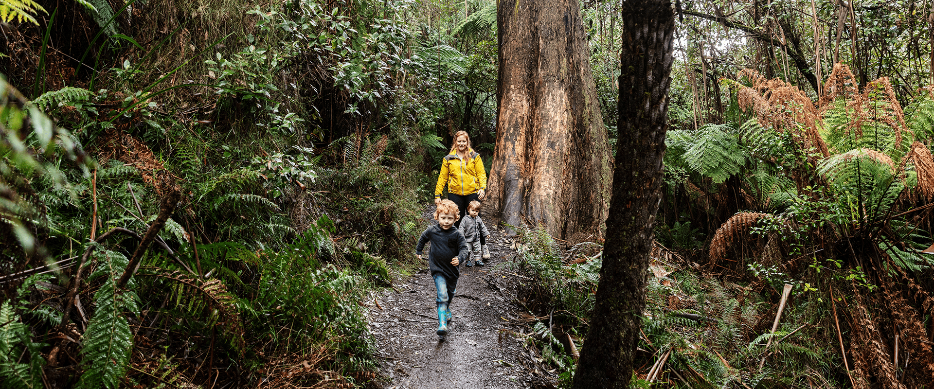
The Dandenong Ranges is a rainforest getaway on Melbourne's doorstep. A short drive or train ride from the city you will find steep volcanic hills covered in stands of the world's tallest flowering tree, the Mountain Ash. Living among the greenery are wallabies, lyrebirds, wombats and the Powerful Owl so please ensure you leave your dogs at home to avoid disturbing the local wildlife.
Take an energetic walk up the 1000 Steps from Ferntree Gully Picnic Area and learn about its poignant association with Australia's Second World War veterans and the Kokoda Track Campaign.
The mountains of the Dandenong Ranges offer stunning views across Melbourne. Waterfalls are also a feature of this cool temperate rainforest. Olinda Falls and Sherbrooke Falls are best after rain. Just don't forget to wear hiking boots!

1000 Steps Walk
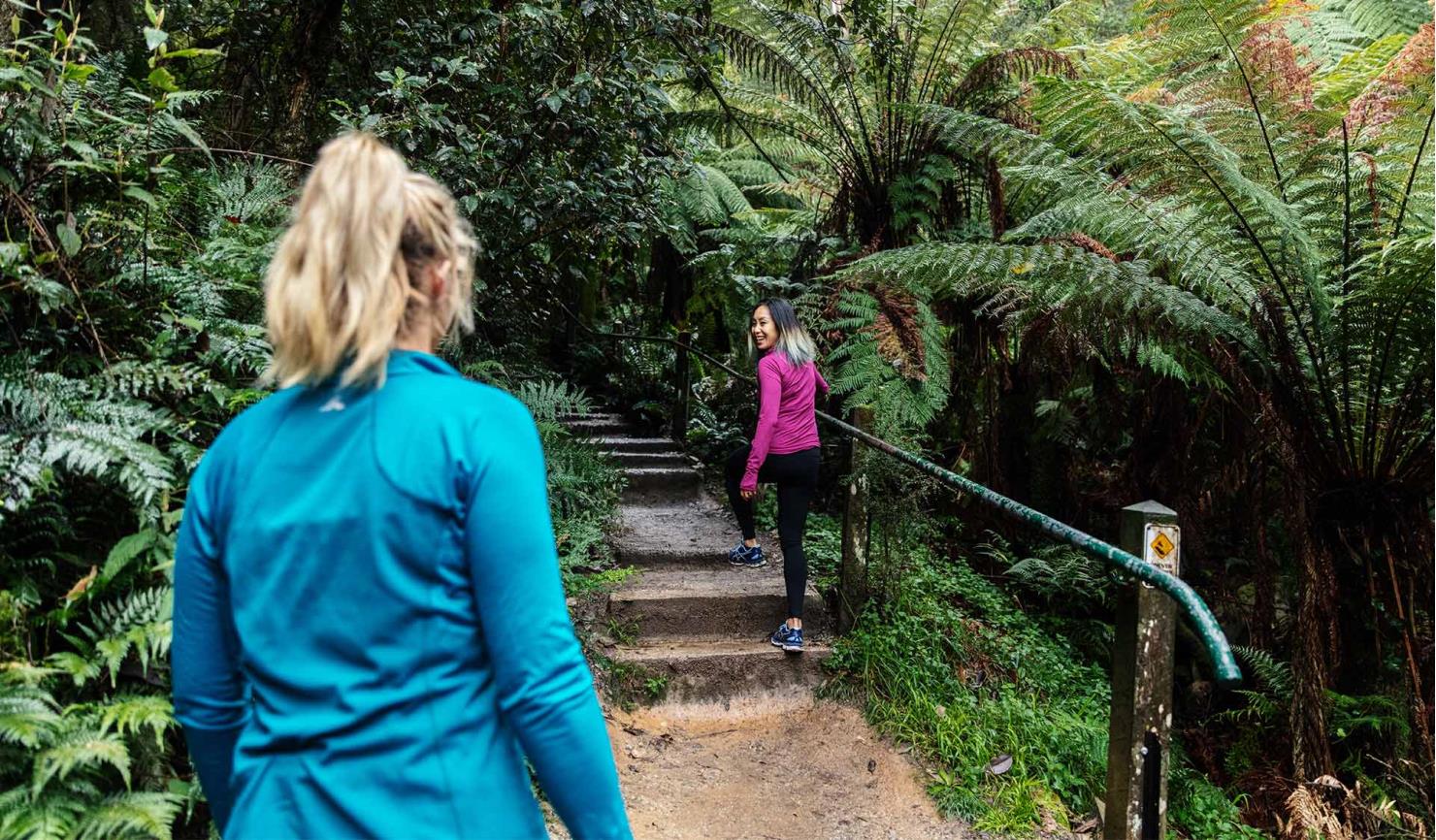
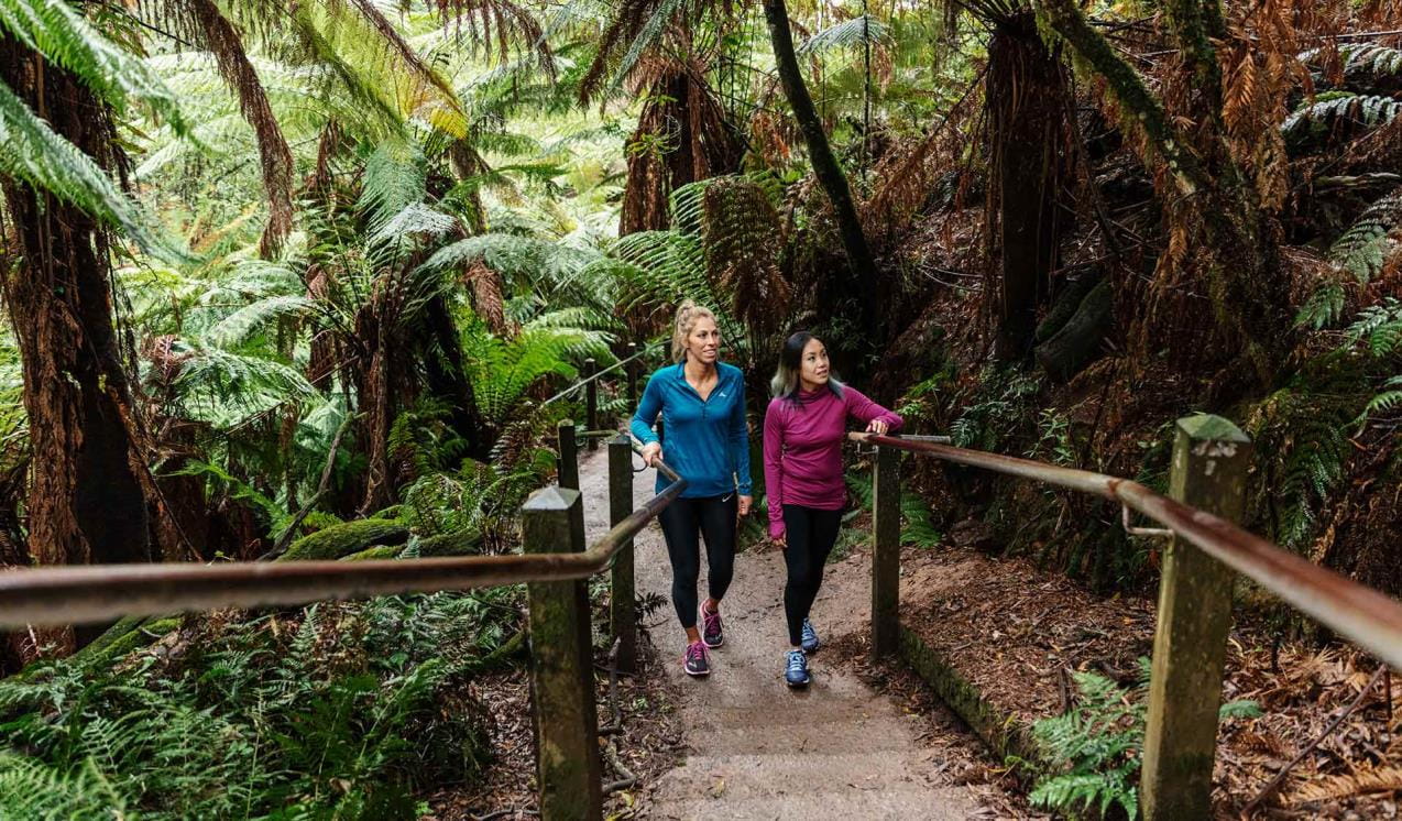
The 1000 Steps is probably Melbourne’s most popular bushwalk. Officially the Kokoda Track Memorial Walk, runners love the challenge of the steep trail, locals appreciate the convenience and tourists just want a picture of a gorgeous rainforest walk.
Sherbrooke Falls walk and picnic area
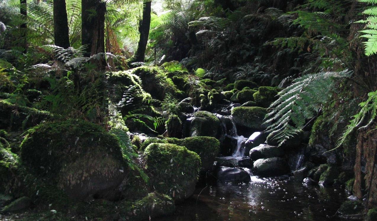
Deep in the Sherbrooke Forest, you'll find Sherbrooke Falls, where little creek cascades into a delightful gully.
When you're there
Download the Dandenong Ranges National Park visitor guide for more information about the park and the plethora of experiences to be had within its borders.
See the Dandenong Ranges National Park map for an overview of the area. For a detailed look, see maps of Doongalla Area, Fern Tree Gully Area, Olinda Area and Sherbrooke Area. Dandenong Ranges maps are also available on Avenza Maps.
Please note, dogs are not allowed in the Dandenong Ranges National Park.
Need to know
Dandenong Ranges National Park
Accessibility
Visiting a park can be more of a challenge for people with disabilities, however in Victoria there are a wide range of facilities to help people of all abilities enjoy our wonderful parks around the state. Grants, O’Donohue, Sherbrooke, One Tree Hill and Ferntree Gully picnic grounds were assessed for accessibility in June 2020, providing information about the accessibility of these areas and photos.
Margaret Lester Forest Walk
TrailRider
Journey among the tallest flowering plants in the world, the Mountain Ash. Picnic with the melodious song of the Superb Lyrebird in the background. Discover rare orchids and marvel at the tree ferns with their link to ancient Gondwanaland. A TrailRider all-terrain wheelchair is the perfect way for park visitors with significant mobility limitations to explore the magnificence of Dandenong Ranges National Park.
Education Excursions
This park offers curriculum-aligned ranger-guided excursions for school students. Download the Education Program to find out more and book your visit.
Assistance Dogs
Assistance dogs are welcome in Parks Victoria parks and reserves. Entry requirements apply for parks and reserves that are usually dog prohibited, such as national parks.
Weddings
While Parks Victoria offers a range of stunning natural landscapes to hold your special day, please note that we do not accept any wedding ceremony or photography bookings in the Dandenong Ranges National Park. Find out more about wedding ceremony and wedding photography and filming permits for other Parks Victoria venues.
Subscribe to Parks Victoria
Sign up to receive the latest ideas, inspiration and news delivered right to your inbox.
Change of Conditions
Nature being nature, sometimes conditions can change at short notice. It’s a good idea to check this page ahead of your visit for any updates.
-
Kalorama Park Picnic Ground (Dandenong Ranges National Park)
Kalorama Park toilets are closed with the disabled toilet open for use
Kalorama Park toilets are closed due to asbestos being discovered in the building, recent vandalism exposed the wall panelling revealing that it contains asbestos. For public safety the affected toilets are closed until works are completed to remove and replace the wall panelling. The disabled toilet does not have asbestos wall cladding and will remain open for the public to use. A time frame for the remediation works is unknown and as soon as funding is secured the works will commence. -
Dandenong Ranges National Park
Mechanics Track partially closed
Mechanics Track has been reopened between Mount Dandenong Tourist Road and Farndons Road. The section of track between Farndons Road and Falls Road is expected to be re-opened by the end of July 2024. Re-opening has been slow given the amount of large trees and damaged assets that required removal and repairs from the 2021 major storm event. Note that the walking track is mostly an earthen trail and is wet and muddy for most of its length.Park Areas Closed Due To Deer Control Activities
Parks Victoria are continuing deer control ground-shooting operations in the Dandenong Ranges National Park. This program will be taking place between the hours of 6pm and 6am on a number of nights in 2024. Current dates of operation are;
10th- 14 June 2024
26th- 28th June 2024These control works are being undertaken by accredited and authorised contractors.For reasons of public safety, various areas of the park will be inaccessible during the evening throughout this period.Signage will be in place at official access points when control activities are occurring. For your own safety please observe the signage during this time and do not enter any closed areas.For further information please call 131963Attachments: Neighbour_Notification_Map_DRNP_2324_09012024010908957 (2,529KB)
Fox Control Dandenong Ranges National Park
Parks Victoria are continuing the fox control program in the Dandenong Ranges National Park to relieve predation to native fauna.Poison Baiting will occur between May - November 2024.Programs involve the use of buried poison baits and canid pest ejectors containing Sodium Monofluoroacetate (1080) and Para-aminopropiophenone (PAPP) in strategic locations across the park. Domestic dogs and cats are at risk from exposure to both poisons.Under the National Parks Act (1975) dogs and cats cannot be taken into or be allowed to remain within the Dandenong Ranges National Park. -
Grants Picnic Ground Hardy Gully Walk
Hardy Gully Nature Walk Closed due to storm damage
Hardy Gully Nature Walk has been badly impacted by a heavy rainfall event on the 15th of July 2024. Visitors are requested not to enter the closed trail due to deep scouring of the track surface. A repair date is unknown at this stage as we wait on the outcome of a possible insurance claim. -
Olinda Falls Picnic Area
Olinda Falls Lower Viewing Platform and Toilets are Closed
The Olinda Falls lower viewing platform is currently closed due to severe damage caused by a fallen tree. All access to the lower falls area is closed to the public. The viewing platform is expected to be replaced sometime in 2024.
The picnic facilities and upper viewing platform remain open with the exception of the public toilets, the toilets are closed permanently.
-
Eagle Nest Picnic Area
Eagles Nest Picnic Ground access road closure
Eagles Nest picnic ground access road is permanently closed to visitors vehicles at Silvan Road. Pedestrian access remains open. -
Valley Picnic Ground
Valley Picnic Ground access road is closed to cars
- Valley Picnic Ground access road is closed to visitors cars, visitors are still able to walk in and use the facilities.
-
Grants Picnic Ground Margaret Lester Forest Walk
Margaret Lester Forest Walk Upgrade Works
In 2024 the Margaret Lester Walking Track is being upgraded to provide an all abilities accessible walking experience. The track will have a 1.2metre wide concrete surface and handrails. Five new stopping points will be created along the track and directional and education signage will be upgraded so people can learn more about the area. Once complete, the track will be a Grade 1 walk, suitable for visitors with prams, wheelchairs or limited mobility, to enjoy the forest.For more information visit:www.parks.vic.gov.au/projects/melbourne-region/dandenong-ranges-national-park-grants-picnic-area-upgrades
Tours and adventure experiences in parks
One of the best ways you can get into nature is with a Licensed Tour Operator.
There are more than 400 Licensed Tour Operators across Victoria who are ready and waiting to help you experience and connect with Victoria’s spectacular parks and waterways.
Discover more than 60 different types of nature-based experiences including hiking, mountain biking, boating, four-wheel driving, indigenous culture tours, birdwatching, surfing, diving and so much more.
Licensed Tour Operators know all the best places to go and will plan and prepare your visit to ensure you are safe and can enjoy your nature-based adventure to the fullest.
How we keep it special
We aim to ensure that our valued parks, and the natural assets and cultural heritage they hold, can be enjoyed now and by future generations.