Anglesea and Aireys Inlet are framed by the natural splendor of the Great Otway National Park. Experience stunning coastal vistas, lush valleys, wild oceans, breathtaking coastal cliffs, waterfalls and tall eucalypt forest. Surf the iconic swells of Bells Beach, discover the delicate kaleidoscope of wildflowers in the heathlands of Anglesea, or snorkel and dive off Point Addis.
Spring wildflowers are spectacular in the heathlands around Anglesea which are the richest and most diverse vegetation community in Victoria. Discover them for yourself as the heathland erupts in springtime in vibrant colour.
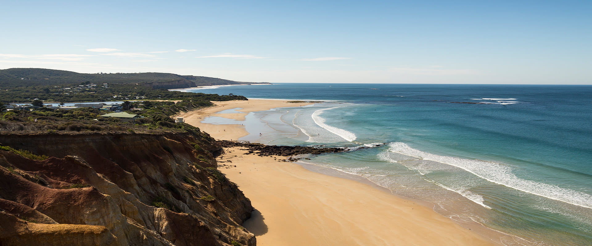
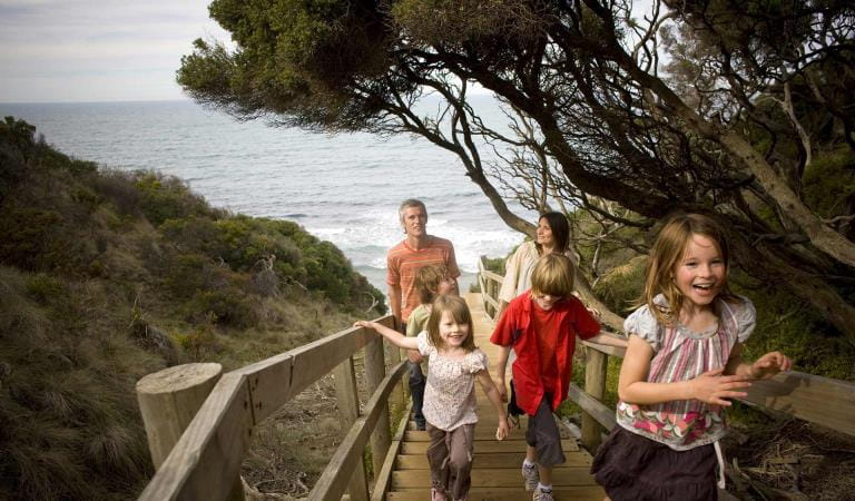
Moggs Creek is one of the many beautiful places in the park. Picnic, bushwalk, and explore the surrounds on Ocean View Track and its magnificent vista over the Great Ocean Road, Fairhaven and the ocean. Distillery Creek Picnic Area is another great picnic area with wood barbecues, tables, flushing toilets and linked nature walks and cycle trail. Shared pathways provide many opportunities for walking and cycling in this section of Great Otway National Park.
Try the more challenging walk or cycle offered on the 12km shared trail, Currawong Falls Circuit which starts from the Distillery Creek Picnic Area. The small and delicate Currawong Falls do not flow often and are at their best after heavy rain.
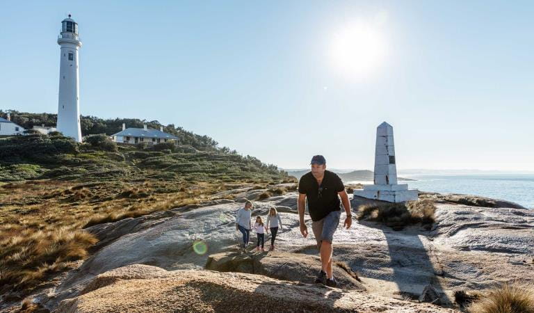
The Ironbark Basin to Anglesea section of the Surf Coast Walk is your chance to immerse yourself in nature. Pass by spectacular cliff tops, wind-swept heathlands and views of Anglesea and learn about the Traditional Owners and their ongoing and active connection to Country as you explore the Yirripa Yan (Wadawurrung Cultural Walk) and Ironbark Basin Circuit.
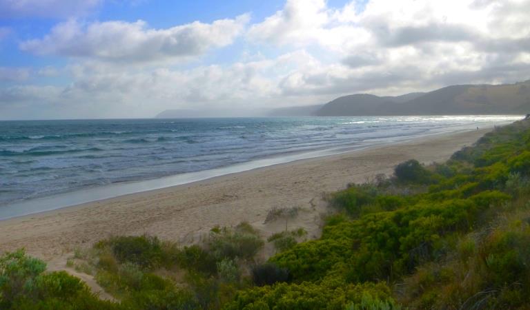
Surfers frequent a variety of beaches along this coastline including the world-famous Bells Beach and Addiscot Beach.
Point Addis Marine National Park is located in a spectacularly scenic area with wide sandy beaches. A staggering diversity of marine life live in the park’s coast and outer reefs. In calm weather and at low tide visitors can explore rock pools, dive and snorkel to explore the magnificent underwater world. Snorkelling is good at Jarosite and Ingoldsby Reef. Addiscot Beach is a great location for rock pooling at low tide.
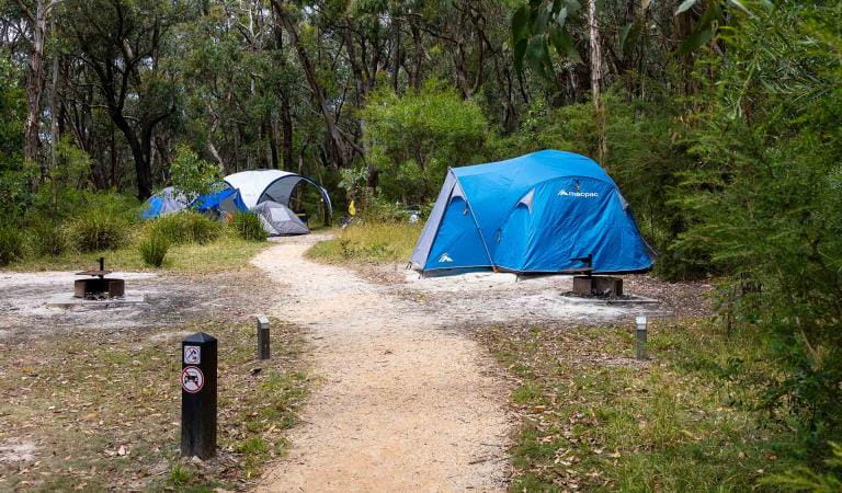
Hammonds Campground is located 12km inland from Aireys Inlet and is the ideal location for wildlife viewing and relaxation.
As beaches and coasts are natural environments, you may encounter hazards. Follow our water safety advice to make sure your day out at Anglesea and Aireys Inlet is a safe and enjoyable one.
Please Note:
The Great Ocean Road Coast and Parks Authority has been appointed as manager for part of the Great Otway National Park, from 1 July 2025.
The Authority will take over the responsibilities of Parks Victoria and ensure the Great Otway National Park continues to thrive and be enjoyed by locals and visitors for generations to come.
Parks Victoria continue to manage the majority of the Great Otway National Park, locations which are primarily accessed from the Princess Highway including Lake Elizabeth, Triplet Falls, Hopetoun Falls, Beachamp Falls, Stevenson Falls, Distillery Creek and many well-known mountain bike and walking trails, as well as Big Hill and Hammonds campgrounds and the Anglesea Heath, accessed via the Great Ocean Road.
Parks Victoria staff will continue to be visible in the area, as they will maintain their role in monitoring and caring for the land during the transition period. For more information visit Great Ocean Road Coast and Parks Authority.
Things to do
Hammonds Campground
Moggs Creek
Surf Coast Walk
How to get there
Anglesea and Aireys Inlet
A bus service runs between Geelong, Lorne and Apollo Bay, connecting with regional train services train services to Melbourne. Visit the PTV website for more information on buses and trains that connect to this part of Great Otway National Park.
When you're there
Need to know
Anglesea and Aireys Inlet
Accessibility
Visiting a park can be more of a challenge for people with disabilities, however in Victoria there are a wide range of facilities to help people of all abilities enjoy our wonderful parks around the state.
The Colac Otway Shire and Surf Coast Shire each have an all-terrain wheelchair, called a Trailrider, that is available for park visitors with mobility difficulties. The chairs can be booked with the respective shires.
Assistance dogs are welcome in Parks Victoria parks and reserves. Entry requirements apply for parks and reserves that are usually dog prohibited, such as national parks.
Change of Conditions
Nature being nature, sometimes conditions can change at short notice. It’s a good idea to check this page ahead of your visit for any updates.
-
Aire River West Campground (Aire River Heritage River)
Aire West Campground – Partial Seasonal Closure
Visitors are advised that sites 17–40 at Aire West Campground in Great Otway National Park are temporarily closed from 29 May to 25 September 2026 due to seasonal conditions.What to expect:Sites 17–40 are closed and unavailable for camping or vehicle access during this periodRemaining sites may still be accessible, subject to conditionsImportant information:The closure period may be extended if conditions remain too wet to safely support camping and vehicle accessVisitors are asked to follow any on-site signage and avoid closed areas to prevent damage to the campground and ensure safety.The Great Ocean Walk hike in camp site is not impacted.Entering into or camping within closed areas is subject to National Park regulationsWe appreciate your cooperation in helping protect the park during these conditions. -
Aire River East Campground (Aire River Heritage River)
Aire East Campground – Seasonal Closure
Aire East Campground in Great Otway National Park will be closed from 29 May to 25 September 2026 as part of the annual seasonal winter closure.This closure is necessary to protect the campground and access tracks during periods of wet weather, when conditions are highly susceptible to damage from vehicle use and camping activity.What to expect:No visitor or vehicle access to the campground during the closure period.Campground and toilet facilities will be unavailable.Important information:The closure period may be extended if conditions remain too wet to safely support vehicle access and camping.Visitors are encouraged to plan ahead and consider alternative campgrounds.We appreciate your cooperation in helping protect the park environment during this time. -
Notices Affecting Multiple Sites
Great Otway National Park Flood Closures
Severe thunderstorms and flash flooding on 16 January 2026 has caused significant damage across parts of the eastern Great Otway National Park.For public safety, the following areas are closed until further notice while assessments and clean-up works are undertaken:Closures included but are not limited to :Erskine falls is limited to the top viewing platform. Access to the base of the falls and along the river track is closed.
Roads & TracksWye RdCurtis TrackGodfrey TrackJamieson Track
Walking tracks
St George
Phantom falls
Lemonade ck
Kalimna
Henderson
Cumberland
Cumberland Garvey Link
Kalimna Garvey LinkCora LynnErskine Falls Walking TrackWon WondahAlternative walking tracks can be found at:Moggs Creek picnic areaDistillery Creek picnic areaOcean TrackCastle RockSheoak Falls to Swallow cavesMany roads, tracks and visitor facilities are impacted by debris, flooding and unstable conditions.The Great Ocean Road has been impacted,Always follow safety signage and directions from response crews, and do not enter any closed areas.Thank you for your patience and understanding as works are undertaken to make these popular areas safe to visit again. -
Ironbark Basin Nature Trail
Surf Coast walk/ Ironbark Nature trail closure
The Ironbark Nature trail loop is undergoing storm damage repairs. It will be closed for the duration of the works. The section of the Surf Coast Walk between Ironbark carpark and Point Addis stairs will be closed also.
Similar experiences