Journey through history, see unforgettable coastal landscapes, and experience some of Victoria's best fishing on the eastern limits of Croajingolong National Park. Visit Point Hicks Lightstation, Captains Cooks first landfall on mainland Australia, go fishing at Tamboon Inlet, and discover the Thurra River Dunes towering over the rugged coast below.
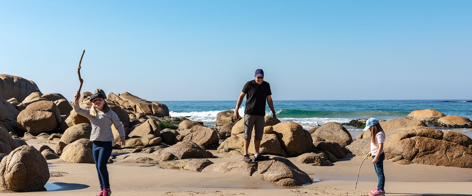
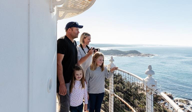
The granite headlands of Point Hicks are famed for being Captain Cooks first landfall on the Australian mainland. Although it isn’t without controversy, one thing is for certain, the panoramic Southern Ocean vistas along with its rich history make it a must-see on your next Croajingolong adventure.
Stay a night in the historic lighthouse keeper’s cottage and join a tour of the historic lighthouse precinct. Learn about life in this remote part of the world and climb the spiral staircase of the light station to be rewarded by stunning windswept coastal views.
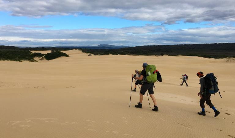
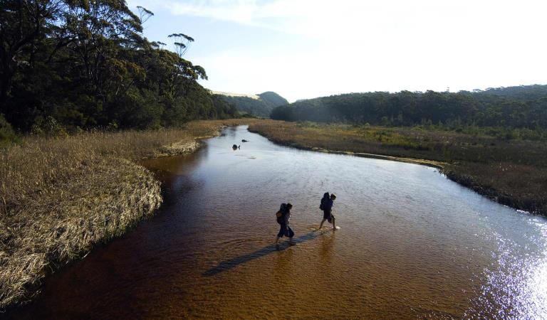
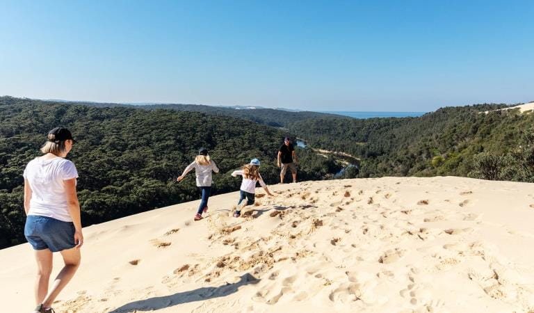
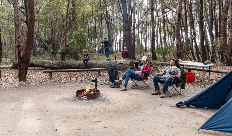
Trade the comfort of the cottage for a shady campsite at Thurra River. Explore the isolated stretch of coast, visible through pockets of coastal woodlands, the tannin tinted Thurra River, perfect for a mid-summer swim, and the largest sand dunes in Victoria, the Thurra River Dunes. Watch for decorated native birds such as the Laughing Kookaburra, Pied Currawong and occasional White-bellied Sea Eagle circling above.
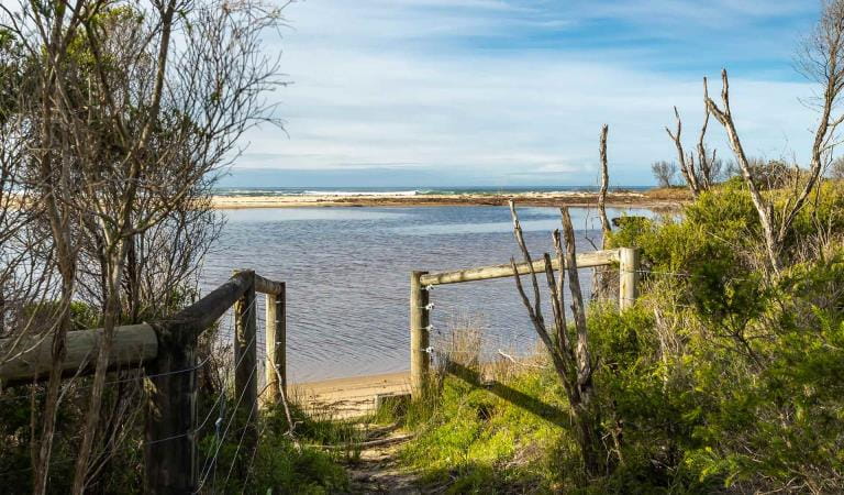
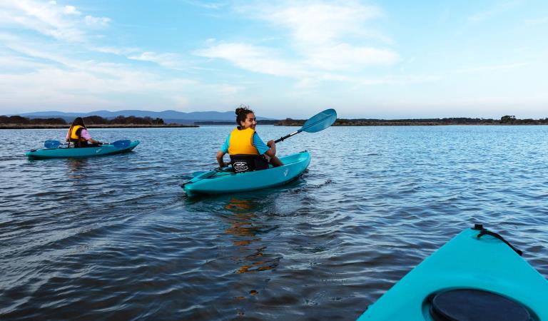
Get back to basics at secluded campsites nestled on the banks of Tamboon Inlet. Only accessible by boat and with its exceptional year-round fishing opportunities, the inlet draws anglers from across the state. Catch bream in the cool of winter and throughout the warmer months; tailor, flathead, salmon and perch.
Things To Do
Mueller Inlet Campground
Peachtree Creek Reserve
Point Hicks Lighthouse
Tamboon Inlet Campground
Thurra River Campground
How to get there
Point Hicks and Tamboon Inlet
Point Hicks Lightstation is easily accessed off the Princes Highway. At Cann River, turn onto Point Hicks Road and follow the unsealed road to the Lightstation Carpark. From here, a walking track climbs through coastal heath to the monumental lighstation.
If you have accommodation booked at the Point Hicks Lightstation, the access information does not apply to you. You will receive a gate pass to drive right up to the light station.
When you're there
When to go
Need to know
Point Hicks and Tamboon Inlet
Accessibility
Visiting a park can be more of a challenge for people with disabilities, however in Victoria there are a wide range of facilities to help people of all abilities enjoy our wonderful parks around the state.
Assistance dogs are welcome in Parks Victoria parks and reserves. Entry requirements apply for parks and reserves that are usually dog prohibited, such as national parks.
Change of Conditions
Nature being nature, sometimes conditions can change at short notice. It’s a good idea to check this page ahead of your visit for any updates.
-
Notices Affecting Multiple Sites
Peachtree Creek Camp Closed for Upgrades - May / June 2026
Peach Tree Creek campground will be closed from April 30 2026 whilst upgrades to the campground are being completed.No access to the boat ramp, jetty or toilet block is possible.Works are expected to be completed by end of June 2026.Alternative access to Tamboon Inlet is available via the boat ramp at Furnell Landing, Tamboon Rd. See map here.Tracks and areas closed in the Croajingolong National Park
The following areas are closed because of the 2019/2020 bushfires and coastal erosion caused by heavy rainfall. Parks Victoria continue to maintain surveillance and security of these areas as works continue to reinstate access.· Point Hicks Lightstation· Saros Track· Sledge TrackThe Wilderness Coast Walk is open all the way from Bemm River to Mallacoota. Staff have recently marked sections of the track however, combined flood and fire damage have made some areas more difficult to negotiate. Hikers must be able to self-navigate with a map and compass.The following walking track is closed:· Wingan Inlet Rapids WalkThe following jetties around Mallacoota are closed:· Kingfish Point. Goanna BayThe following tracks remain closed due to storm damage· Miners Track -
Mueller Camp (Croajingolong National Park)
Mueller Inlet Camp closed due to flooding
Mueller Inlet camp is closed due to flooding. The river inlet is currently shut and all sites and the carpark are flooded.Alternative camping is available nearby at Thurra River Camp.Rangers will monitor the flooding and update this page as soon as camping is available. -
Allan Head (Croajingolong National Park)
Allan Head Jetty Closure
The Allan Head jetty is temporarily closed for public safety. Visitors are advised that the Allan Head day visitor area remains open, however access onto the jetty is restricted. -
Goanna Bay (Croajingolong National Park)
Goanna Bay Jetty Closure
The Goanna Bay Jetty is temporarily closed for public safety. Visitors are advised that the Goanna Bay day visitor area remains open, however access onto the jetty is restricted. -
Kingfish Point (Croajingolong National Park)
Kingfish Point Jetty Closure
The Kingfish Point Jetty is closed for public safety. Visitors are advised that the Kingfish Point day visitor area remains open. -
Notices Affecting Multiple Parks
Peachtree Creek Camp Closed for Upgrades - May / June 2026
Peachtree Creek Creek campground is closed from 30 April 2026 whilst upgrades are being completed.No access to the boat ramp, jetty or toilet block is possible whilst works are underway.Works are expected to be completed by end of June 2026.Alternative access to Tamboon Inlet is available via the boatramp at Furnell Landing at the end of Tamboon Rd. See here for map.Planned aerial shooting operations targeting deer
Control operations (aerial shooting) targeting deer are planned for this area. During operations parts of the Park will be closed to visitors. More information on closures will be posted a minimum of 4 weeks prior to commencement.Visitors are advised to check the Change of conditions listing prior to arrival for up to date information and maps.For more information about deer control to protect biodiversity, please visit this link.Ground shooting operations targeting deer
Control operations (ground shooting) targeting deer are undertaken in this area. The Park will remain open to visitors during operations.
For more information about deer control to protect biodiversity, please visit our Deer page.
-
Croajingolong National Park
Planned aerial shooting operations targeting deer
Control operations (aerial shooting) targeting deer are planned for this area. During operations parts of the Park will be closed to visitors.Partial closure of Croajingolong NP from June 9 - June 12 2026 (inclusive).Attachments: Information_CapeHowe_Aerial_9-12Jun (252KB)
-
Genoa Peak (Croajingolong National Park)
Genoa Peak Road and Walking Track Temporary Closure
Genoa Peak Road and Genoa Peak walking track will be temporarily closed from Tuesday the 2nd June 2026 to Tuesday the 2nd July 2026 to allow for hazardous tree treatment works and road maintenance and repairs.Genoa Peak Road and Walking Track closure
Genoa Peak Road and Genoa Peak Walking Track will be temporarily closed to public access from the 2nd June 20026 to the 2nd July 2026 to allow for hazardous tree treatment and road maintenance works.Genoa Peak Road -4WD only
The Genoa Peak Road is open to 4WD vehicles only and is NOT advised for 2WD vehicles.The road has had major flood damage resulting in wash outs and deep rutting.Genoa Peak Walking Track remains open.
Similar Experiences
Mallacoota Inlet
Shipwreck Creek