Explore
Lake Elizabeth Campground
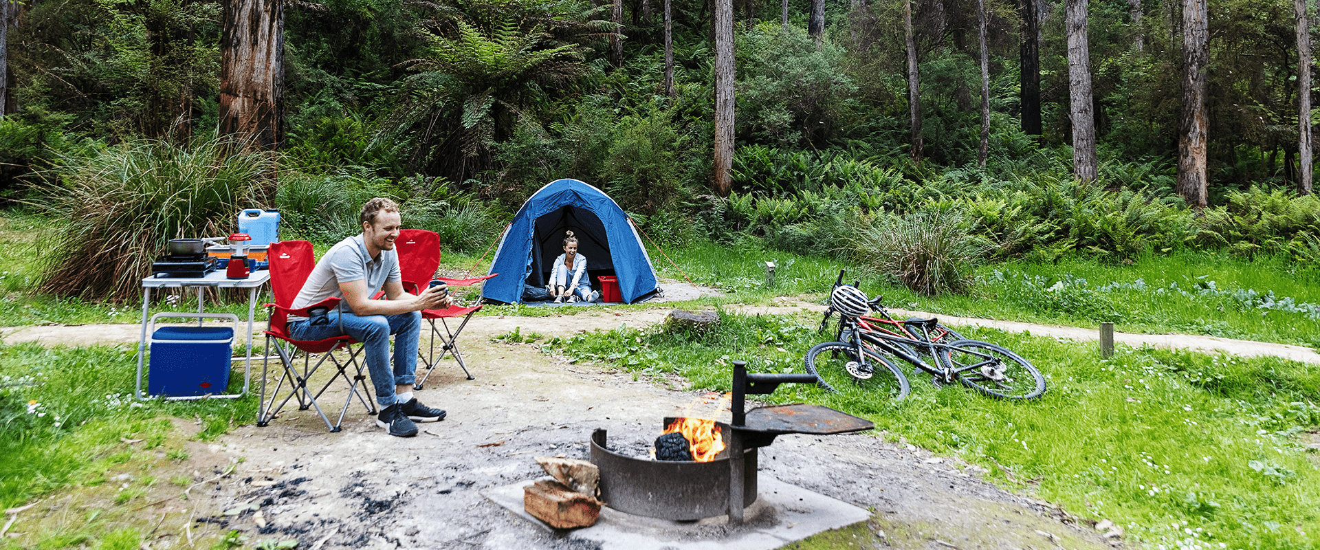
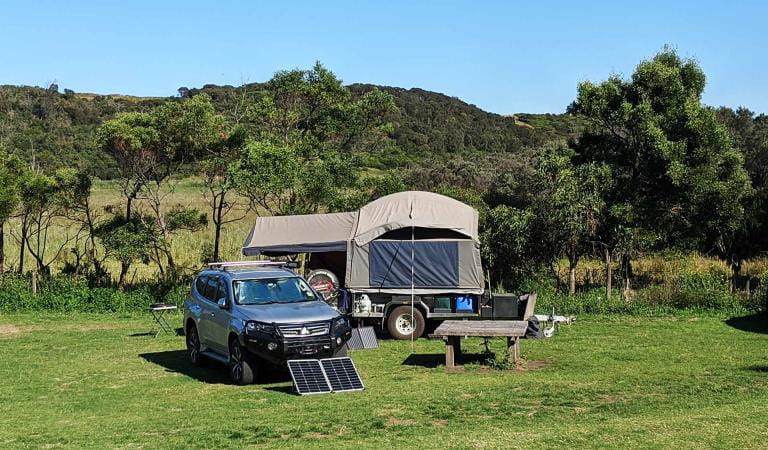
There are 20 campsites accommodating up to six people per site. All campsites are unpowered and are suitable for tents only. There is no direct vehicle access to the campsites. A 15-minute unloading bay is located close by and a separate carpark is located above and behind the campground just a two minute walk away.
Non flush toilets, shared fireplaces and picnic tables are provided. Dogs are permitted on-lead.
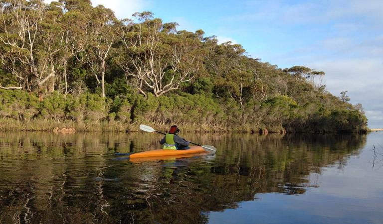
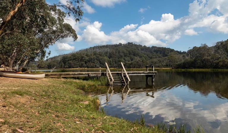
Once you're unpacked and set up, walk the 1km to beautiful Lake Elizabeth. Flooded after a landslip created a natural dam, the lake is scattered with the still-upright trunks of dead trees, giving an eerie atmosphere to the valley. Platypus are sometimes seen early morning and at dusk in the still waters. A host of birds live in the area and Satin Bowerbirds (the male dark satin blue and the female is olive green) are often seen near the camping round. Wrens, robins and grey shrike thrush also visit regularly. You may see glowworms beside this track after dark.
Dogs should be kept on-lead to reduce their impact on native wildlife and to preserve their health and your dogs as snakes are common in this area and its walks. There is poor mobile phone reception here.
Explore the area by walking, canoeing, mountain biking and four-wheel driving. Birdwatching is popular here. The village of Forrest is nearby for supplies and is a major mountain bike trailhead for the area's cycling network.
As rivers, lakes and reservoirs are natural environments, you may encounter hazards. Follow our water safety advice to make sure your day out at Lake Elizabeth is a safe and enjoyable one.
Things to do
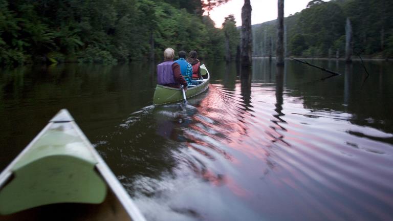
Canoeing and Kayaking
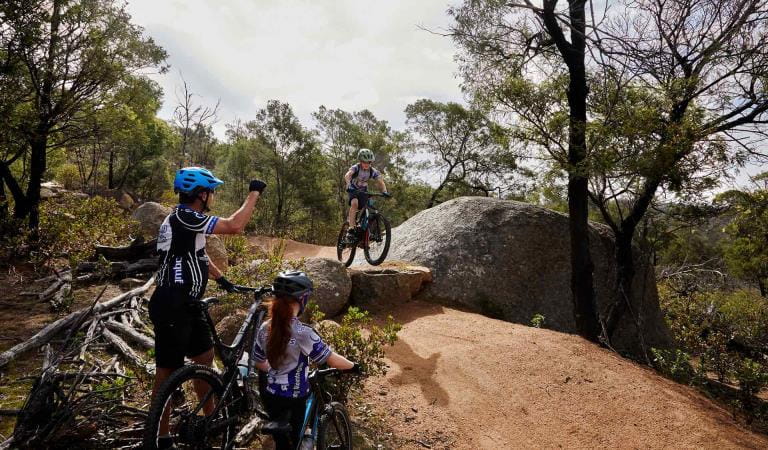
Mountain biking
How to get there
Lake Elizabeth Campground
When you're there
A 40-minute drive south takes you to the Great Ocean Road and the many waterfalls and other attractions along this famous drive. Forrest itself is a mountain bike trailhead hub. You can ride to it from the campground via the Baridjaru Trail. Download the visitor guide before you go.
Need to know
Lake Elizabeth Campground
Accessibility
Lake Elizabeth Day Visitor and Camping facility has all ability access. Forested areas generally are more difficult grade walks often with steps and minor creek crossings. Lake Elizabeth Loop Walk Grade 3. the walk has some steps, uneven surfaces and is not an all abilities walk.
Be prepared and stay safe
Lake Elizabeth Campground is in the Great Otway National Park in the South West fire district. Bushfires can occur during the warmer months. It is your responsibility to check current and forecast weather conditions. Campfires cannot be lit on days of Total Fire Ban, however gas cookers can be used for preparing food.
Check the Fire Danger Rating and for days of Total Fire Ban at emergency.vic.gov.au, on the Vic Emergency App or call the Vic Emergency Hotline 1800 226 226.
Change of Conditions
Nature being nature, sometimes conditions can change at short notice. It’s a good idea to check this page ahead of your visit for any updates.
-
Great Otway National Park
Delayneys Track Closed
Delayneys Track is closed until further notice.
Temporary park closures Great Otway National Park
Sections of the Great Otway National Park will be temporarily closed at night from Monday 15th April 2024 through to June 1st 2024 to allow for the safe delivery of park conservation work. Temporary closed areas will be clearly sign posted. All campgrounds will remain open during this operation. For further information please contact Parks Victoria on 13 19 63 or email westregiondcp@parks.vic.gov.auYan wirring mirr Trail Upgrades
The Yan wirring mirr walking trail is having some essential trial maintenance and repair work done over the next 6 weeks during this time it may be necessary to close the walking trail for periods to ensure public safety. -
Other issues
Sharps Campground permanently closed
Permanently closed due to environmental and safety risks. -
Aire Crossing Campground (Great Otway National Park, Aire River Heritage River)
Youngs Creek Track Closed Great Otway National Park
Following recent rainfall and current conditions, Youngs Creek track within the Great Otway National Park is currently closed.Safety for our visitors and protection of the environment has led to this decision. The nearby Triplet Falls and Aire Crossing visitor sites remain open along with the tracks leading to them. -
Notices Affecting Multiple Sites
Erskine Falls lower lookout closure
The lower lookout at Erskine Falls will be temporarily closed to allow for infrastructure upgrades.The upper lookout is still accessible.Erskine River Walk is available from the bottom end of the walking track in Lorne, however access to the carpark at the top is not possible due to upgrades.Please take your rubbish home
Reminder to campers and visitors to please take your rubbish home. Please do not put rubbish in toilets. Visitors have been placing rubbish in the pit toilets making human waste removal difficult. Parks appreciates your assistance in looking after the Park. -
Jamieson Creek (Great Otway National Park)
Wye Road Closure
Wye Road is temporarily closed to allow for maintenance grading and culvert installation. The Jamieson to Wye River walk is unaffected and remains open. -
Lemonade Creek Walk (Great Otway National Park)
Lemonade Creek Walking Track Closed
Lemonade Creek Walking Track will be closed until June 30 as works are underway to repair damaged bridges. -
Melba Gully Day Visitor Area (Great Otway National Park)
Melba Gully - Large bus access
Melba Gully Walk Track and picnic area is accessible for large coaches. Toilet facilities are available on site -
Maits Rest Rainforest Walk (Great Otway National Park)
Maits Rest Carpark- bus access
Maits Rest Carpark is suitable for small coaster buses only. Large buses or coaches are advised to use Melba Gully walk track near Lavers Hill.
Similar experiences
Lake Catani Campground
Aire River East Campground