Plan carefully to ensure that you have enough daylight to complete these walks.
Things to do
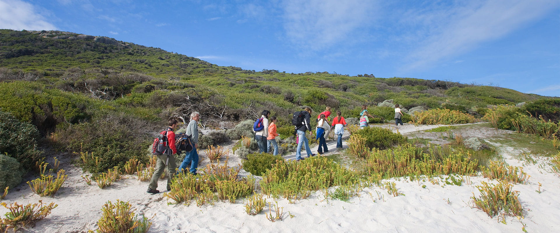
Lilly Pilly Gully Nature Walk
Go on a family-friendly walk through heathland before you find yourself walking among tall eucalpyt trees. Follow the boardwalk through the shady rainforest, where you can admire lush ferns and a trickling creek. Look closely and tread quietly to discover a variety of flora and fauna.
The 5.2km nature walk takes around an hour and a half return and is perfect for families with kids and people with limited mobility. The track is predominantly compacted sand, relatively flat and easy-going with a good pram.
Lilly Pilly Gully Circuit Walk
See more of Lilly Pilly Gully on this scenic circuit walk. Weave through stringybark forest along the southern slope of Mt Bishop before descending into the lush rainforest of Lilly Pilly Gully. Follow the nature walk back to the carpark. The 5.8km circuit walk takes around two hours return.
Mount Bishop Walk
If you're feeling adventurous and prepared for a more challenging walk, hike from Lilly Pilly Gully to the rocky summit of Mt Bishop. You'll be rewarded with spectacular panoramic views of the west coast of Wilsons Prom and offshore islands. The 7.4km walk takes around two and a half hours return.
Lilly Pilly Link Walk
Go for an easy stroll along Lilly Pilly Link Walk, which connects Tidal River and Lilly Pilly Gully. Enjoy panoramic views of Norman Bay and Tidal River as you weave through coastal heath. The views are even more striking in spring and summer when you can see stunning wildflower displays. The 1km walk takes around 20 minutes each way.
Norman Beach, Tidal Overlook, Squeaky Beach, Picnic Bay, Whisky Bay
This spectacular four beach walk allows the walker to fully experience the beauty of both land and sea at the Prom. Travel alternates between track and beach walking.
The 6km walk will table around 3 hours one way. Grade: Easy/moderate.
Darby River to Tongue Point
Offering magnificent views of Darby Swamp, Vereker Range and Darby and Cotters Beach, this walk climbs gently through wind swept coastal vegetation before following the headland towards Tongue Point, a coastal headland jewelled with stacks of weathered granite. The track ends prior to the semi-attached island. For your safety don’t attempt to cross over to it. Just before the Darby Saddle track junction, a short side track with some steps leads down to the delightful and secluded Fairy Cove. For your safety, check tides before you go.
This walk commences at the southern end of Darby River carpark and covers 3.8km over approx 2 hours of walking one way. Grade: Moderate.
Darby Saddle to Tongue Point
The track from Darby Saddle provides spectacular coastal and forest scenery as it climbs uphill through stringybark and casuarina forest. At 2.1km a side track (300 metres) leads up to Sparkes Lookout which offers views as far as the pyramid-shaped Rodondo Island in the south and Shallow Inlet in the north.
After the turnoff, the main track climbs steeply to Lookout Rocks, a vantage point offering views across to Norman Island. From here the track descends steeply through low heathland where it joins the track from Darby River and continues to Tongue Point, a coastal headland jewelled with tumbled stacks and boulders of weathered granite. The track ends prior to the semi-attached island. For your safety don’t attempt to cross over to it.
The 5.6km walk will take around 2.5 hours one way. Grade: Moderate/hard.
Darby River, Fairy Cove, Tongue Point, Darby Saddle
This track allows visitors to fully enjoy the stunning Tongue Point coastal area. The walk can be done in either direction however walkers will need to organise a car shuttle.
The 9.4 km will take around 3-3.5 hours one way. Grade: Moderate/hard.
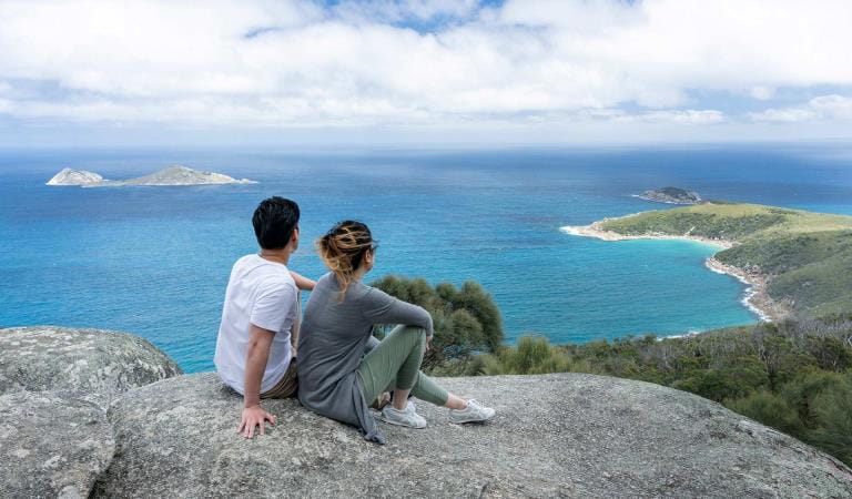
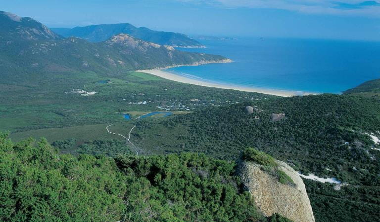
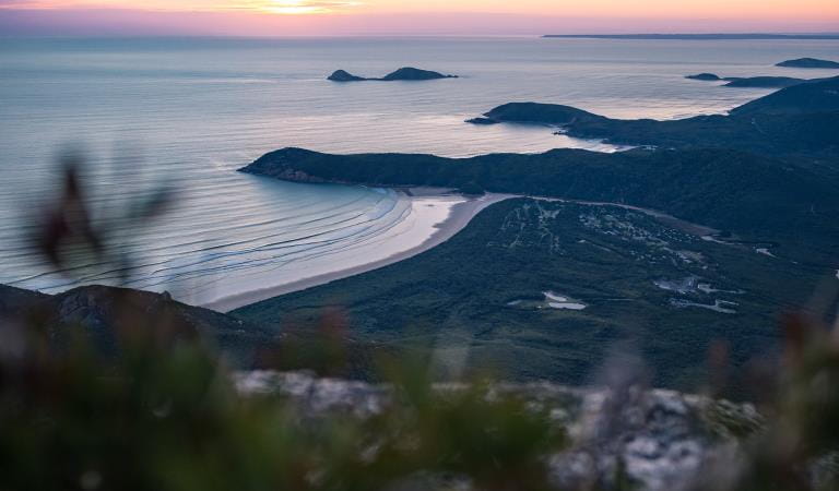
Mount Oberon Summit
Starting from the Telegraph Saddle car park, this iconic Prom walk follows the management vehicle track up Mount Oberon. Steps below the rocky summit lead to postcard perfect, panoramic views over Tidal River, the coast and offshore islands. Be prepared - even in summer months the summit can be windy, cool and clouded. Beware of unprotected cliffs.
The 6.8 km walk will take around 2 hours return. Grade: Moderate/hard.
Sealers Cove
One of the most popular walks at the Prom, the Sealers track climbs steadily to Windy Saddle and then downhill through beautiful forest to a boardwalk over Sealers Swamp to Sealers Cove.
The 9.5 km walk will take around 3 hours one way. Grade: Moderate.
Please note: Sealers Cove Walk is closed due to storm damage until further notice.
Darby River to Tongue Point
Mount Bishop
Mount Oberon
Squeaky Beach
How to get there
Day Walks
When you're there
Need to know
Day Walks
Preparing for a busy summer
The Prom gets extremely busy over summer. For both visitor safety and your enjoyment, there is a limit to the number of vehicles that can be in the park. On busy summer days it can be challenging to park and safely move around popular sites like Tidal River and Squeaky Beach as cars and pedestrians often share the same roads.
If you are visiting the Prom this summer, please:
- consider visiting the Prom during on a weekday if you can
- carpool to and within the Prom to reduce congestion issues
- you may have to wait in your car, please bring food and water
- arrive before 10am and be prepared for crowds
- check the Prom webpage before you travel for the latest conditions
- only bring a maximum of two vehicles per site with your camping booking – this will be monitored and enforced
- support the park team by leaving the park when you check-out to allow space for new campers and visitors
Change of Conditions
Nature being nature, sometimes conditions can change at short notice. It’s a good idea to check this page ahead of your visit for any updates.
-
Notices Affecting Multiple Sites
Stockyard Campground & Toilet Block Closed
Stockyard Campground and Toilet Block are closed until further notice.Invasive Species Control Programs 2025 - 2027
Wilsons Promontory National Park will be conducting invasive species control programs from 1 July 2025 – 30 June 2027. Introduced species such as deer, rabbits, foxes and feral cats are all major threats to nature.
By removing introduced hog deer and rabbits, we are reducing grazing pressure on the incredible variety of native plants and plant communities, including some that are nationally threatened. By targeting foxes and feral cats, we are reducing the threat of predation for native species such as the Southern Brown Bandicoot, Long-nosed Potoroo, Ground Parrot, New Holland Mouse, Eastern Pygmy Possum and the Hooded Plover.
All animal control programs are carried out under strict conditions, compliant with all relevant legislation, Codes of Practice and Standard Operating Procedures, designed to ensure safe, effective, and humane practices are implemented.
For further information, please visit Prom Sanctuary.Park closure 5pm Sunday 9th August to 8am Friday 14 August 2026
Wilsons Promontory National Park will be closed to all park visitors from 5pm Sunday 9th August to 8am Friday 14th August 2026 to undertake essential park management and conservation programs. -
Wilsons Promontory National Park
Sealers Cove boardwalk is closed
The Sealers Cove boardwalk needs to be rebuilt, following major storm and flood damage.This will be a major and complex project. It will replace two kilometres of boardwalk over sensitive terrain while sensitively managing the surrounding environment.There is currently no public access to the boardwalk, and access to Sealers Cove is only possible via a 25km hike from Telegraph Saddle.For more information, including expected timeframes for the rebuild, visit the Sealers Cove Boardwalk project page.