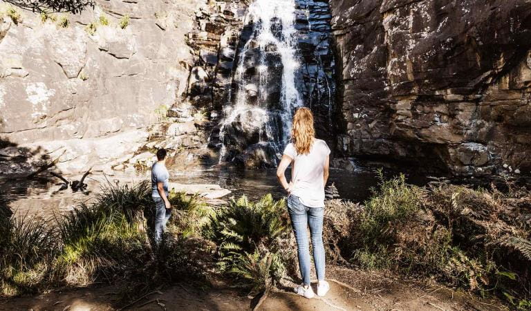
MacKenzie Falls is the most iconic and spectacular waterfall in the Grampians. Watch the majestic waterfall from the lookout platform or tackle the steep climb to the base of the falls. Make the most of your day trip in the Grampians National Park with a strenuous walk through the beautiful MacKenzie River Gorge to Zumsteins Historic Area.
MacKenzie Falls is one of the largest waterfalls in Victoria and a must-see on your trip to Grampians National Park. It's the only waterfall in the Grampians that flows all year round.
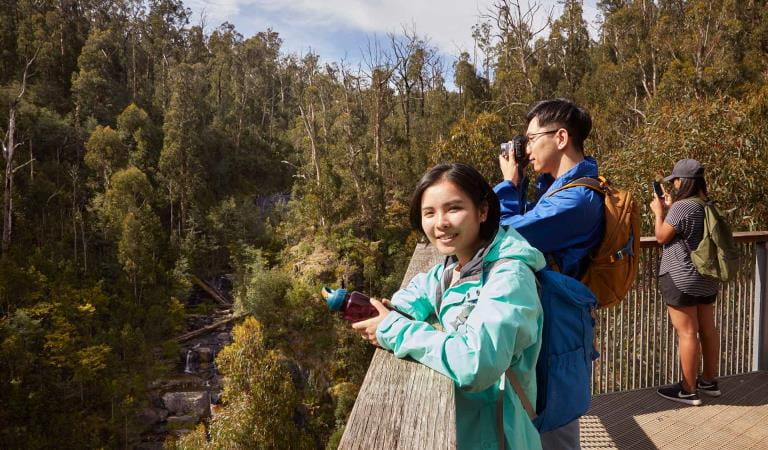
See the beauty and power of MacKenzie Falls from a variety of lookouts and walks, which start at the carpark and cater to a range of abilities.
As waterfalls are within a natural environment, you may encounter hazards. Follow our water safety advice to make sure your day out at MacKenzie Falls is a safe and enjoyable one.
Please note that for visitor and staff safety, MacKenzie Falls precinct (including Fish Falls) will be closed on days of Extreme and Catastrophic Fire Danger. Check the Fire Danger Rating forecast before you visit at cfa.vic.gov.au.
Things to do
MacKenzie Falls Walk
Embark on a steep walk to the base of MacKenzie Falls to see the waterfall up close and get a true sense of its power. Watch as water gracefully cascades down the sheer cliff face into the pretty pool below, creating a fine rainbow mist in the air.
It may seem inviting to take a dip, but swimming is not permitted at MacKenzie Falls due to many unseen dangers in the water.
The walk is 2km return and you'll need to trek down 260 narrow steps to reach the base of the falls, so be prepared for a difficult climb back to the top.
MacKenzie Falls Lookout Walk
Enjoy sweeping views of MacKenzie Falls and the MazKenzie River from Bluff Lookout. The 1.9km return walk is wheelchair friendly and meanders through stringybark forest. The lookout is the only spot where you can see multiple cascades of the river flowing through the gorge.
Broken Falls Walk
Admire beautiful views of the upper sections of MacKenzie Falls on the Broken Falls Walk. The 500m walk is wheelchair friendly and has only a slight track gradient. Broken Falls Lookout is one of the best places to see the impressive geological formations of the MacKenzie River Gorge.
MacKenzie River Walk
One of the Grampians' best kept secrets, the MacKenzie River Walk winds it way along the river through young eucalypt forest. Best tackled by fit walkers, the 7km return walk (Fish Falls 4km return) can require water crossings, rock hopping and rock scrambling.
Enjoy scenic views of tranquil waterholes, rocky escarpments and the terraced cascades of Fish Falls. Keep an eye out for wildlife, including the impressive Wedge-tailed Eagle circling above.
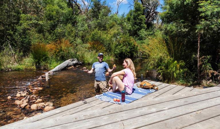
Finish the walk with a picnic or barbecue at Zumsteins Historic Area and discover the remnants of an historic settlement, including old buildings and a now-empty swimming pool.
Zumsteins Historic Area
Day trips
Picnics
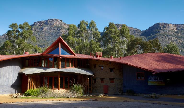
Brambuk The National Park and Culture Centre
How to get there
MacKenzie Falls
When you're there
MacKenzie Falls is a popular place in the Grampians. Visit early in the day to escape the crowds. Download the Grampians National Park Visitor Guide before you go.
Need to know
MacKenzie Falls
Accessibility
The MacKenzie Falls Walk and Broken Falls Walk are suitable for people with limited mobility and wheelchairs.
Assistance dogs are welcome in Parks Victoria parks and reserves. Entry requirements apply for parks and reserves that are usually dog prohibited, such as national parks.
Change of Conditions
Nature being nature, sometimes conditions can change at short notice. It’s a good idea to check this page ahead of your visit for any updates.
-
Grampians (Gariwerd) National Park
Grampians (Gariwerd) National Park – What’s Open What’s Closed Update – 4 July 2025
During the summer of 2024/2025 the central, southern and western areas of the Grampians (Gariwerd) National Park were impacted by multiple bushfires. Since then, a staged re-opening has commenced and many popular visitor areas have re-opened in the Northern, Wonderland and southern areas of the park. However, in the Mount William, Victoria Range, Victoria Valley and Wallaby Rocks areas; many visitor sites and roads remain closed.Visitor Sites Reopening 4 July 2025Central Grampians, Wonderland Range & Halls Gap area:· Mount Rosea walking track· Borough Huts Campground· Stony Creek Group Campground· Stony Creek Road (providing access to Stony Creek Group Campground)· Bugiga Hike-in Campground· Tunnel Track· Terraces Fireline (walking only – an alternate walking link from Borough Huts Campground to Halls Gap)Grampians Peaks TrailThe popular section from Sundial Carpark to Borough Huts campground will reopen. This includes Bugiga Hike-in Campground and Stony Creek Group Campground, providing a two day and one night walking experience from Halls Gap or a two-night, three-day experience by hiking an alternate route along Terraces Fireline returning to Halls Gap.The Griffin Fireline reopens with vehicle access to the Griffin Trailhead in the (Serra Range) southern section. The upgraded track is now accessible to all vehicles.Key visitor sites remaining closedCentral Grampians, Wonderland Range & Halls Gap area:· Sundial Peak walking track· Designated climbing areas 83 - 91Roads in fire impacted areasIt is expected that most of the roads within the National Park will reopen to the public by mid to late July. There will be longer term closures required for some roads, where significant damage has occurred and further essential works are required.Stay safe when visiting the parkDo not enter closed fire affected areas, they are fragile and unstable with significant hazards such as falling trees, unstable tracks and loss of signage.For more detail on “What’s Open What’s Closed”Please refer to the attached “What’s Open What’s Closed” July 4 Park Update. It provides a park wide compilation of all three staged fire recovery reopening’s in 2025.For further information, visit Brambuk the National Park and Cultural Centre in Halls Gap, call Parks Victoria on 131963 or go to parks.vic.gov.auAttachments: GNP Park Update 4 July 2025 - What's Open What's Closed (846KB)
Grampians (Gariwerd) National Park - Roads Update 04.07.2025
The Grampians (Gariwerd) National Park has many roads temporarily closed due to the recent bushfires. Please be aware the movement of visitors in parts of the National Park is restricted.It is expected that most of the roads within the National Park will reopen to the public by mid to late July. There will be longer term closures required for some roads, where significant damage has occurred and further essential works are required.Key roads open include Grampians Tourist Rd (most side roads remain closed), Mt Victory Rd, Sundial Rd, Silverband Rd, Roses Gap Rd, Mt Zero Rd and Victoria Valley Rd.Seasonal road closures are now in place from June 12 – October 30, 2025.Please refer to the attached up-to-date road report below.Attachments: Grampians (Gariwerd) National Park - Road Report - 04.07.2025 (218KB)
Grampians (Gariwerd) National Park – Fire Recovery Update
The impact of the 2024/2025 summer fires in the Grampians (Gariwerd) National Park was widespread. Parks Victoria is now progressing with large scale fire recovery works across the park, including dedicated programs to address biodiversity impacts.For more detailed information, please see the attached Biodiversity Newsletter.Attachments: GNP Biodiversity Newsletter May 2025 (872KB)
-
Brambuk the National Park and Cultural Centre (Brambuk - The National Park and Cultural Centre Park, Grampians (Gariwerd) National Park)
Brambuk the National Park and Cultural Centre – Closures during 2025
Brambuk the National Park and Cultural Centre – Closures during 2025· Cultural tours, activities and venue hire currently unavailable.· Park information centre and gift shop remain open.Parks Victoria is working with a strategic partnership committee of Gariwerd Traditional Owners from Barengi Gadjin Land Council, Eastern Maar Aboriginal Corporation, and Gunditj Mirring Traditional Owners Aboriginal Corporation to ‘reimagine’ the future of Brambuk the National Park and Cultural Centre.The reimagining project aims to renew Traditional Owner management arrangements of the Brambuk precinct and includes careful consideration of the tourism and visitor experiences, commercial opportunities, cultural education and training programs that may be available in the future. As part of this project, there are also building upgrades and refurbishments that require the Cultural Centre to be closed during 2024-25. However, the park information centre, gift shop and self-guided walks remain available.For Junior Ranger School holiday programs visit https://www.parks.vic.gov.au/things-to-do/junior-rangersFor a list of Grampians (Gariwerd) National Park Licensed Tour Operators Visit https://www.parks.vic.gov.au/ltoFor up-to-date national park information, brochures, maps, permits and access advice contact information staff at Brambuk the National Park and Cultural Centre info@parks.vic.gov.au or phone 8427 2058Further details on the Brambuk Reimagining project can be found on the Parks Victoria website https://www.parks.vic.gov.au/projects/western-victoria/brambuk-cultural-centre-upgrade
Similar experiences
Masons Falls
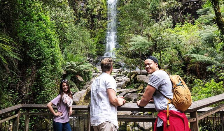
Erskine Falls