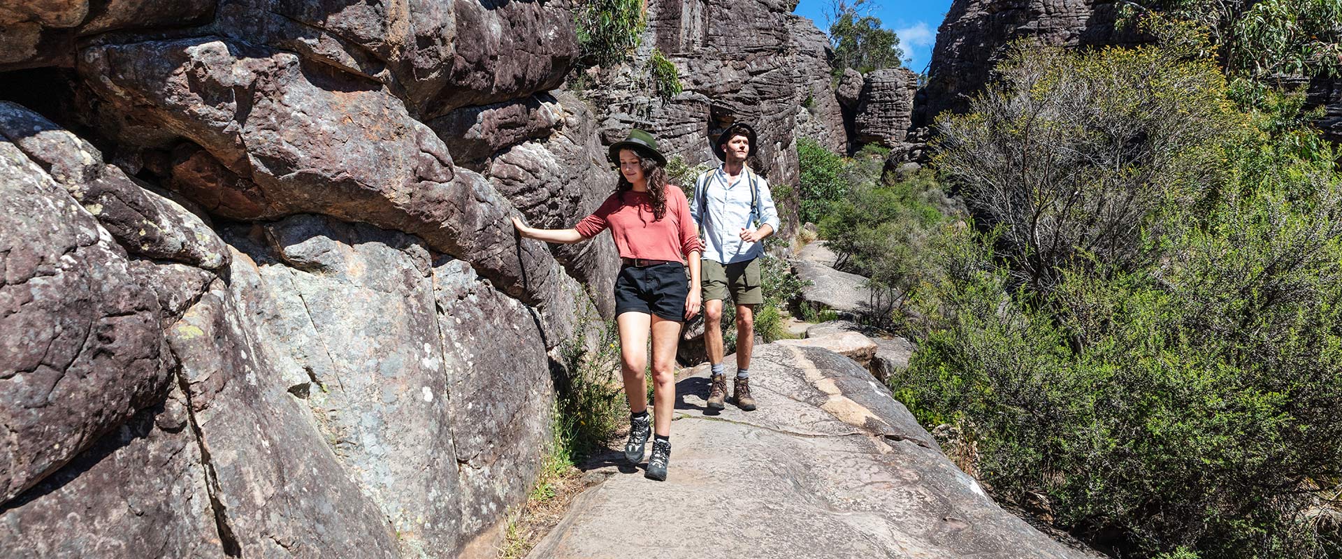
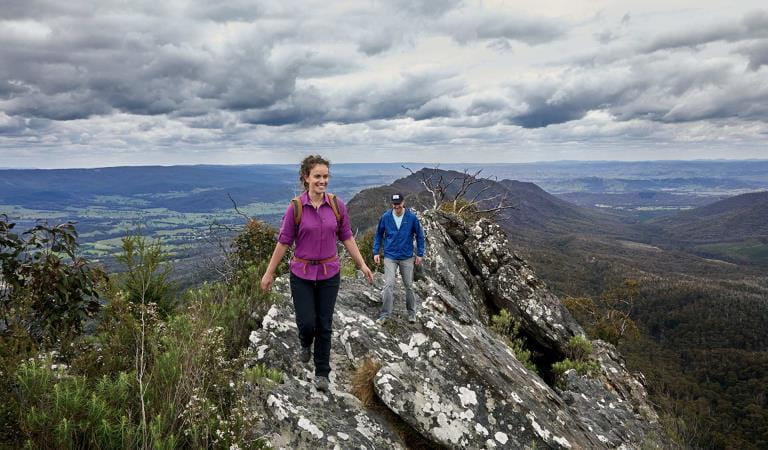
The central Grampians is the most popular area of the national park, boasting a variety of short walks, lookouts, waterfalls and picnic areas. Hikers flock to the Wonderland Range, while a memorable car tour from the pretty town of Halls Gap takes in the Balconies, Boroka Lookout, Mackenzie Falls and Zumsteins.
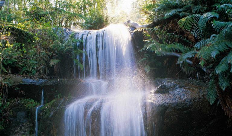
The Grampians between Halls Gap, Mackenzie Falls and Zumsteins is home to many of the most famous sights of this celebrated national park. There are epic landscapes and a mix of easy and challenging trails to explore them. See majestic waterfalls and take a memorable scenic drive over mountains and through valleys.
Traditionally known as Gariwerd, the Grampians and the surrounding region has a fascinating Aboriginal history. Make Brambuk – The National Park & Cultural Centre in Halls Gap your first stop. Here you can explore what Gariwerd-Grampians means to Aboriginal people and find general information about visiting the Grampians National Park.
Grampians is most famous for its spring wildflowers, Aboriginal culture and cascades and waterfalls. Take a short journey to the iconic and enduring Mackenzie Falls. Or venture deeper along trails into the rugged landscape to discover the slither of Silverband, cascades of Fish or Turret Falls.
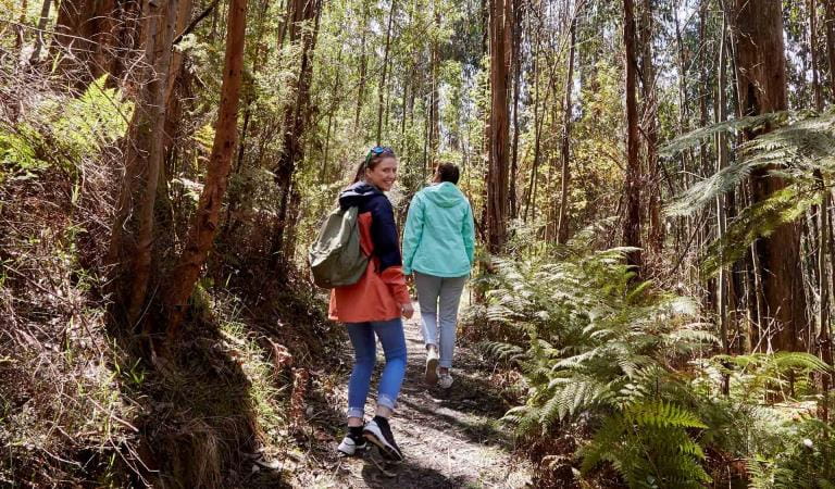
Bushwalking in the Wonderland from its carpark near Halls Gap is aptly named. A hike to the Pinnacle is very popular despite being a strenuous walk. An easier and no less spectacular view can be had by walking the Lakeview Loop from Sundial Carpark. Venus Baths is a delight for all with its refreshing spa-like rock pools. It is another easy walk from Halls Gap along the Stony Creek.
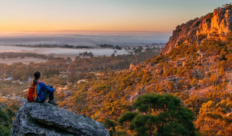
If you’re an experienced walker you’ll enjoy the unique challenge of the park’s overnight hikes. A section of the iconic Grampians Peaks Trail starts at Halls Gap. Visit the website for further details.
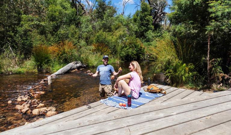
There are lakes here too! Go fishing, canoeing, kayaking or sailing. Lake Wartook, Lake Bellfield and Moora Moora Reservoir all have access.
The Grampians is a special place for nature lovers and there is something to see in all seasons.
Things to do
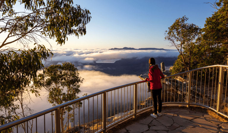
Boroka Lookout
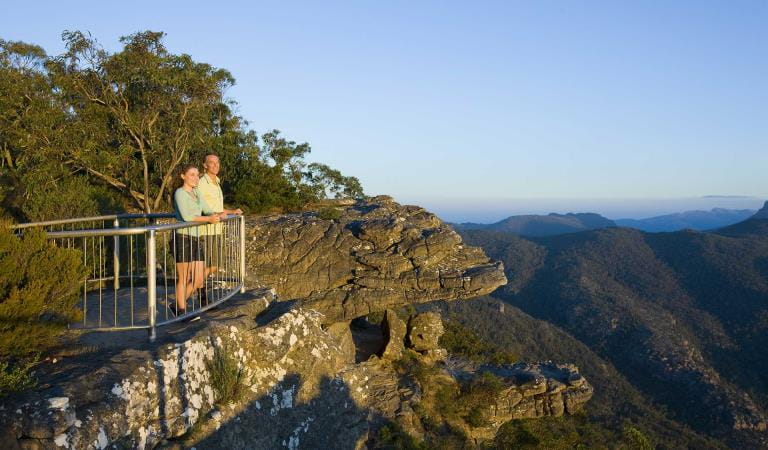
Reeds Lookout
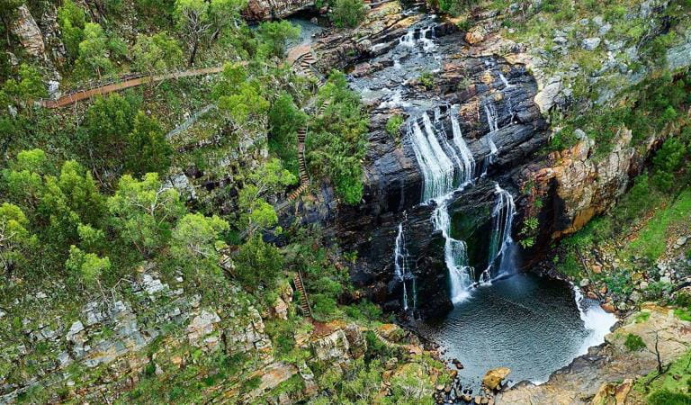
Mackenzie Falls
Zumsteins Historic Area
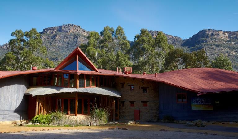
Brambuk The National Park and Culture Centre
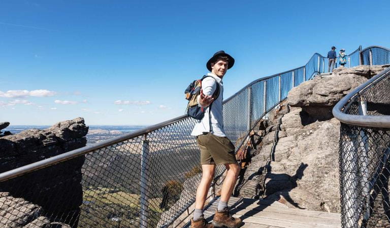
The Pinnacle walks
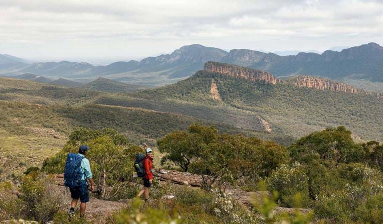
Grampians Peaks Trail
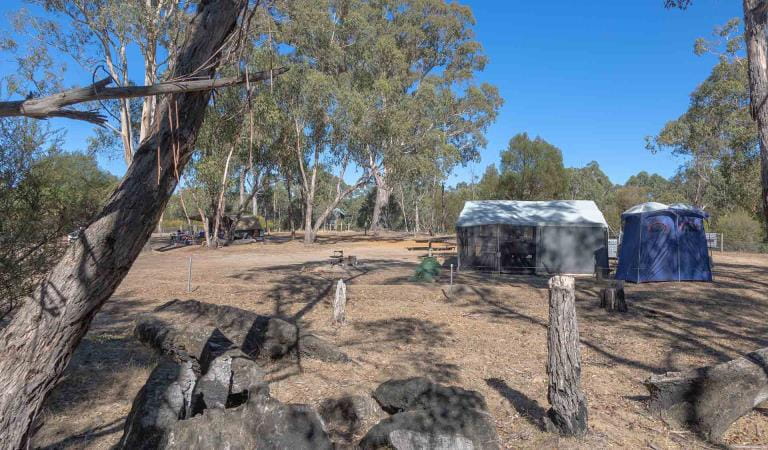
Boreang Campground
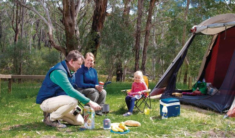
Borough Huts Campground
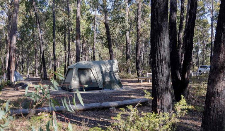
Smiths Mill Campground
How to get there
Central Grampians
When you're there
Need to know
Central Grampians
Accessibility
A Trailrider all-terrain wheelchair and Sherpa Volunteers are now available for park visitors with limited mobility to explore the natural beauty of Grampians National Park. The Grampians has two TrailRiders available for visitors and both of these chairs are fitted with electric motors to assist operators on steeper sections of track. Passengers must wear a helmet.
The TrailRider all-terrain wheelchair and Volunteer Sherpa service is free of charge however please book a week in advance. To book the TrailRider please contact Brambuk – The National Park and Cultural Centre on (03) 8427 2058. To book a Volunteer Sherpa please contact the Volunteer Sherpa Coordinator on (03) 8427 3541 or volunteersherpa@parks.vic.gov.au
Assistance dogs are welcome in Parks Victoria parks and reserves. Entry requirements apply for parks and reserves that are usually dog prohibited, such as national parks.
Change of Conditions
Nature being nature, sometimes conditions can change at short notice. It’s a good idea to check this page ahead of your visit for any updates.
-
Mackenzie Falls Day Visitor Area (Grampians (Gariwerd) National Park)
Mackenzie Falls (Migunang wirab) – Closed for major construction works – 9 February 2026 to midyear 2026
Construction work at Mackenzie Falls in the Grampians (Gariwerd) National Park is underway and the carpark and precinct is closed to visitors.The works at Mackenzie Falls precinct includes the construction of a new viewing platform at the base of the falls, upgrades to the carpark and the Bluff Lookout Walk and other important safety improvements to stabilise rock and improve walking tracks.
The Mackenzie Falls carpark and all walking tracks in the precinct including Broken Falls Walk, Mackenzie Falls Walk to the base (from the carpark), the Bluff Lookout Walk, and parts of Mackenzie Falls River Walk are closed. We anticipate that construction work will finish in the second half of the year.The carpark will be a construction site throughout the works period with large machinery operating and materials being stored on site. There will be no access for all vehicles or visitors at Mackenzie Falls Precinct during construction.Zumsteins to Fish Falls – This popular walk to the beautiful Fish Falls is a 1.5 to 2 hour return walk (Grade 3) – walkers should have a reasonable fitness level, carry water and wear sturdy walking shoes as the track can be rocky with uneven surfaces and some steep sections.Mackenzie River Walk – This is a 2 to 3 hour return walk (grade 3). Start at Zumsteins Picnic Area and follow the track to Fish Falls and then to the base of Mackenzie Falls. Walkers require a reasonable fitness level, need to wear sturdy walking shoes as the track can be rocky with uneven surfaces including steep sections and steps. Please ensure you carry plenty of water and be aware mobile phone service is limited. Access to the steps at the base of Mackenzie Falls to the Mackenzie Falls carpark will be closed to walkers, return by the same route to Zumsteins Picnic Area.Access to the base of Mackenzie Falls via the Mackenzie River Walk will remain open until 26 April 2026. After this date until works are complete, the base of Mackenzie Falls will be inaccessible. Fish Falls will still be accessible from Zumsteins Picnic Area.Zumsteins Picnic Area ParkingDuring construction parking at the popular Zumstein picnic area will be limited. It is not recommended for large passenger coaches and long caravans to visit during construction. Similarly, they should not travel between Mackenzie Falls and Zumsteins due to the narrow winding road.A small amount of parking for campervans, small motorhomes and cars with trailers is available opposite the Zumsteins Picnic Area car park, however, may not be available on busy weekends and public holidays.For further information on the Mackenzie Falls (Migunang wirab) project visit https://www.parks.vic.gov.au/projects/western-victoria/mackenzie-falls-revitalisationPopular day visitor sites such as Reeds Lookout, the Balconies, Boroka Lookout, Silverband Falls and various walks with large bus carparking will still be available. For further information on the Mackenzie Falls River Walk contact Brambuk the National Park and Cultural Centre in Halls Gap (Ph 8427 2058).Please keep up to date with closures through the Change of Conditions page for Grampians (Gariwerd) National Park. -
Strachans Campground (Grampians (Gariwerd) National Park)
Strachans Campground – Temporary Closure – 13 April – 22 May 2026
Strachans Campground will be closed to visitors for major upgrade works from 13 April to 22 May 2026.For further information contact Brambuk the National Park and Cultural Centre in Halls Gap (Ph 8427 2058). -
Grampians (Gariwerd) National Park
Autumn 2026 Planned Burns – Grampians (Gariwerd) National Park
Forest Fire Management Victoria (FFMVic) has scheduled 3 planned burns within the Grampians (Gariwerd) National Park throughout Autumn 2026.During these burning operations, there may be temporary closures to visitor sites, campgrounds, walking tracks and roads within Grampians (Gariwerd) National Park to allow for on ground burn operations and the safe movement of vehicles, heavy machinery and aircraft.Closures will remain in place temporarily, for the duration of ignition, the following 12-24 hours, or until the whole burn unit is declared ‘safe’- this period of time could be one day or multiple days.The re-opening of roads, walking tracks and visitor sites will be communicated by FFMVic once burn areas have been assessed and declared ‘safe’. Until then visitors are urged to follow the advice of on ground signage and remain clear of burning operations.
Planned Burns within the Grampians (Gariwerd) National Park – Autumn 2026Please refer to the attached Autumn 2026 Planned Burns map.Dunkeld – Cooks Rd4km NW of Dunkeld, 216 haObjective - To develop a fuel reduced area to the North-west of Dunkeld.This burn will see a temporary disruption during ignition to Mount Sturgeon summit (from Victoria Valley road and the park boundary south of the summit) including the Grampians Peaks Trail (GPT section S4). A detour will be in place to allow walkers access between Victoria Valley Trailhead, Mount Sturgeon car park and Dunkeld, via the Dunkeld loop walk.Grampians NP - Pomonal Fireline2km NW of Pomonal, 230 haObjective - To develop a fuel reduced area to the North-west of Pomonal.Boronia Peak Trail, Tunnel Walling Track and Pomonal Fireline will be closed during burning operations.The Fyans Creek Loop walk will remain open between Delleys Bridge and Brambuk the National Park and Cultural Centre, as will the Terraces Fireline to Lake Bellfield and Barri-Yalug Hike in Campground.Grampians NP - Mt Zero Rd - South3km N of Halls Gap, 130 haObjective - To develop a fuel reduced area to the North of Halls Gap.Mt Difficult Fireline (North of the Watchtower area), and Mt Zero Rd (between Pines Rd to Red Gum Lease Track) will be closed but will have detours in place.The Grampians Peaks Trail from Mt Difficult Road (south of Werdug) to Halls Gap may have a detour in place via Mt Difficult Road, Boroka Lookout to Halls Gap.The Watchtower Climbing Area will be temporarily closed.Planned burning is a carefully planned and controlled process where fire is used to reduce dry vegetation such as leaves and branches that can build up over time and make forests more flammable. Without planned burning and other bushfire risk management works, bushfires will be bigger and harder for our firefighters to control.Autumn typically provides FFMV more opportunities to conduct planned burns, as the weather is more stable, and fire behaviour tends to be manageable and predictable. As soon as favourable weather and forest conditions arrive, we’ll make sure all available resources are delivering planned burning. Visit the Planned Burns Victoria website before you travel to make sure your trip isn’t affected.Stay informed about the Autumn planned burns schedule:Visit & Sign Up: Sign up to Planned Burns Victoria www.vic.gov.au/plannedburns Set up automated notifications about upcoming planned burns on public land near you. There is no charge to sign up to receive text messages.Download: The Vic Emergency App. Set up a watch zone and choose to be notified about planned burns in the ‘alerts’ settingsCall: The Vic Emergency Hotline on 1800 226 226 and request an interpreter or assistance for hearing difficulties via the National Relay Service. IN AN EMERGENCY CALL 000Email: For specialist advice about planned burns in the Wimmera District you can contact Horsham FFMVic Office at wimmera.fuelmanagement@delwp.vic.gov.au or phone the office on (03) 8508 1222.For Information about park closures and campground bookings within Grampians National Park:Visit the Parks Victoria website: https://www.parks.vic.gov.au/places-to-see/parks/grampians-national-park#change-of-conditionsVisit Brambuk the National Park and Cultural Centre – 277 Grampians Road Halls Gap, Ph 8427 2058 or for bookings and cancellations advice contact the Parks Victoria Information Centre Ph 13 1963 or email info@parks.vic.gov.auYou may see or smell smoke in the vicinity of the burn. For advice on how this may impact your health, visit www.epa.vic.gov.au/smokeAttachments: Autumn 2026 GNP Planned Burns (1,920KB)
Grampians (Gariwerd) National Park - Roads Update 17.04.2026
The Grampians (Gariwerd) National Park has some roads temporarily closed due to bushfire and flood impacts.Please be aware the movement of visitors in some areas of the National Park is restricted.Please refer to the attached up-to-date road report below.Attachments: Grampians (Gariwerd) National Park - Road Report - 17.04.2026 (224KB)
-
Chatauqua Peak Loop Walk (Grampians (Gariwerd) National Park)
Chatauqua Peak Loop - Partial closure and detour
The Chatauqua Peak Loop south-eastern section (including Bullaces Glen) will be partially closed for track upgrades from Tuesday 21 April to Friday 5 June 2026.Track upgrades include stabilisation and drainage works.Chatauqua Peak and Clematis Falls will remain accessible for day walkers and GPT hikers via the Halls Gap Recreation Reserve.Please see the map below.
-
Notices Affecting Multiple Sites
Grampians Peaks Trail – Hike-in Campground Reopenings (sections C3-C5 & S1-S2)
Five hike-in campgrounds along the Central and Southern sections of the Grampians Peaks Trail reopened to hikers on 2 March 2026.(GPT central section C3-C5) Barri Yalug, Duwul and Durd Durd hike-in campgrounds(GPT south section S1-S2) Yarram and Wannon hike-in CampgroundsThis means the full 164km Grampians Peaks Trail experience (from Mt Zero (Mura Mura) Trailhead in the north to Dunkeld township in the south) will be available for hiking and overnight camping. Redman Road Trailhead is also open for vehicle access.These hike-in campgrounds were damaged by the 2024/25 bushfires and have required significant repair and replacement works to reopen.Please remember, the Grampians landscape was recently impacted by bushfire and is recovering. Stay on formed tracks and be mindful that walking track and surrounding forest conditions have changed· Before attempting the Grampians Peaks Trail, please see the Plan and Prepare Guide for detailed information on how to plan and prepare for the hikePlease note:· Drinking water is untreated and is only available at serviced water tanks located at selected trailheads, road crossings, access points and some hike-in campgroundsTo stay up-to-date with what's open and closed in Grampians (Gariwerd) National Park see our Change of ConditionsIf you are visiting the area and require more detailed local information, visit Brambuk the National Park and Cultural Centre at 277 Grampians Rd Halls Gap, open 9am to 4pm, 7 days a week. Alternatively, you can call (03) 8427 2258 or email brambuk@parks.vic.gov.au -
Brambuk the National Park and Cultural Centre (Brambuk - The National Park and Cultural Centre Park, Grampians (Gariwerd) National Park)
Brambuk the National Park and Cultural Centre – Building Upgrades in 2026
The Cultural Centre is closed for refurbishment.Parks Victoria is working with a strategic partnership committee of Gariwerd Traditional Owners from Barengi Gadjin Land Council, Eastern Maar Aboriginal Corporation, and Gunditj Mirring Traditional Owners Aboriginal Corporation to ‘reimagine’ the future of Brambuk the National Park and Cultural Centre.Building upgrades are essential to ensure the centre meets current services requirements, accessibility, and compliance to current building regulation. New visitor experiences and activation opportunities including Aboriginal arts, community events and cultural exhibitions are being explored as Brambuk moves towards operation by a Gariwerd Traditional Owner entity.The National Park Information Centre and gift shop remain open.For up-to-date national park information, brochures, maps, permits and access advice contact information staff at Brambuk the National Park and Cultural Centre info@parks.vic.gov.au or phone 8427 2058For Junior Ranger School holiday programs visit https://www.parks.vic.gov.au/things-to-do/junior-rangersFor a list of Grampians (Gariwerd) National Park Licensed Tour Operators Visit https://www.parks.vic.gov.au/ltoFurther details on the Brambuk Reimagining project can be found on the Parks Victoria website https://www.parks.vic.gov.au/projects/western-victoria/brambuk-cultural-centre-upgrade
Similar experiences
Cathedral Range State Park
Mount Arapiles-Tooan State Park
Budj Bim National Park
Baw Baw National Park
Kinglake National Park