Explore
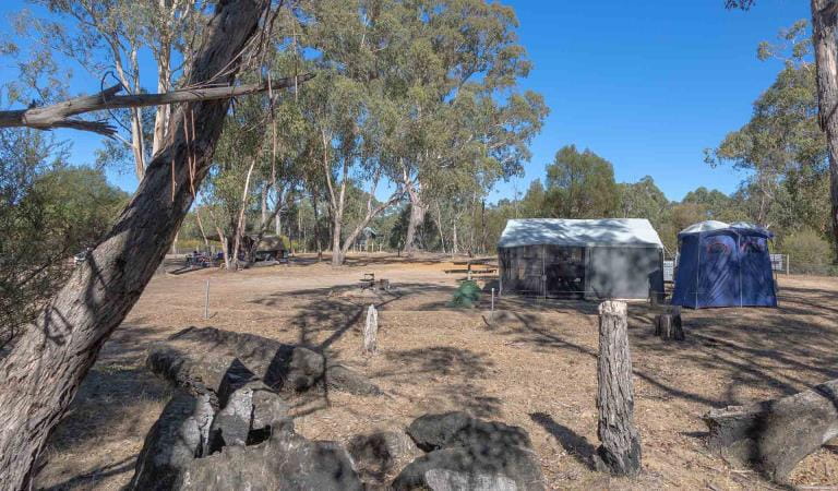
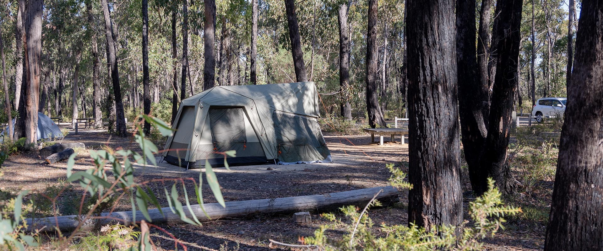
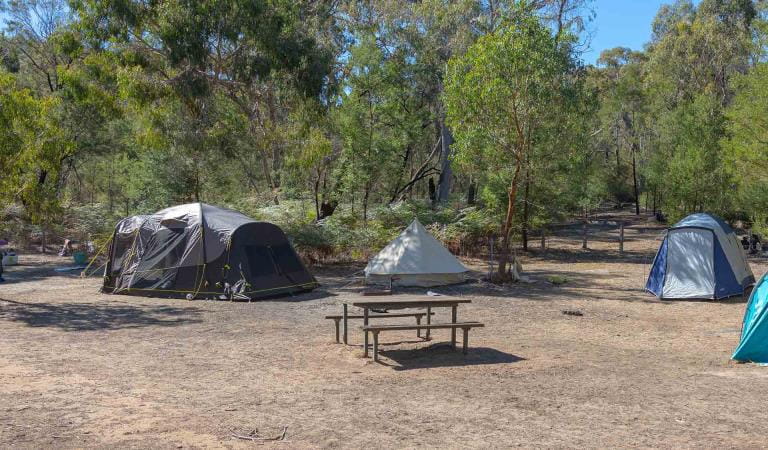
Smiths Mill Campground
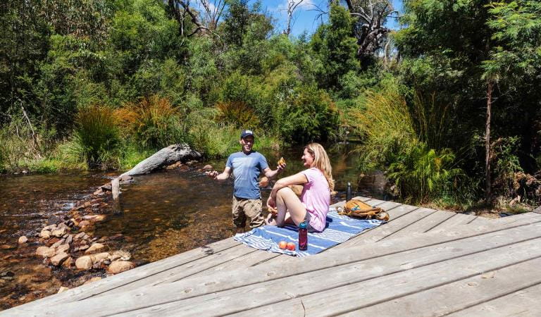
Just 1km from popular sights such as Mackenzie Falls, and only a short drive to Boroka Lookout, Reeds Lookout and Zumsteins Picnic Area, Smiths Mill is the ideal campground to explore the central Grampians.
Smiths Mill Campground is located in woodland at the site of an old sawmill. Enjoy sleeping in the company of emus and kangaroos far from civilisation.
There are 28 sites suitable for tent-based camping with adjacent vehicle parking and five drive-in sites suitable for camper-trailers, caravans and campervans. Each site at Smiths Mill Campground accommodates a maximum of 6 people. Sites are unpowered.
There are non-flush toilets, a bush shower, and shared fire pits available.
Popular nearby sights include Mackenzie Falls, Boroka Lookout, Reeds Lookout and Zumsteins Picnic Area.
Things to do
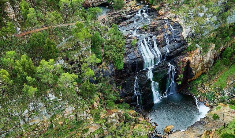
MacKenzie Falls
Zumsteins Historic Area
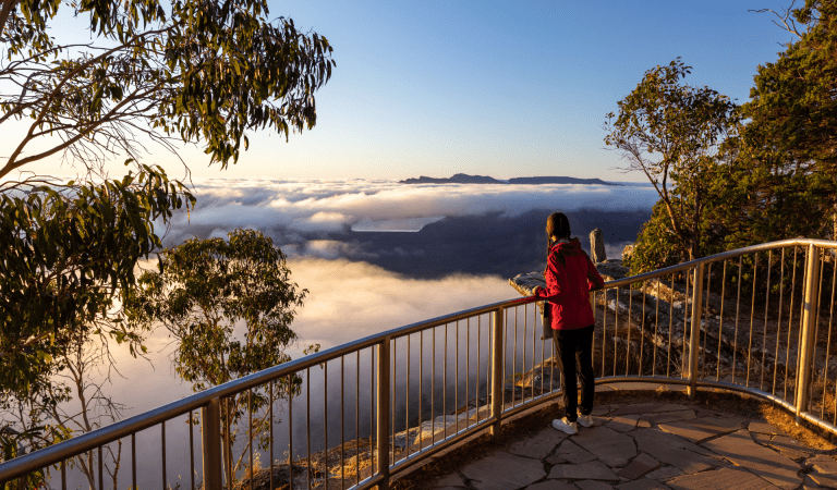
Boroka Lookout
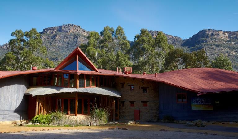
Brambuk The National Park and Culture Centre
How to get there
Smiths Mill Campground
Sites
When you're there
There is no supplied drinking water — limited non-potable water may be available from a seasonal rainwater tank and a river-fed campground taps. Bring your own firewood and keep fires in designated fireplaces.
Download the Grampians National Park visitor guide to get the most out of your park visit.
Need to know
Smiths Mill Campground
Safety tips for a great visit
Stay safe and get the most out of your park visit by preparing for natural hazards and other outdoor risks in Victoria’s parks. You are responsible for your own safety and the safety of those in your care.
Accessibility
Visiting a park can be more of a challenge for people with disabilities, however in Victoria there are a wide range of facilities to help people of all abilities enjoy our wonderful parks around the state.
Bushfire awareness
Smiths Mill Campground in the Grampians National Park is in the Wimmera fire district. Bushfire safety is a personal responsibility. Anyone entering the park during the bushfire season needs to stay aware of forecast weather conditions. Check the Fire Danger Rating and for days of Total Fire Ban at emergency.vic.gov.au, on the Vic Emergency App or call the Vic Emergency Hotline 1800 226 226.
No fires may be lit on Total Fire Ban days. On Catastrophic Fire Danger Rating days this park will be closed for public safety. Closure signs will be erected but do not expect an official warning.
Change of Conditions
Nature being nature, sometimes conditions can change at short notice. It’s a good idea to check this page ahead of your visit for any updates.
-
Grampians (Gariwerd) National Park
Grampians (Gariwerd) National Park – What’s Open What’s Closed Update – 4 July 2025
During the summer of 2024/2025 the central, southern and western areas of the Grampians (Gariwerd) National Park were impacted by multiple bushfires. Since then, a staged re-opening has commenced and many popular visitor areas have re-opened in the Northern, Wonderland and southern areas of the park. However, in the Mount William, Victoria Range, Victoria Valley and Wallaby Rocks areas; many visitor sites and roads remain closed.Visitor Sites Reopening 4 July 2025Central Grampians, Wonderland Range & Halls Gap area:· Mount Rosea walking track· Borough Huts Campground· Stony Creek Group Campground· Stony Creek Road (providing access to Stony Creek Group Campground)· Bugiga Hike-in Campground· Tunnel Track· Terraces Fireline (walking only – an alternate walking link from Borough Huts Campground to Halls Gap)Grampians Peaks TrailThe popular section from Sundial Carpark to Borough Huts campground will reopen. This includes Bugiga Hike-in Campground and Stony Creek Group Campground, providing a two day and one night walking experience from Halls Gap or a two-night, three-day experience by hiking an alternate route along Terraces Fireline returning to Halls Gap.The Griffin Fireline reopens with vehicle access to the Griffin Trailhead in the (Serra Range) southern section. The upgraded track is now accessible to all vehicles.Key visitor sites remaining closedCentral Grampians, Wonderland Range & Halls Gap area:· Sundial Peak walking track· Designated climbing areas 83 - 91Roads in fire impacted areasIt is expected that most of the roads within the National Park will reopen to the public by mid to late July. There will be longer term closures required for some roads, where significant damage has occurred and further essential works are required.Stay safe when visiting the parkDo not enter closed fire affected areas, they are fragile and unstable with significant hazards such as falling trees, unstable tracks and loss of signage.For more detail on “What’s Open What’s Closed”Please refer to the attached “What’s Open What’s Closed” July 4 Park Update. It provides a park wide compilation of all three staged fire recovery reopening’s in 2025.For further information, visit Brambuk the National Park and Cultural Centre in Halls Gap, call Parks Victoria on 131963 or go to parks.vic.gov.auAttachments: GNP Park Update 4 July 2025 - What's Open What's Closed (846KB)
Grampians (Gariwerd) National Park - Roads Update 03.07.2025
The Grampians (Gariwerd) National Park has many roads temporarily closed due to the recent bushfires. Please be aware the movement of visitors in parts of the National Park is restricted.It is expected that most of the roads within the National Park will reopen to the public by mid to late July. There will be longer term closures required for some roads, where significant damage has occurred and further essential works are required.Key roads open include Grampians Tourist Rd (most side roads remain closed), Mt Victory Rd, Sundial Rd, Silverband Rd, Roses Gap Rd, Mt Zero Rd and Victoria Valley Rd.Seasonal road closures are now in place from June 12 – October 30, 2025.Please refer to the attached up-to-date road report below.Attachments: Grampians (Gariwerd) National Park - Road Report - 03.07.2025 (218KB)
Grampians (Gariwerd) National Park – Fire Recovery Update
The impact of the 2024/2025 summer fires in the Grampians (Gariwerd) National Park was widespread. Parks Victoria is now progressing with large scale fire recovery works across the park, including dedicated programs to address biodiversity impacts.For more detailed information, please see the attached Biodiversity Newsletter.Attachments: GNP Biodiversity Newsletter May 2025 (872KB)
-
Brambuk the National Park and Cultural Centre (Grampians (Gariwerd) National Park, Brambuk - The National Park and Cultural Centre Park)
Brambuk the National Park and Cultural Centre – Closures during 2025
Brambuk the National Park and Cultural Centre – Closures during 2025· Cultural tours, activities and venue hire currently unavailable.· Park information centre and gift shop remain open.Parks Victoria is working with a strategic partnership committee of Gariwerd Traditional Owners from Barengi Gadjin Land Council, Eastern Maar Aboriginal Corporation, and Gunditj Mirring Traditional Owners Aboriginal Corporation to ‘reimagine’ the future of Brambuk the National Park and Cultural Centre.The reimagining project aims to renew Traditional Owner management arrangements of the Brambuk precinct and includes careful consideration of the tourism and visitor experiences, commercial opportunities, cultural education and training programs that may be available in the future. As part of this project, there are also building upgrades and refurbishments that require the Cultural Centre to be closed during 2024-25. However, the park information centre, gift shop and self-guided walks remain available.For Junior Ranger School holiday programs visit https://www.parks.vic.gov.au/things-to-do/junior-rangersFor a list of Grampians (Gariwerd) National Park Licensed Tour Operators Visit https://www.parks.vic.gov.au/ltoFor up-to-date national park information, brochures, maps, permits and access advice contact information staff at Brambuk the National Park and Cultural Centre info@parks.vic.gov.au or phone 8427 2058Further details on the Brambuk Reimagining project can be found on the Parks Victoria website https://www.parks.vic.gov.au/projects/western-victoria/brambuk-cultural-centre-upgrade
Similar experiences
Stony Creek Campground
Buandik Campground