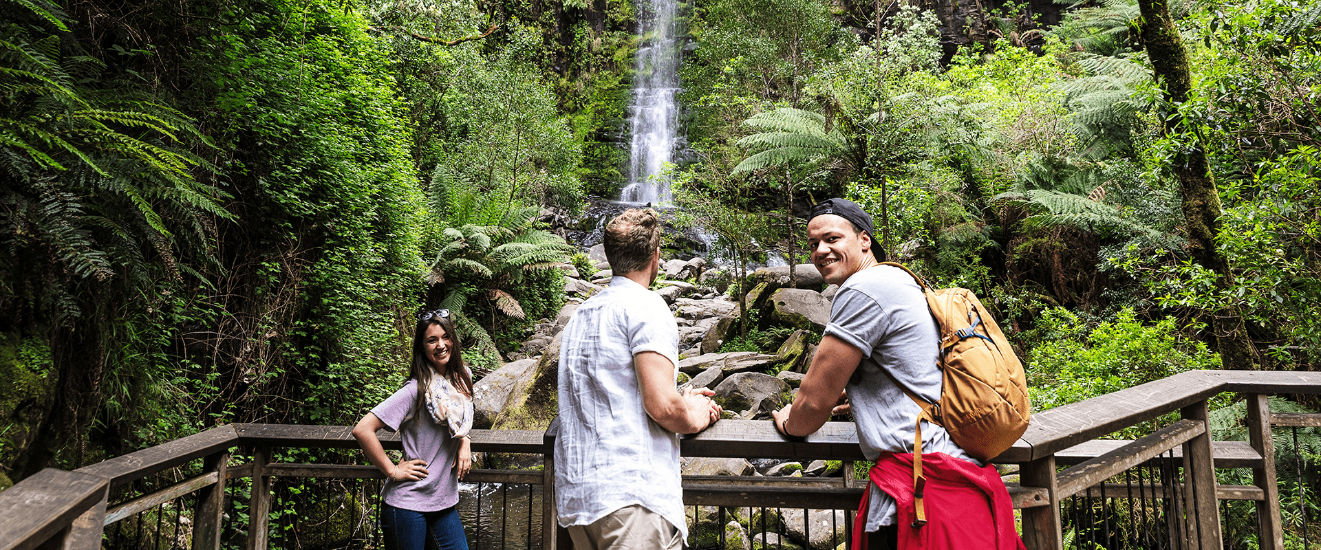
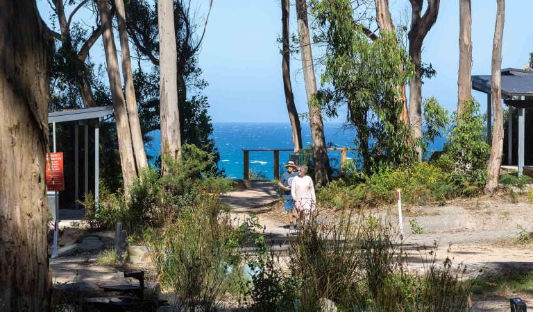
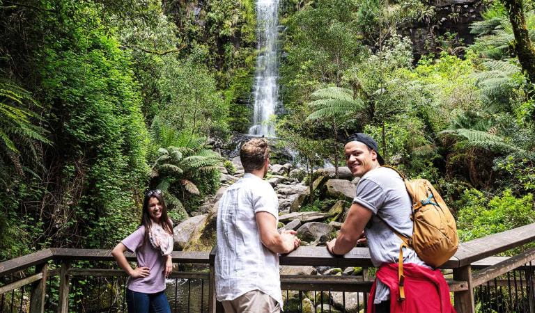
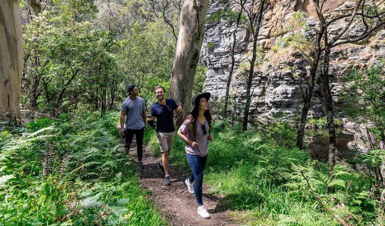
The coastal town of Lorne is where the bush meets the beach. Expect white sandy beaches, clifftops and incredible coastal vistas, numerous waterfall walks and picnic areas fringed by lush fern gullies. Walkers are spoilt for choice in this pocket of the Great Otway National Park, with Sheoak Falls and the longer Canyon Walk standing out.
With over 10 waterfall walks within 10 minutes of Lorne, enter the waterfall capital of Australia and experience a lost world of emerald green gullies.
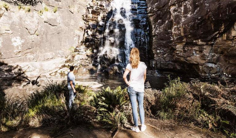
Discover the magnificent Erskine Falls which flows year-round and only a short drive from town. A short walk down more than 270 steps leads to a lookout at the base of the falls. Admire one of the highest drops in the Otways as you watch the water cascade over the moss-laden cliff face and plunge into the gully below.
The pleasant Blanket Leaf Picnic Area is nestled among tall eucalyptus trees and has everything you need for a peaceful day out, including accessible picnic tables, fireplaces and shelter. Stroll to Cora Lynn Cascade or follow Lemonade Creek Walk to approach Erskine Falls from a different angle.
Sheoak Picnic Area is a hub for those wanting to chase waterfalls, with walks leading to Kalimna, Sheoak, Henderson, Won Wondah and Phantom Falls. The tranquil picnic ground contains accessible picnic tables, fireplaces and shelters - perfect if you want to make a day of your visit!
Also starting at Sheoak Picnic Area, the Lower and Upper Kalimna Falls Walk requires preparation. The 8km trail follows the old timber tramway through shady fern gullies and tall, open eucalypt forest.
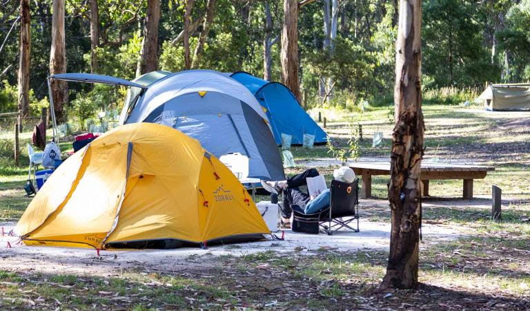
Choose from a range of camping opportunities in the area. Enjoy panoramic views just meters from Jamieson Creek Campground, relax on the banks of St George River at Allenvale Campground or unwind at Big Hill Campground after a day of mountain biking or four-wheel driving.
As beaches and coasts are natural environments, you may encounter hazards. Follow our water safety advice to make sure your day out at Lorne is a safe and enjoyable one.
Please Note:
The Great Ocean Road Coast and Parks Authority has been appointed as manager for part of the Great Otway National Park, from 1 July 2025.
The Authority will take over the responsibilities of Parks Victoria and ensure the Great Otway National Park continues to thrive and be enjoyed by locals and visitors for generations to come.
Parks Victoria continue to manage the majority of the Great Otway National Park, locations which are primarily accessed from the Princess Highway including Lake Elizabeth, Triplet Falls, Hopetoun Falls, Beachamp Falls, Stevenson Falls, Distillery Creek and many well-known mountain bike and walking trails, as well as Big Hill and Hammonds campgrounds and the Anglesea Heath, accessed via the Great Ocean Road.
Parks Victoria staff will continue to be visible in the area, as they will maintain their role in monitoring and caring for the land during the transition period. For more information visit Great Ocean Road Coast and Parks Authority.
Things to do
Jamieson Creek Campground
Sheoak Falls
Allenvale Campground
Erskine Falls
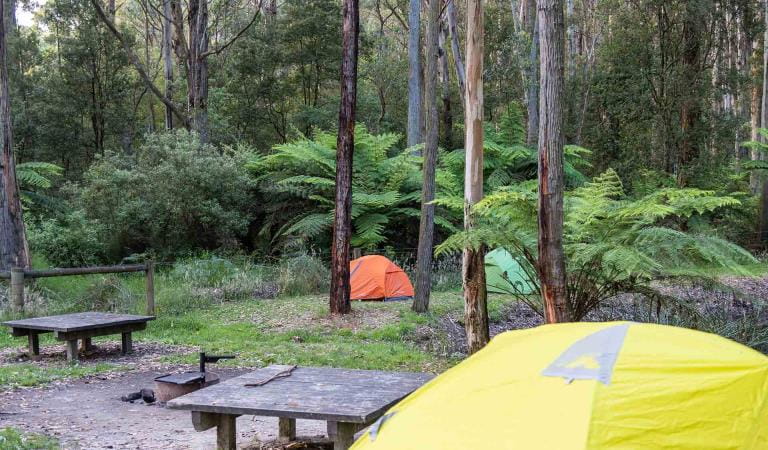
Big Hill Campground
Cumberland Falls Walk
How to get there
Lorne
A bus service runs between Geelong, Lorne and Apollo Bay, connecting with regional train services train services to Melbourne. Visit the PTV website for more information on buses and trains that connect to this part of the Great Otway National Park.
When you're there
Need to know
Lorne
Accessibility
Visiting a park can be more of a challenge for people with disabilities, however in Victoria there are a wide range of facilities to help people of all abilities enjoy our wonderful parks around the state.
The Colac Otway Shire and Surf Coast Shire each have an all-terrain wheelchair, called a Trailrider, that is available for park visitors with mobility difficulties. The chairs can be booked with the respective shires.
Assistance dogs are welcome in Parks Victoria parks and reserves. Entry requirements apply for parks and reserves that are usually dog prohibited, such as national parks.
Change of Conditions
Nature being nature, sometimes conditions can change at short notice. It’s a good idea to check this page ahead of your visit for any updates.
-
Notices Affecting Multiple Sites
Great Otway National park sites closed due to major flood damage
Severe thunderstorms and flash flooding on 16 January 2026 has caused significant damage across parts of the eastern Great Otway National Park.For public safety, the following areas are closed until further notice while assessments and clean-up works are undertaken:Closures included but are not limited to :Erskine falls is limited to the top viewing platform. Access to the base of the falls and along the river track is closed.Roads & TracksWye RdWye TrackCurtis TrackGodfrey TrackJamieson Track
Walking tracks
St George
Phantom falls
Lemonade ck
Kalimna
Henderson
Sheoak FallsSheoak picnic ground walking Nature LoopCumberland
Cumberland Garvey Link
Kalimna Garvey LinkCora LynnErskine Falls Walking TrackWon WondahMany roads, tracks and visitor facilities are impacted by debris, flooding and unstable conditions.The Great Ocean Road has been impacted,Always follow safety signage and directions from response crews, and do not enter any closed areas.Thank you for your patience and understanding as works are undertaken to make these popular areas safe to visit again.
Great Ocean Walk destination car parking at the Twelve Apostles visitor center during summer & Peak Visitation periods
During the busy peak visitation period at the Twelve Apostles precinct (from summer through to early autumn including school holidays, public holidays, long weekends & busy peak visitation weekends concluding after Chinese New Year / Easter), due to the sheer volume of visitors onsite, a traffic management program is in place to maximize public safety & ensure visitor experience. If you are planning to park your vehicle at the Twelve Apostles before walking the Great Ocean Walk (or sections of it including section 8) during this period, please communicate this information to onsite traffic control staff at the entrance & they will do their best to accommodate your vehicle in the main carpark. This will avoid your car remaining in the overflow carpark area which needs to be cleared and locked each night. Similarly, if you arrive at the Twelve Apostles to park your car at a time when traffic control are not onsite, or setting up, please park your vehicle in the main carpark area. Your assistance is greatly appreciated!