Explore
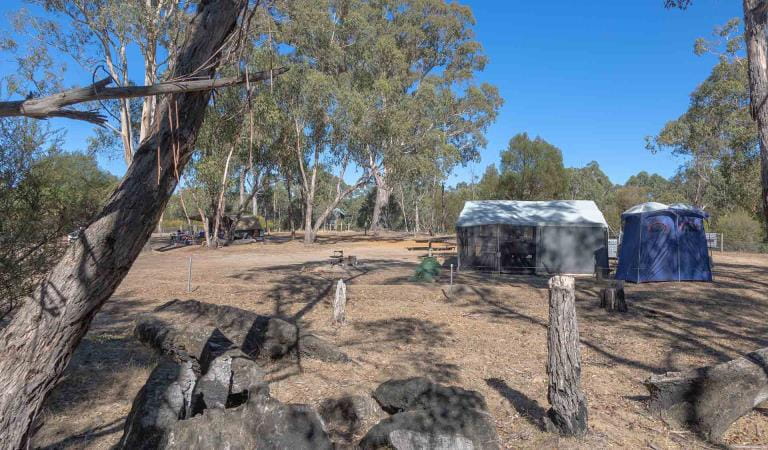
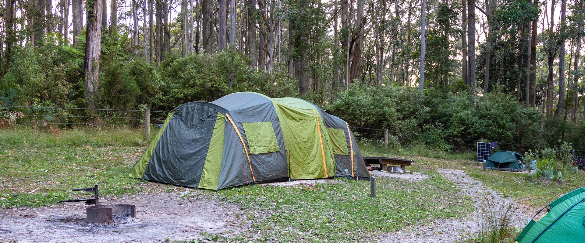
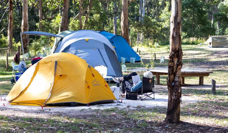
Big Hill Campground
Unwind in nature after a day of mountain biking or four-wheel driving. Relax at camp and enjoy the company of native wildlife.
Set in an open, easily accessible grassy area surrounded by tall forest, Bill Hill Campground is ideally positioned for mountain biking, four-wheel driving or relaxing in nature. Keep an eye out around the campground for brightly coloured King Parrots and Crimson Rosellas, and if you’re lucky you may even see a koala.
The campground offers 13 campsites, each accommodating up to six people. Sites 1-7 are suitable for tents only, while sites 8-13 cater for camper trailers and caravans. All campsites are unpowered.
Campground facilities include non-flush toilets, shared fireplaces and shared low tables/seats. Remember to bring your own firewood to protect the surrounding wildlife habitat.
Advanced bookings and payment are required year-round.
Things To Do
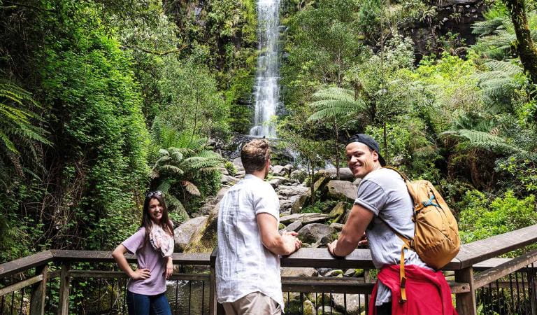
Erskine Falls
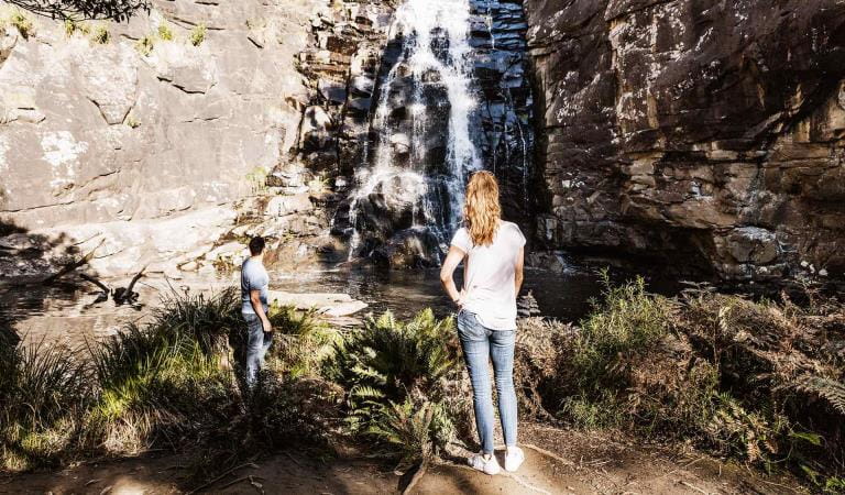
Sheoak Falls
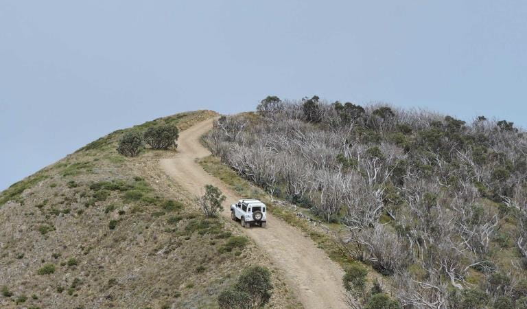
Victoria's Iconic 4WD Adventures
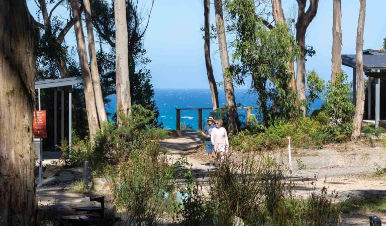
Lorne
How to get there
Big Hill Campground
When you're there
While the campground caters for self-contained comfort, you should bring your own drinking water and firewood, and take all rubbish home with you.
Fuel stoves or gas barbecues are preferred for cooking.
Need to know
Big Hill Campground
Accessibility
Visiting a park can be more of a challenge for people with disabilities, however in Victoria there are a wide range of facilities to help people of all abilities enjoy our wonderful parks around the state.
Be prepared and stay safe
Big Hill Campground is in the Great Otway National Park in the Central fire district. Bushfires can occur during the warmer months. It is your responsibility to check current and forecast weather conditions. Campfires cannot be lit on days of Total Fire Ban, however gas cookers can be used for preparing food.
Check the Fire Danger Rating and for days of Total Fire Ban at emergency.vic.gov.au, on the Vic Emergency App or call the Vic Emergency Hotline 1800 226 226.
Change of Conditions
Nature being nature, sometimes conditions can change at short notice. It’s a good idea to check this page ahead of your visit for any updates.
-
Aire River West Campground (Great Otway National Park GORCAPA, Aire River Heritage River)
Aire West Campground – Partial Seasonal Closure
Visitors are advised that sites 17–40 at Aire West Campground in Great Otway National Park are temporarily closed from 29 May to 25 September 2026 due to seasonal conditions.What to expect:Sites 17–40 are closed and unavailable for camping or vehicle access during this periodRemaining sites may still be accessible, subject to conditionsImportant information:The closure period may be extended if conditions remain too wet to safely support camping and vehicle accessVisitors are asked to follow any on-site signage and avoid closed areas to prevent damage to the campground and ensure safety.The Great Ocean Walk hike in camp site is not impacted.Entering into or camping within closed areas is subject to National Park regulationsWe appreciate your cooperation in helping protect the park during these conditions. -
Aire River East Campground (Aire River Heritage River, Great Otway National Park GORCAPA)
Aire East Campground – Seasonal Closure
Aire East Campground in Great Otway National Park will be closed from 29 May to 25 September 2026 as part of the annual seasonal winter closure.This closure is necessary to protect the campground and access tracks during periods of wet weather, when conditions are highly susceptible to damage from vehicle use and camping activity.What to expect:No visitor or vehicle access to the campground during the closure period.Campground and toilet facilities will be unavailable.Important information:The closure period may be extended if conditions remain too wet to safely support vehicle access and camping.Visitors are encouraged to plan ahead and consider alternative campgrounds.We appreciate your cooperation in helping protect the park environment during this time. -
Notices Affecting Multiple Sites
Great Otway National Park Flood Closures
Severe thunderstorms and flash flooding on 16 January 2026 has caused significant damage across parts of the eastern Great Otway National Park.For public safety, the following areas are closed until further notice while assessments and clean-up works are undertaken:Closures included but are not limited to :Erskine falls is limited to the top viewing platform. Access to the base of the falls and along the river track is closed.
Roads & TracksWye RdCurtis TrackGodfrey TrackJamieson Track
Walking tracks
St George
Phantom falls
Lemonade ck
Kalimna
Henderson
Cumberland
Cumberland Garvey Link
Kalimna Garvey LinkCora LynnErskine Falls Walking TrackWon WondahAlternative walking tracks can be found at:Moggs Creek picnic areaDistillery Creek picnic areaOcean TrackCastle RockSheoak Falls to Swallow cavesMany roads, tracks and visitor facilities are impacted by debris, flooding and unstable conditions.The Great Ocean Road has been impacted,Always follow safety signage and directions from response crews, and do not enter any closed areas.Thank you for your patience and understanding as works are undertaken to make these popular areas safe to visit again. -
Maits Rest Rainforest Walk (Great Otway National Park GORCAPA)
Maits Rest Carpark – Temporary Partial Closure
Visitors are advised that maintenance works will be undertaken at the Maits Rest Carpark in Great Otway National Park on 10 June 2026.These works involve repairing and resurfacing sections of the carpark affected by pothole damage.What to expect:Partial closure of the carpark during worksReduced parking availabilityConstruction activity and machinery on siteAccess:The carpark will remain partially open, with approximately half of the parking area availableAccess to the Maits Rest Rainforest Walk will remain open at all timesVisitors are asked to follow all signage and directions from contractors to ensure safety.We appreciate your patience while these essential maintenance works are completed.
Similar experiences
Allenvale Campground
Jamieson Creek Campground